North Chickamauga Safety
Warning Alert
Closures Due To Improvement Project
Important alert for all visitors:
Beginning March 23, 2026 and lasting for approximately one year, improvements will be made to create a safer, more accessible experience for visitors. This includes paving the parking area, improving the park entrance, adding an ADA-accessible river viewing pier, and installing a restroom.
During this time, the following areas will be closed and inaccessible:
- Montlake Road Entrance and the Main Trailhead
- Blue Hole Trail & Blue Hole Access
- Hogskin Loop Trail
- Stripmine Falls
- Cumberland Trail from the Main Trailhead to Boston Branch Overlook
Learn more and view the map of the closed area on our safety information page.
Know Before You Go
The park often experiences high visitation. Please do not park on roadsides or in non-designated areas. If the park is full, please consider visiting another state park in the area.
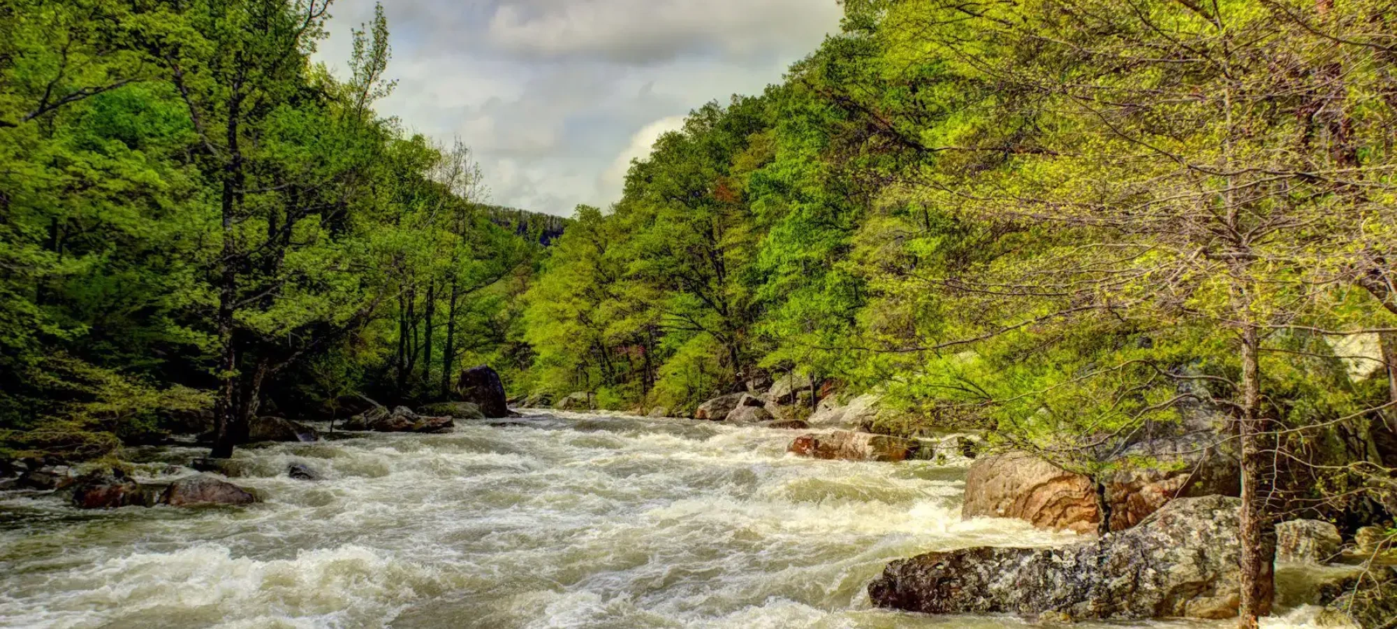
Access to all areas along the creek may close due to inclement weather and/or rising waters. A four-point, color-coded rating system is used to determine the closing of creek access areas. Rangers and staff may close areas with little to no notice to park visitors. Learn more on our safety information page.
North Chickamauga Creek Gorge Safety Information
North Chickamauga Creek Gorge State Park is considered a rugged natural area and recreational activities within the park are inherently dangerous. It is necessary to traverse uneven, natural trail surfaces to access some areas of the park. Stay informed about weather and potential hazards during your stay.

Dirt, Rock, Boulders, and More
Nature Challenges
Trails to the creek, swimming holes, waterfalls, and Blue Hole are a combination of dirt, rock, boulders, water crossings, and other obstacles.
Trails into the gorge are steep with significant elevation changes. These trails are a combination of dirt, rock, boulders, and other obstacles and may require water crossing.
Ascending and descending wooden and stone stairs is necessary to access the backcountry areas of the park.
Visiting Blue Hole
Use good judgment and common sense when deciding whether you should hike to the Blue Hole. If you have hesitations about your safety or ability, please plan to enjoy one of the many other swimming holes available at the park.
Blue Hole is only accessible when the creek water levels are within safe ranges. Be aware of posted area closure status before hiking.
If you decide to hike to the Blue Hole, please use caution and follow these rules at all times:
- Be aware of posted area closure status.
- Keep your hands free.
- No alcoholic beverages.
- No glass containers.
- No fires or grills allowed.
- Dogs must remain on leash and under control at all times.
- Camp only in designated areas.

Be Prepared
Following these guidelines will help make your trip more relaxed and enjoyable as well as help prevent injury.

Closing of Areas
Area Status
Access to all areas along the creek may close due to inclement weather or rising waters. A four-point, color-coded rating system is used to determine the closing of creek access areas. Rangers and staff may close areas with little to no notice to park visitors. The Blue Hole is closed at the Purple and Red Water Levels.
[1] GREEN. Low hazard, water level conditions within normal range. Gorge open – water access – swimming allowed.
[2] YELLOW. Medium hazard, water level may be above normal with possible rain or storms in forecast. Gorge open – water access – swimming allowed.
[3] PURPLE. High hazard, high water level and/or swift moving water with possible rains and storms in forecast. Gorge open – no swimming.
[4] RED. Severe hazard, dangerous conditions. Gorge closed – No access to water – No swimming.