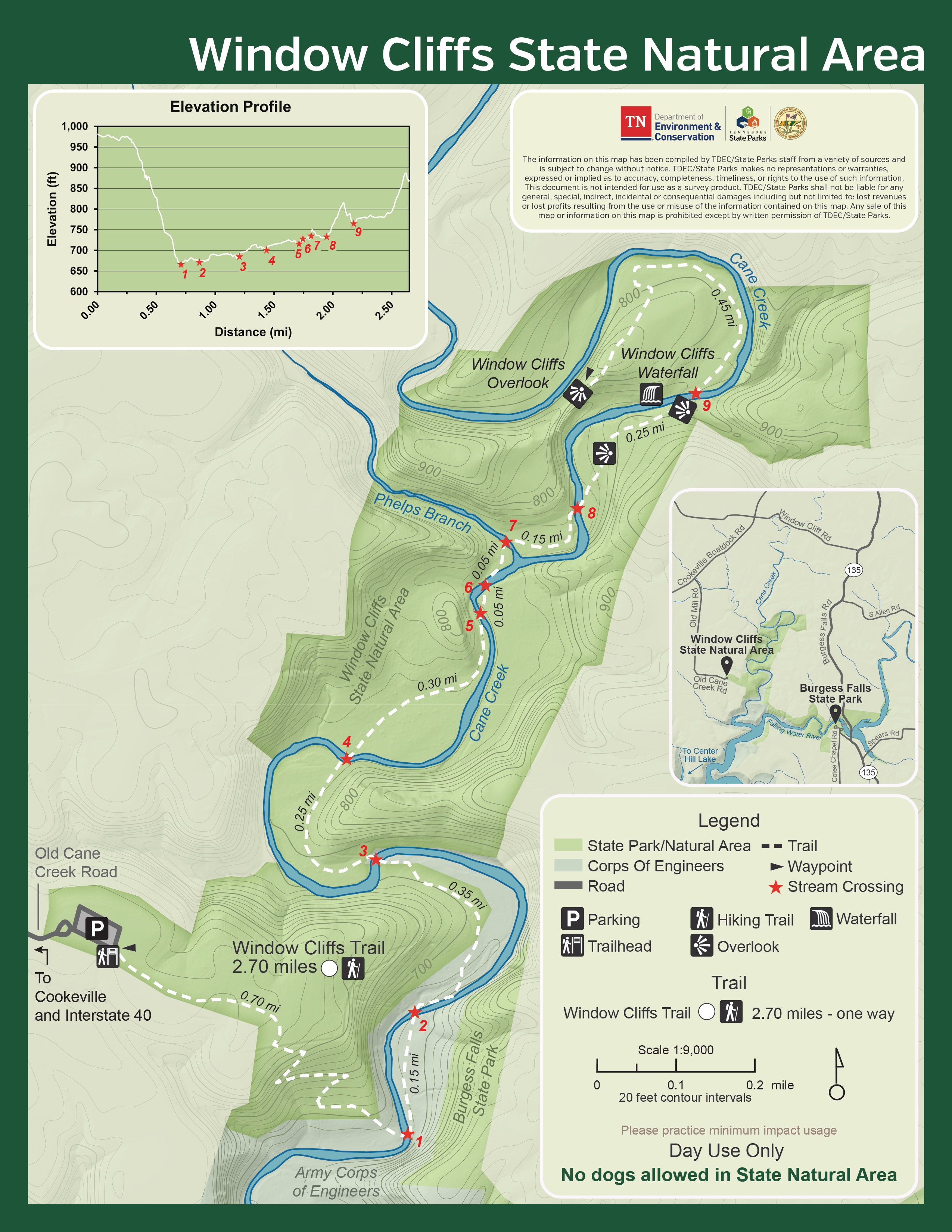
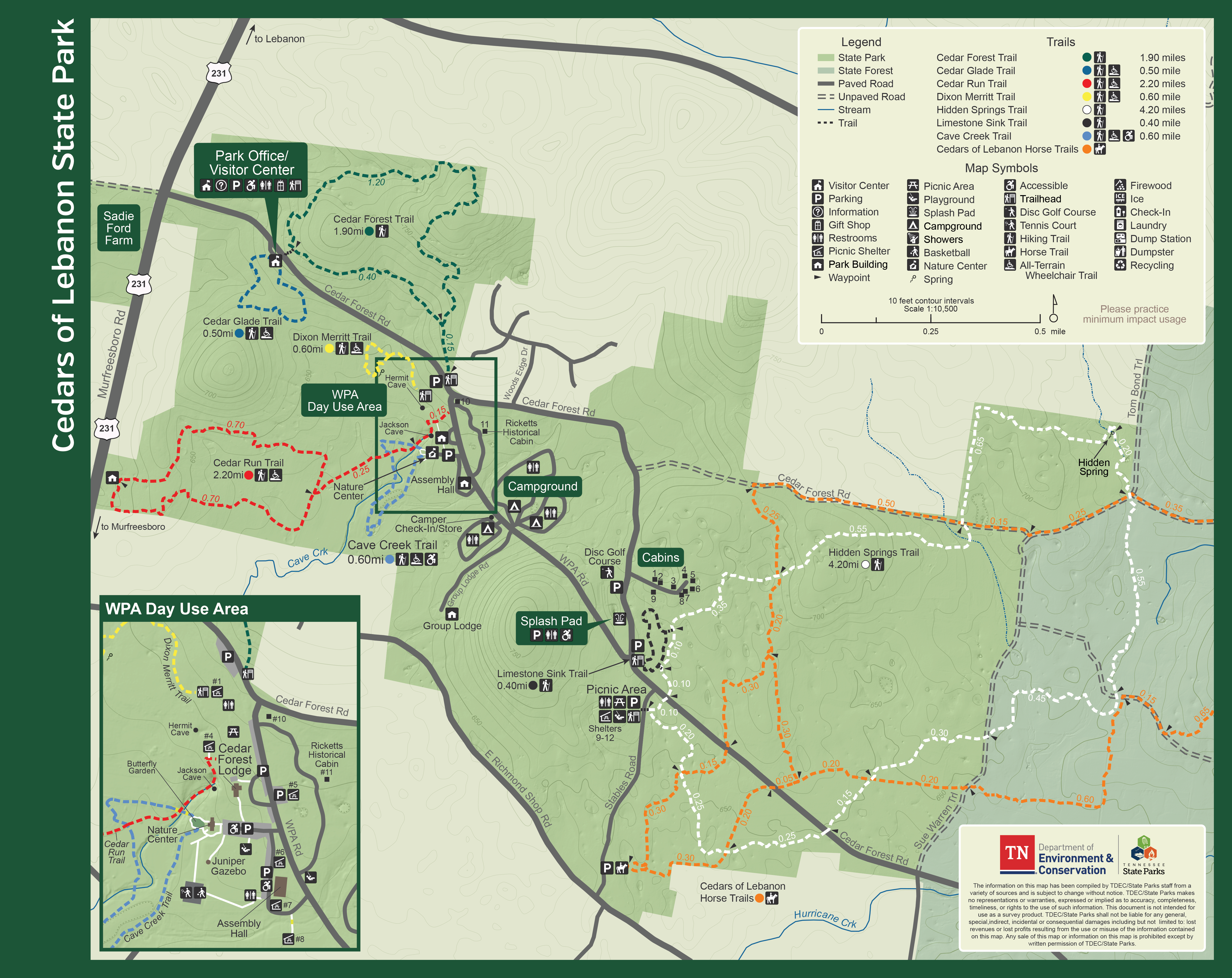
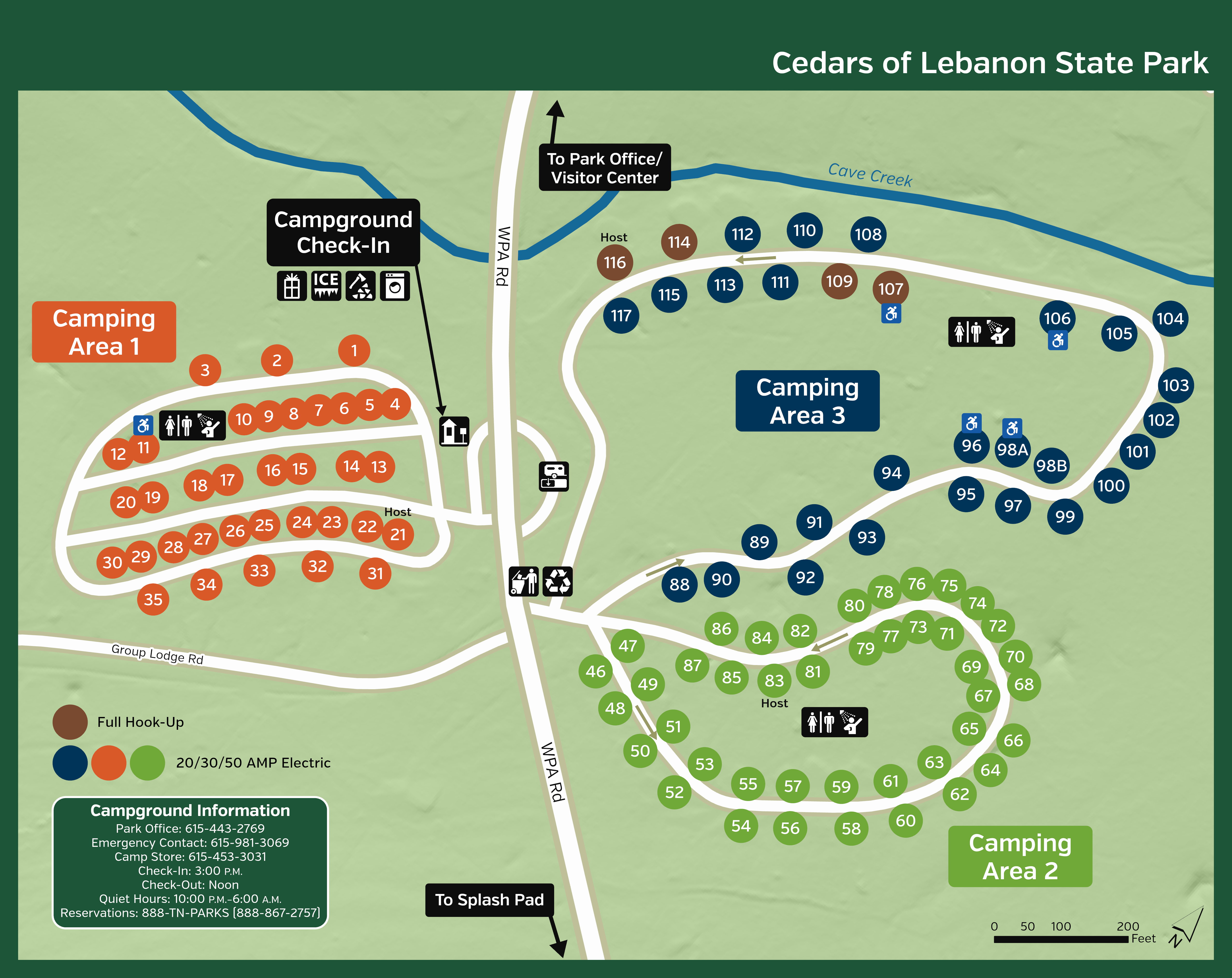
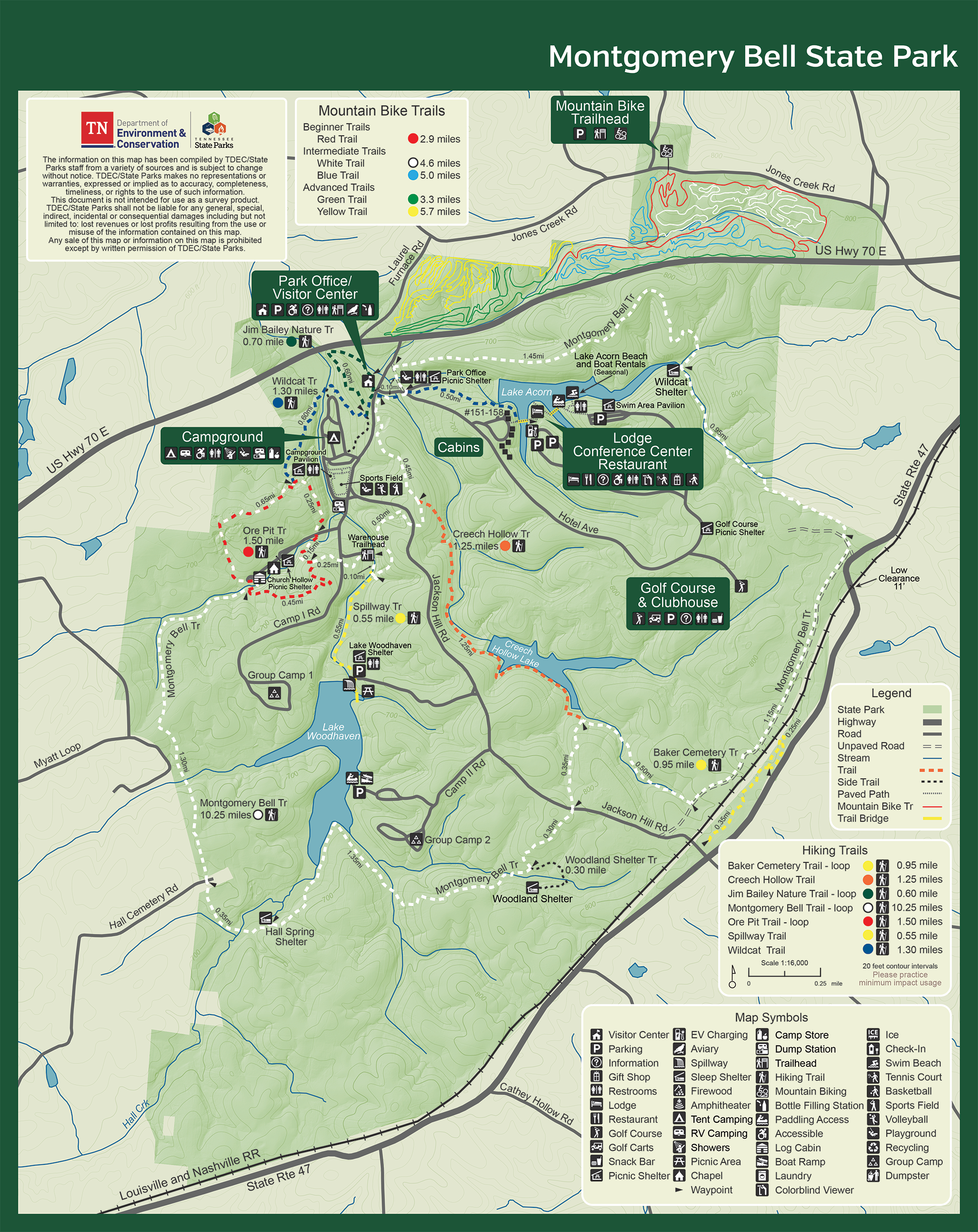
Park Trail Maps

Park Trail Maps
Looking for a trail in a Tennessee State Park? This page provides links to the trail maps we provide, organized by park. We have printable and digital options that provide the details you need to have your next great adventure in Tennessee.
Free Offline Trail Maps
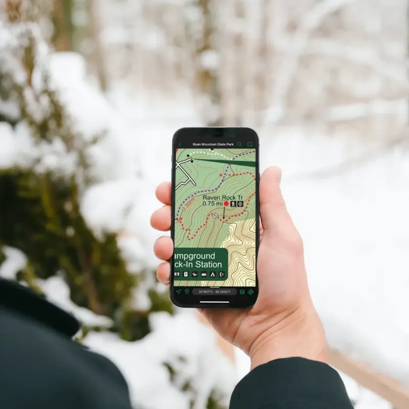
No internet access out on the trail? No problem!
Thanks to the generous support of our Trail Pack supporters, Tennessee State Parks visitors can now access offline GPS-use trail maps at no cost! The Avenza Maps® app uses GPS location tracking, not your cell signal, so it works even when you do not have service. As you hike our state parks’ trails, your location moves in real-time on the map and will guide your way for as long as your device's battery works.
How to Use Avenza Maps
- Find a park below and click on the link for Offline-Use GPS Map. Or, browse all Tennessee State Parks maps here.
- The link will prompt you to download the Avenza app from the Apple App or Google Play store.
- Once downloaded, allow the app to use your location.
- Download your free maps.
- Open the Avenza App and use your map during your next hike!
Available Park Maps
-
Bicentennial Capitol Mall State Park
-
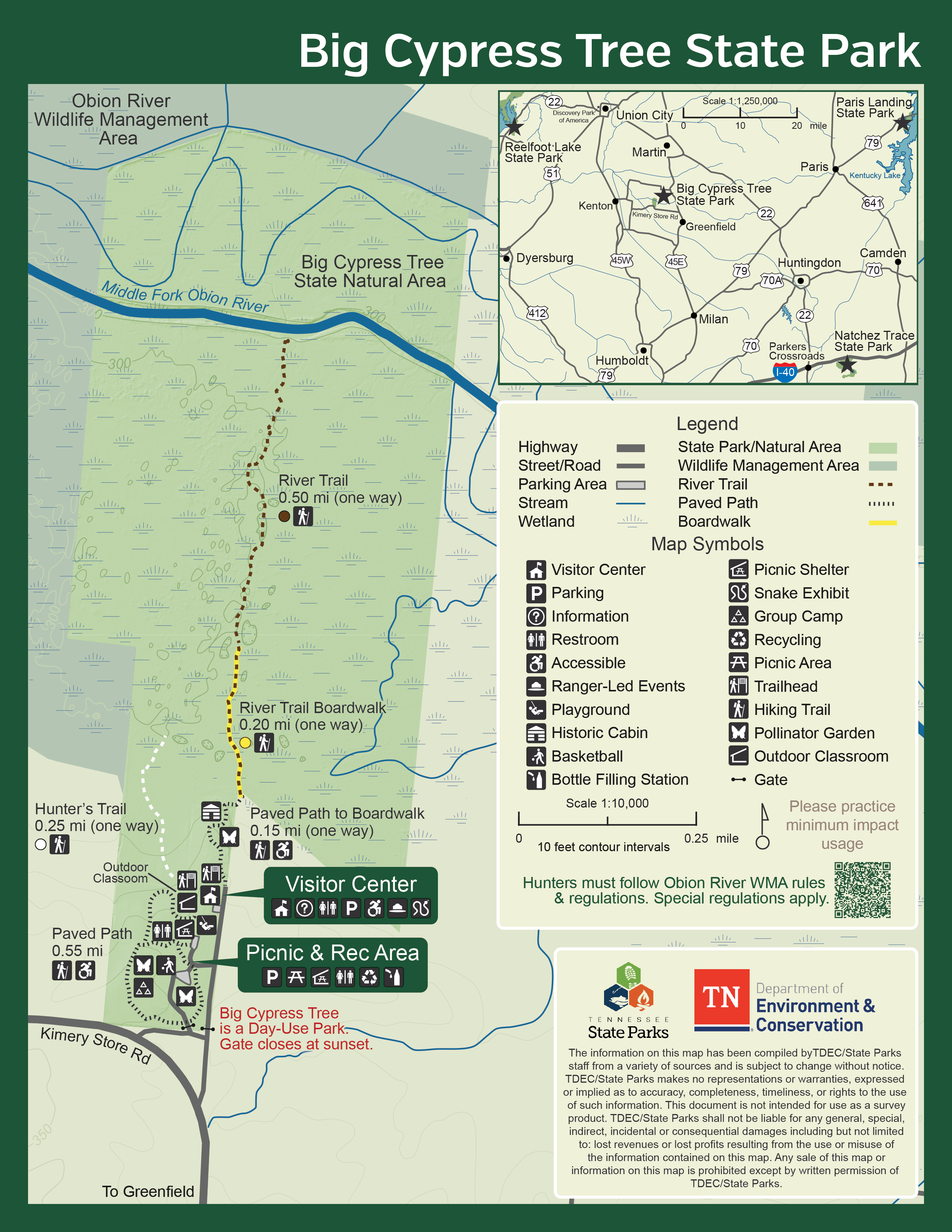
Big Cypress Tree State Park
-
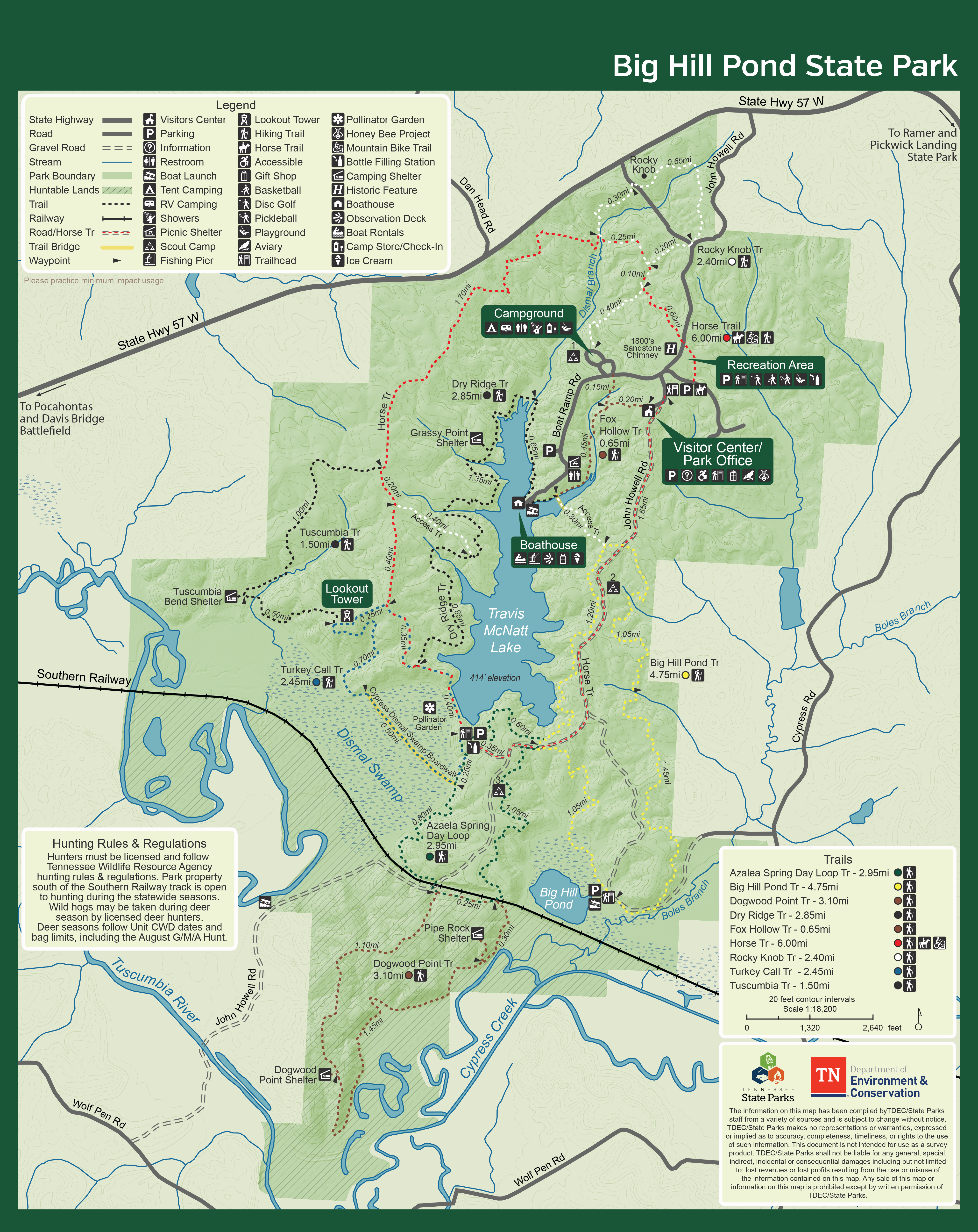
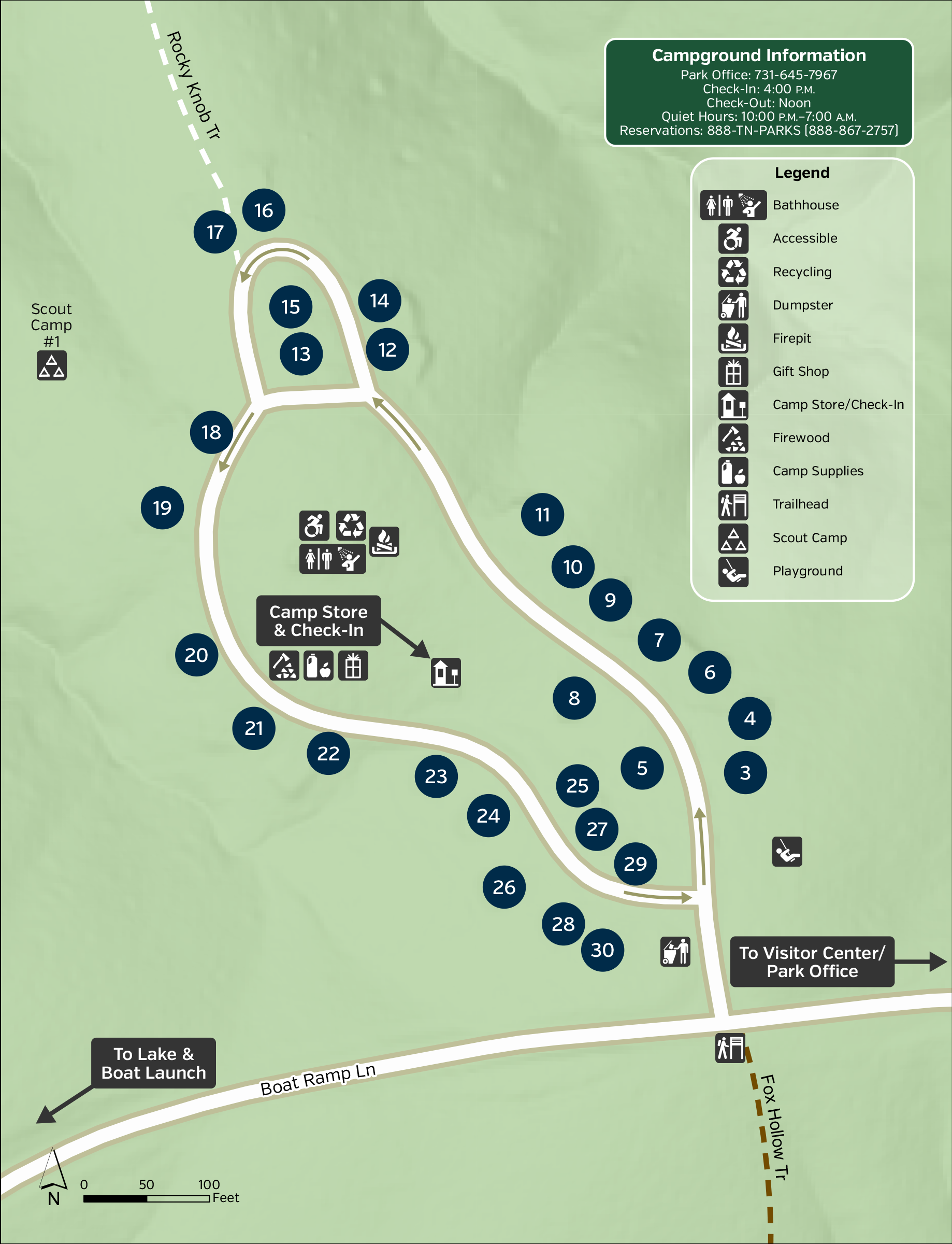
Big Hill Pond State Park
-
Big Ridge State Park
-
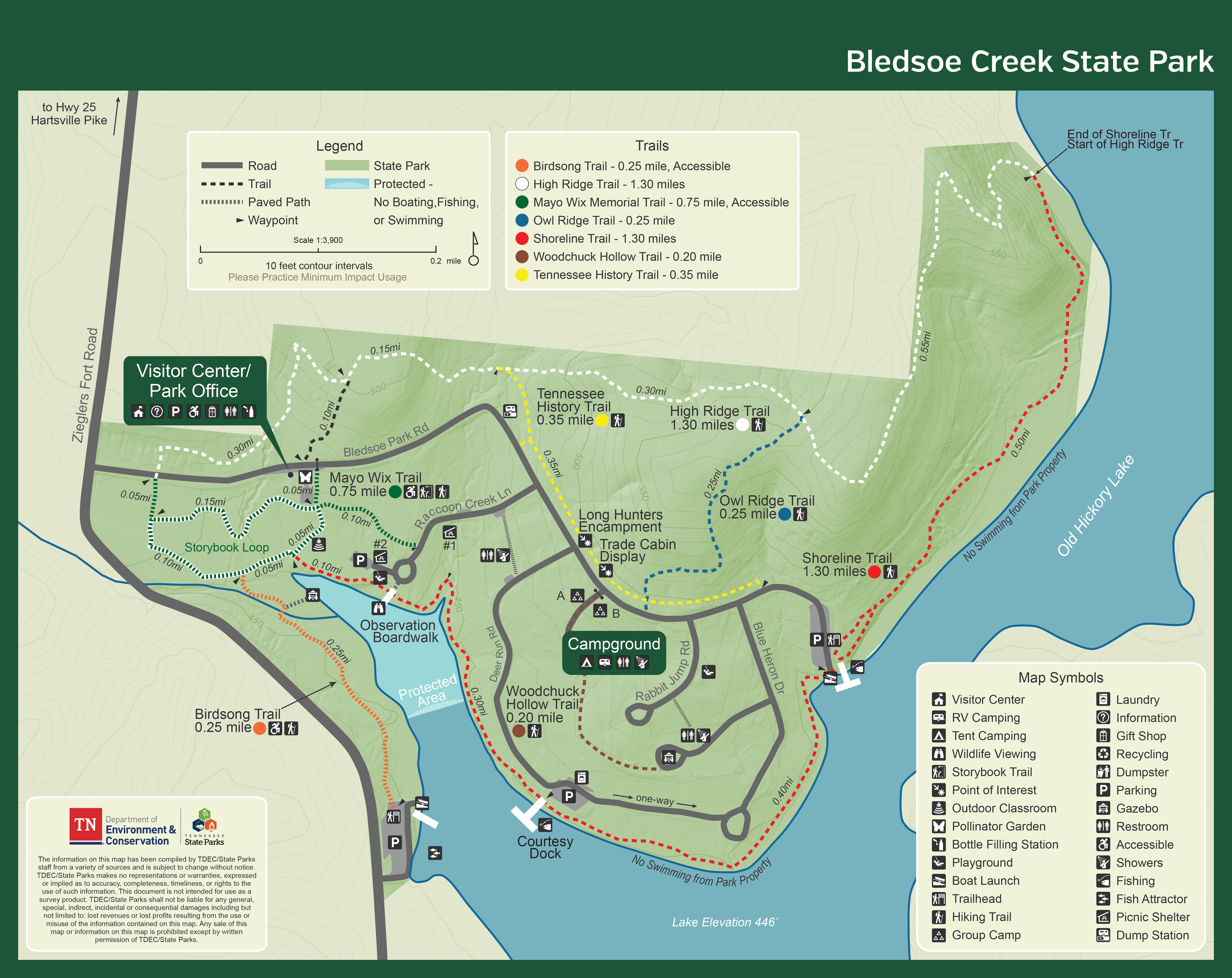
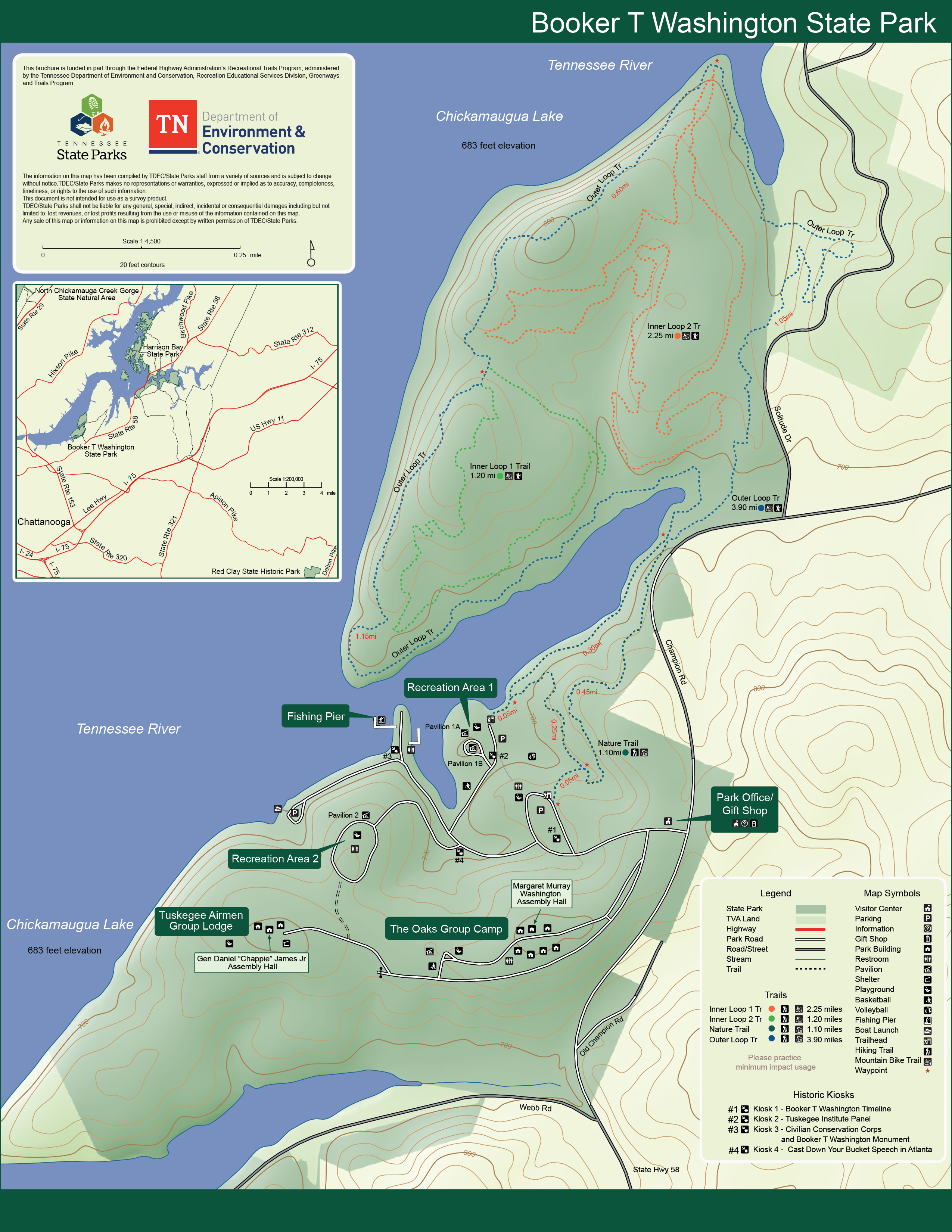
Booker T. Washington State Park
-
Chickasaw State Park
-
Cordell Hull State Historic Park
-
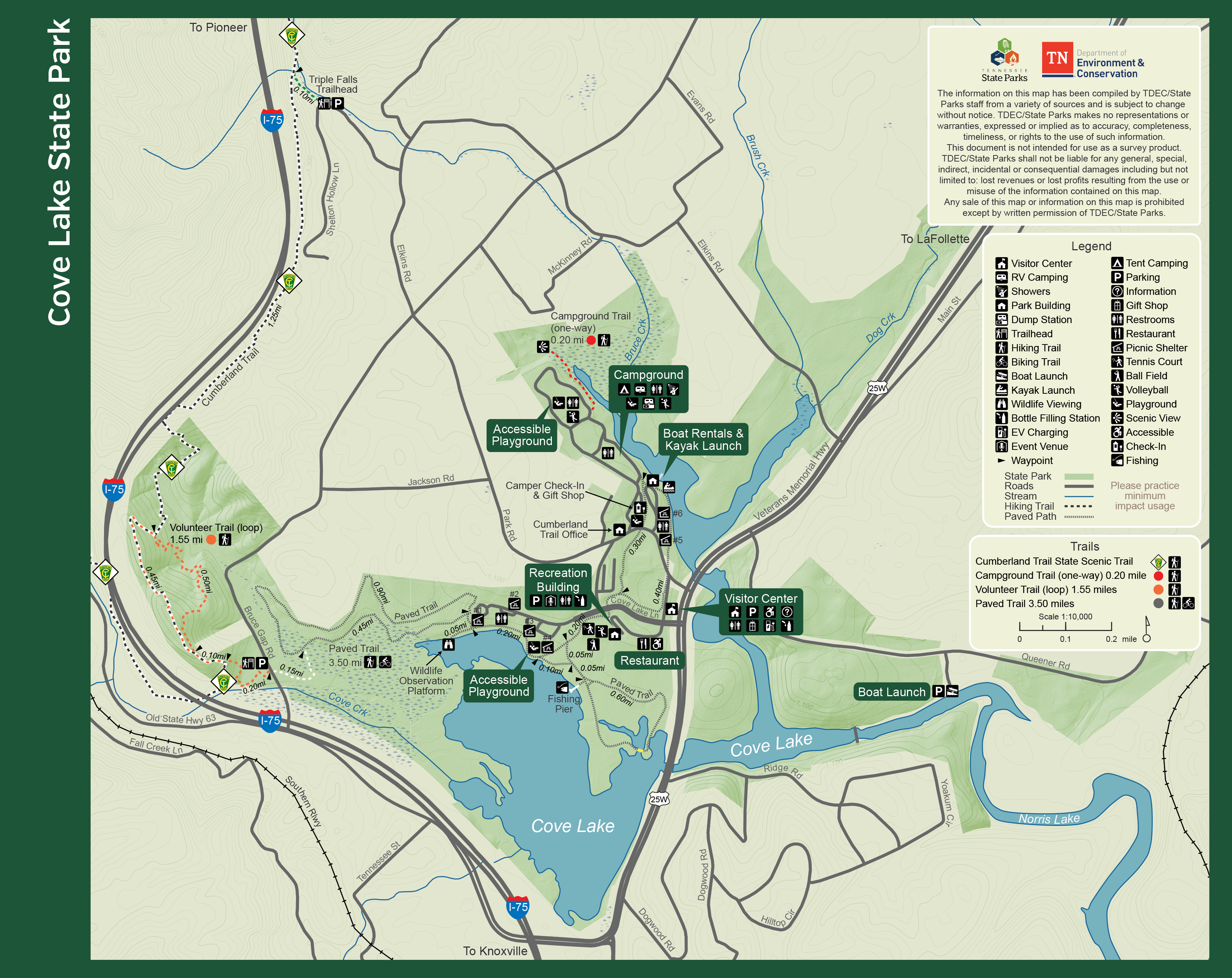
Cove Lake State Park
-
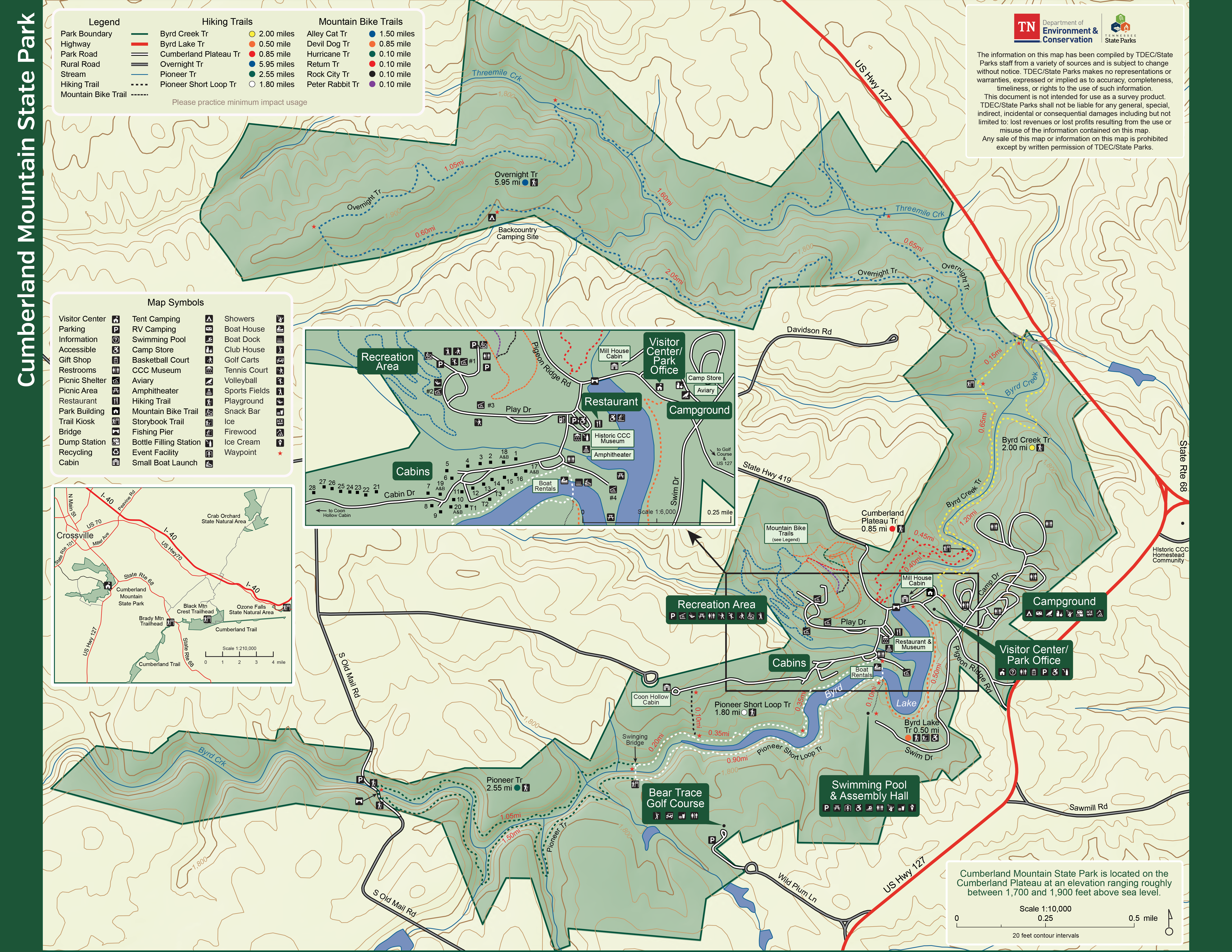
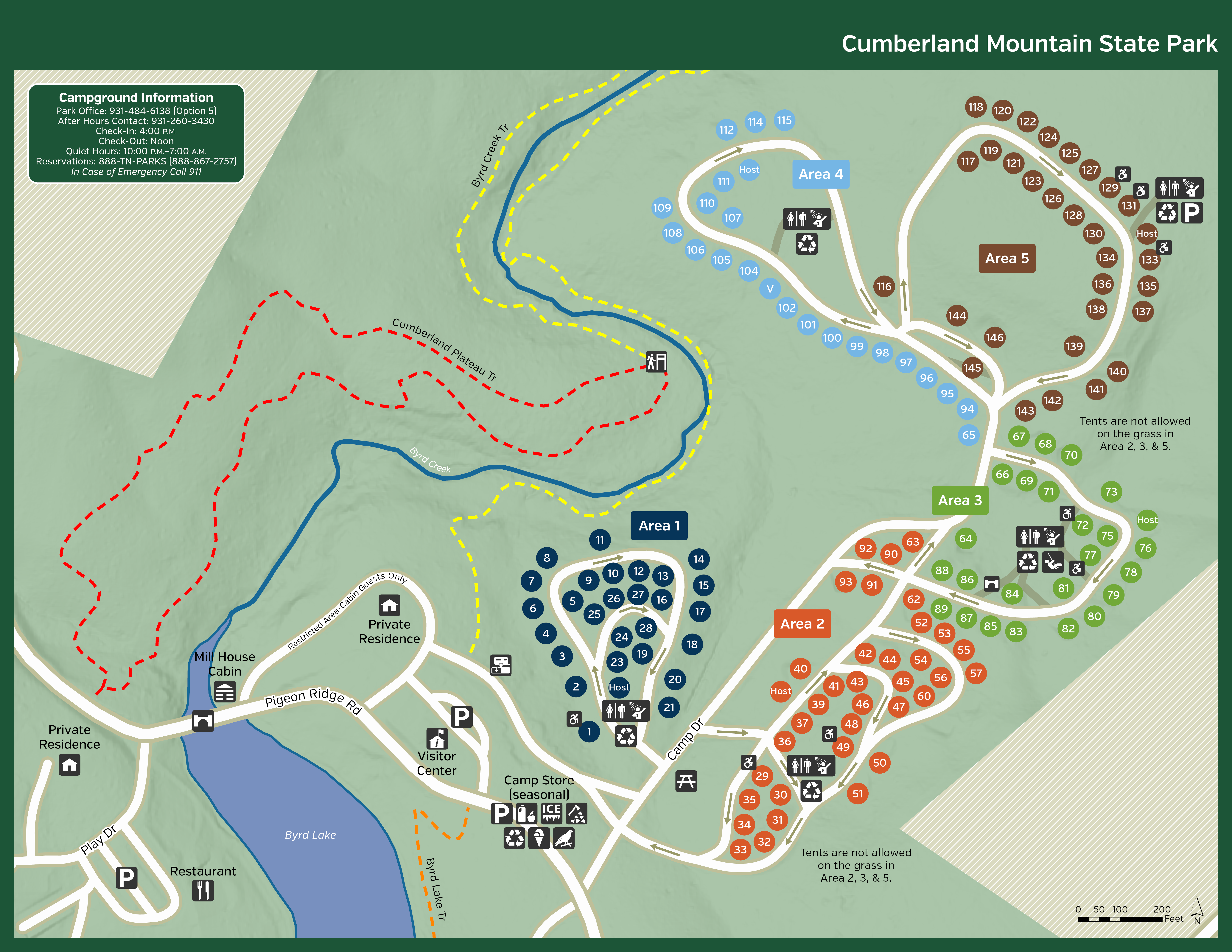
Cumberland Mountain State Park
-
Cumberland Trail State Scenic Trail State Park
Interactive GIS Map of Completed Trail Sections
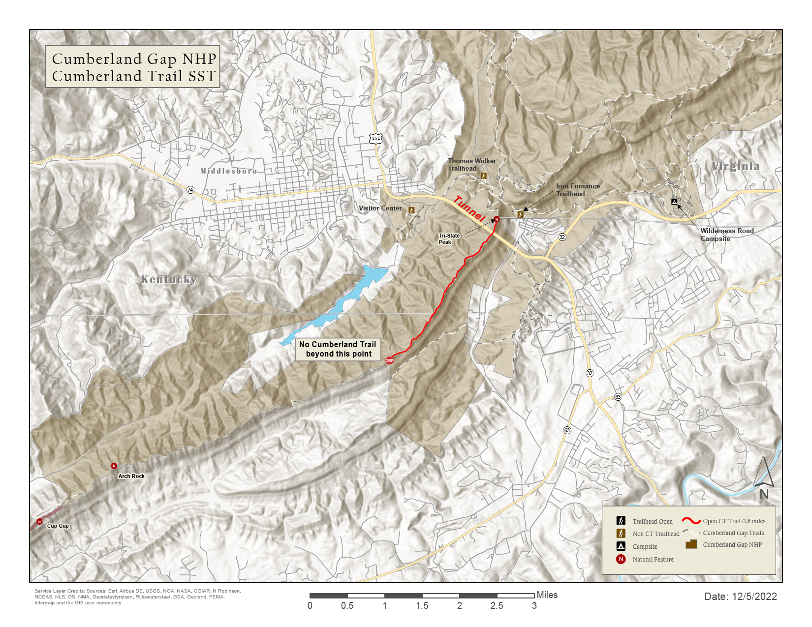
Printable Trail Map - Cumberland Gap
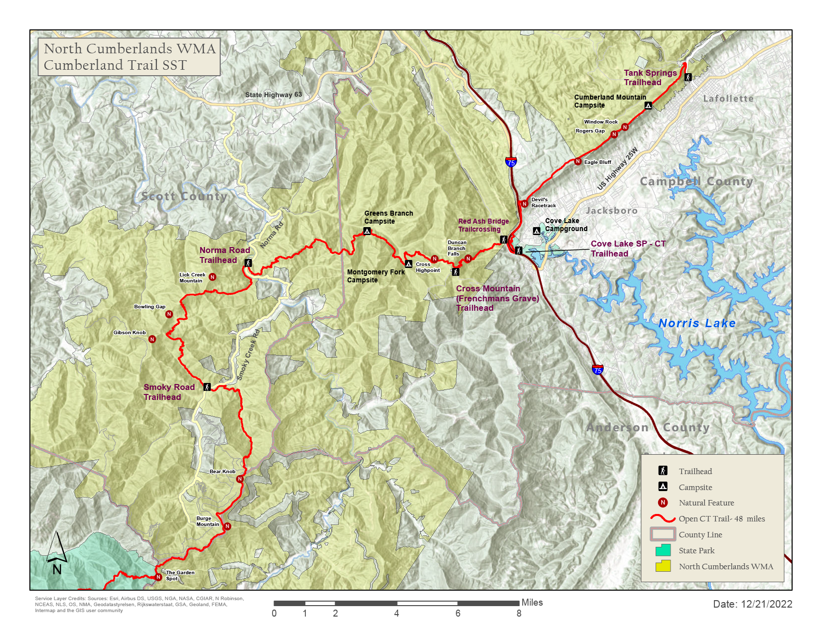
Printable Trail Map - North Cumberland WMA, Cove Lake
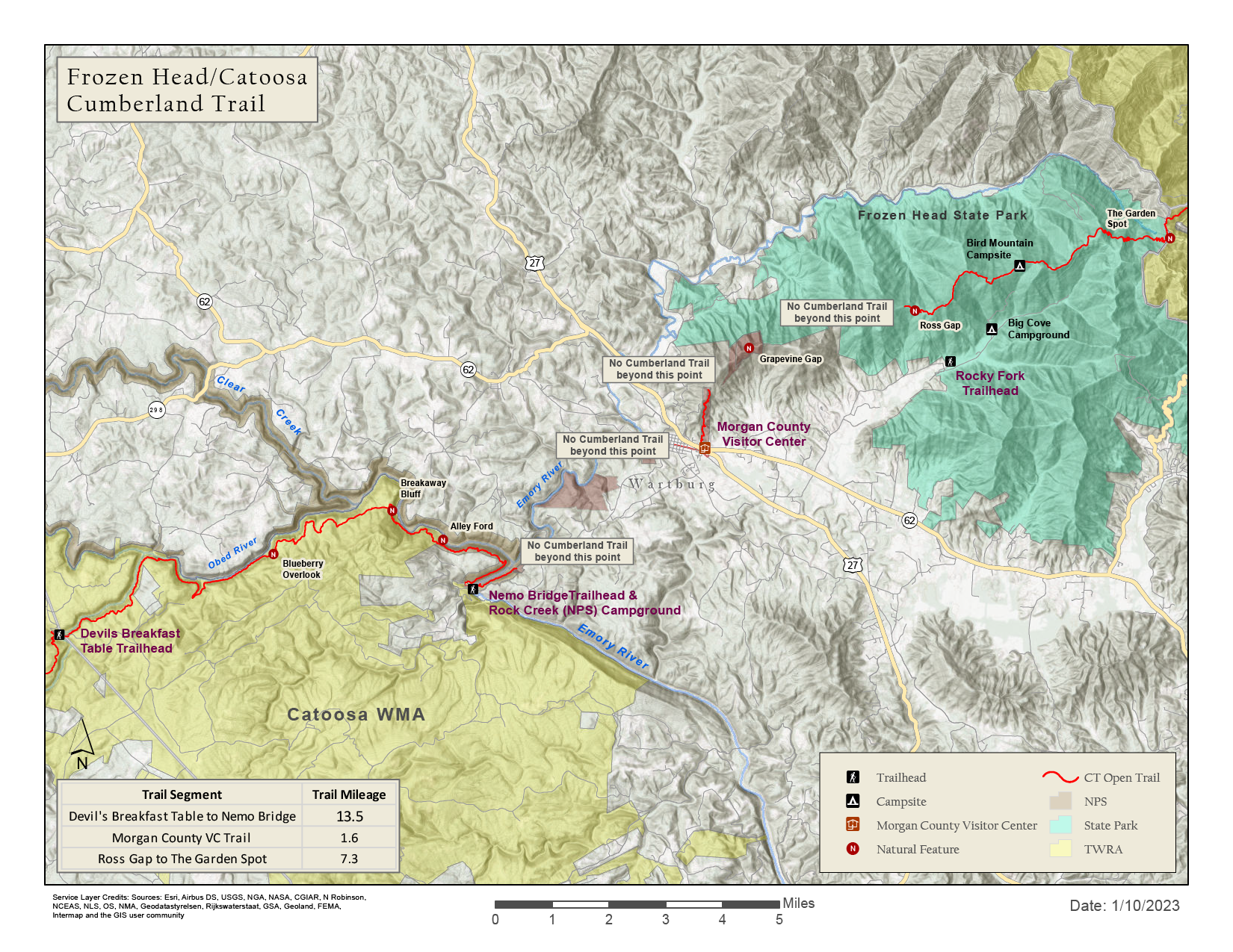
Printable Trail Map - Frozen Head, Catoosa WMA
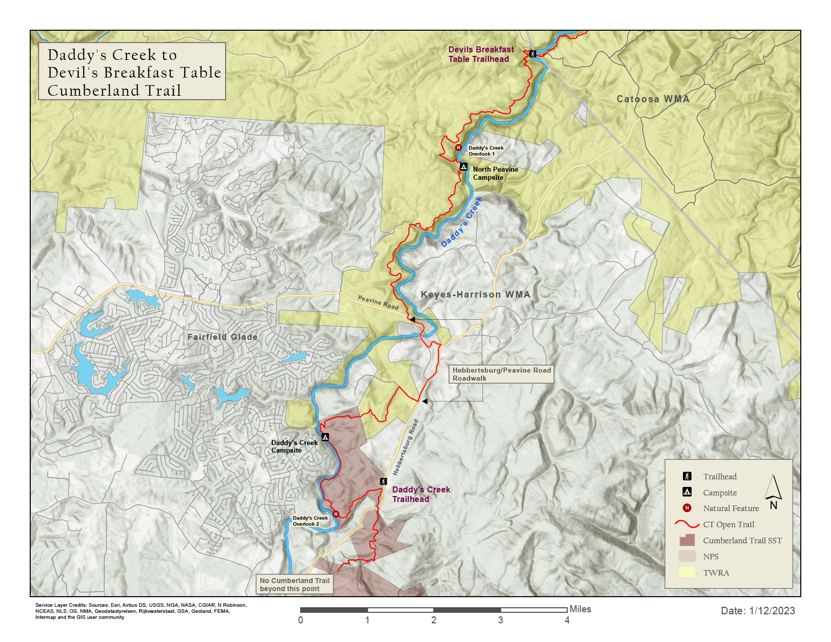
Printable Trail Map - Daddy's Creek
Printable Trail Map - Ozone Falls SNA to Hwy 68
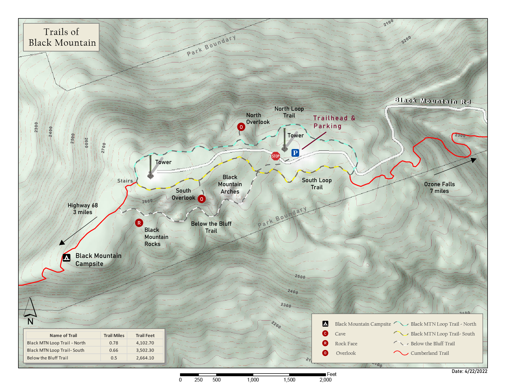
Printable Trail Map - Black Mountain
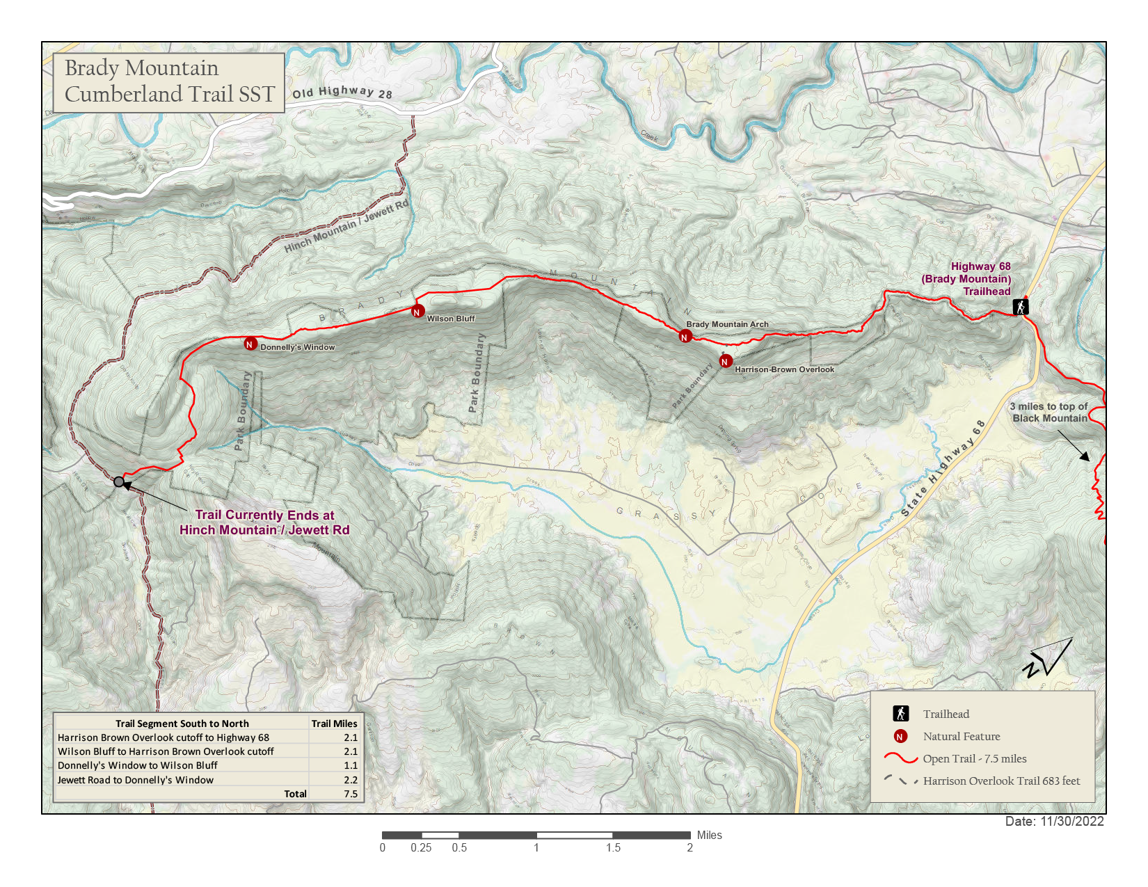
Printable Trail Map - Brady Mountain
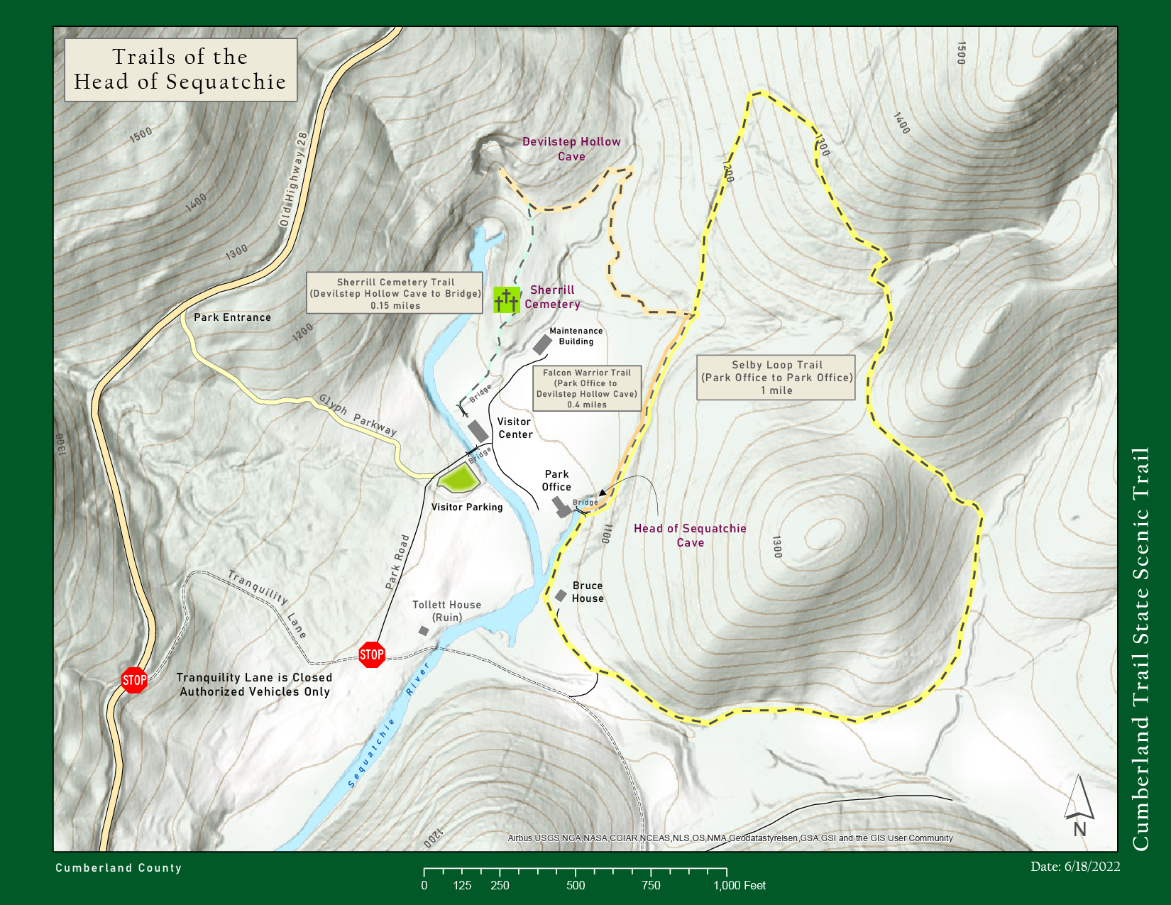
Printable Trail Map - Head of Sequatchie
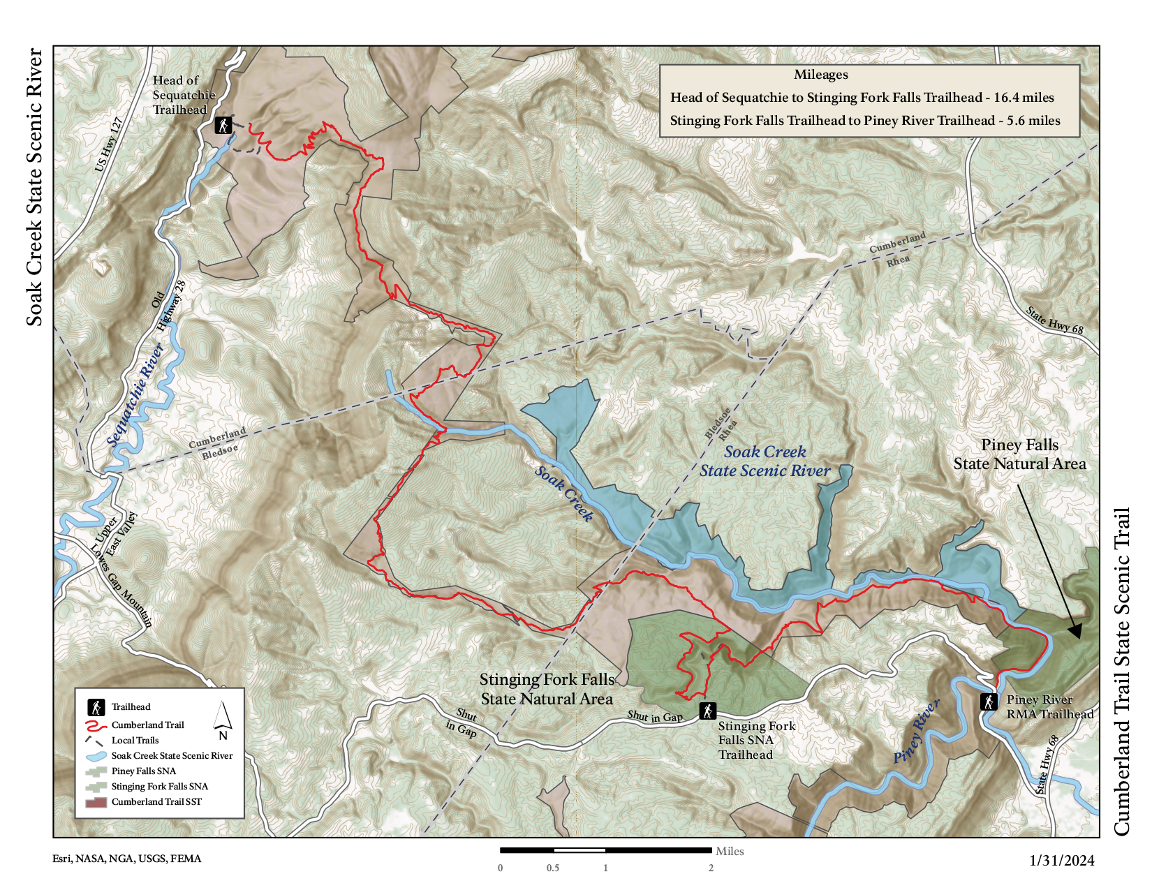
Printable Trail Map - Soak Creek State Scenic River
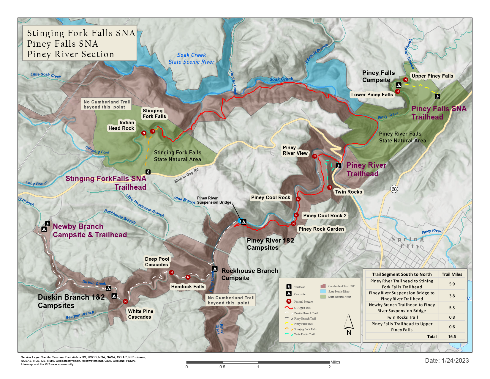
Printable Trail Map - Piney River, Piney Falls SNA, Stinging Fork SNA
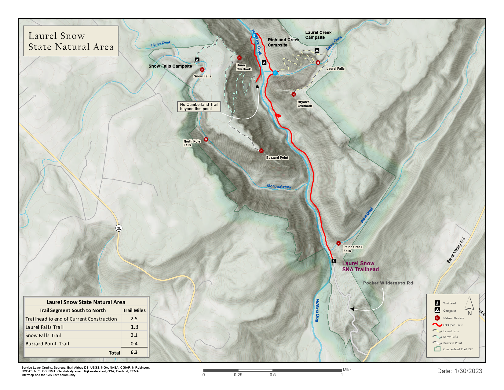
Printable Trail Map - Laurel-Snow SNA
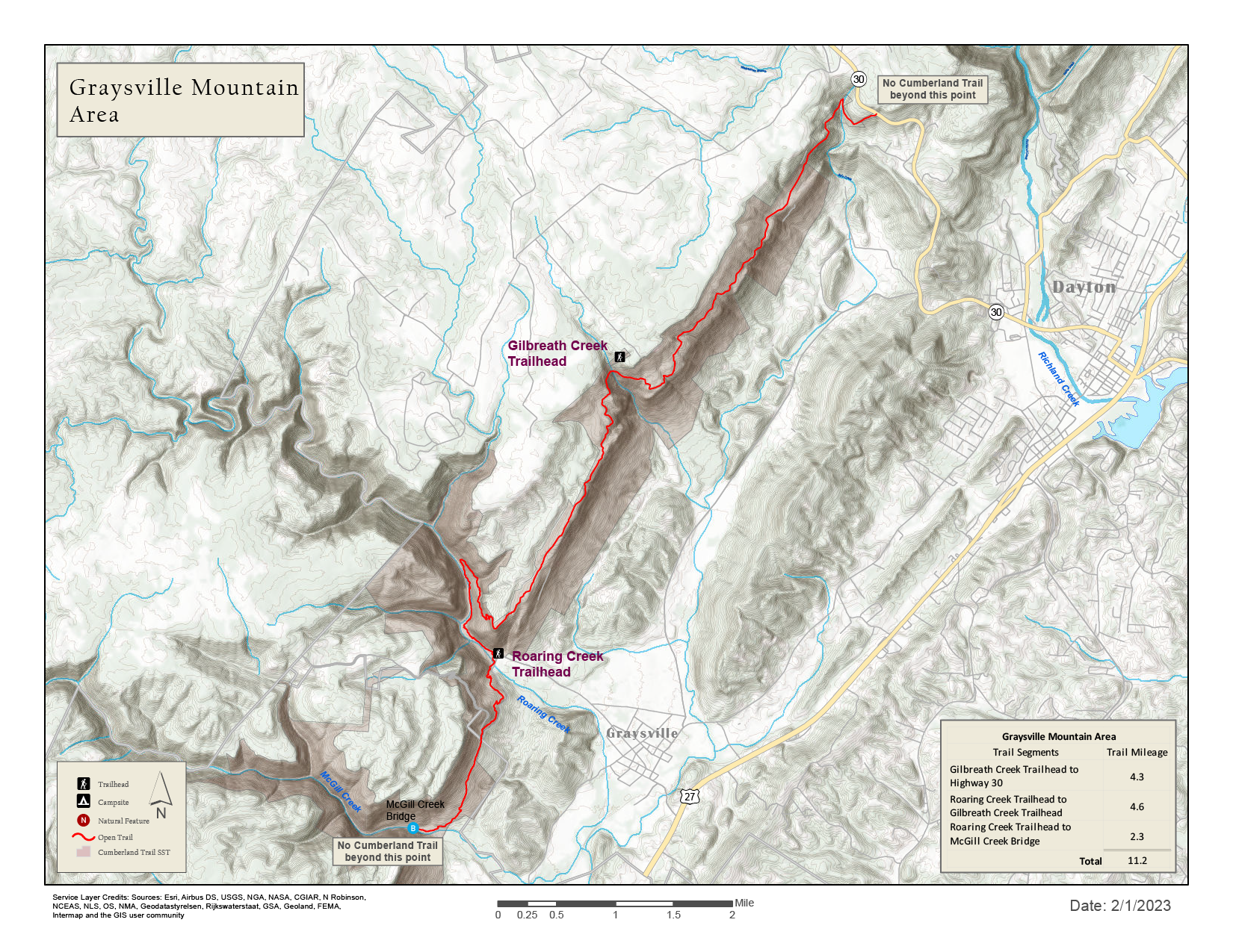
Printable Trail Map - Graysville Mountain
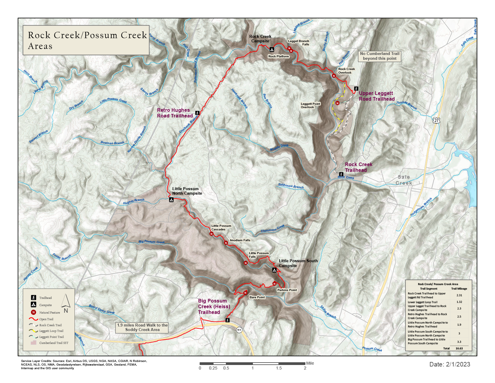
Printable Trail Map - Rock Creek & Possum Creek
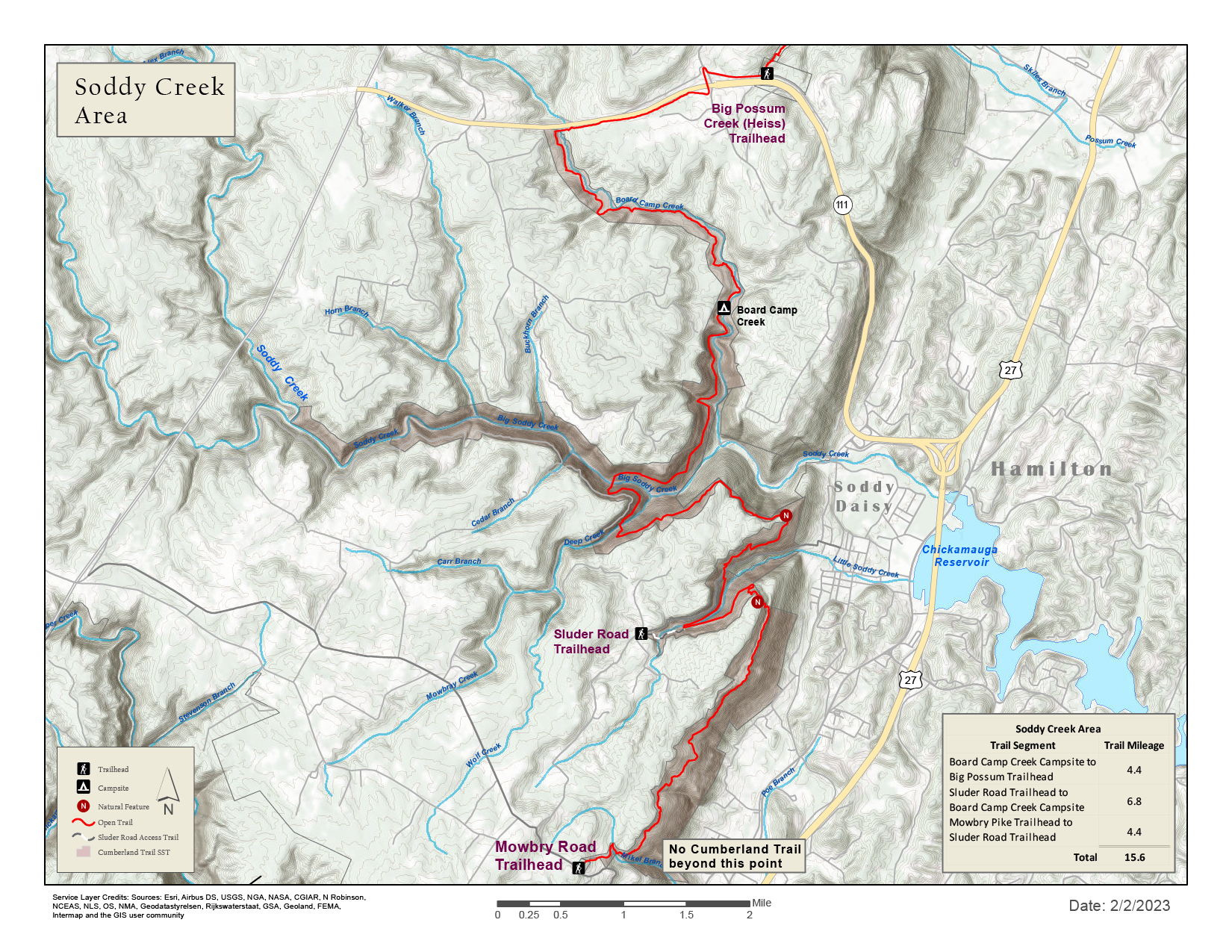
Printable Trail Map - Soddy Creek
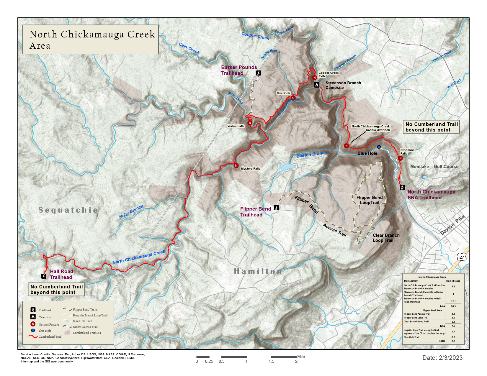
Printable Trail Map - North Chickamauga Creek SNA
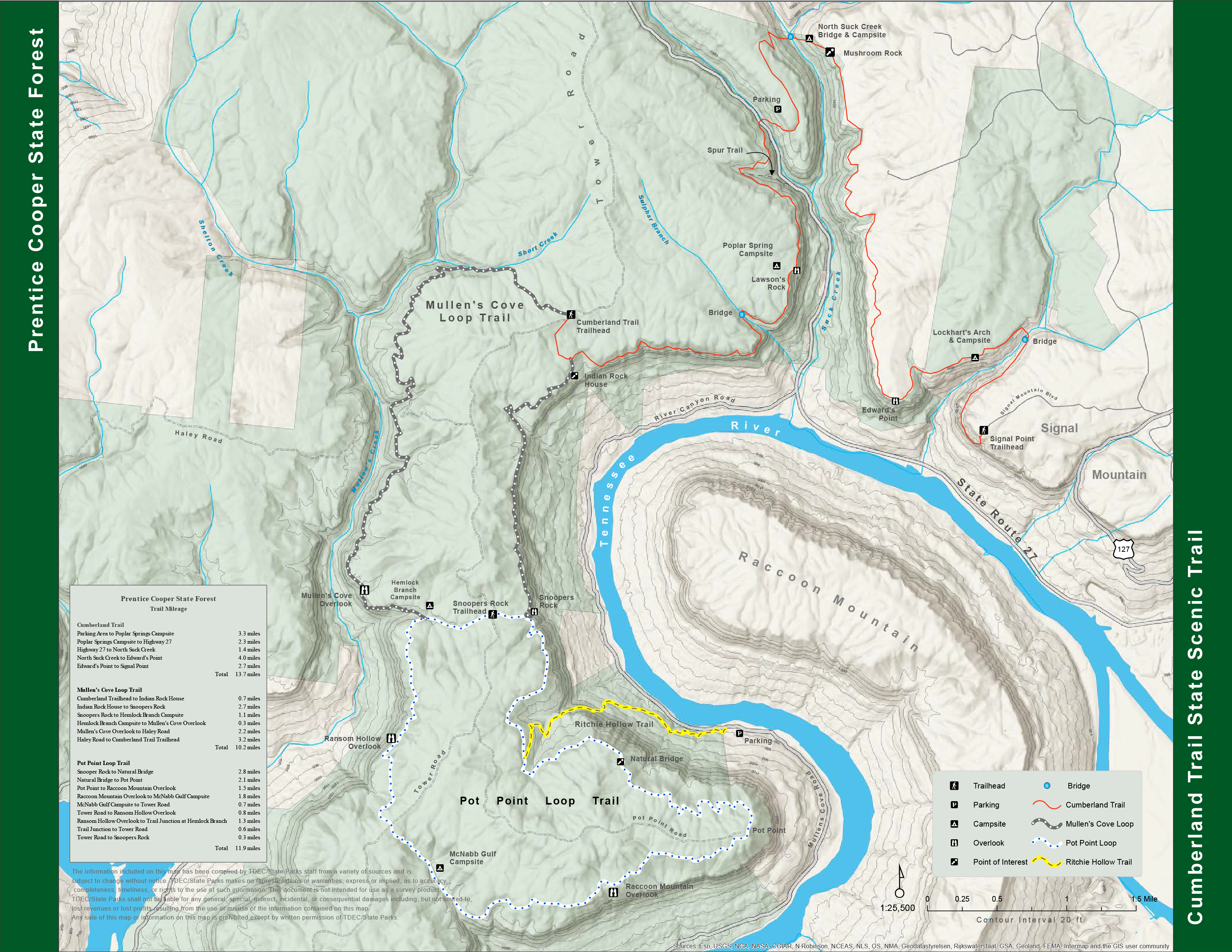
Printable Trail Map - Prentice Cooper
Offline-Use GPS Map - Cumberland Gap
Offline-Use GPS Map - North Cumberland WMA, Cove Lake
Offline-Use GPS Map - Frozen Head, Catoosa WMA
Offline-Use GPS Map - Daddy's Creek
Offline-Use GPS Map - Ozone Falls SNA to Hwy 68
Offline-Use GPS Map - Black Mountain
Offline-Use GPS Map - Brady Mountain
Offline-Use GPS Map - Head of Sequatchie
Offline-Use GPS Map - Soak Creek State Scenic River
Offline-Use GPS Map - Piney River, Piney Falls SNA, Stinging Fork SNA
Offline-Use GPS Map - Laurel-Snow SNA
Offline-Use GPS Map - Graysville Mountain
Offline-Use GPS Map - Rock Creek & Possum Creek
Offline-Use GPS Map - Soddy Creek
-
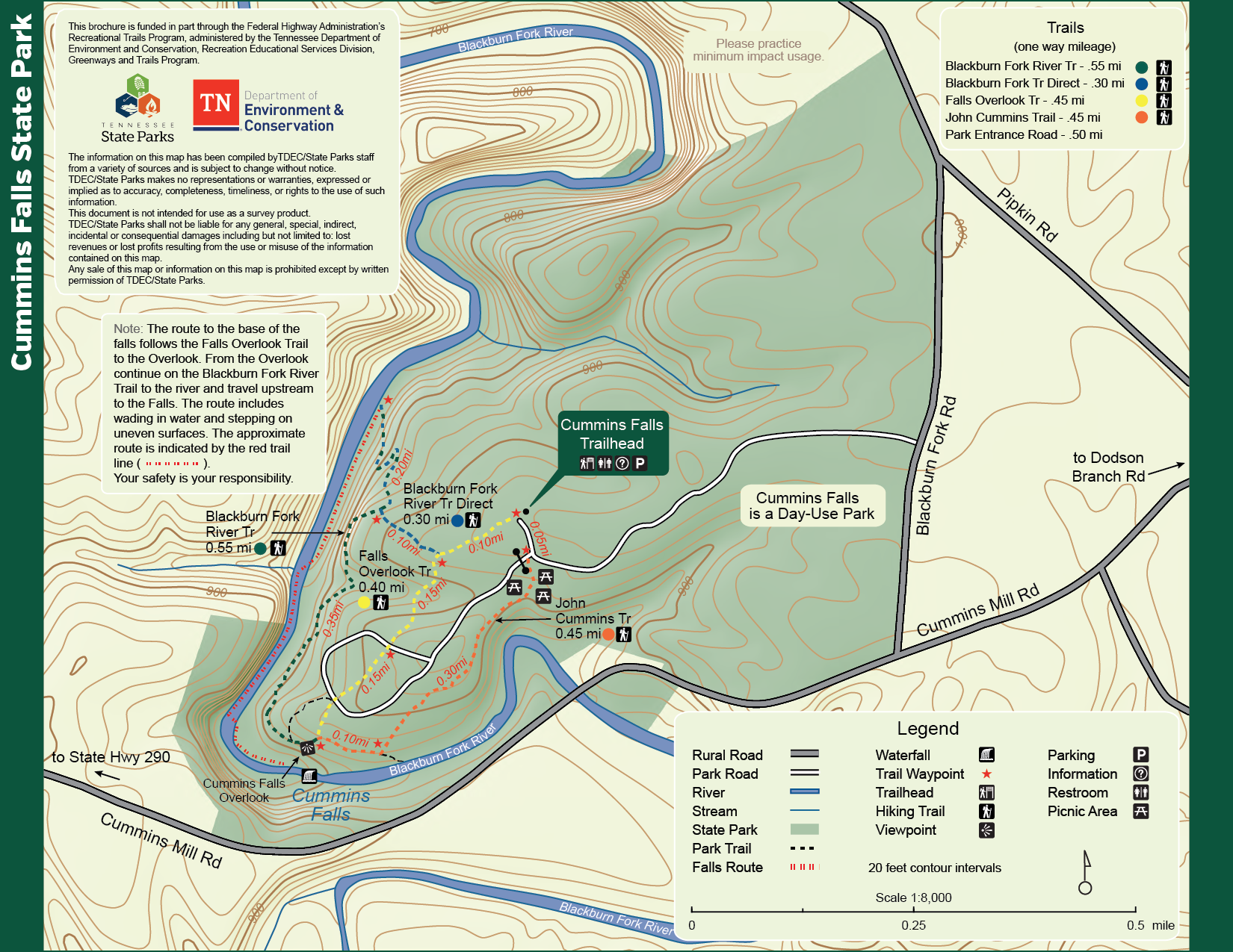
Cummins Fall State Park
-
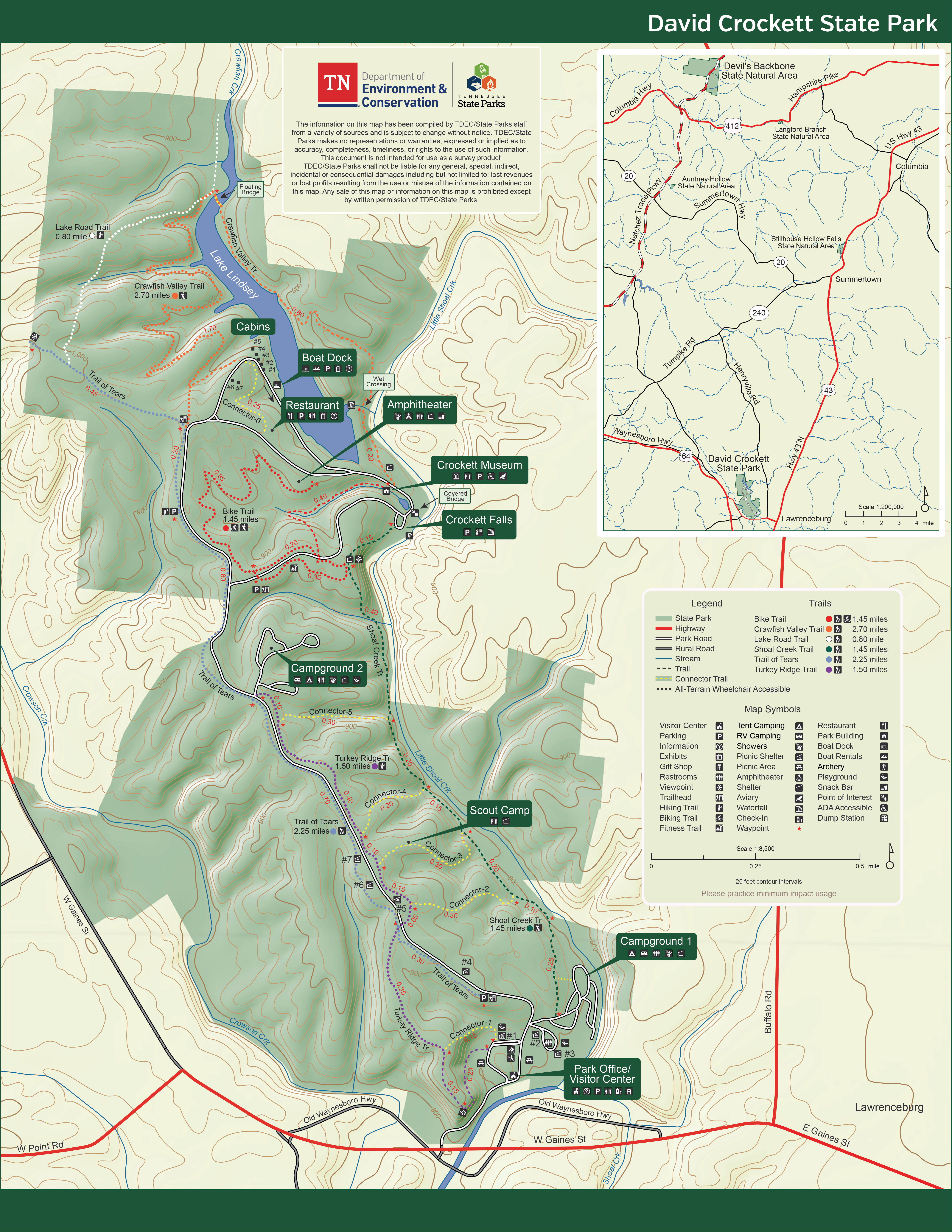
David Crockett State Park
-
David Crockett Birthplace State Park
-
Dunbar Cave State Park
-
Edgar Evins State Park
-
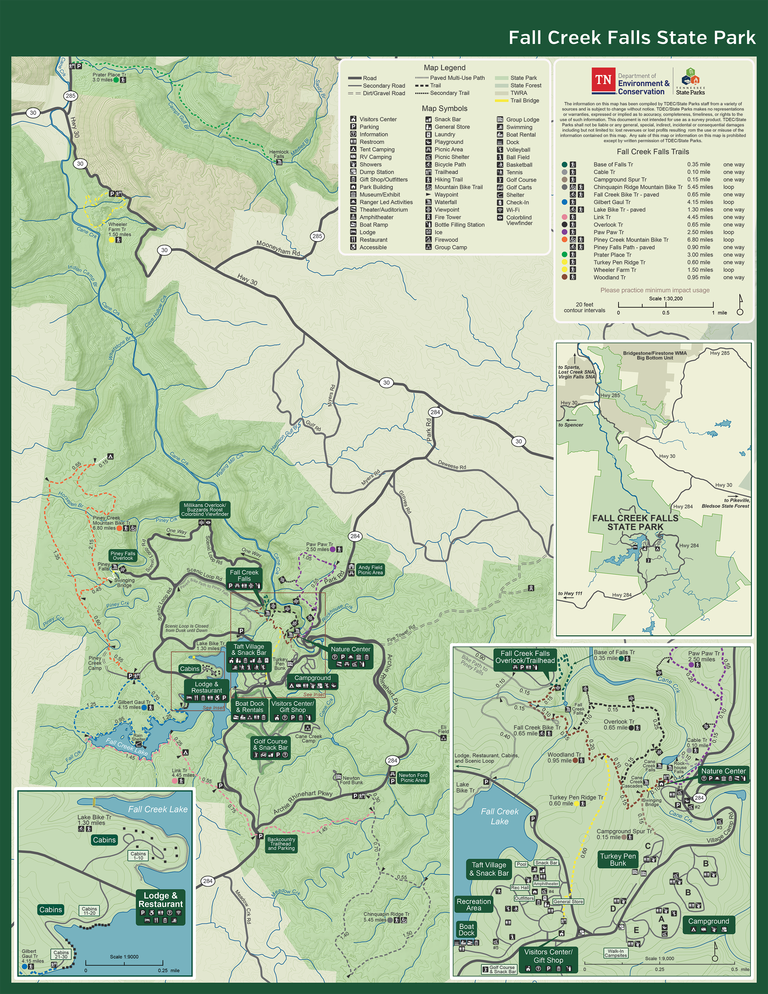
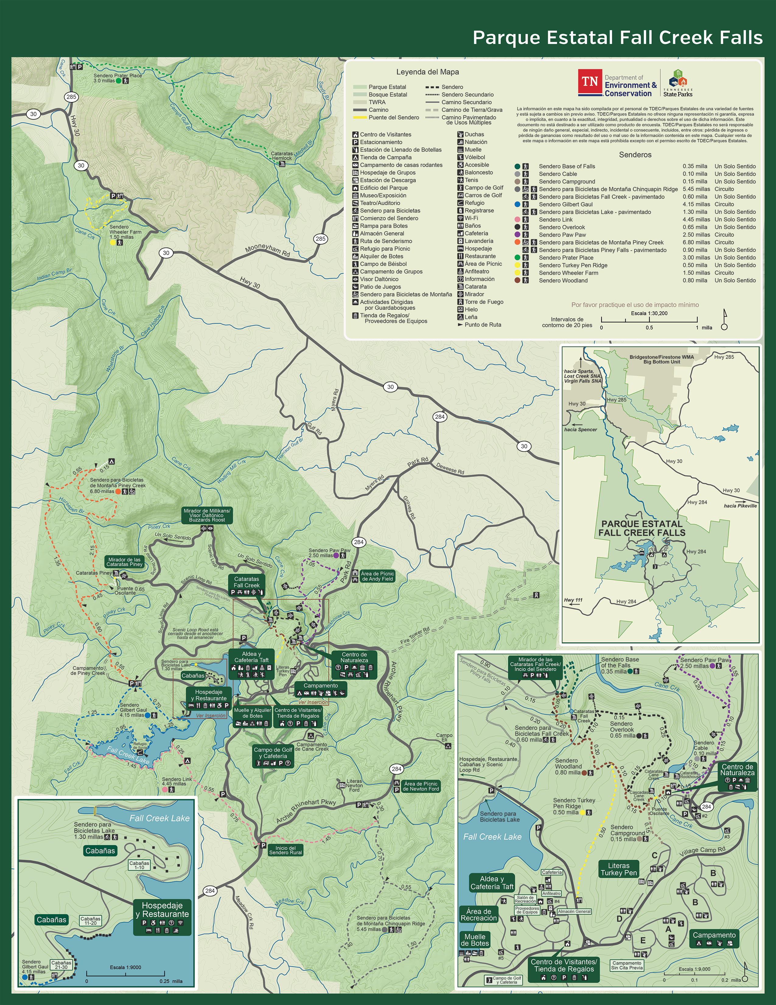
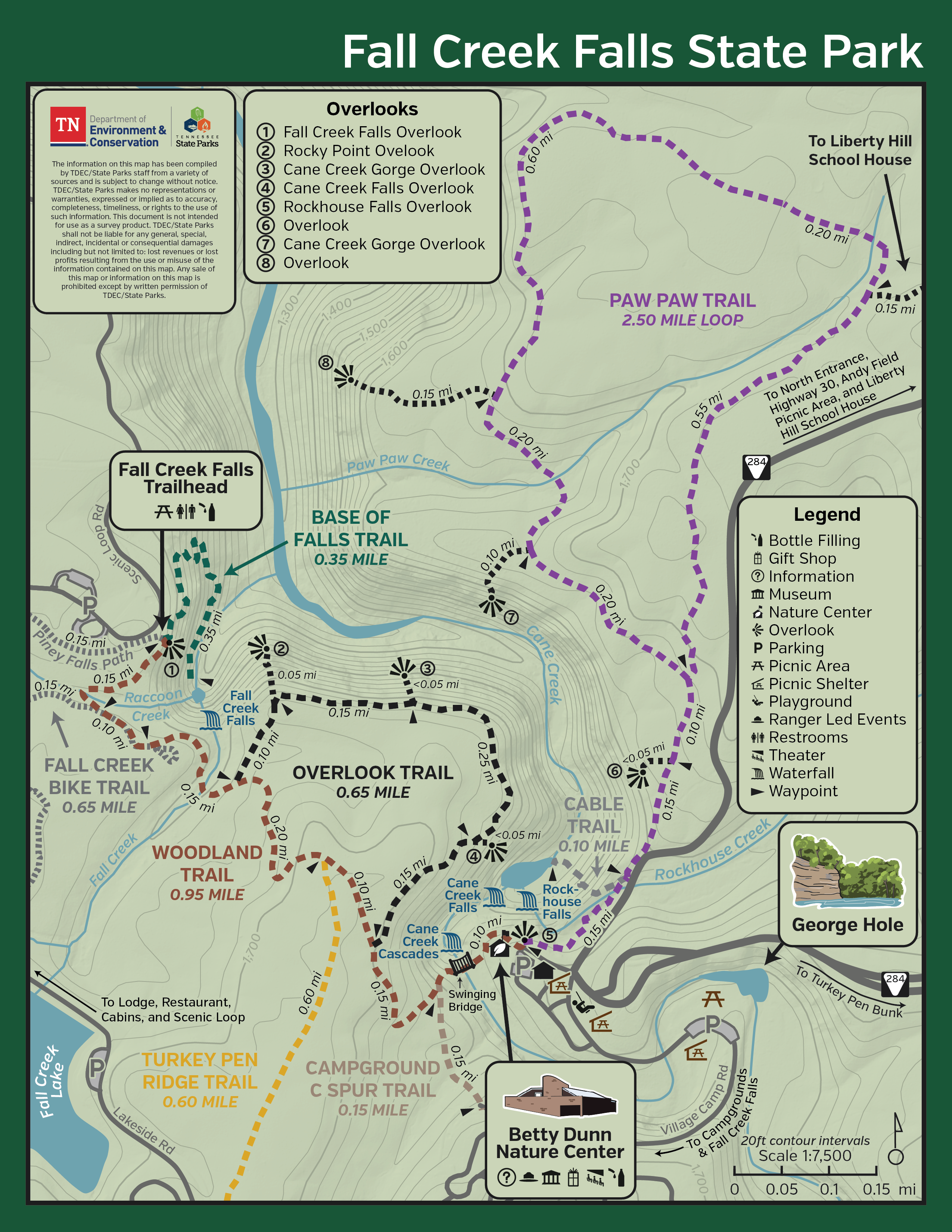
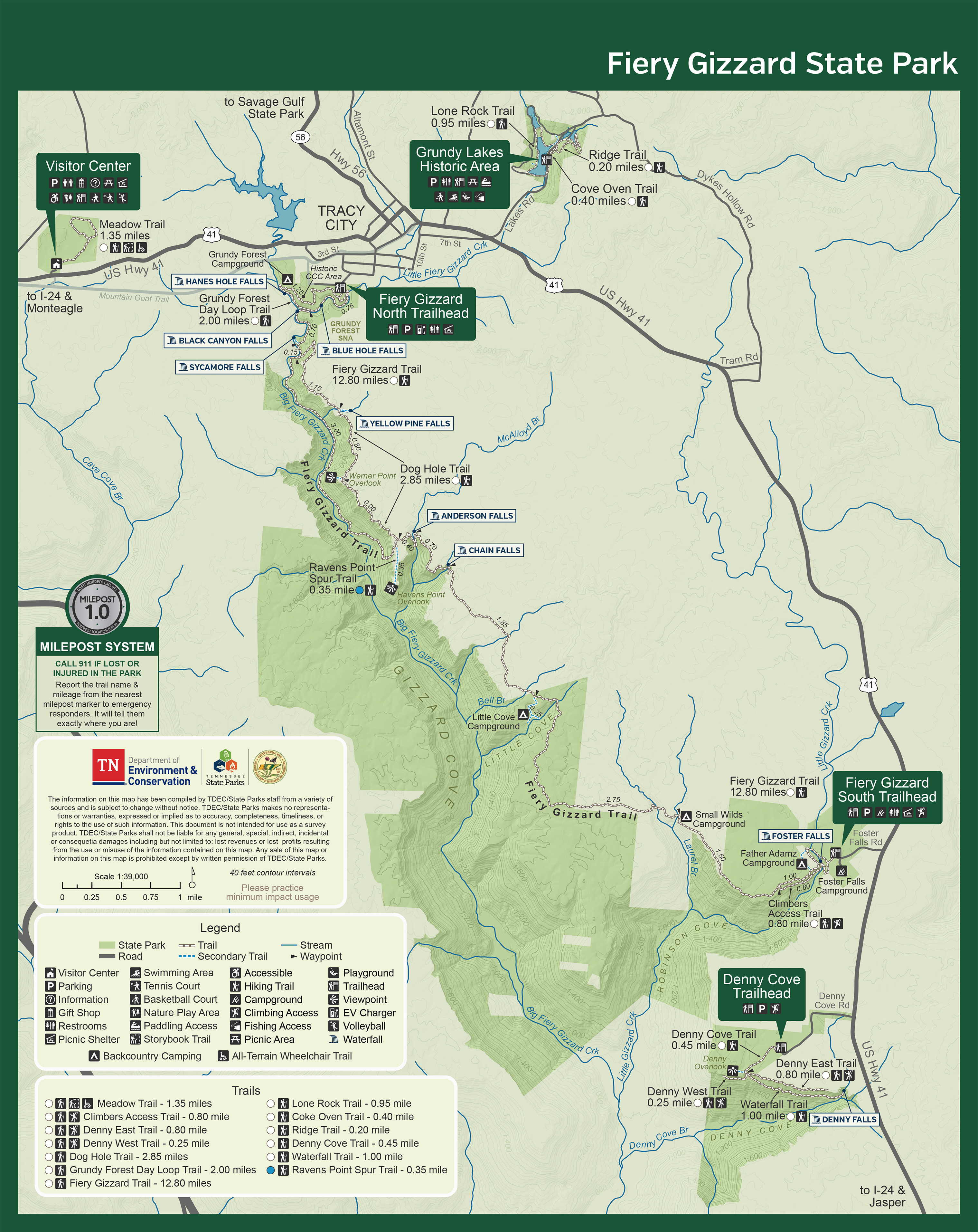
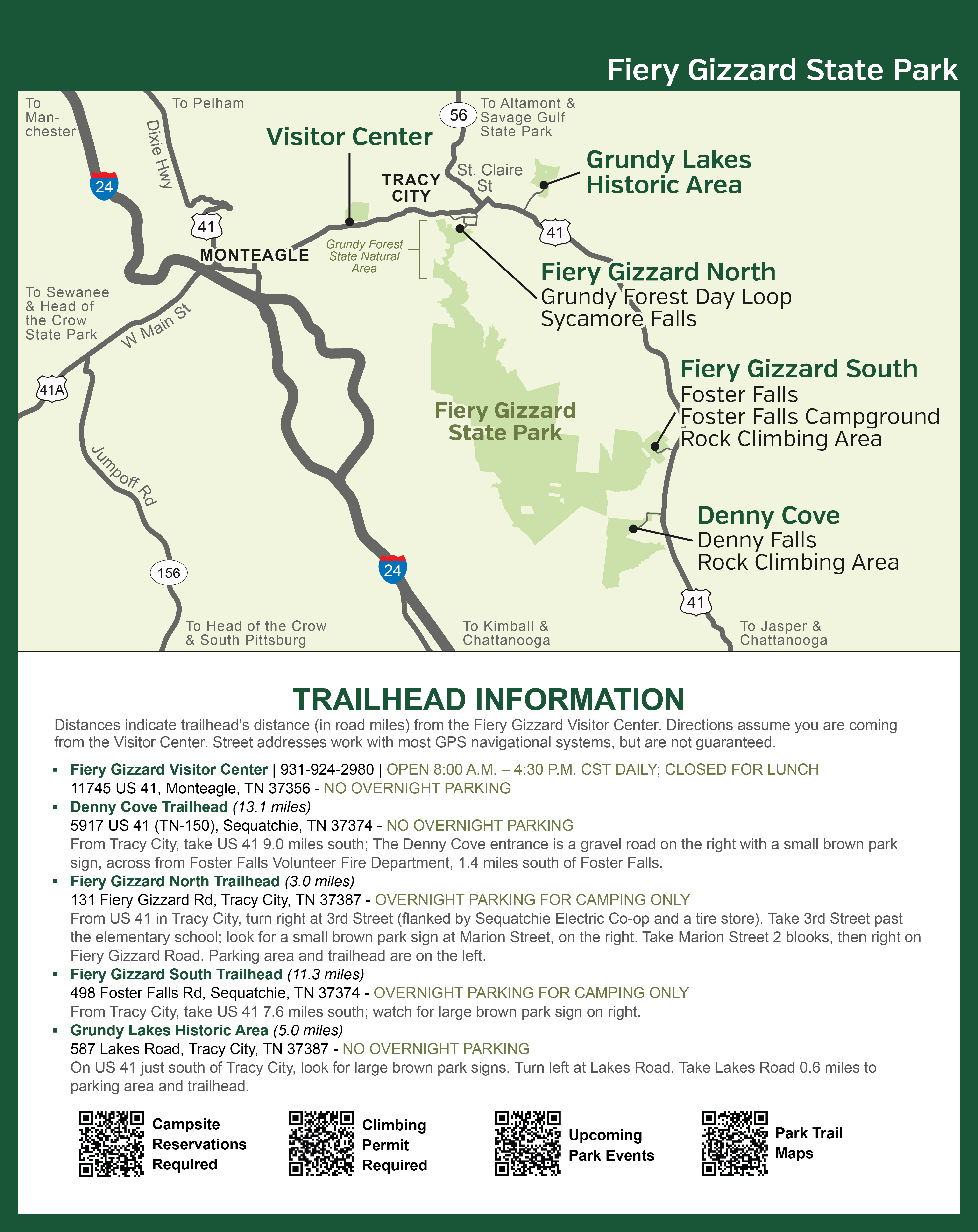
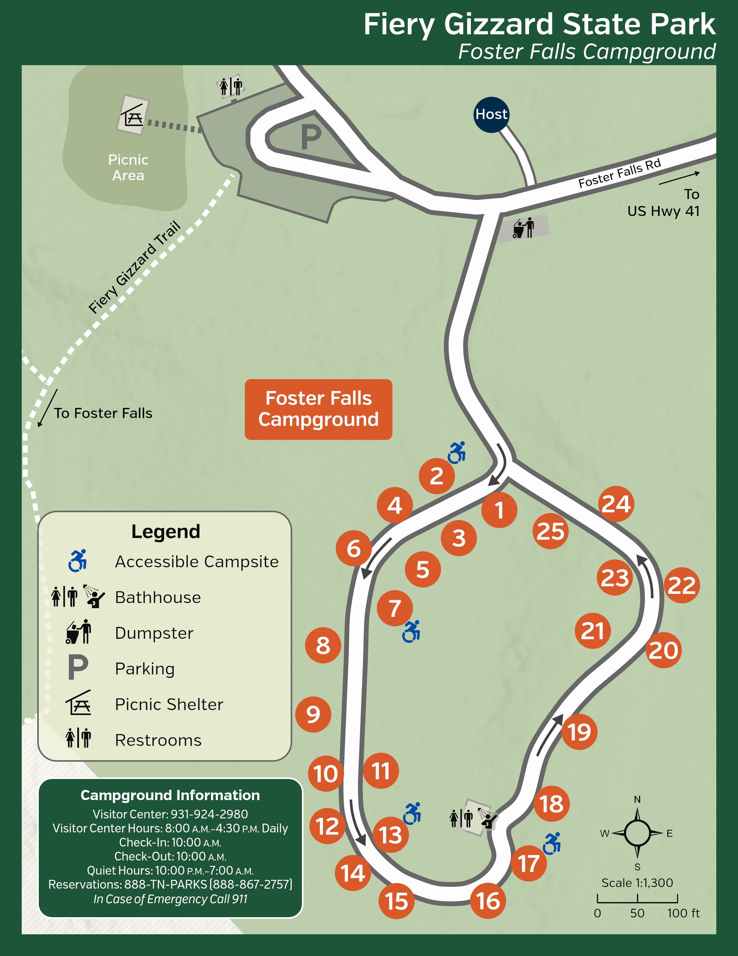
Fiery Gizzard State Park
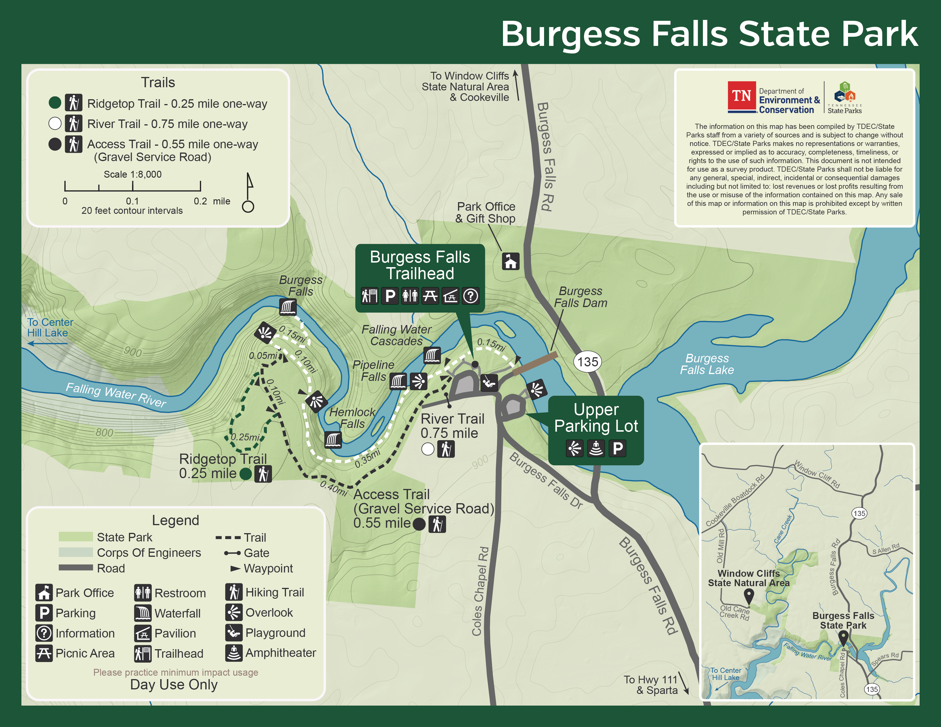
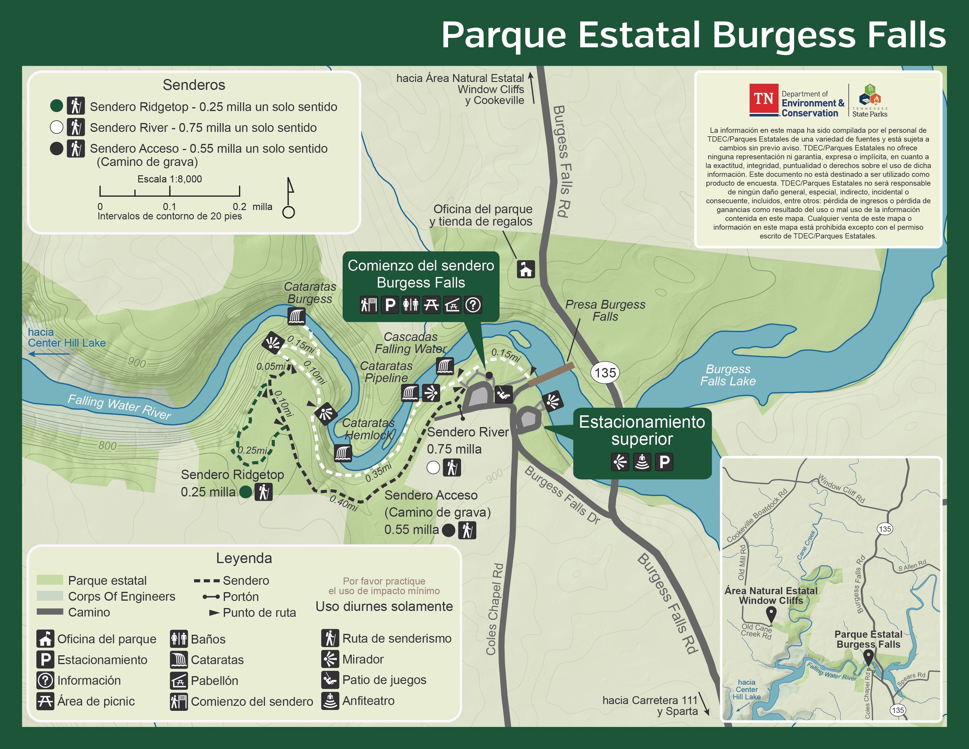
Fiery Gizzard Printable Trail Map
Fiery Gizzard Offline-Use GPS Map
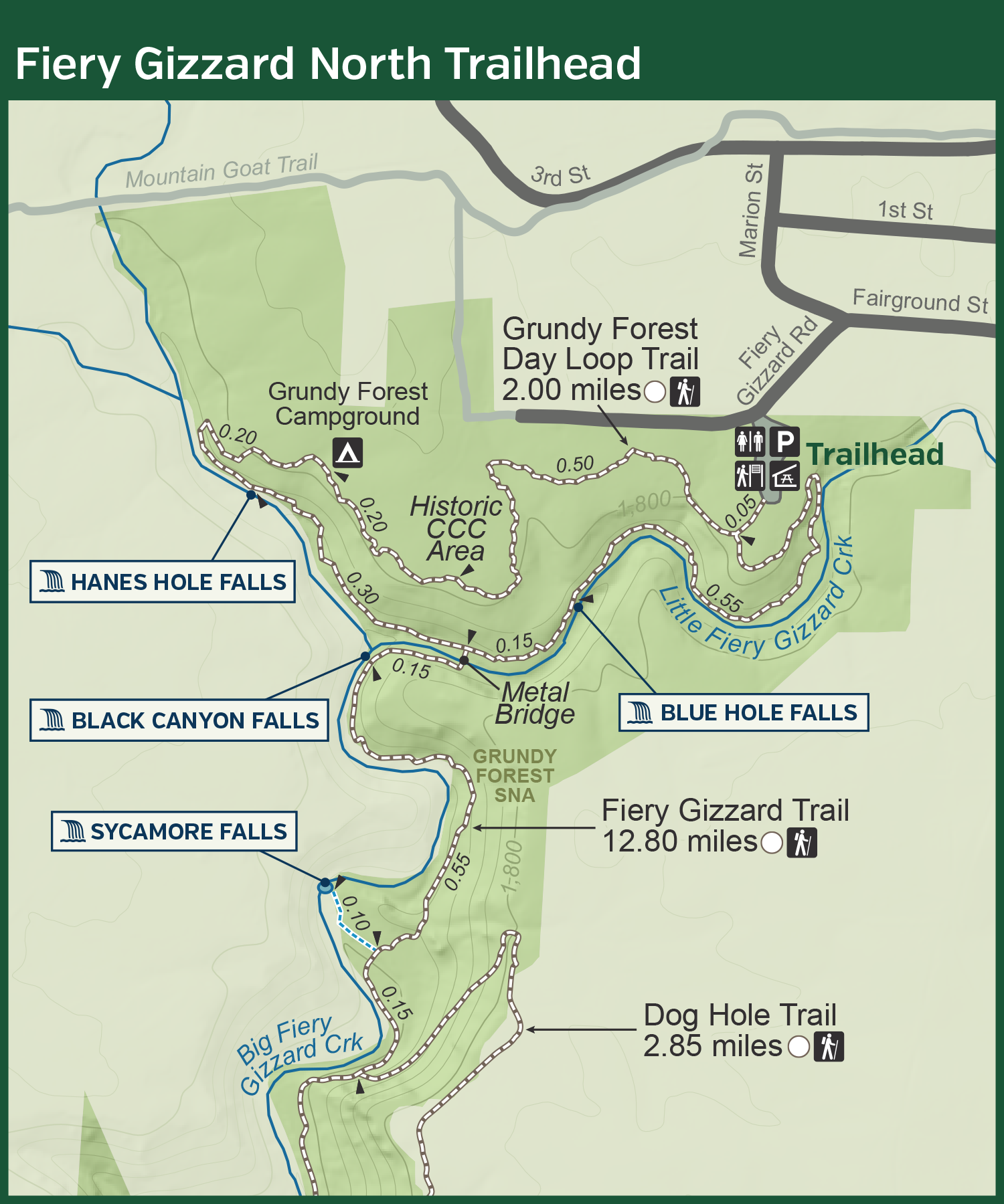
Fiery Gizzard North Trailhead Printable Map
Fiery Gizzard North Trailhead Offline-Use GPS Map
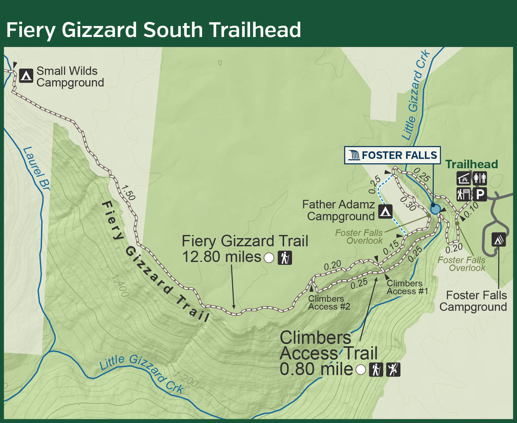
Fiery Gizzard South Trailhead Printable Map
Fiery Gizzard South Trailhead Offline-Use GPS Map
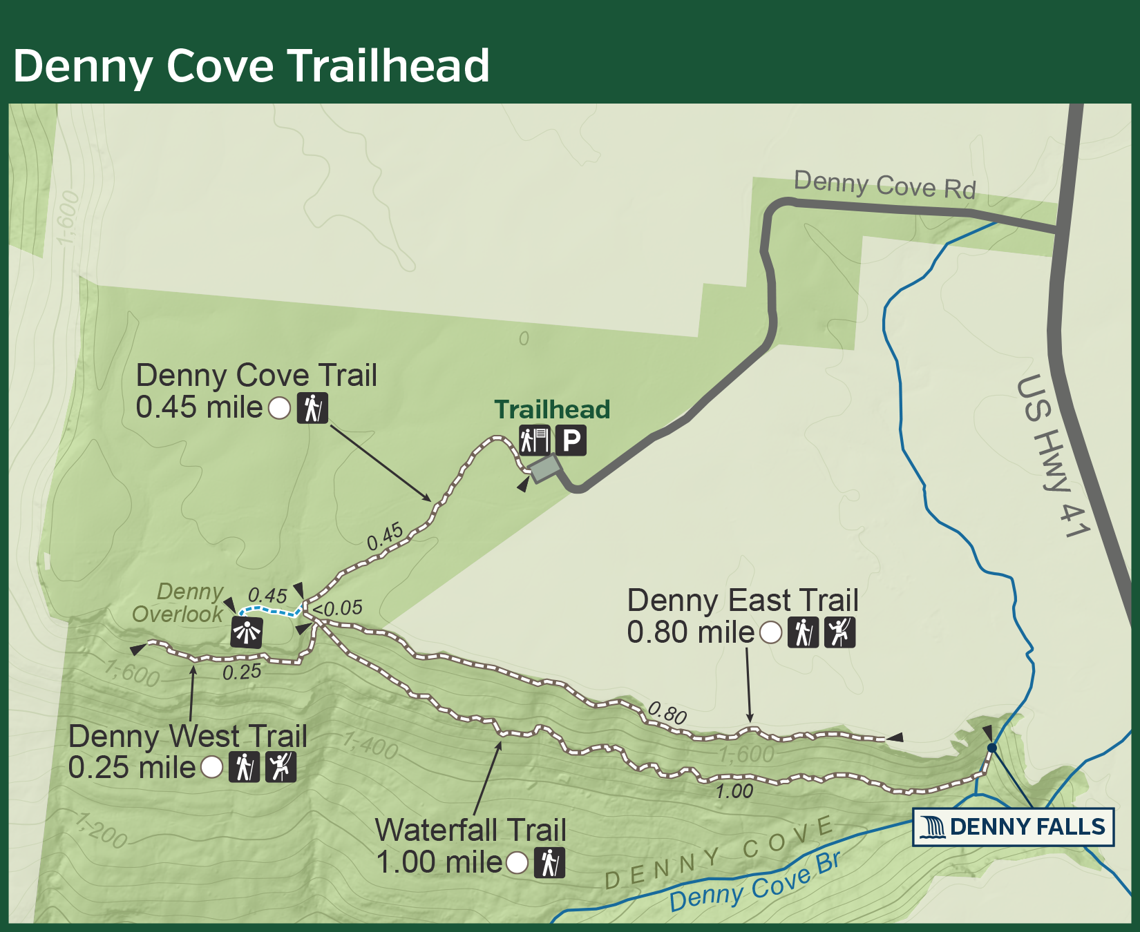
Denny Cove Trailhead Printable Map
Denny Cove Trailhead Offline-Use GPS Map
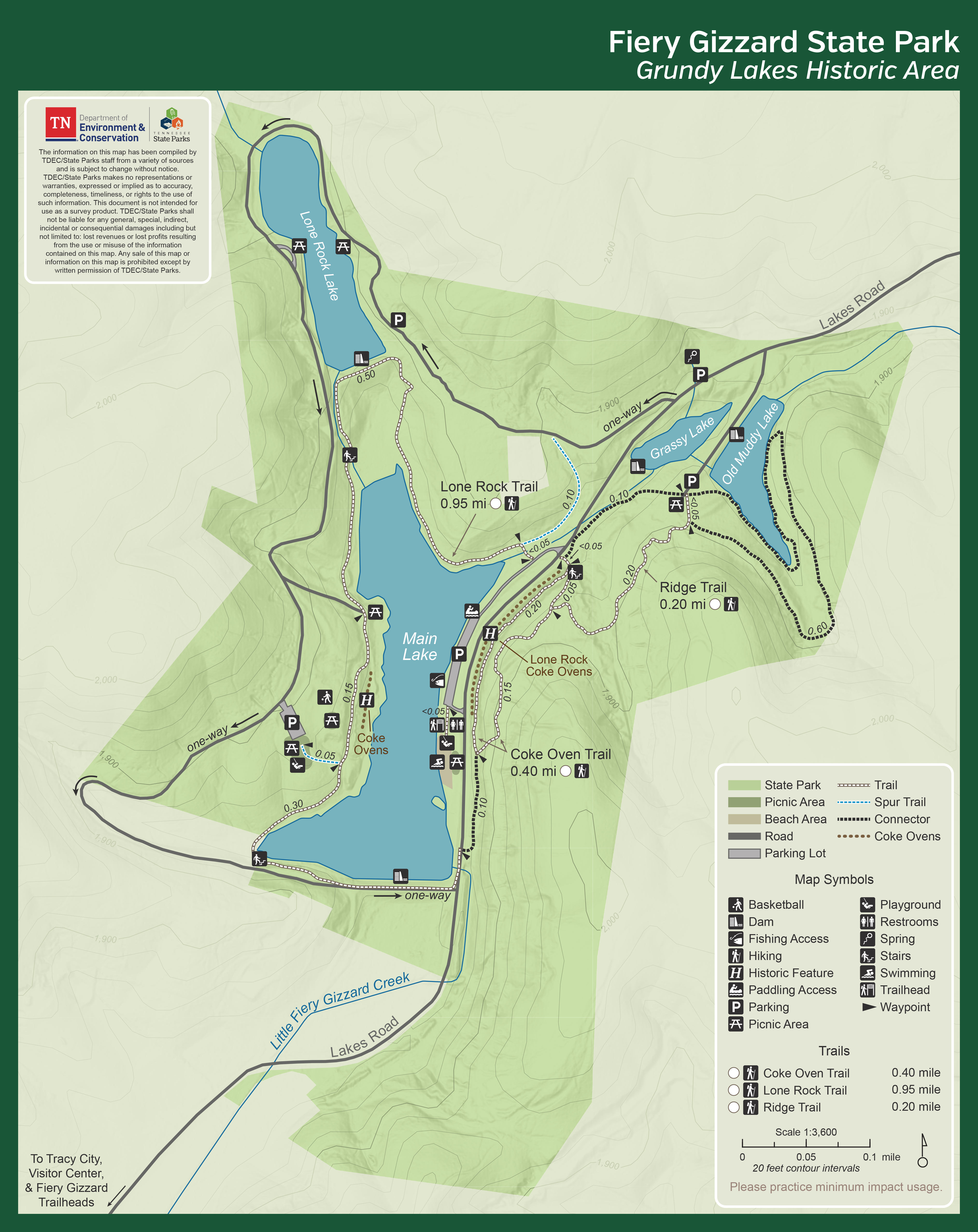
Grundy Lakes Historic Area Printable Map
Grundy Lakes Historic Area Offline-Use GPS Map
Fiery Gizzard State Park Driving Map & Information
Foster Falls Printable Campground Map
South Cumberland State Park adopted the new name Fiery Gizzard State Park in 2025. If you're looking for Savage Gulf maps? They are now located under Savage Gulf State Park below. Additionally, please look at Head of the Crow State Park for additional trail maps from this area.
-
Fort Loudoun State Historic Park
-
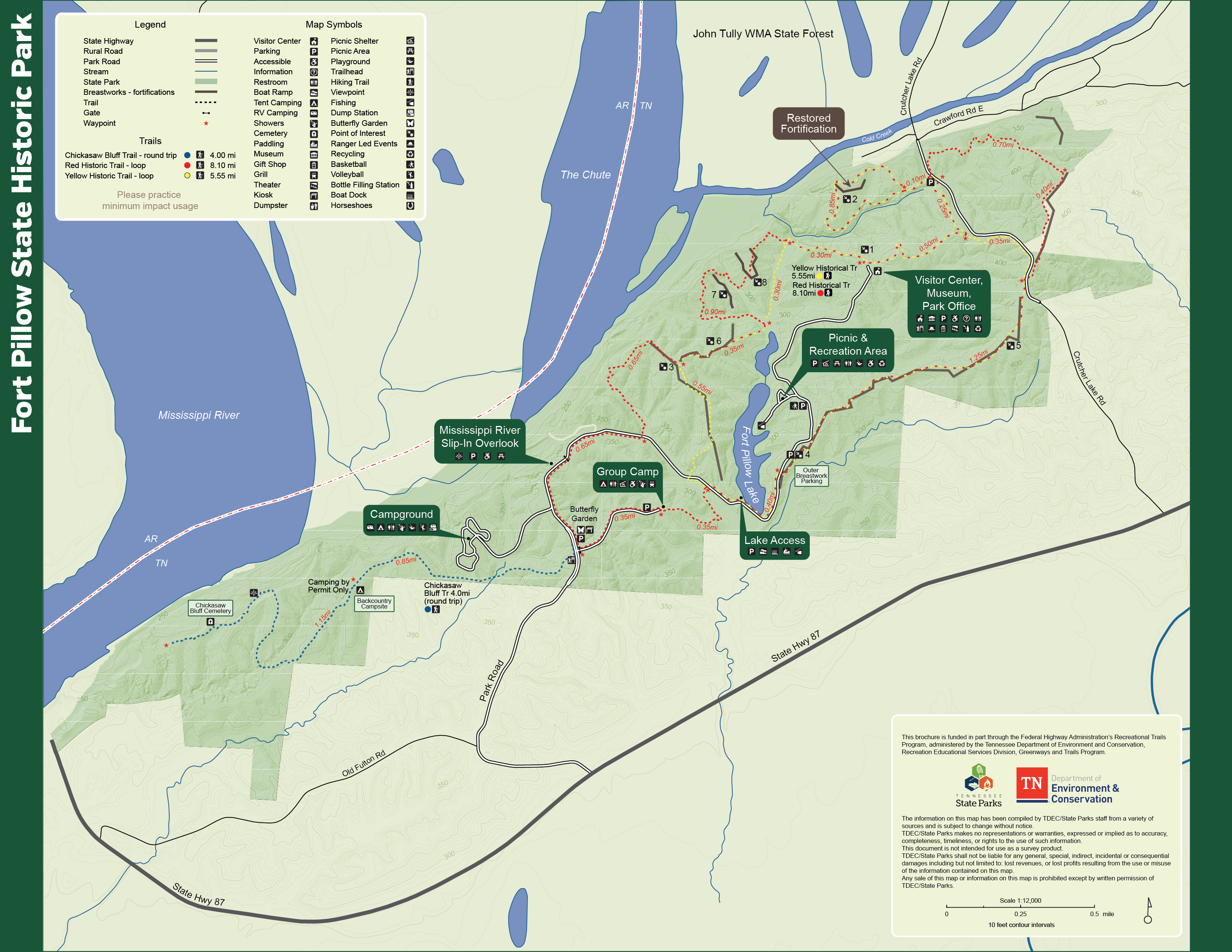
Fort Pillow State Historic Park
-
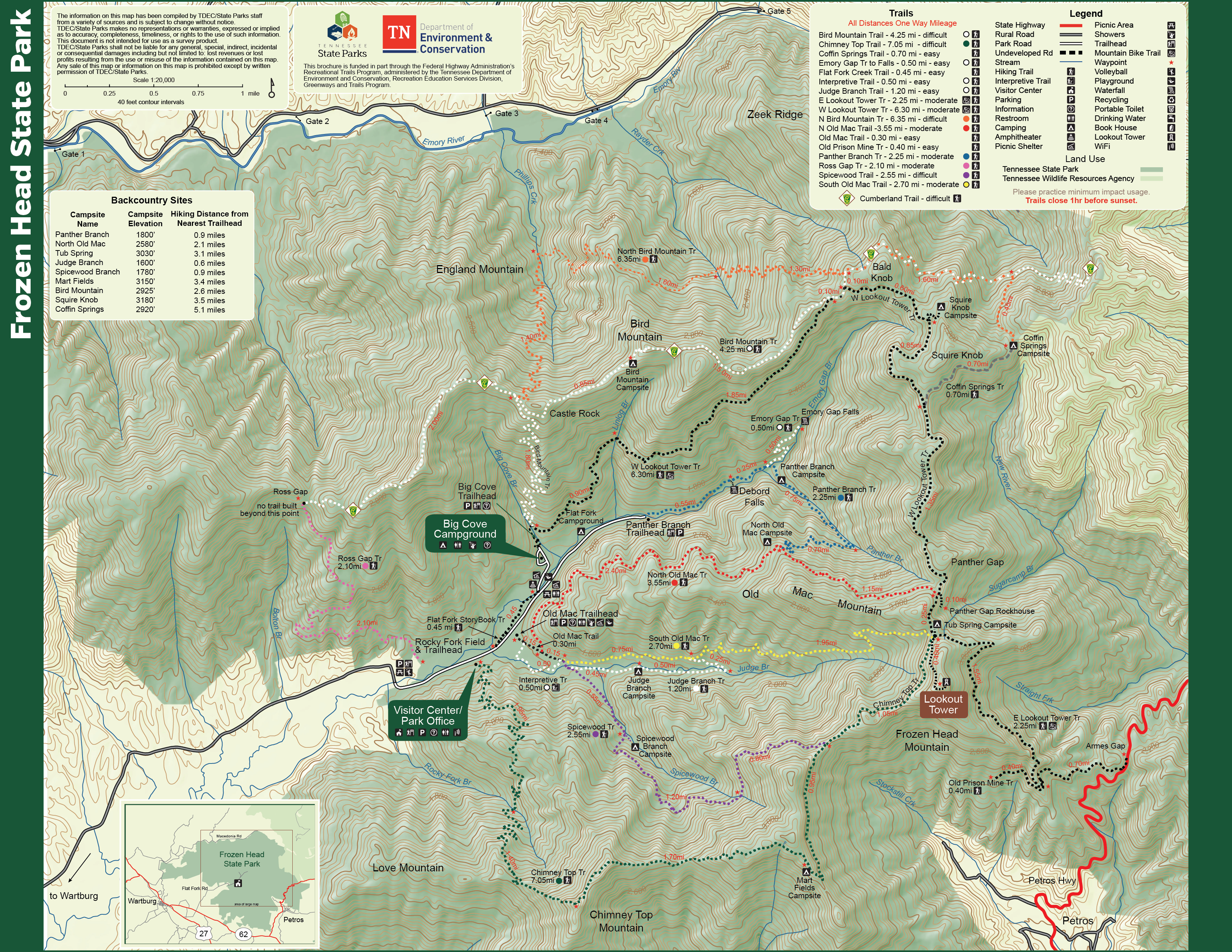
Frozen Head State Park
-
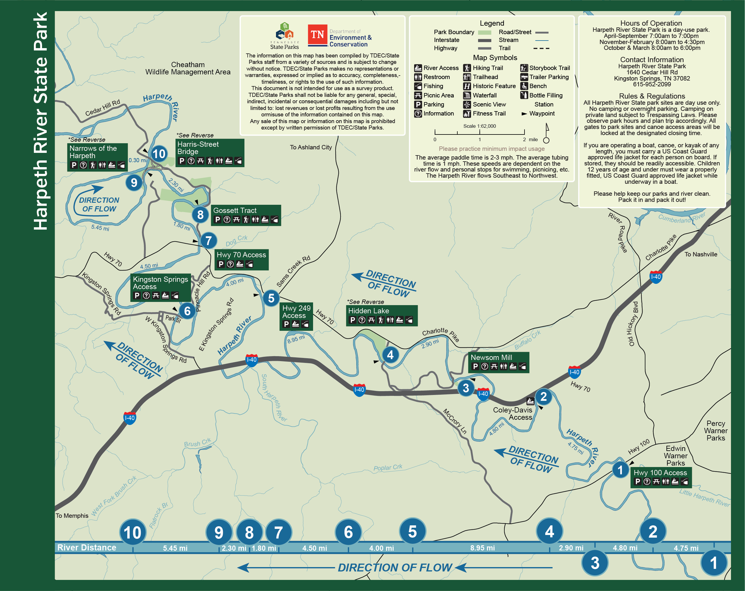
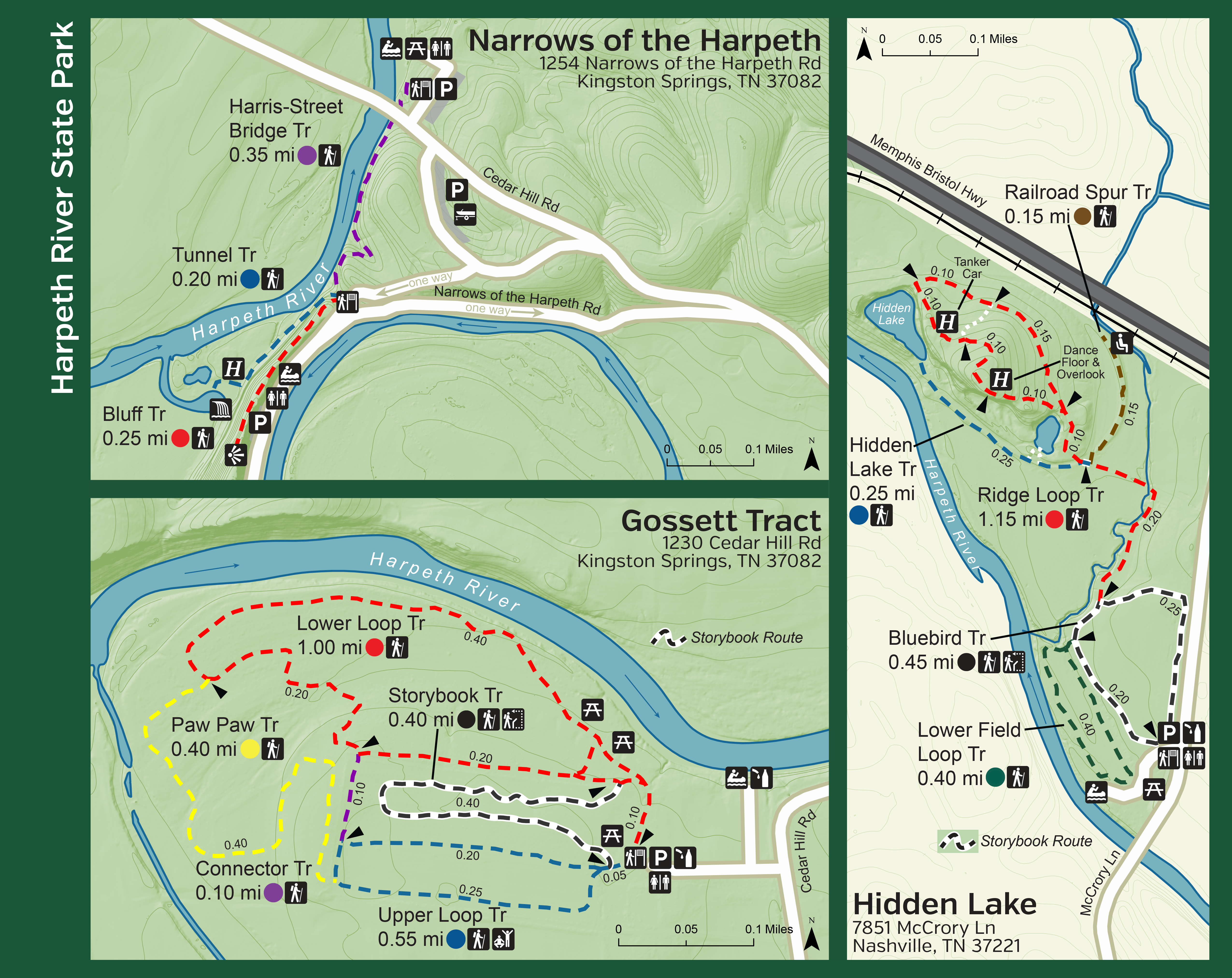
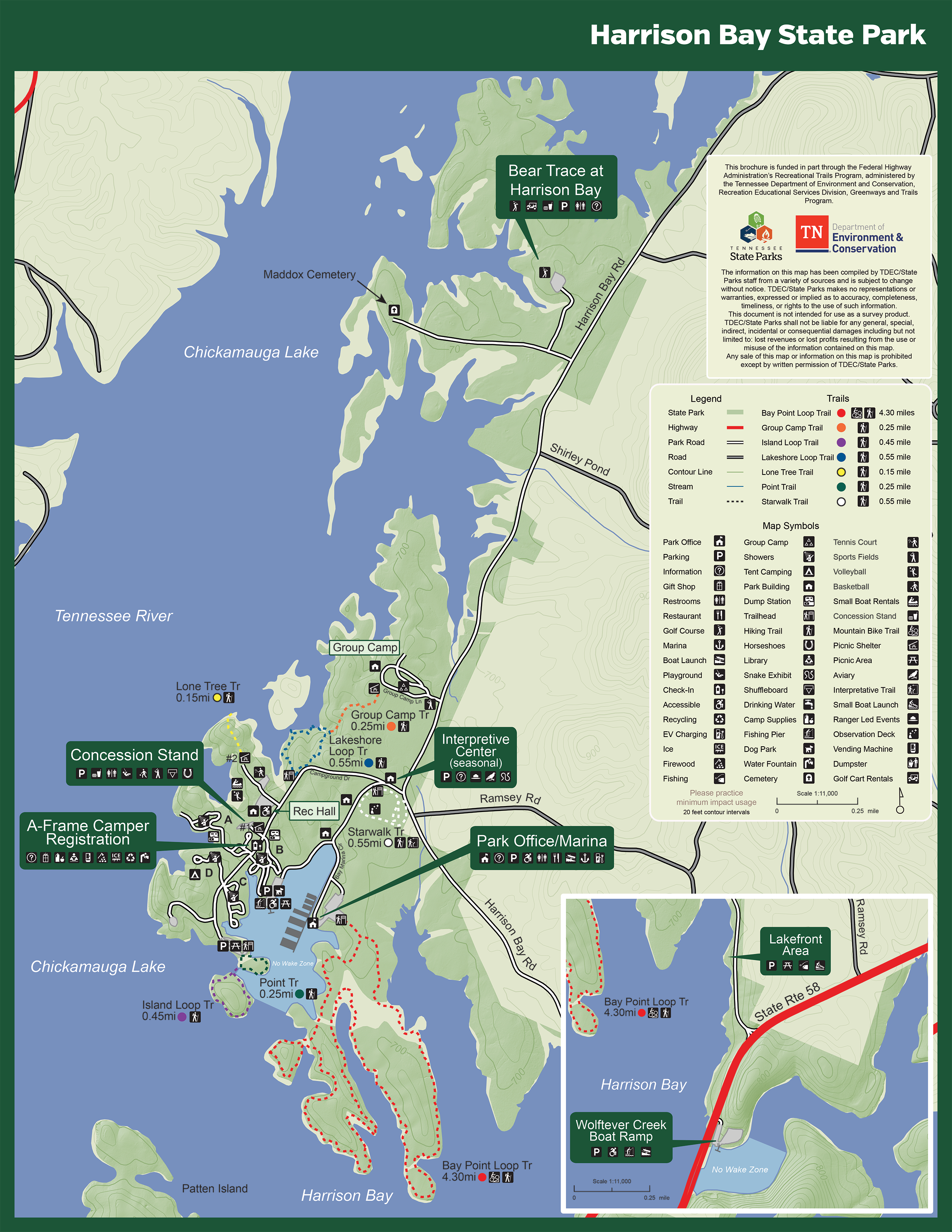
Harrison Bay State Park
-
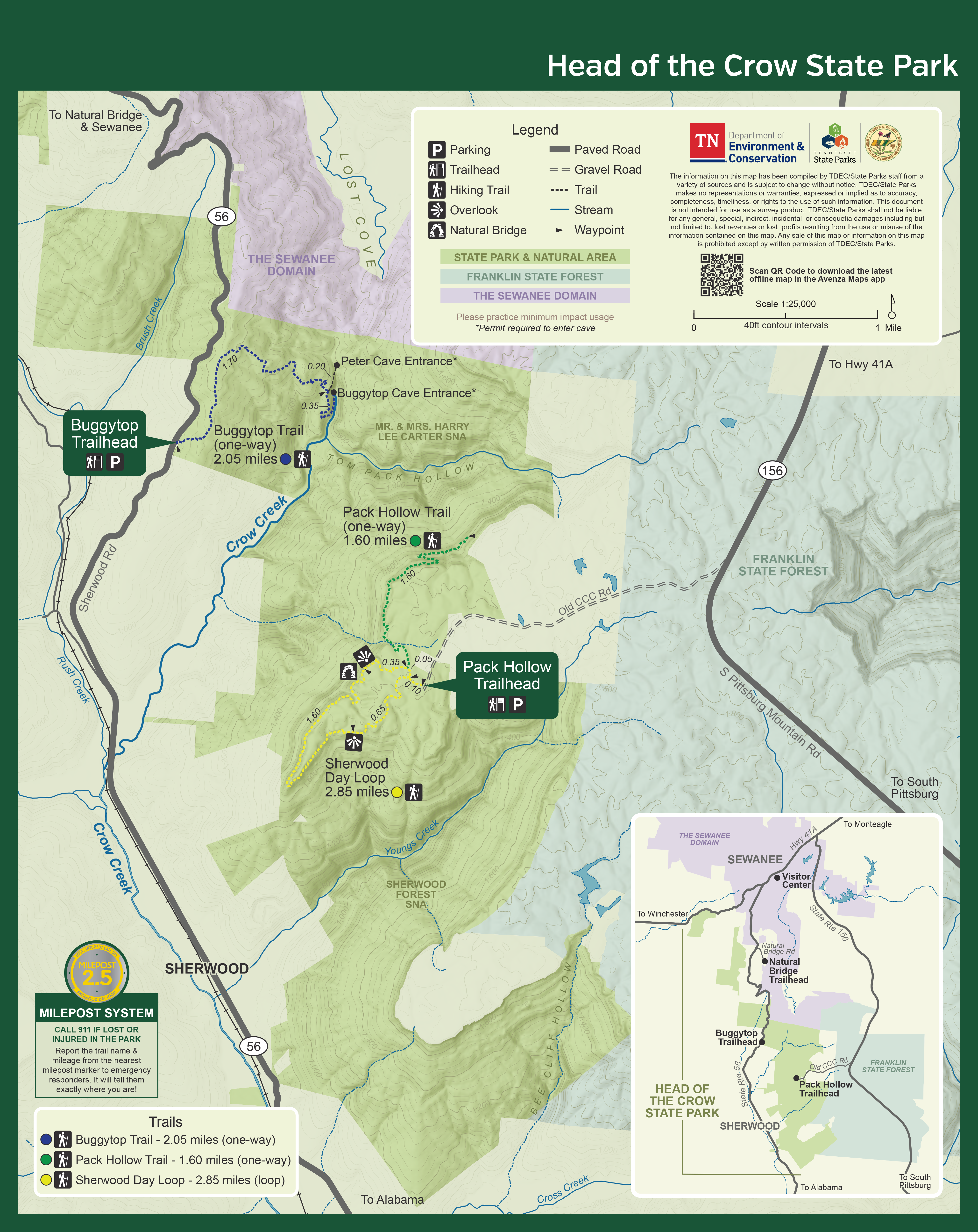
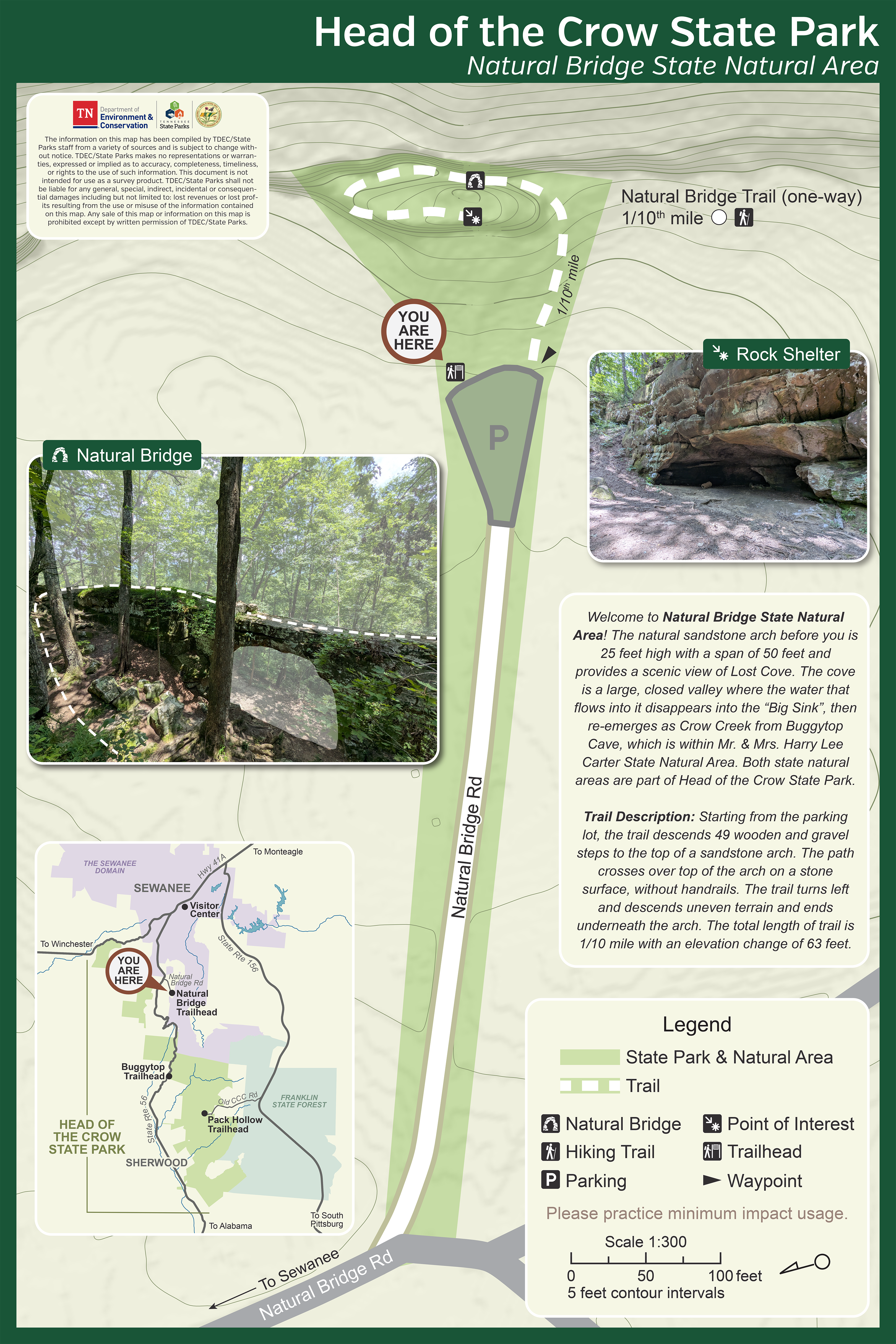
Head of the Crow State Park
Head of the Crow Printable Trail Map
Head of the Crow Offline-Use GPS Map
Natural Bridge Trailhead Printable Map
Natural Bridge Trailhead Offline-Use GPS Map
Head of the Crow encompasses areas formerly managed by Fiery Gizzard State Park (formerly South Cumberland State Park). Please view maps of Fiery Gizzard State Park above.
-
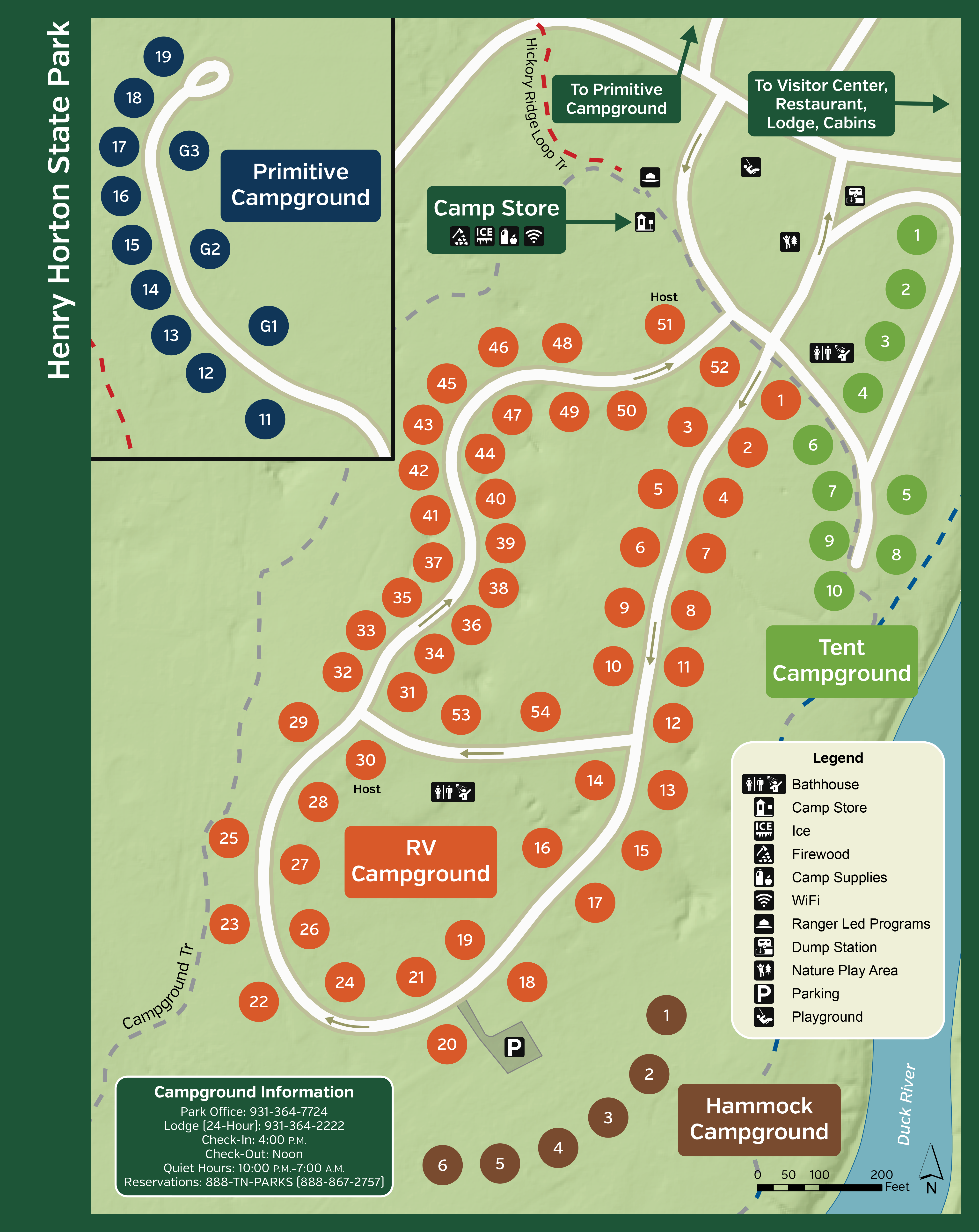
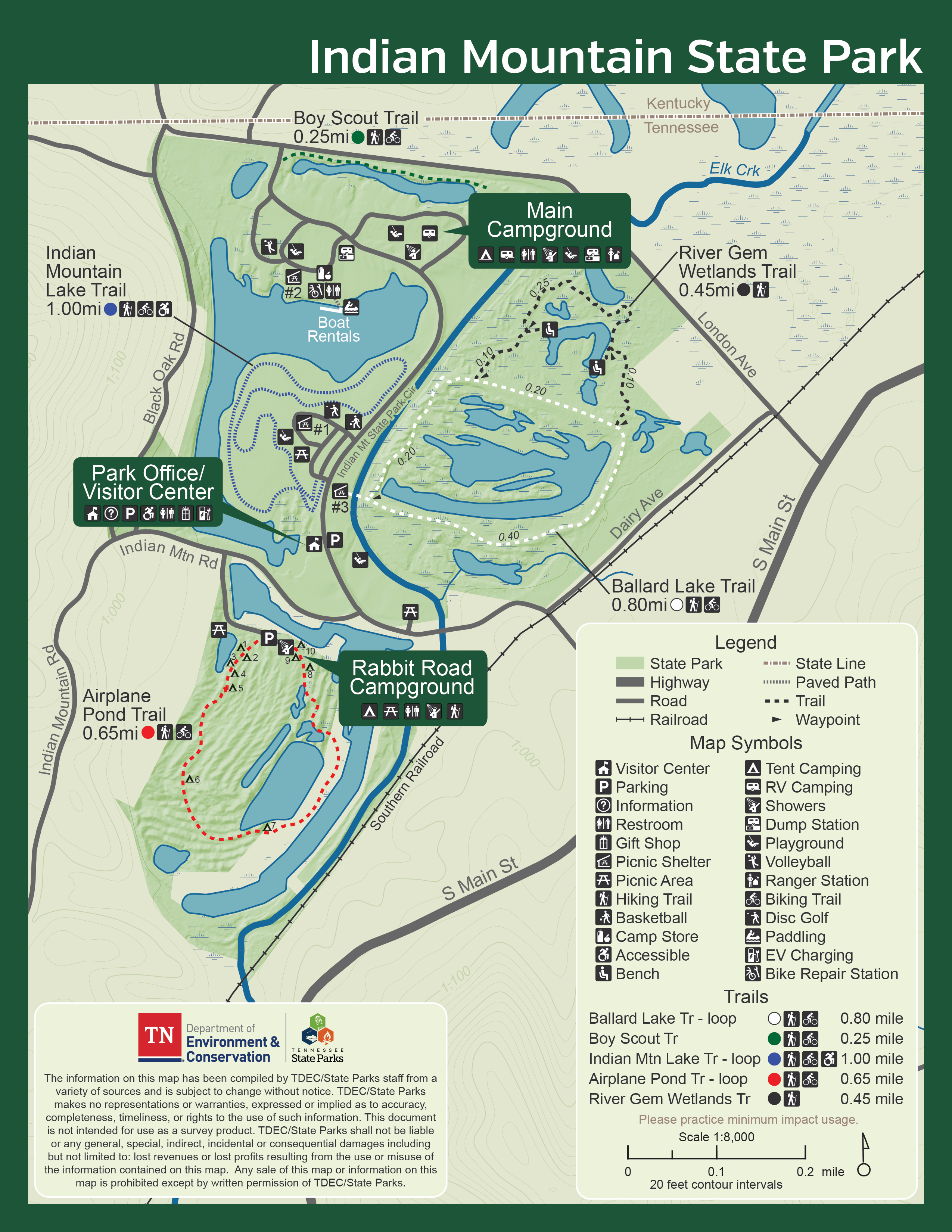
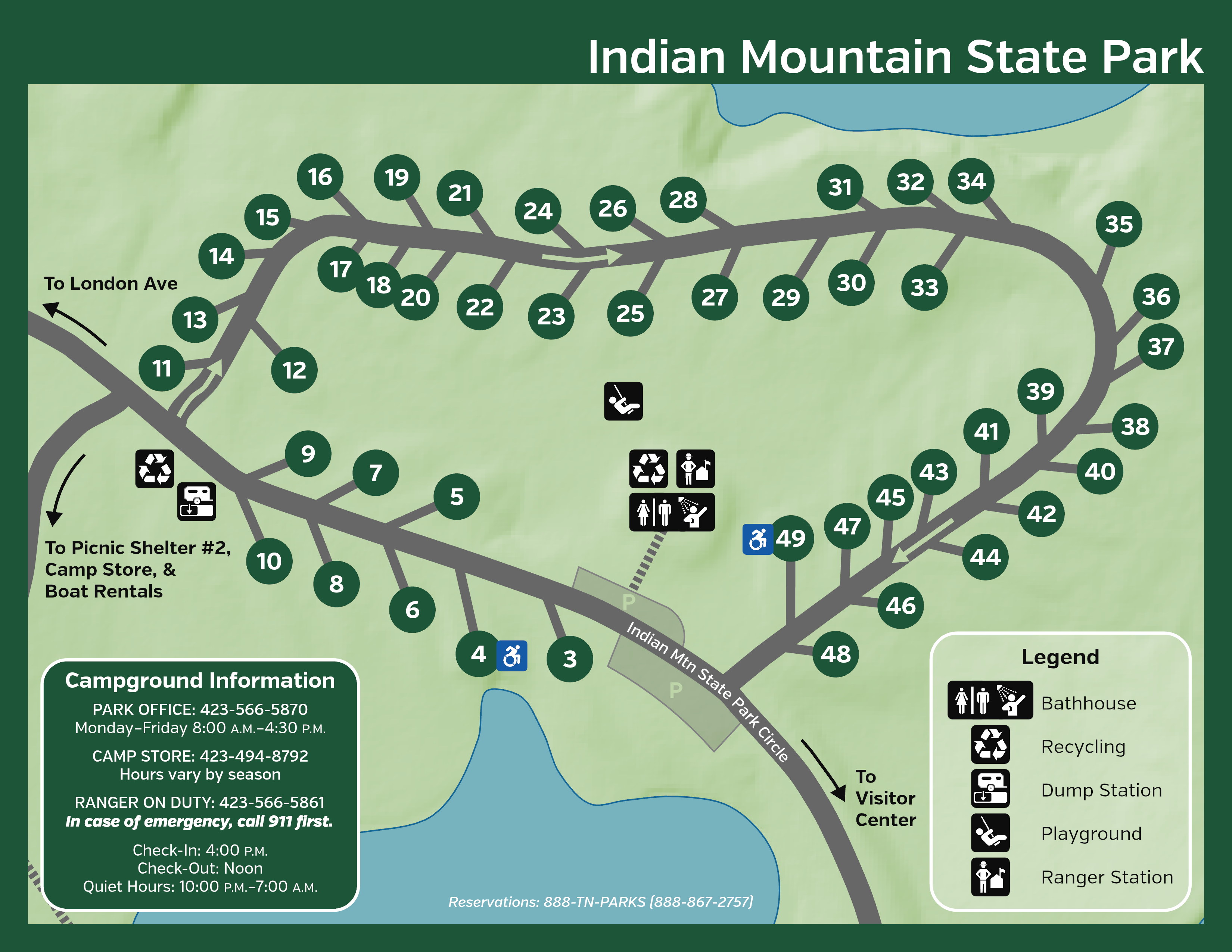
Indian Mountain State Park
-
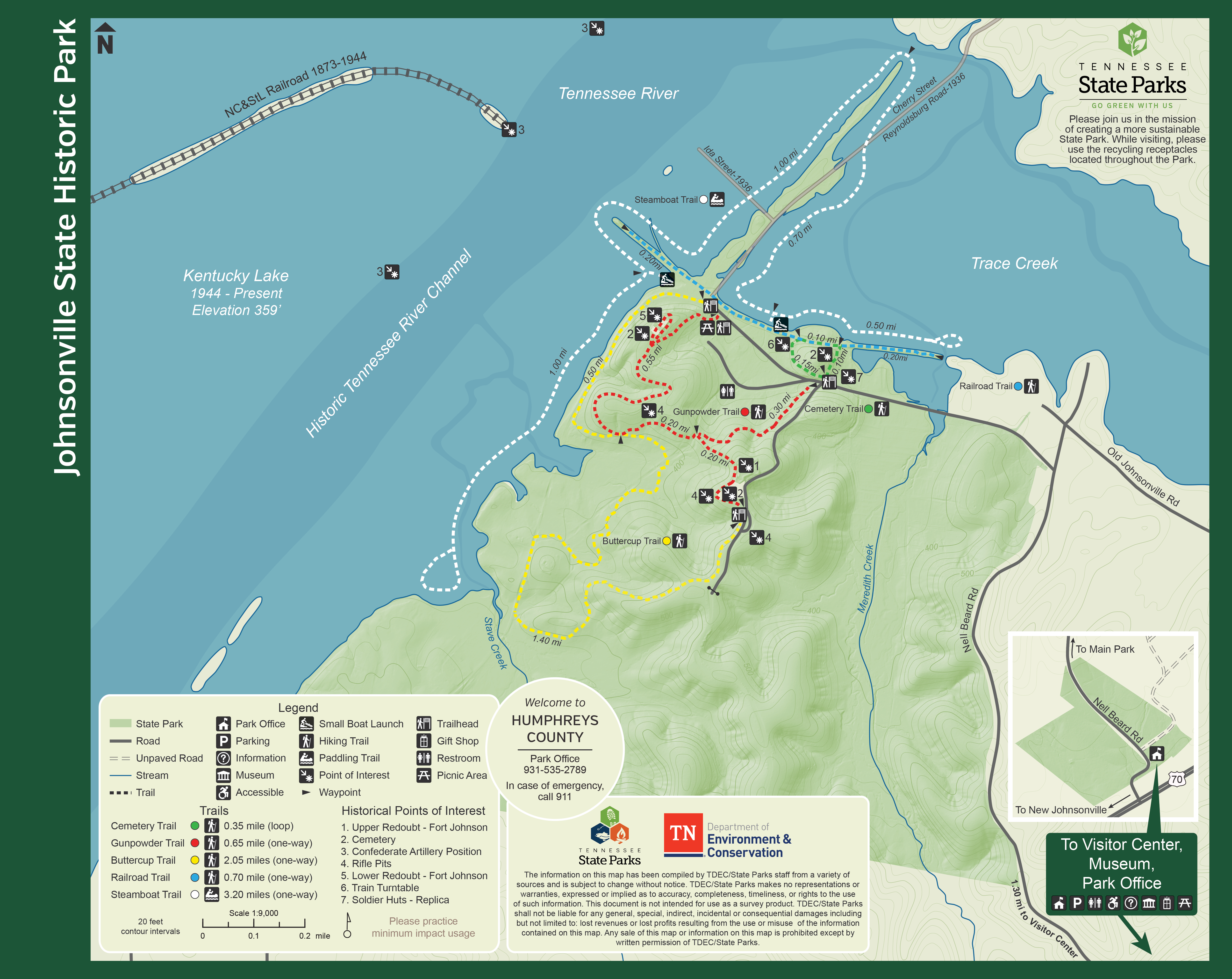
Johnsonville State Historic Park
-
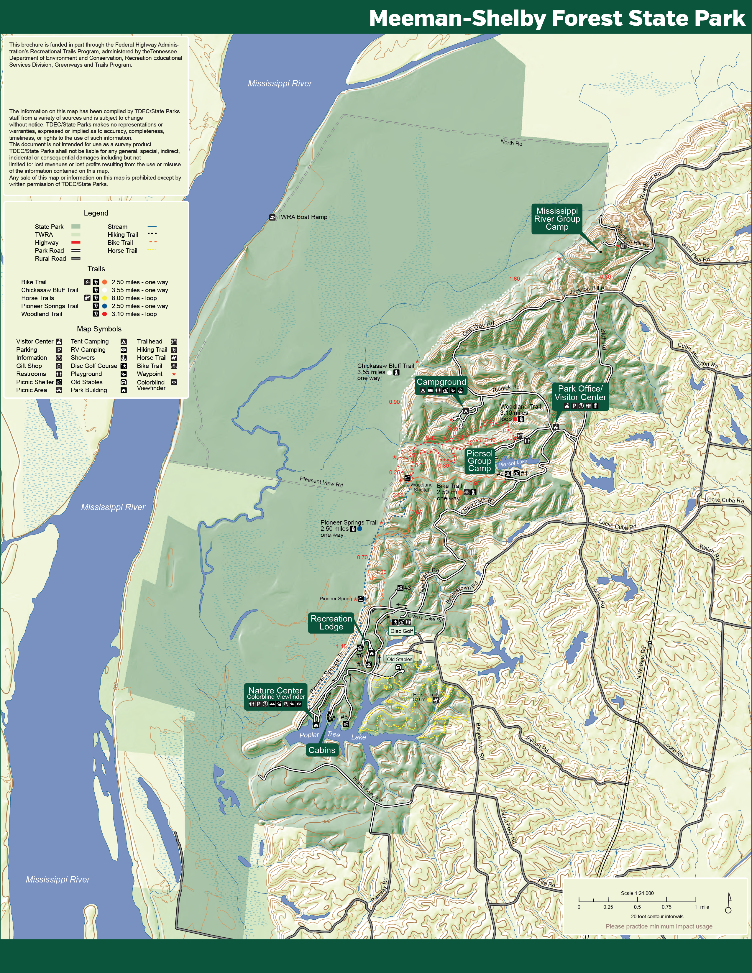
Meeman-Shelby Forest State Park
-
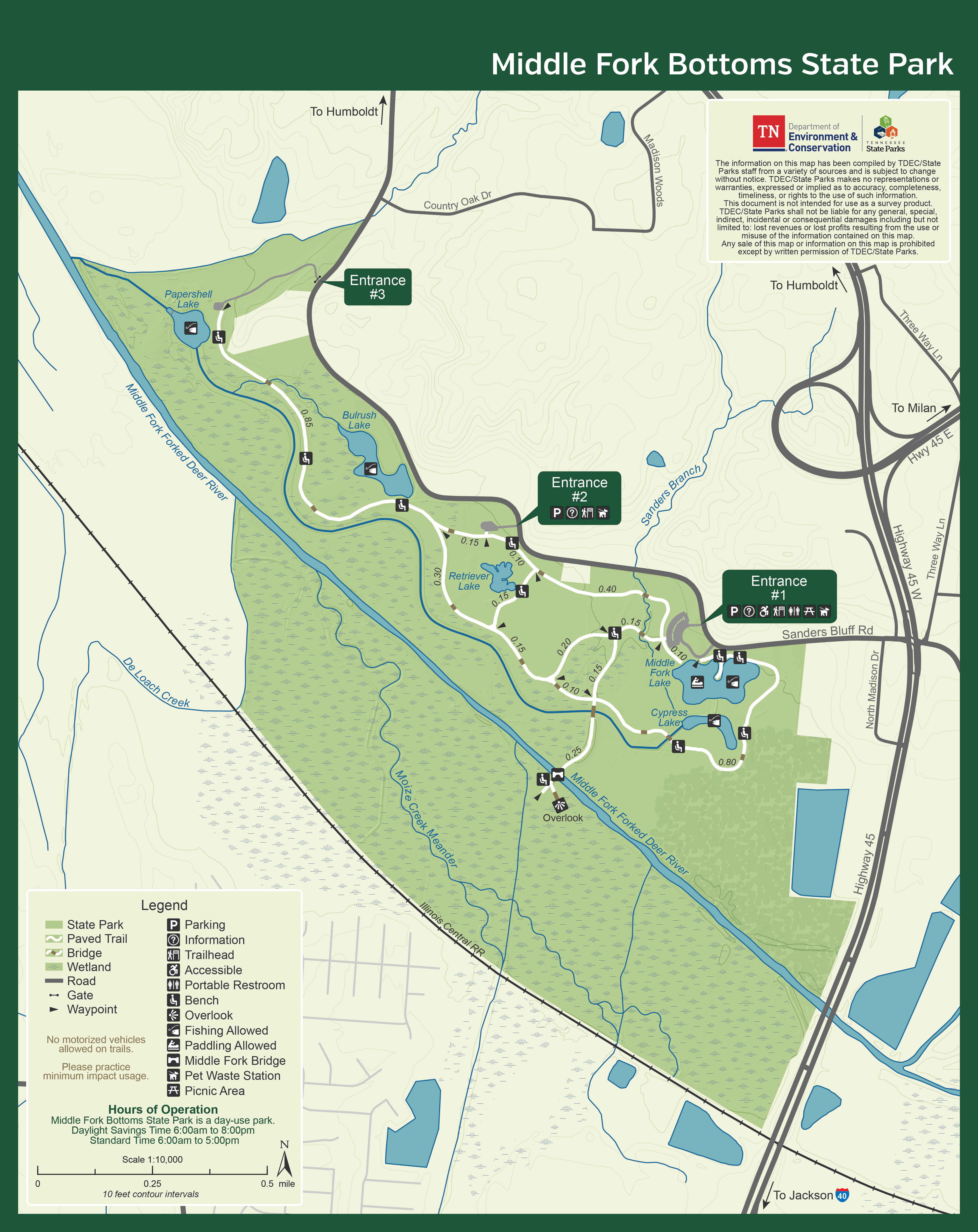
Middle Fork Bottoms State Park
-
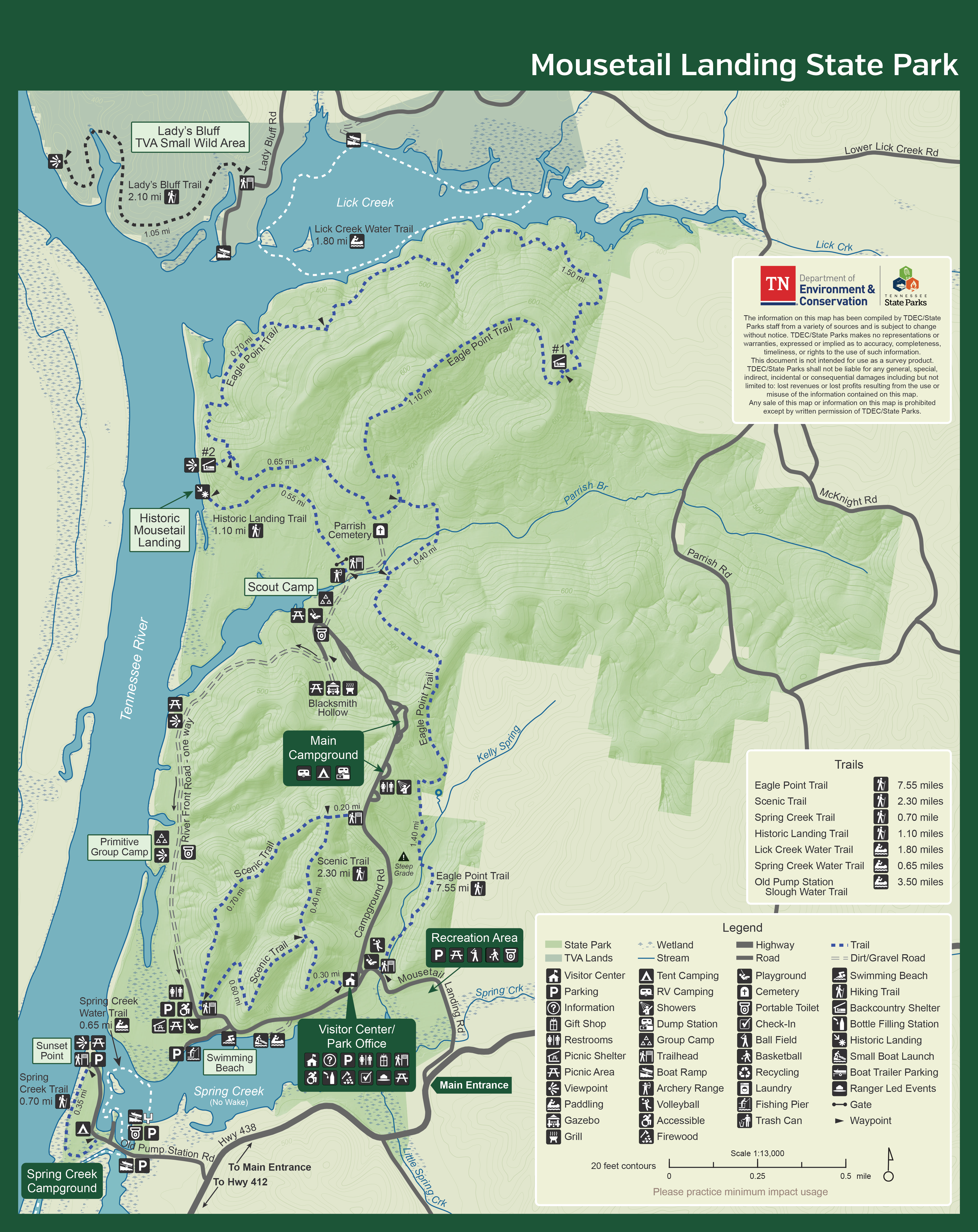
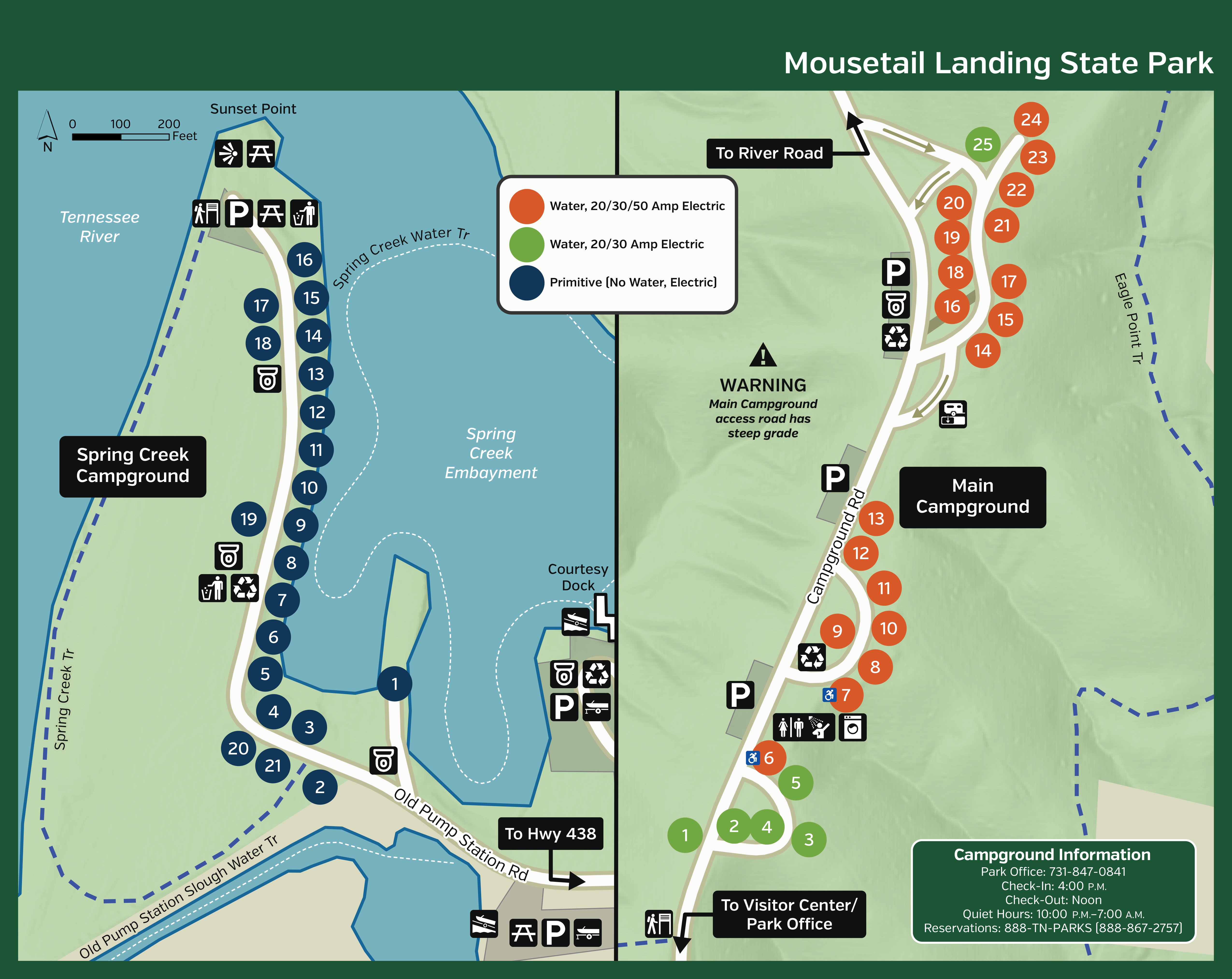
Mousetail Landing State Park
-
Natchez Trace State Park
-
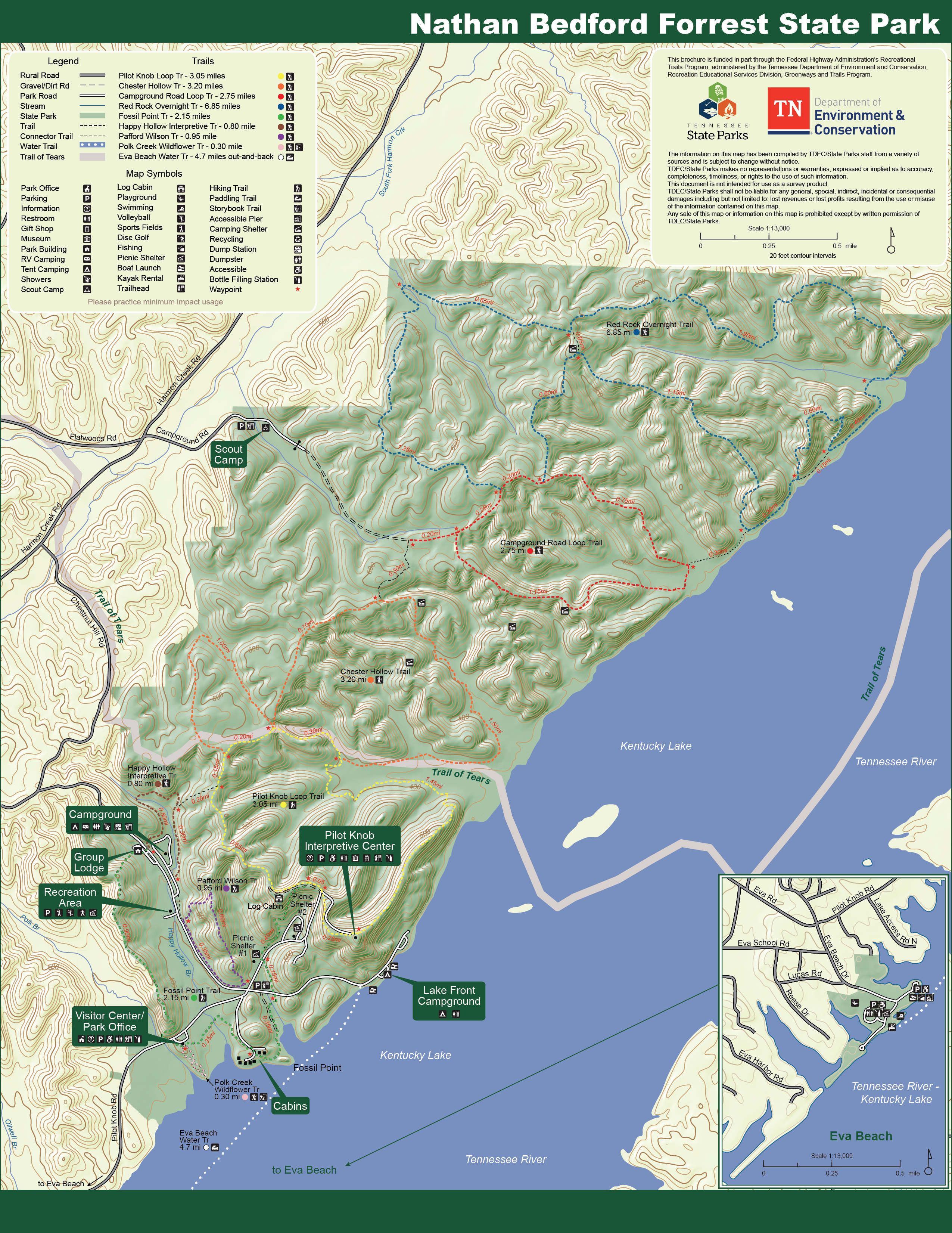
Nathan Bedford Forrest State Park
-
Norris Dam State Park
-
North Chickamauga Creek Gorge State Park
-
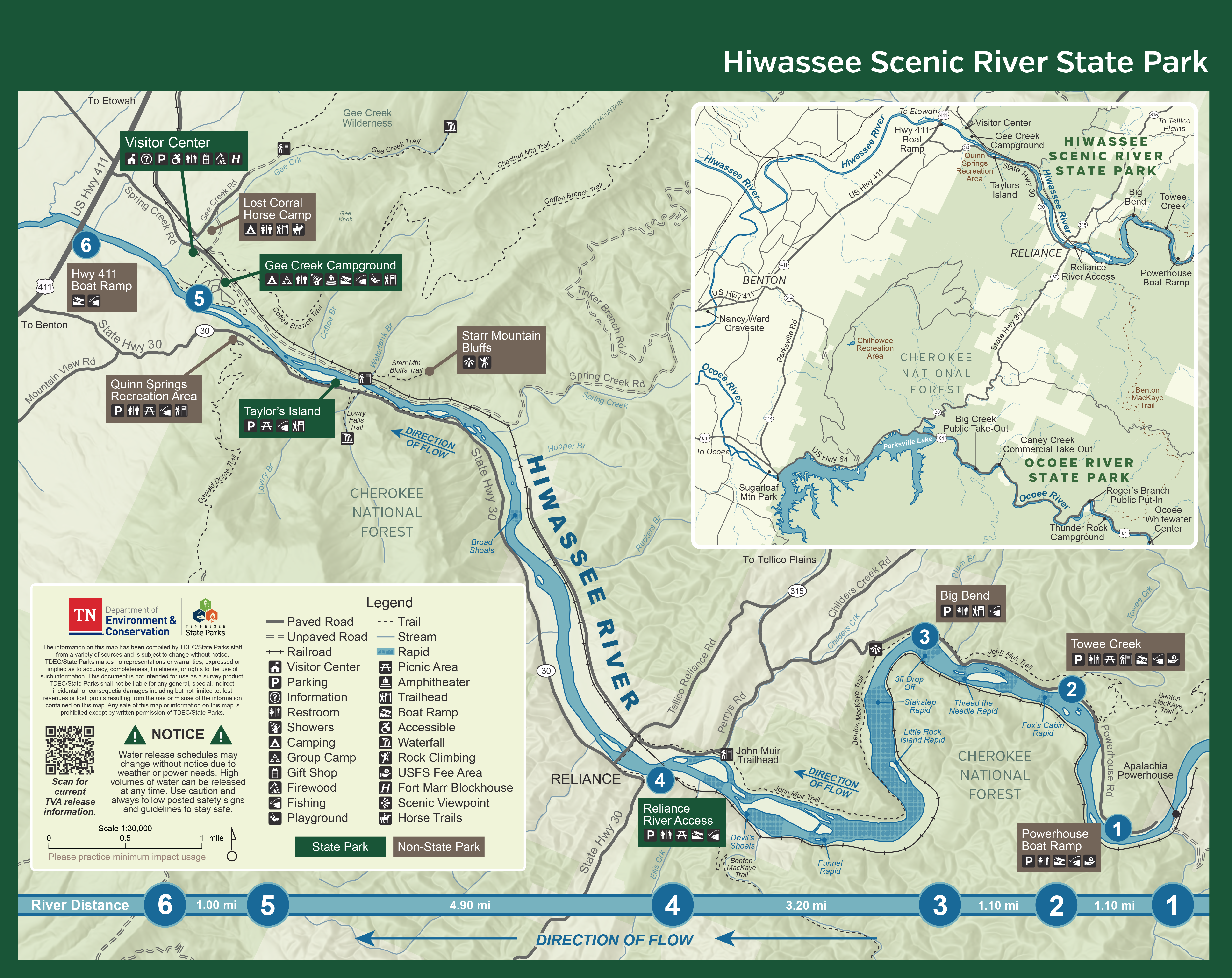
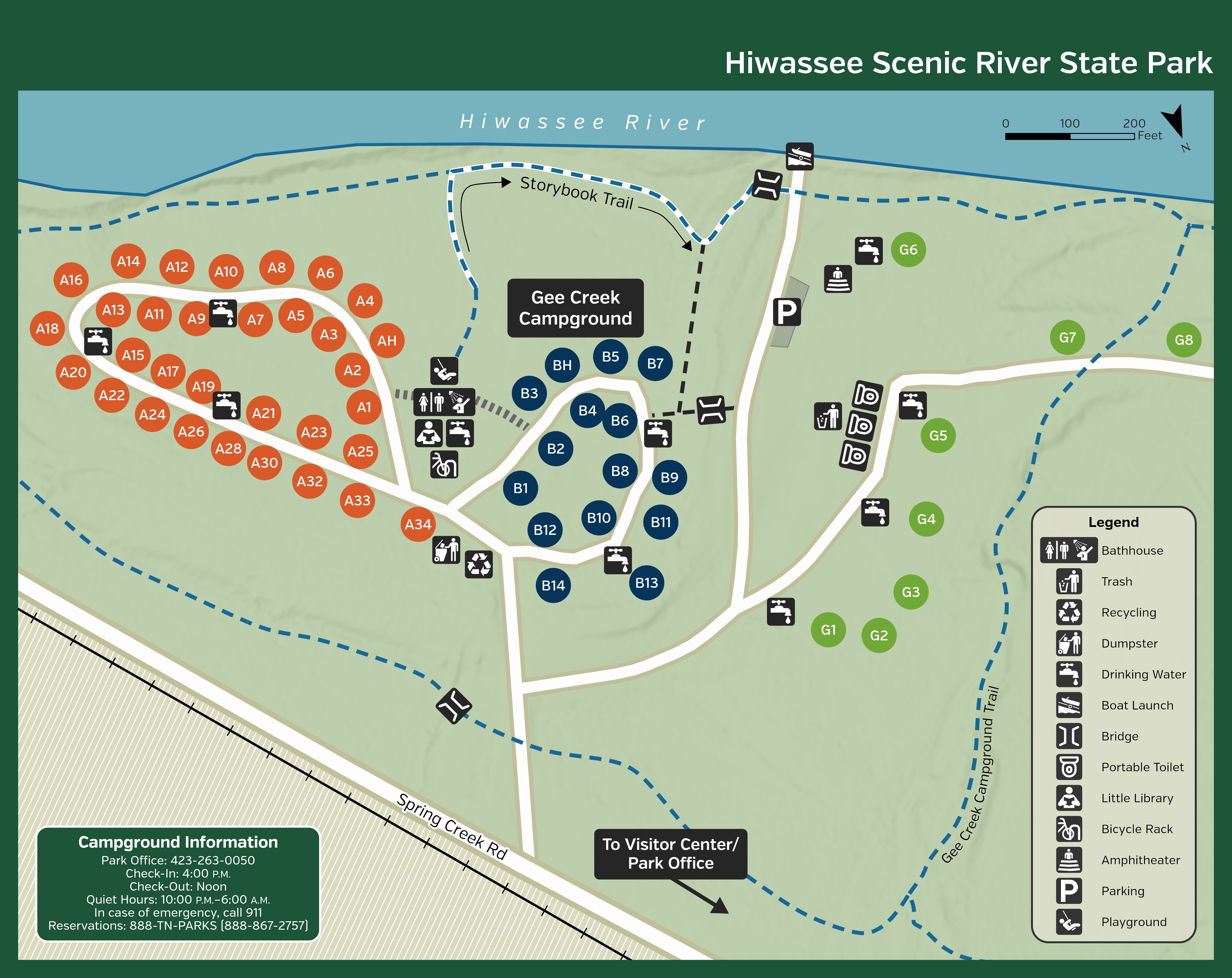
Ocoee River State Park
-
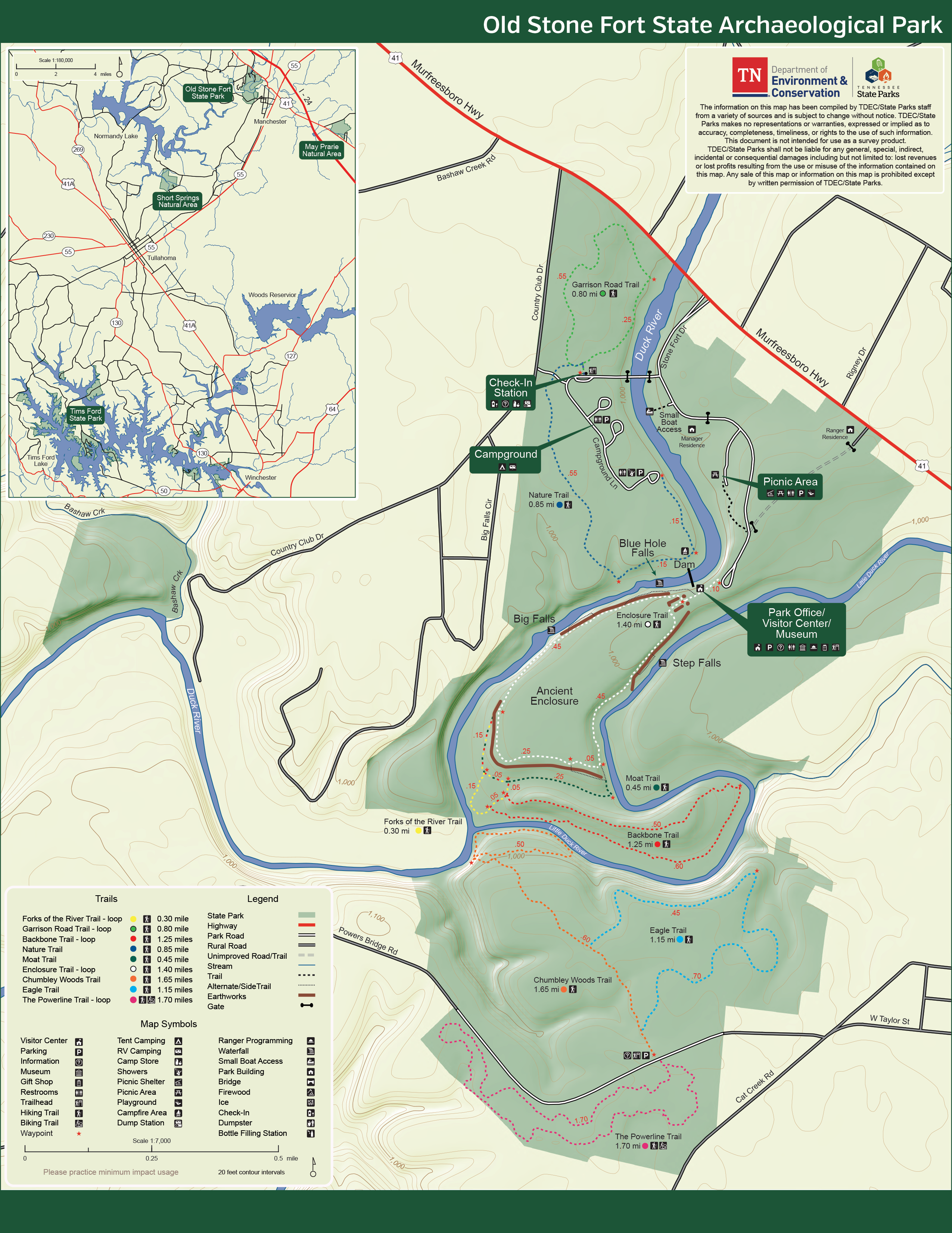
Old Stone Fort State Archaeological Park
-
Panther Creek State Park
-
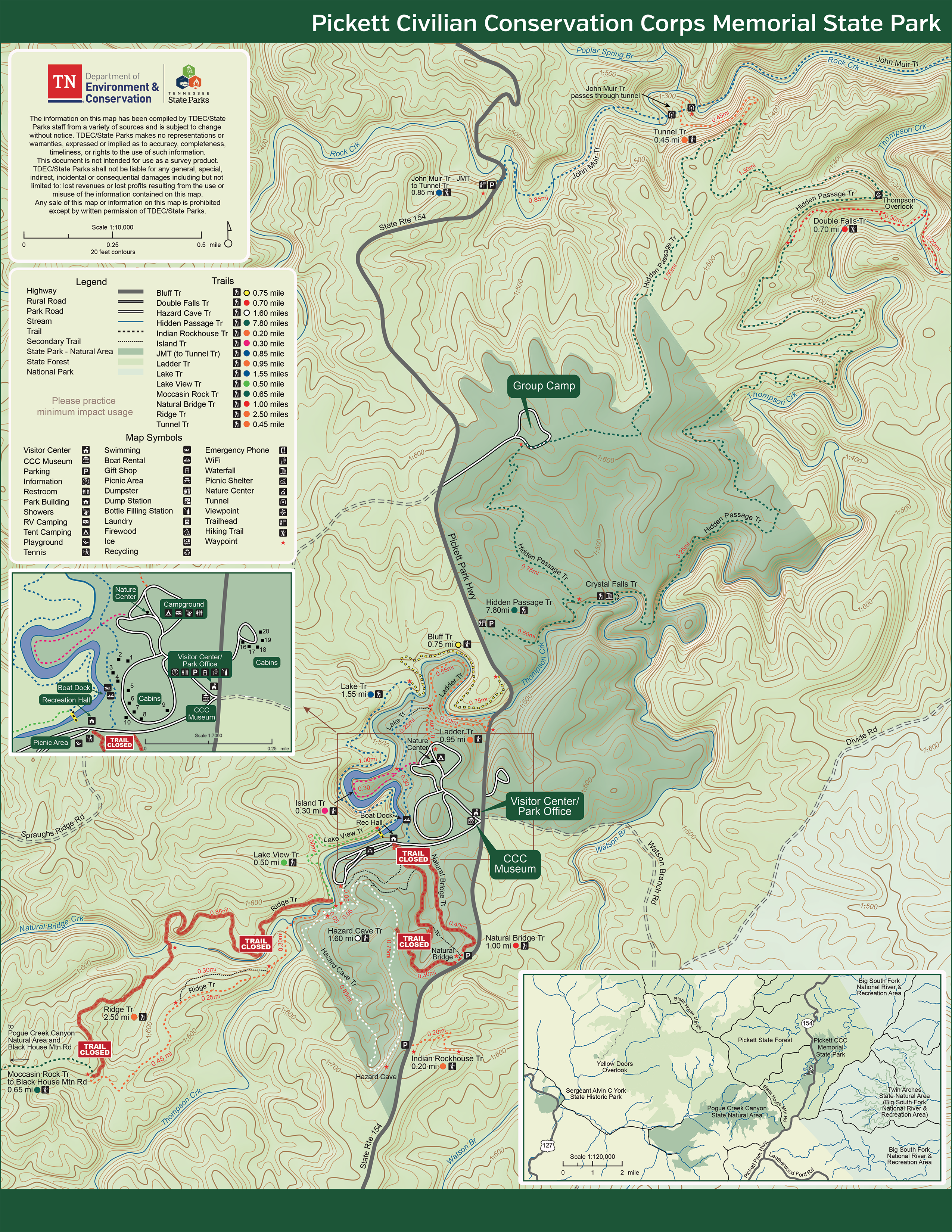
Pickett CCC Memorial State Park
-
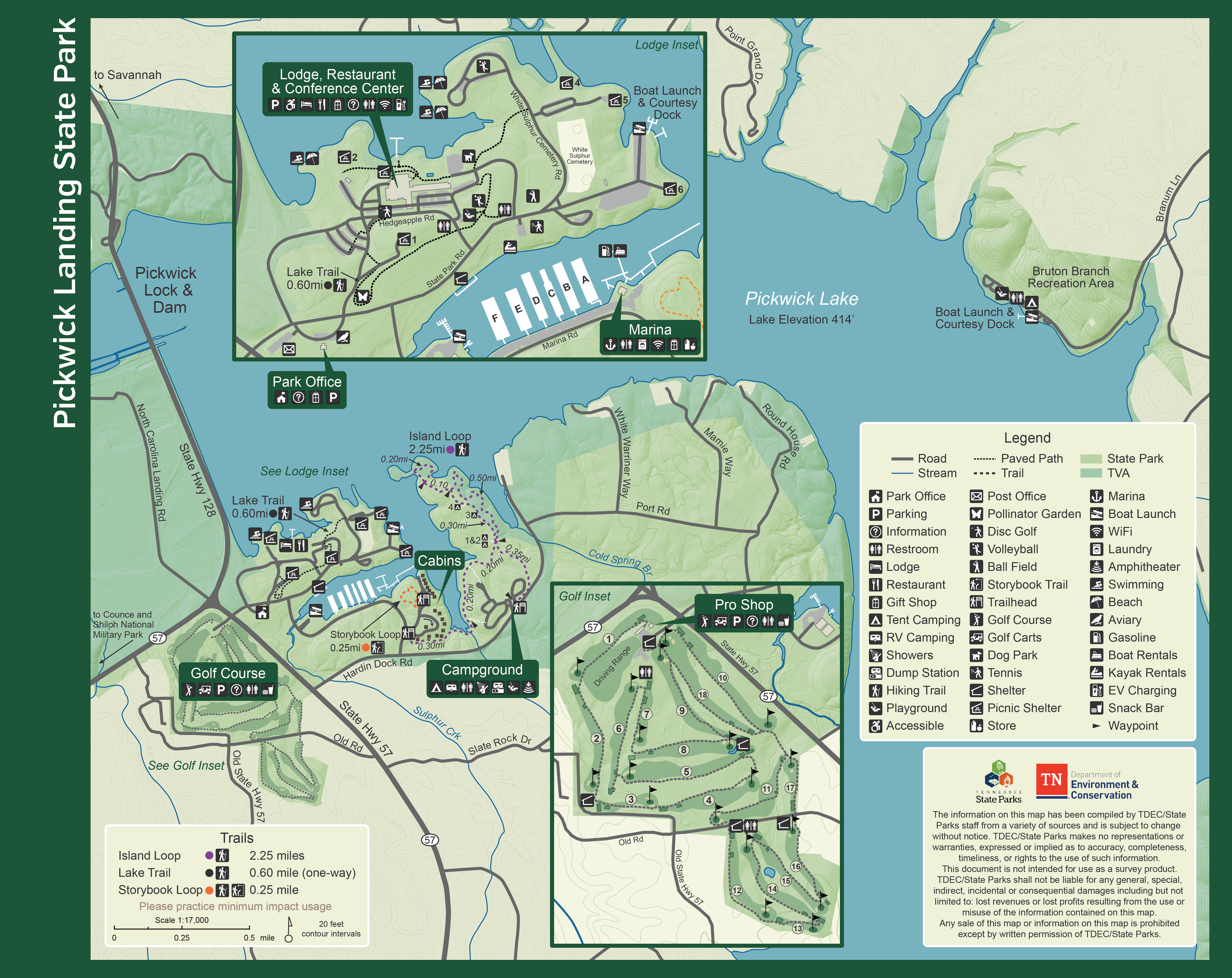
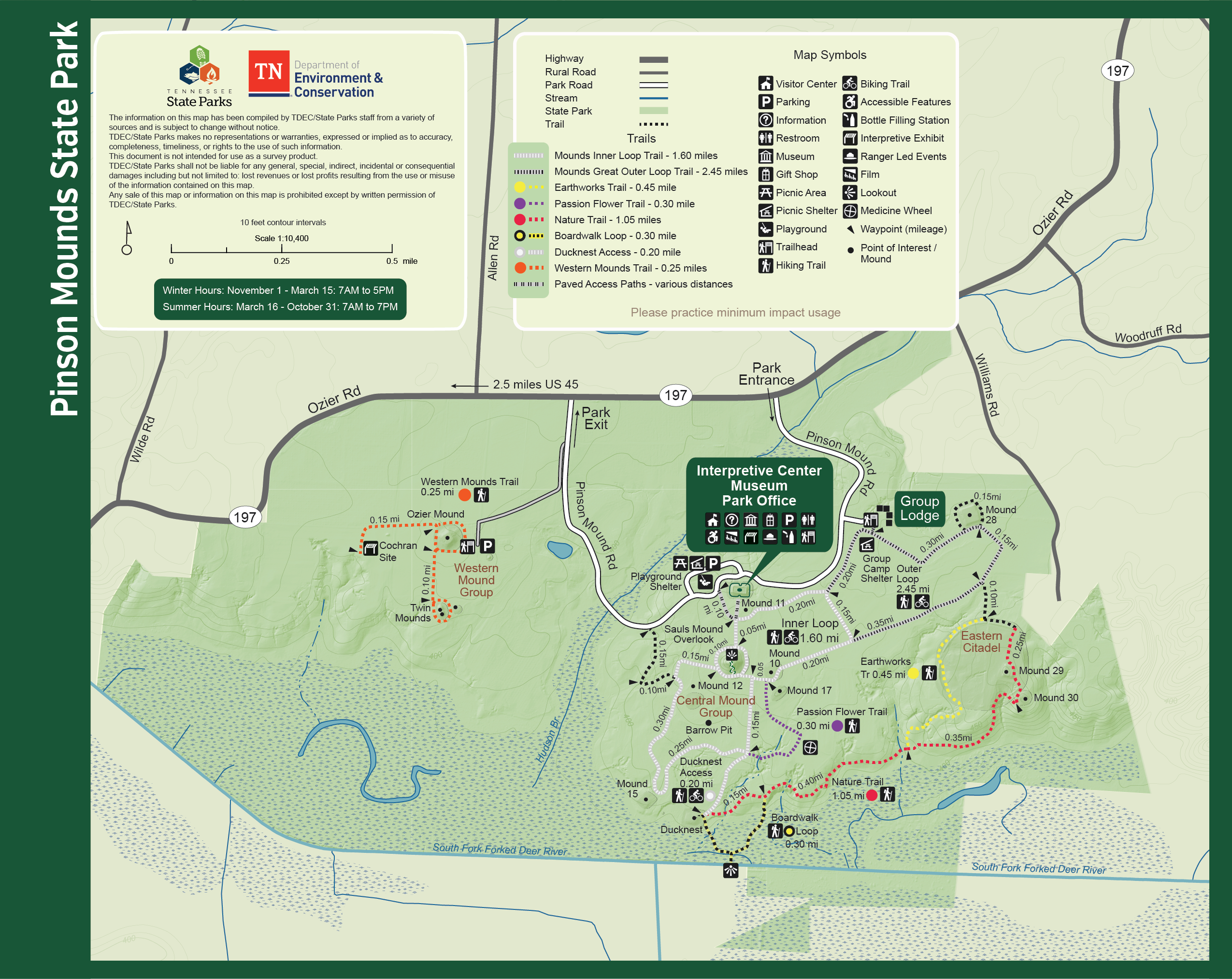
Pinson Mounds State Archaeological Park
-
Port Royal State Park
-
Radnor Lake State Park
-
Red Clay Historic State Park
-
Reelfoot Lake State Park
-
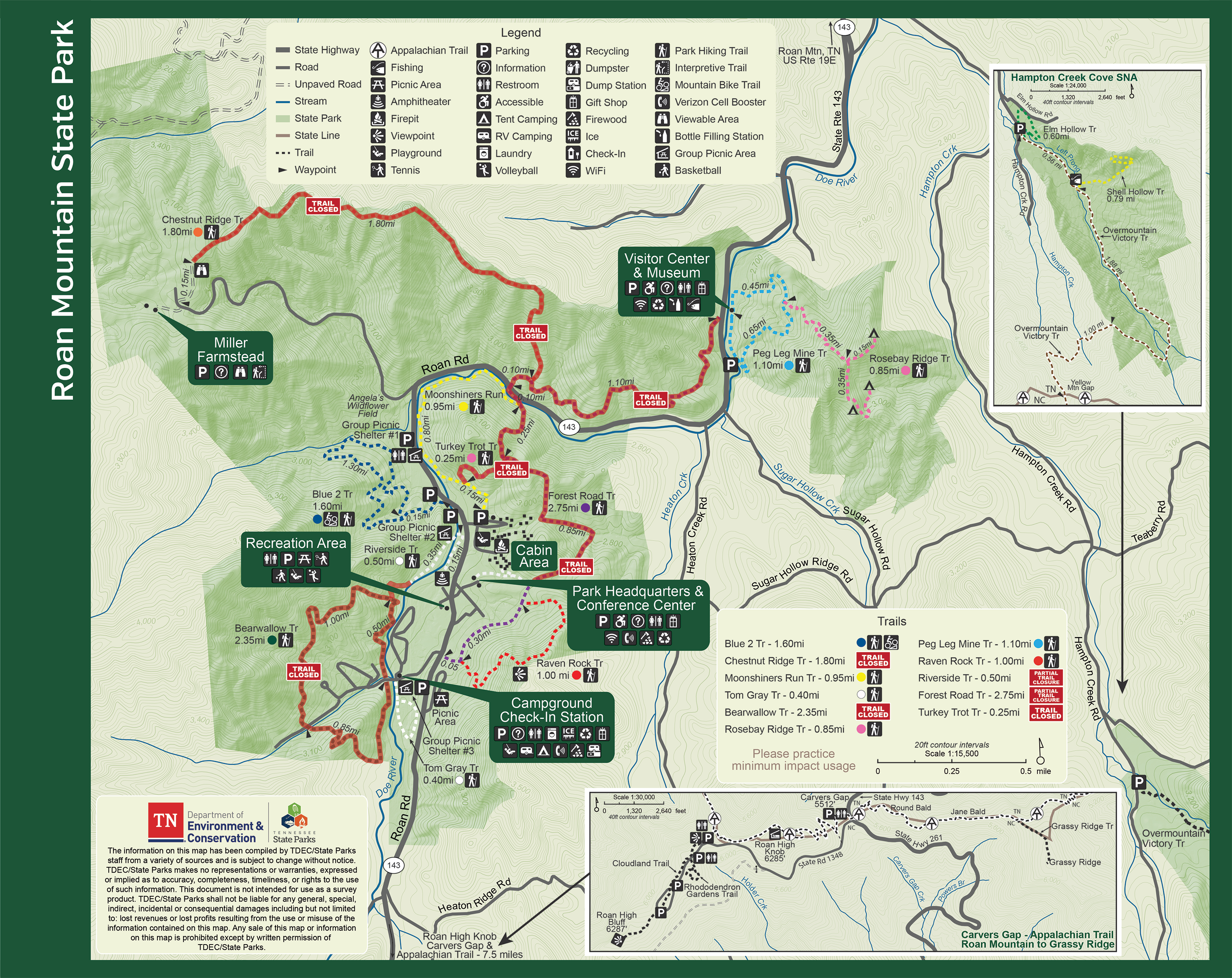
Roan Mountain
On-site Trail Map and Guide (Available at the park office and gift shop)
Rosebary Ridge Backcountry Camping Printable Map
Rosebary Ridge Backcountry Camping Offline-Use GPS Map
-
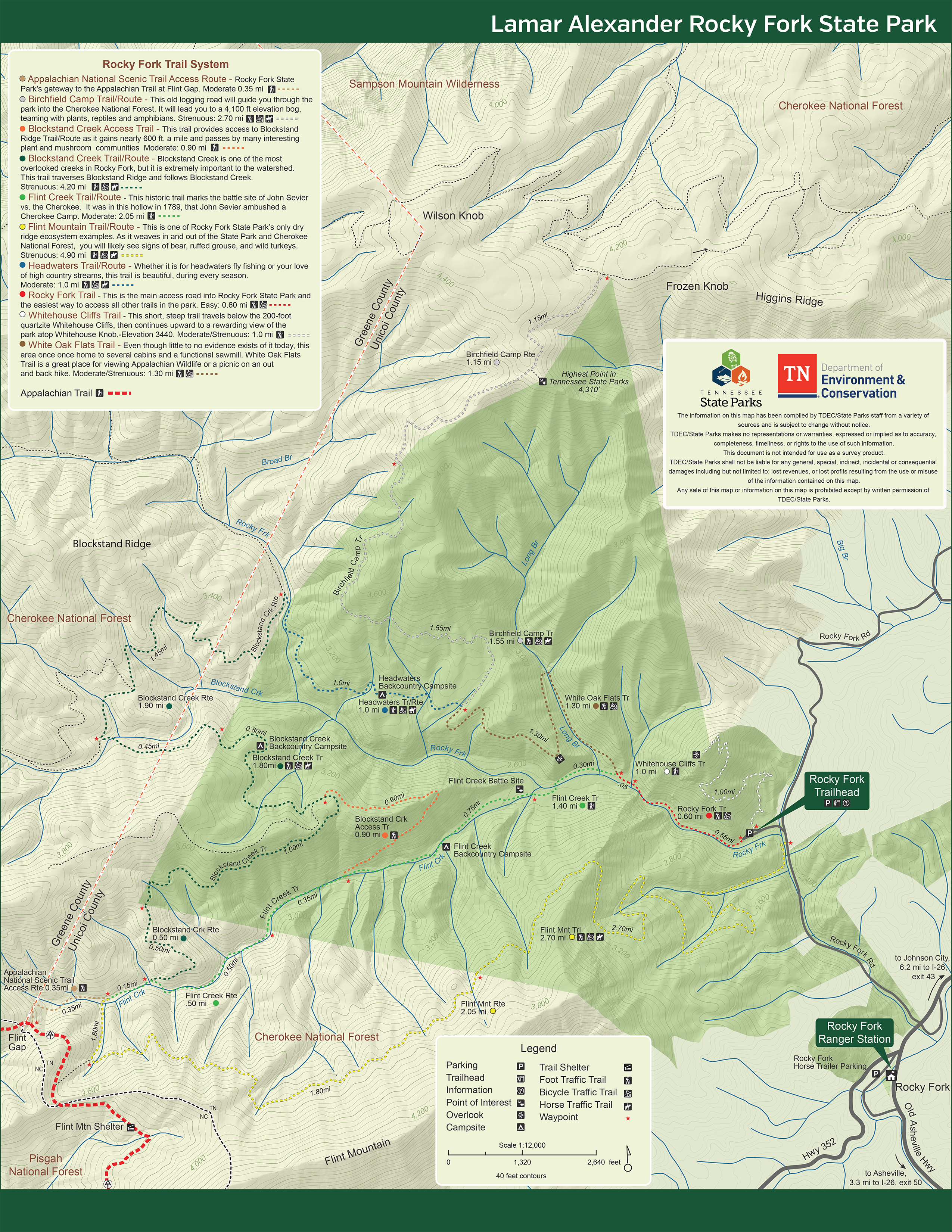
Rocky Fork State Park
-
Savage Gulf State Park
-
Scott's Gulf Wilderness State Park
-
Seven Islands State Birding Park
-
Sgt. Alvin C. York State Historic Park
-
Standing Stone State Park
-
Sycamore Shoals State Historic Park
-
T.O. Fuller State Park
-
Warriors' Path State Park