Roan Mountain State Park Mountain Biking

  • A lush, green forest scene with tall trees and a leafy ground cover. A rustic wooden railing lines a narrow, winding path, creating a calm, serene atmosphere.
    • A rider in a tan jersey and black shorts tilts forward while catching air on a narrow dirt trail lined with bare trees and shrubs.

    Mountain Biking at Roan Mountain

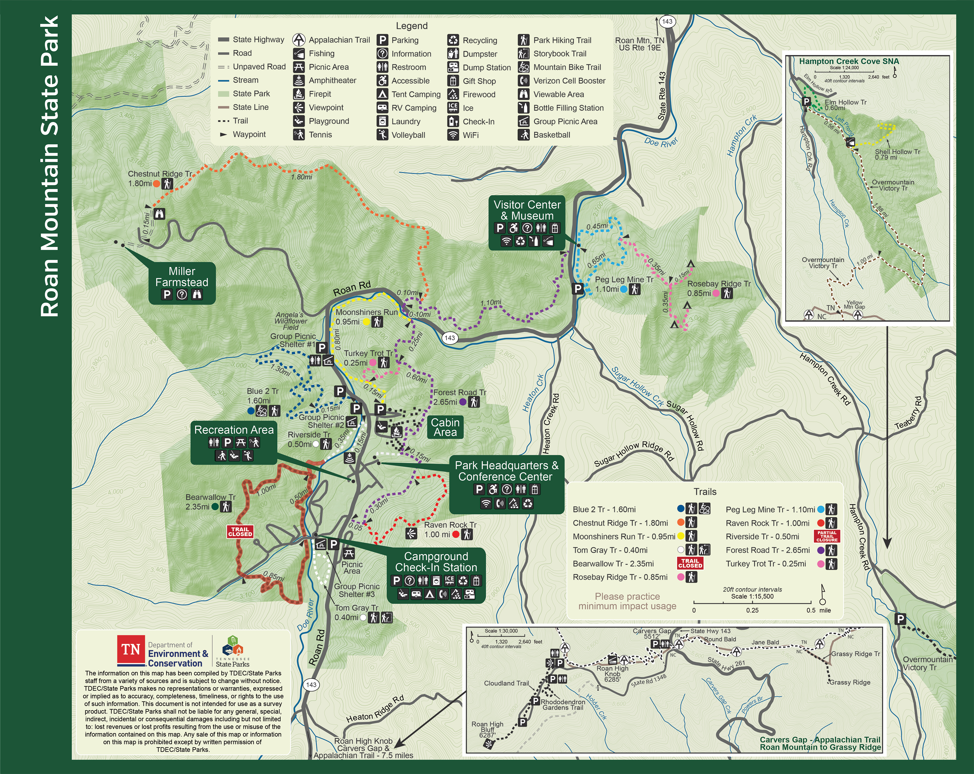
    There are approximately 12 miles of day-use hiking trails in Roan Mountain State Park and approximately 1.6 miles of mountain bike trails.

    Difficulty levels range from easy to strenuous. The Appalachian Trail is accessible by an 8-mile drive from the park.  

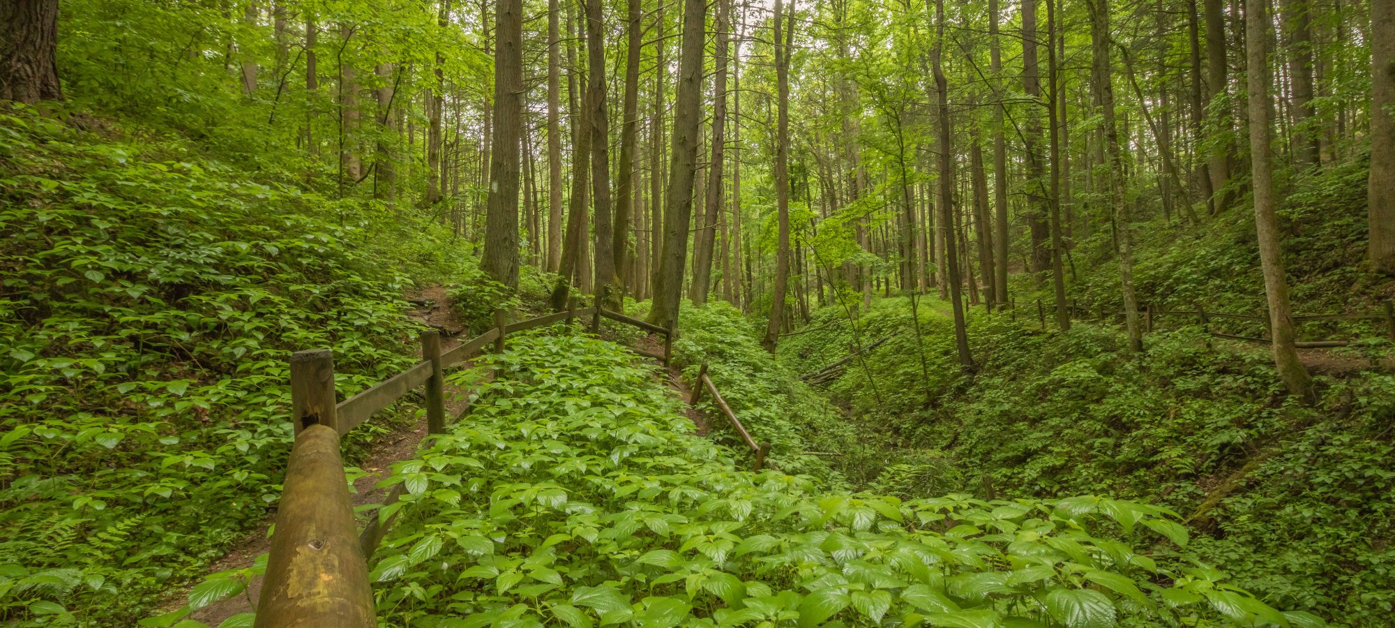
    Roan Mountain State Park’s terrain can be steep and challenging but rewarding. Know the local weather conditions prior to biking and plan accordingly.  

    Trails

      Blue 2 Trail

      Roan Mountain State Park
      Distance
      1.60 mi.
      Difficulty
      Moderate
      Surface
      Natural
      Currently a partial closure on this trail but a reroute has been created to fulfill the shorter loop. Hiking - easy to moderate. Biking - Moderate to Hard. Mountain-bike trail standards would rate this single-track loop as easy, but it does require some experience. It climbs and descends steeply in short sections and makes some narrow switchback turns. With careful observation, hikers and bikers will see evidence of old homes and farm sites that are located throughout this hollow. The mountain bike trails should not be ridden when they are muddy, as riding in wet conditions damages the trails. Mountain bikers should wear helmets while riding. The mountain bike trails are always open to hikers. Please be courteous to fellow trail users and call out before passing.
      Availability
      Partial Closure
      Allowed
      Hiking Mountain Biking

    Trail Definitions

    • Cross Slope 

      Describes the degree of incline from one side of the trail path to the other; measured as a percentage. Cross slope aids in water drainage and impacts the overall trail stability.   

    • Grade  

      Describes the rise in elevation over a horizontal distance on the trail; measured as a percentage.  Higher percentages represent a steeper grade indicating a more challenging ascent or descent for hikers.    

    • Standard Ramp Grade

      Serves as a reference guide for the grade of the trail.  Standard Ramp Grade is 8.3% across all trail assessments.  

    • Surface 

      A characteristic of the trail expressed in terms of material type, grading, compaction, and roughness of the path. Possible surface types include soil, gravel, paved, and mulch.   

    • Tread Width    

      Represents the horizontal distance from one edge of the trail path to the other; measurements can vary.  Tread width helps to determine the amount of space a hiker has to pass through. Obstacles on the trail can alter the remaining tread width.   

    • Trail Types: Loop

      Trail returns at or near the point from which you started. 

    • Trail Types: Network 

      Offers multiple route options within one trail, and each route is connected

    • Trail Types: Out and Back

      This type of trail travels out to an endpoint where hikers turn around and travel back to the starting point.   

    • Trail Types: Stacked Loop

      A loop trail contained completely within another trail.   

    Enhance Your Park Visit with Our Mobile Apps

    Plan your visit with the Tennessee State Parks app and discover guided adventures with the Explore Tennessee State Parks app.

    Visitor Center Gift Shop

    The Visitor Center Gift Shop is the perfect place to pick up a map, learn about the park, or find a souvenir. You’ll find an assortment of apparel and keepsakes to remember your trip to the park.

    Address:
    527 Highway 143, Roan Mountain TN, 37687

    Hours
    8:00 AM - 4:30 PM

    Happenings

    No events are scheduled at this time, but there's always more to explore.

    Find More Events

    Other Activities at Roan Mountain State Park