Accessibility Information for Trails

Planning Your Hike
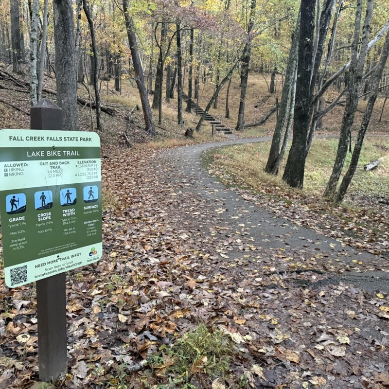
Detailed trail information offers an in-depth look into our trails, ensuring an easier trip planning experience.
When browsing trails at the parks linked below, you will find key data points such as estimated duration, trail surface type, and allowed uses. This information allows you to find the best trail for you and your hiking partner.
Tennessee is the first state to use High-Efficiency Trail Assessment Process (HETAP) to provide such information. This modern technology measures specific details such as length, grade, and possible obstructions on a trail, helping hikers decide whether or not they want to use a trail.
Trail Accessibility Information
Trail accessibility information provides an in-depth look at our trails, making trip planning easier. At Tennessee State Parks, we recognize that hiking looks different for all individuals, and with hundreds of trails available, we want to make finding the best trail a breeze.
For visitors like Amy and Lizzy, trail information allows them to make confident choices as they plan a trip to one of their favorite state parks. Watch as they discover what it means to enjoy the outdoors together.
Understanding Trail Accessibility Information
When browsing trails at the parks linked below, you will find key data points, including estimated duration, trail surface type, typical grade, and allowed uses. This information allows you to find the best trail for you and your hiking partner. The video below will help you read and understand trail accessibility information signs so you are better prepared for your next adventure.