Roan Mountain Hiking

Notification Alert
Notification

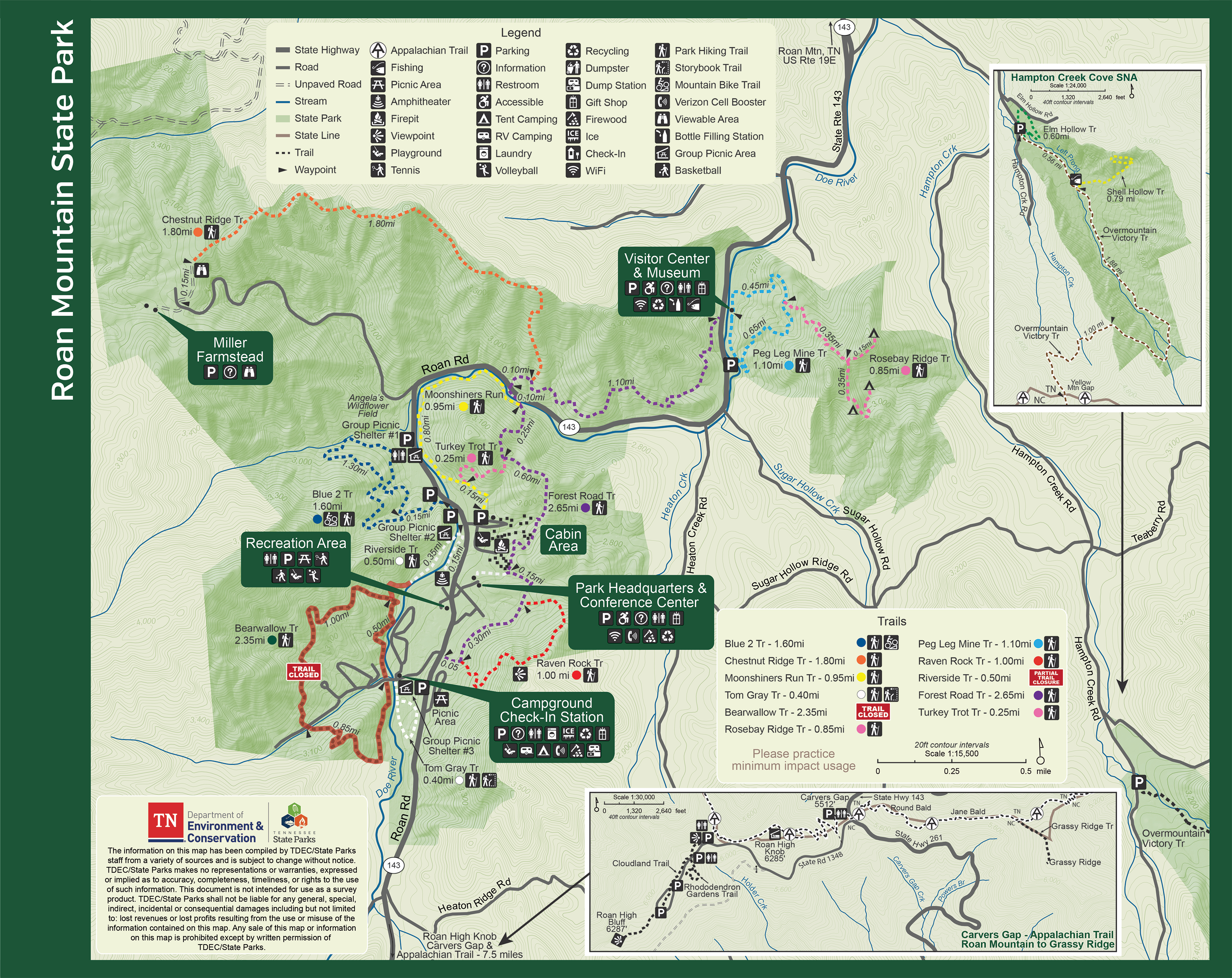
Trail Closure Status

Due to severe storms in September 2024, the Bear Wallow Trail at Roan Mountain State Park and the Birchfield Trail at Hampton Creek Cove State Natural Area remain closed.

Visitors should use one of our other open trails during this time. Thank you for your patience and understanding.

  • Roan Mountain State Park
  • Forest trail at Roan Mountain surrounded by tall trees and a carpet of fallen leaves.

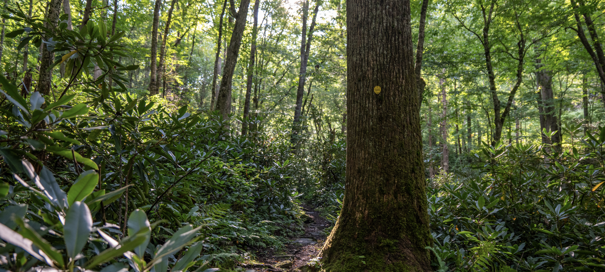
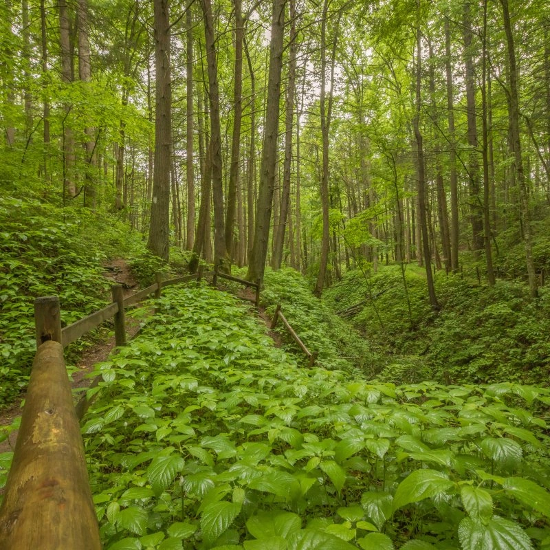
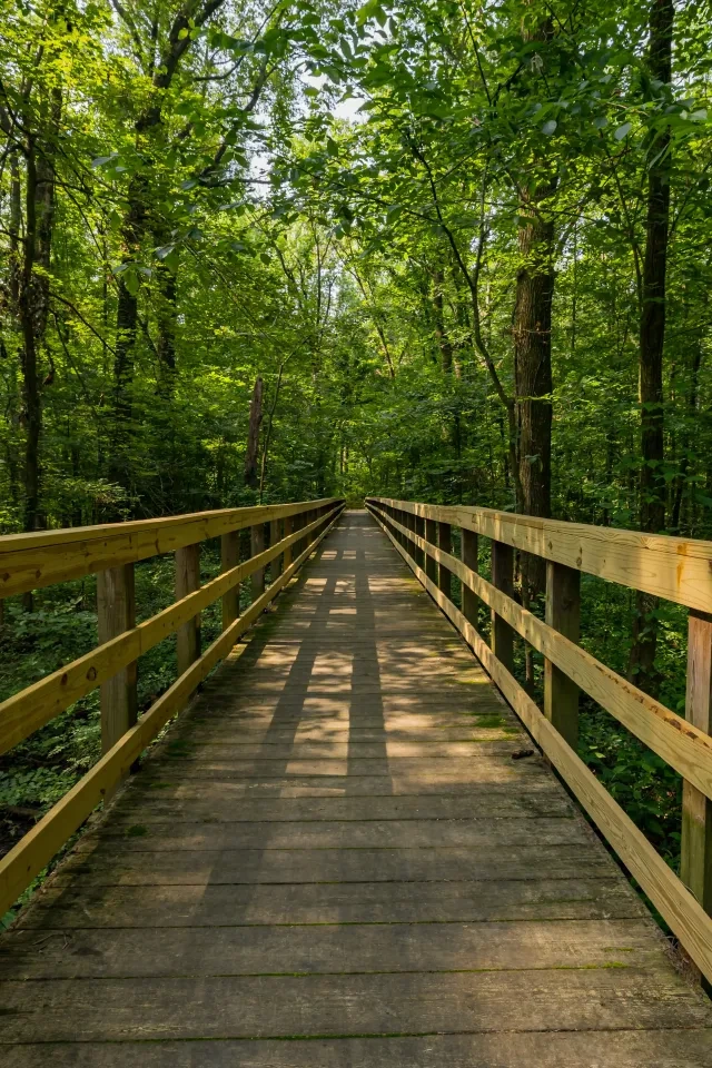
    Hiking at Roan Mountain

    There are approximately 12 miles of day-use hiking trails in Roan Mountain State Park and approximately three miles of mountain bike trails.

    Difficulty levels range from easy to strenuous. The Appalachian Trail is not in the park itself, but an access point is located eight miles from the park.

    Trails

    Showing page 1 of 2
    • Chestnut Ridge Trail

      Roan Mountain State Park
      Distance
      1.80 mi.
      Difficulty
      Surface
      Natural
      This trail is very strenuous, the most challenging trail in the park. Hikers can access the Chestnut Ridge Trail from the Forest Road Trail. The Chestnut Ridge climbs very steeply through deciduous forest and rhododendron thickets. The trail quickly gains elevation on its way to the Miller Farmstead on Strawberry Mountain. Views from the trail are especially nice in winter when the leaves have fallen from the trees. At the top of the trail, hikers are rewarded with a stunning view of the Roan Highlands from an overlook platform. Black bears frequent this remote section of the park. Hikers are encouraged to make noise and hike in pairs.
      Availability
      Open
      Allowed
      Hiking

      Elm Hollow Trail

      Roan Mountain State Park
      Distance
      Difficulty
      Surface
      Natural
      Availability
      Open
      Allowed
      Hiking

      Forest Road Trail

      Roan Mountain State Park
      Distance
      2.75 mi.
      Difficulty
      Surface
      Natural
      Moderate to Hard. The longest trail in the park connects the visitor center and the campground and acts as a link to several other trails. The southern section of the trail is rated easy from the campground to the cabin area. From the cabin area to the north, the trail ranges from moderately difficult to difficult. The section from the Turkey Trot junction to Hwy 143 is very steep, but worth the effort, especially in spring when the forest floor is carpeted in wildflowers. Hikers on the Forest Road Trail can expect rhododendron tunnels, bridge crossings over the Doe River, and beautiful views of Roan Mountain during the winter months.
      Availability
      Open
      Allowed
      Hiking

      Moonshiners Run

      Roan Mountain State Park
      Distance
      0.95 mi.
      Difficulty
      Difficult
      Surface
      Natural
      Easy to Moderate. This linear trail mostly follows the Doe River from the southwestern Turkey Trot trailhead to Hwy 143 at Cates Hole. The trail consists mostly of rolling hills and a few steep climbs. Trail users will find many places to stop and take a break next to the Doe River while enjoying riverside views and spring wildflowers.
      Availability
      Open
      Allowed
      Hiking

      Moonshiners Run

      Roan Mountain State Park
      Easy to Moderate. This linear trail mostly follows the Doe River from the southwestern Turkey Trot trailhead to Hwy 143 at Cates Hole. The trail consists mostly of rolling hills and a few steep climbs. Trail users will find many places to stop and take a break next to the Doe River while enjoying riverside views and spring wildflowers.
      Distance
      0.95 mi.
      Difficulty
      Difficult
      Surface
      Natural
      Allowed
      Hiking

      Trail Type
      Information unavailable

      Elevation
      Gain 150.00'
      Loss 252.80'
      Grade
      Typical 7.8%
      Max 34.5%
      Cross Slope
      Typical 3.4%
      Max 16.4%
      Tread Width
      Typical 27"
      Minimum 14"
      Surface Type
      Soil 87.7%; Rock 12.3%
      Obstructions Exist
      Rock: 6 in tall; Large rocks: 5 in tall; Rock: 7 in tall

      Overmountain Victory Trail

      Roan Mountain State Park
      Distance
      Difficulty
      Surface
      Natural
      Availability
      Open
      Allowed
      Hiking

      Peg Leg Mine Trail

      Roan Mountain State Park
      Distance
      1.10 mi.
      Difficulty
      Easy
      Surface
      Natural
      The loop trail begins behind the visitor center and highlights how habitat types differ with changing elevation and moisture conditions. The effects of invasive species on indigenous plants and trees, like the Eastern Hemlock, are also noticeable on the trail. About halfway along your hike, a side trail will lead to the ruins of an iron ore mine that was operational in the late 1800s, during a time when iron ore mining was a prominent industry in the area. Most of the mine shaft has caved in over the years, so entry is prohibited for safety reasons. As you near the mine site, you will notice the scarred landscape containing mine test holes and rail cart path-ways. Upon arriving to the mine site, you will find steps that lead down to the en-trance where miners and carts, loaded with iron-rich rock, once came and went. Upon returning to the main trail, hikers can see diverse wildlife as they move through the Appalachian forest past unique rock formations, hiking down and over small ridges, and meandering along the Doe River before returning to the visitor center.
      Availability
      Open
      Allowed
      Hiking

      Raven Rock Trail

      Roan Mountain State Park
      Distance
      1.00 mi.
      Difficulty
      Difficult
      Surface
      Natural
      Access for the trail is available at two junctions along the Forest Road Trail. Although the trail is rated difficult, it is considered by many hikers to be one of the favorite trails in the park. The trail is steep from either direction and ascends quickly to the crest of Heaton Ridge. The Raven Rock Overlook is located approximately halfway from either end of the trail. In addition to spring wildflowers, the trail offers stunning views of the Roan Valley and surrounding mountain ranges and is a great place to watch a Roan Mountain Sunset.
      Availability
      Open
      Allowed
      Hiking

      Riverside Trail

      Roan Mountain State Park
      Distance
      2.65 mi.
      Difficulty
      Surface
      Natural
      The Riverside Trail provides access from the cabin area to the amphitheater and picnic Shelter 2 by way of a boardwalk over a restored wetland. At Shelter 2, the trail enters the woods and leads hikers alongside the peaceful Doe River. The trail passes the group camp area to connect the Bear Wallow Trail. Hikers along the Riverside Trail can stop for a break along the water or find a spot to cast a line in the Doe River. The river is home to several types of trout and sustains several unique species. If you are lucky, you might even see an Eastern Hellbender salamander.
      Availability
      Open
      Allowed
      Hiking

      Rosebay Ridge Trail

      Roan Mountain State Park
      Distance
      0.50 mi.
      Difficulty
      Surface
      Natural
      This scenic trail follows the ridgeline through groves of rosebay rhododendrons and a lush oak-hickory forest. Built by dedicated AmeriCorps volunteers, the trail leads hikers to the park’s peaceful backcountry area. Visitors are welcome to continue exploring the backcountry, but please remain on the marked trail and respect the privacy of any campers you may encounter. Backcountry camping is permitted only at designated campsites and by reservation.
      Availability
      Open
      Allowed
      Hiking
    • Shell Hollow Trail

      Roan Mountain State Park
      Distance
      Difficulty
      Surface
      Natural
      Availability
      Open
      Allowed
      Hiking

      Tom Gray Trail

      Roan Mountain State Park
      Distance
      0.40 mi.
      Difficulty
      Easy
      Surface
      Natural
      Storybook Trail hike follows along the Doe River. Books are available for purchase at the Campground Check-In Station and Visitor Center Gift Shop. A self-guided nature brochure is also available.
      Availability
      Open
      Allowed
      Hiking storybook

      Turkey Trot Trail

      Roan Mountain State Park
      Distance
      0.25 mi.
      Difficulty
      Surface
      Natural
      Moderate to Hard. This trail begins at the cabin overflow parking lot and ends at the top of the ridge. It serves as an access point from the cabin area to the Forest Road Trail and Moonshiners Run Trail.
      Availability
      Open
      Allowed
      Hiking

    Trail Definitions

    • Cross Slope 

      Describes the degree of incline from one side of the trail path to the other; measured as a percentage. Cross slope aids in water drainage and impacts the overall trail stability.   

    • Grade  

      Describes the rise in elevation over a horizontal distance on the trail; measured as a percentage.  Higher percentages represent a steeper grade indicating a more challenging ascent or descent for hikers.    

    • Standard Ramp Grade

      Serves as a reference guide for the grade of the trail.  Standard Ramp Grade is 8.3% across all trail assessments.  

    • Surface 

      A characteristic of the trail expressed in terms of material type, grading, compaction, and roughness of the path. Possible surface types include soil, gravel, paved, and mulch.   

    • Tread Width    

      Represents the horizontal distance from one edge of the trail path to the other; measurements can vary.  Tread width helps to determine the amount of space a hiker has to pass through. Obstacles on the trail can alter the remaining tread width.   

    • Trail Types: Loop

      Trail returns at or near the point from which you started. 

    • Trail Types: Network 

      Offers multiple route options within one trail, and each route is connected

    • Trail Types: Out and Back

      This type of trail travels out to an endpoint where hikers turn around and travel back to the starting point.   

    • Trail Types: Stacked Loop

      A loop trail contained completely within another trail.   

    Need a Map?

    Explore our collection of printable and digital trail maps, organized by park. Whether you’re hiking, camping, or paddling, you’ll find the resources you need to navigate confidently.


    Visitor Center Gift Shop

    The Visitor Center Gift Shop is the perfect place to pick up a map, learn about the park, or find a souvenir. You’ll find an assortment of apparel and keepsakes to remember your trip to the park.

    Address:
    527 Highway 143, Roan Mountain TN, 37687

    Hours
    8:00 AM - 4:30 PM

    Skip photo gallery
    Media Crowdriff
    Happenings

    No events are scheduled at this time, but there's always more to explore.

    Find More Events

    Other Activities at Roan Mountain State Park