Cedars of Lebanon Hiking

  • Path through a field with fall foliage under a cloudy blue sky.
  • Sunlit forest path surrounded by green trees and foliage.

    Hiking at Cedars of Lebanon  

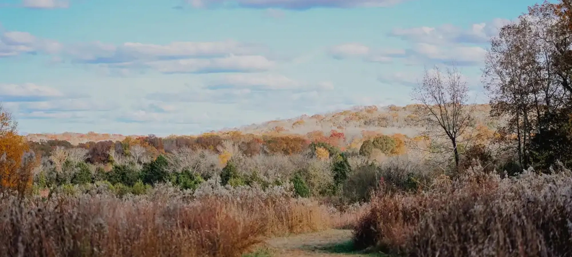
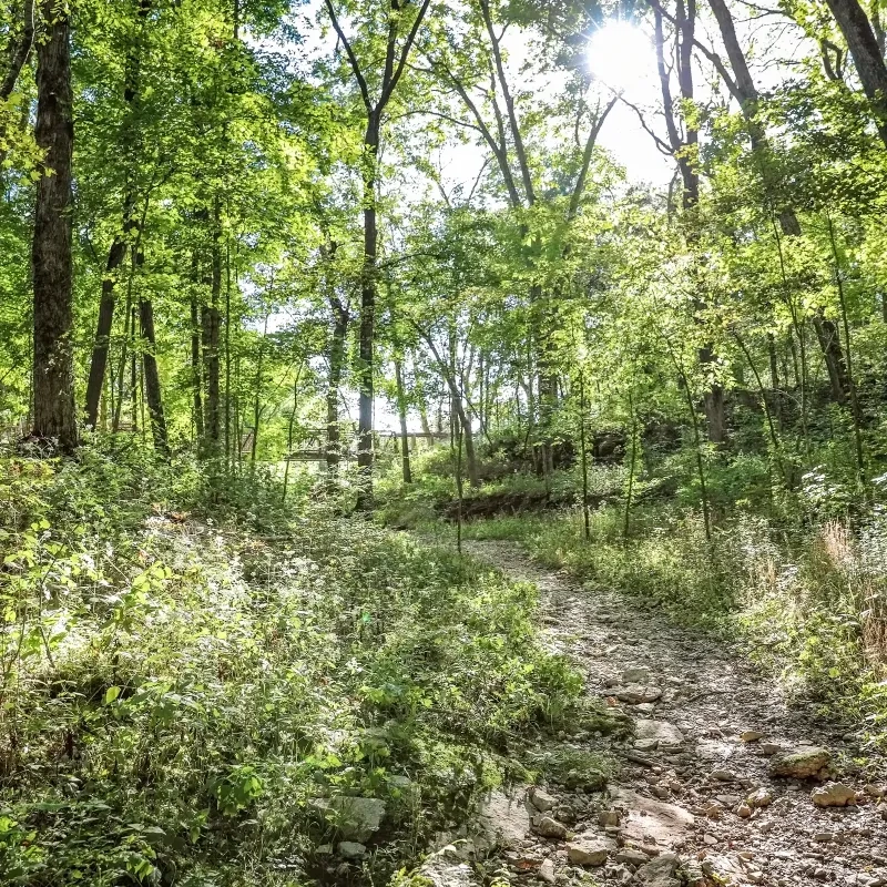
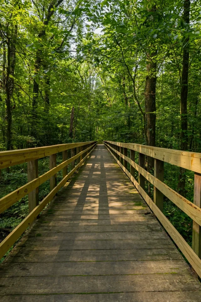
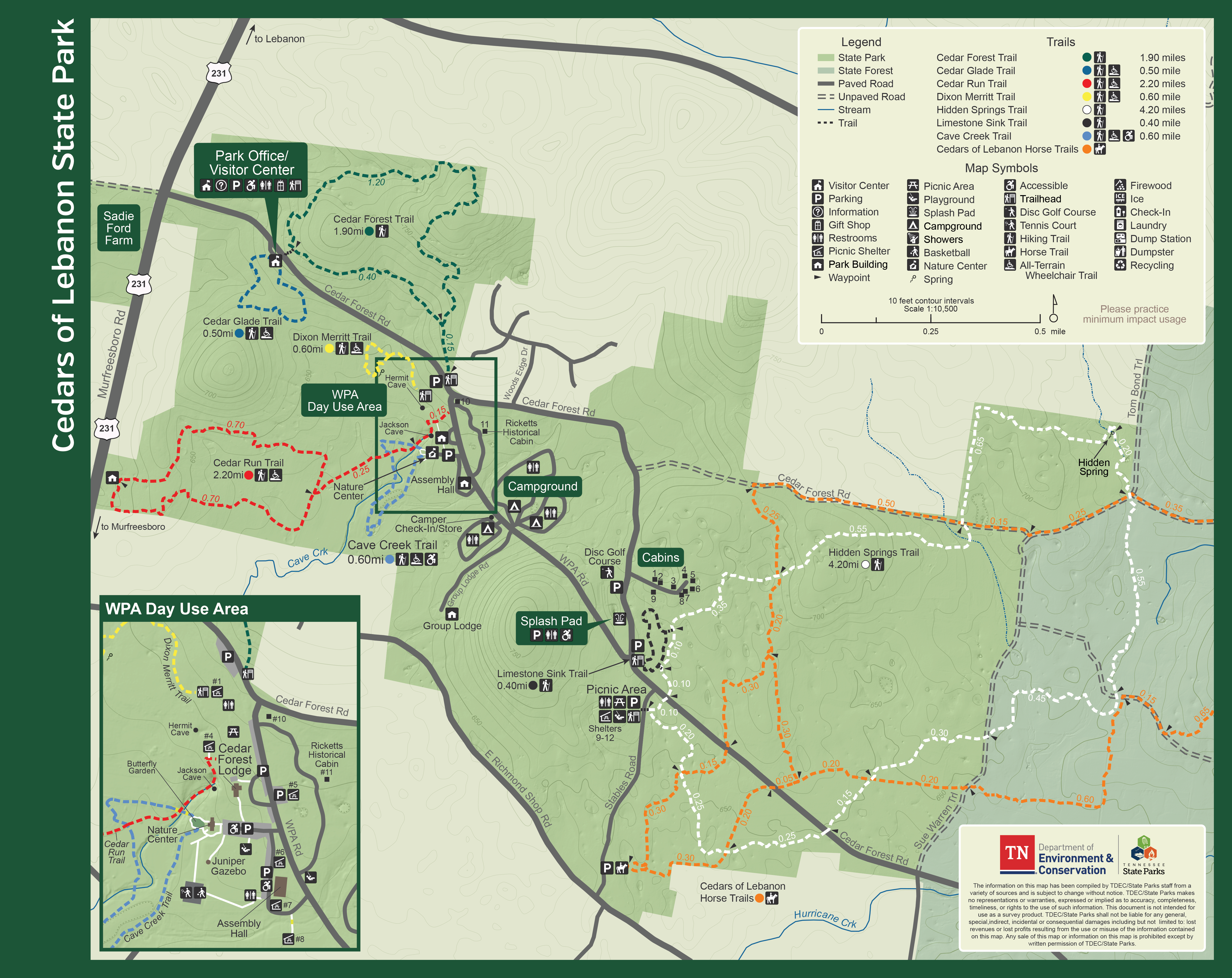
    Ten miles of hiking trails meander through the forests and glades. Hiking trails are open year-round. Visitors frequently enjoy glimpses of fox, deer, and turkey throughout the park. Each trail is blazed with a rectangular colored blaze-mark located on trees along the trail. Please note the color of the blaze-mark for the trail that you hike. Remember to stay on the trail for your own safety. Trail maps are available in the park office. 

    Trails

    Showing page 1 of 1
    • Cave Creek Trail

      Cedars of Lebanon State Park
      Distance
      0.60 mi.
      Difficulty
      Moderate
      Surface
      Paved
      This is the park’s newest trail, featuring an ADA-accessible paved path made from Tennessee tires. Accessible parking is available at the Nature Center, and the trail begins at the concrete path going into the Butterfly Garden. Along the route, you’ll cross several boardwalks, a large steel bridge overlooking Cave Creek, and an overlook with views of Jackson Cave. The trail showcases restored native grasslands with milkweed (the monarch butterfly’s host plant), native river cane, and a variety of native trees including Paw Paw, Ohio Buckeye, and Black Walnut. The loop returns to the Nature Center and offers plenty of places to relax, with benches and picnic tables located throughout the trail.
      Availability
      Open
      Allowed
      Hiking wheelchair all_terrain_wheelchair

      Cave Creek Trail

      Cedars of Lebanon State Park
      This is the park’s newest trail, featuring an ADA-accessible paved path made from Tennessee tires. Accessible parking is available at the Nature Center, and the trail begins at the concrete path going into the Butterfly Garden. Along the route, you’ll cross several boardwalks, a large steel bridge overlooking Cave Creek, and an overlook with views of Jackson Cave. The trail showcases restored native grasslands with milkweed (the monarch butterfly’s host plant), native river cane, and a variety of native trees including Paw Paw, Ohio Buckeye, and Black Walnut. The loop returns to the Nature Center and offers plenty of places to relax, with benches and picnic tables located throughout the trail.
      Distance
      0.60 mi.
      Difficulty
      Moderate
      Surface
      Paved
      Allowed
      Hiking wheelchair all_terrain_wheelchair

      Trail Type
      Information unavailable

      Elevation
      Gain 21.20'
      Loss 42.40'
      Grade
      Typical 1.9%
      Max 7.5%
      Cross Slope
      Typical 1.1%
      Max 4.1%
      Tread Width
      Typical 72"
      Minimum 72"
      Surface Type
      Rubber 75.8%; Wood Mulch 12.5%; Conrete 9.5%; Other 2.1%
      Obstructions Exist
      No obstructions present

      Cedar Forest Trail

      Cedars of Lebanon State Park
      Distance
      1.90 mi.
      Difficulty
      Difficult
      Surface
      Natural
      The trailhead is located near the Cedar Forest Road and WPA Road split, with plenty of parking available across the street near Shelter 1. An old service road guides hikers to the loop trail, a rocky path that winds up to a hilltop crest before returning. Much of the route is marked by striking limestone outcrops and sinkholes as it passes through scenic cedar woodlands and oak–hickory forest. In spring, the understory comes alive with toad shade trillium, white trout lily, round-leaf ragwort, spring beauty, and rue anemone. Summer brings blooms of St. John’s wort, heartleaf skullcap, rose pink, and wingstem. The loop eventually leads back to the service road.
      Availability
      Open
      Allowed
      Hiking

      Cedar Forest Trail

      Cedars of Lebanon State Park
      The trailhead is located near the Cedar Forest Road and WPA Road split, with plenty of parking available across the street near Shelter 1. An old service road guides hikers to the loop trail, a rocky path that winds up to a hilltop crest before returning. Much of the route is marked by striking limestone outcrops and sinkholes as it passes through scenic cedar woodlands and oak–hickory forest. In spring, the understory comes alive with toad shade trillium, white trout lily, round-leaf ragwort, spring beauty, and rue anemone. Summer brings blooms of St. John’s wort, heartleaf skullcap, rose pink, and wingstem. The loop eventually leads back to the service road.
      Distance
      1.90 mi.
      Difficulty
      Difficult
      Surface
      Natural
      Allowed
      Hiking

      Trail Type
      Information unavailable

      Elevation
      Gain 135.30'
      Loss 133.30'
      Grade
      Typical 2.9%
      Max 22.7%
      Cross Slope
      Typical 2.0%
      Max 12.4%
      Tread Width
      Typical 33"
      Minimum 12"
      Surface Type
      Soil 86.4%; Rock 9.1%; Gravel 4.5%
      Obstructions Exist
      Tree root step: 12 in tall; Tree: 24 in of tread remaining; Tree root: 6 in tall

      Cedar Glade Trail

      Cedars of Lebanon State Park
      Distance
      0.50 mi.
      Difficulty
      Difficult
      Surface
      Natural
      Located beside the park office parking lot, the trailhead kiosk offers a welcoming introduction to this interpretive trail. The path gently winds through cedar woodlands and open glades, with educational signs along the way highlighting the unique cedar glade ecology and pointing out native plants and wildlife. Beautiful year-round, the trail is especially striking in spring when the endemic wildflowers blanket the glades. The loop eventually leads you back to the park office.
      Availability
      Open
      Allowed
      Hiking all_terrain_wheelchair

      Cedar Glade Trail

      Cedars of Lebanon State Park
      Located beside the park office parking lot, the trailhead kiosk offers a welcoming introduction to this interpretive trail. The path gently winds through cedar woodlands and open glades, with educational signs along the way highlighting the unique cedar glade ecology and pointing out native plants and wildlife. Beautiful year-round, the trail is especially striking in spring when the endemic wildflowers blanket the glades. The loop eventually leads you back to the park office.
      Distance
      0.50 mi.
      Difficulty
      Difficult
      Surface
      Natural
      Allowed
      Hiking all_terrain_wheelchair

      Trail Type
      Information unavailable

      Elevation
      Gain 48.10'
      Loss 56.20'
      Grade
      Typical 3.3%
      Max 17.8%
      Cross Slope
      Typical 1.8%
      Max 9.0%
      Tread Width
      Typical 38"
      Minimum 24"
      Surface Type
      Soil 73.3%; Rock 16.4%; Gravel 5.6%; Asphalt 3.5%; Concrete 1%
      Obstructions Exist
      Tree root: 4 in tall; Tree root: 4 in tall; Tree stump: 12 in of tread remaining

      Cedar Run Trail

      Cedars of Lebanon State Park
      Distance
      2.20 mi.
      Difficulty
      Easy
      Surface
      Natural
      In fields behind the nature center, this trail forms a large loop routing through open meadows and a cedar forest. The meadows are actively managed to promote native grasses and flowering plants in an effort to improve habitat for quail and other wildlife. Level to gently sloping terrain and mowed grass surface provide an excellent trail for runners. Parts of this trail may be shared with horseback riders.
      Availability
      Open
      Allowed
      Hiking all_terrain_wheelchair

      Cedars of Lebanon Horse Trails

      Cedars of Lebanon State Park
      Distance
      0.00 mi.
      Difficulty
      Surface
      Natural
      This trail offers access to the Cedars of Lebanon Forest. The trail is limited to horseback riders due to safety reasons.
      Availability
      Open
      Allowed
      Horseback Riding

      Dixon Merritt Trail

      Cedars of Lebanon State Park
      Distance
      0.60 mi.
      Difficulty
      Difficult
      Surface
      Natural
      This short trail winds through cedar woodlands between Cedar Forest Road and the open grasslands. Hidden behind Picnic Shelter 1, the mostly level path travels about 0.20 miles to a small loop before returning the same way. Along the loop, you’ll find a wet-weather wash and a small seasonal pond, which may host amphibian eggs in the spring. The trailhead has been relocated to the edge of the parking lot of Shelter 1.
      Availability
      Open Seasonal
      Allowed
      Hiking all_terrain_wheelchair

      Dixon Merritt Trail

      Cedars of Lebanon State Park
      This short trail winds through cedar woodlands between Cedar Forest Road and the open grasslands. Hidden behind Picnic Shelter 1, the mostly level path travels about 0.20 miles to a small loop before returning the same way. Along the loop, you’ll find a wet-weather wash and a small seasonal pond, which may host amphibian eggs in the spring. The trailhead has been relocated to the edge of the parking lot of Shelter 1.
      Distance
      0.60 mi.
      Difficulty
      Difficult
      Surface
      Natural
      Allowed
      Hiking all_terrain_wheelchair

      Trail Type
      Information unavailable

      Elevation
      Gain 8.20'
      Loss 57.10'
      Grade
      Typical 2.9%
      Max 11.4%
      Cross Slope
      Typical 1.8%
      Max 10.0%
      Tread Width
      Typical 28"
      Minimum 12"
      Surface Type
      Soil 84.6%; Rock 9%; Gravel 6.4%
      Obstructions Exist
      Drainage - Step through: 12 in deep; Rock step: 8 in tall; Rock: 6 in tall

      Hidden Springs Trail

      Cedars of Lebanon State Park
      Distance
      4.20 mi.
      Difficulty
      Moderate
      Surface
      Natural
      Hidden Springs Trail is the longest loop trailin the park, averaging 2.5 hours to complete. The varying terrain includes a lovely section of oak-hickory forest as well as glades and cedar woodlands. There are a couple of wet weather surface streams, a rarity in the park where most water remains underground. Near the halfway point, the trail crosses one of these streams twice and passes by a deep round sinkhole for which the trail is named.
      Availability
      Open
      Allowed
      Hiking

      Limestone Sink Trail

      Cedars of Lebanon State Park
      Distance
      0.40 mi.
      Difficulty
      Difficult
      Surface
      Natural
      True to its name, the Limestone Sinks Trail highlights distinctive karst features, including sinkholes of varying shapes, limestone outcrops, and a rockhouse. A highlight of the trail is a remarkably large, centuries-old burled chinkapin oak. The trail connects twice with the nearby Hidden Springs Trail. A small parking area is located at the junction with Cedar Forest Road, directly across from the large lot near the splashpad. Limestone Sinks is the park’s shortest loop trail.
      Availability
      Open
      Allowed
      Hiking

      Limestone Sink Trail

      Cedars of Lebanon State Park
      True to its name, the Limestone Sinks Trail highlights distinctive karst features, including sinkholes of varying shapes, limestone outcrops, and a rockhouse. A highlight of the trail is a remarkably large, centuries-old burled chinkapin oak. The trail connects twice with the nearby Hidden Springs Trail. A small parking area is located at the junction with Cedar Forest Road, directly across from the large lot near the splashpad. Limestone Sinks is the park’s shortest loop trail.
      Distance
      0.40 mi.
      Difficulty
      Difficult
      Surface
      Natural
      Allowed
      Hiking

      Trail Type
      Information unavailable

      Elevation
      Gain 16.90'
      Loss 23.60'
      Grade
      Typical 2.0%
      Max 15.6%
      Cross Slope
      Typical 1.2%
      Max 9.1%
      Tread Width
      Typical 34"
      Minimum 12"
      Surface Type
      Soil 81.6%; Rock 18.4%
      Obstructions Exist
      Rock step: 12 in tall; Tree: 24 in of tread remaining; Rock: 12 in tall

      Sadie Ford Farm Birding Trail

      Cedars of Lebanon State Park
      Distance
      1.00 mi.
      Difficulty
      Surface
      Natural
      Availability
      Open
      Allowed
      Hiking

    Trail Definitions

    • Cross Slope 

      Describes the degree of incline from one side of the trail path to the other; measured as a percentage. Cross slope aids in water drainage and impacts the overall trail stability.   

    • Grade  

      Describes the rise in elevation over a horizontal distance on the trail; measured as a percentage.  Higher percentages represent a steeper grade indicating a more challenging ascent or descent for hikers.    

    • Standard Ramp Grade

      Serves as a reference guide for the grade of the trail.  Standard Ramp Grade is 8.3% across all trail assessments.  

    • Surface 

      A characteristic of the trail expressed in terms of material type, grading, compaction, and roughness of the path. Possible surface types include soil, gravel, paved, and mulch.   

    • Tread Width    

      Represents the horizontal distance from one edge of the trail path to the other; measurements can vary.  Tread width helps to determine the amount of space a hiker has to pass through. Obstacles on the trail can alter the remaining tread width.   

    • Trail Types: Loop

      Trail returns at or near the point from which you started. 

    • Trail Types: Network 

      Offers multiple route options within one trail, and each route is connected

    • Trail Types: Out and Back

      This type of trail travels out to an endpoint where hikers turn around and travel back to the starting point.   

    • Trail Types: Stacked Loop

      A loop trail contained completely within another trail.   

    Need a Map?

    Explore our collection of printable and digital trail maps, organized by park. Whether you’re hiking, camping, or paddling, you’ll find the resources you need to navigate confidently.


    Visitor Center Gift Shop 

    The Visitor Center Gift Shop is the perfect place to pick up a map, learn about the park, or find a souvenir. You’ll find an assortment of apparel and keepsakes to remember your trip to the park.   

    Address:
    328 Cedar Forest Road, Lebanon TN, 37090

    Hours
    8:00 AM - 4:30 PM

    Skip photo gallery
    Media Crowdriff
    Happenings

    No events are scheduled at this time, but there's always more to explore.

    Find More Events

    Other Activities at Cedars of Lebanon State Park