Chickasaw Hiking

  • Wooden bridge over a calm lake surrounded by dense green forest.
  • Two children walk along a leafy, winding trail near a lake, holding sticks. The sky is overcast, creating a calm, serene outdoor scene.

    Hiking at Chickasaw  

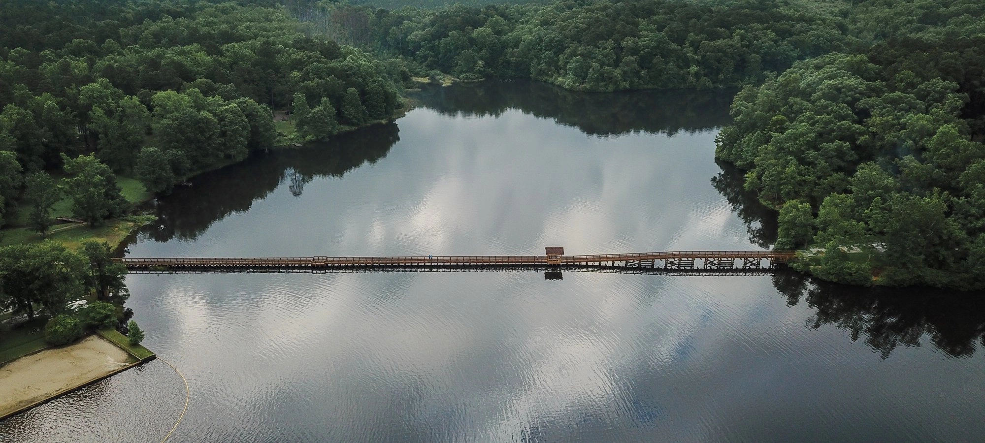
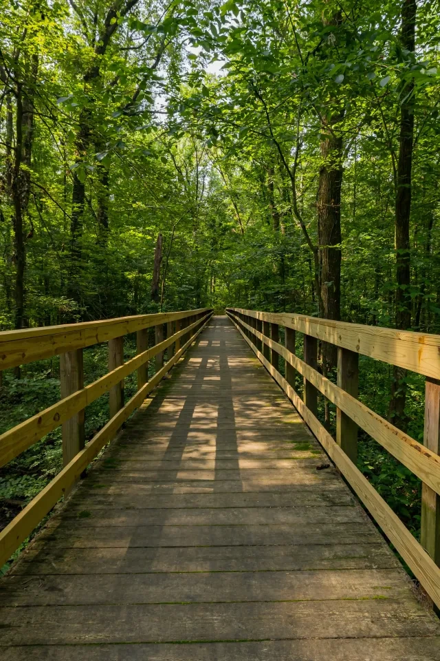
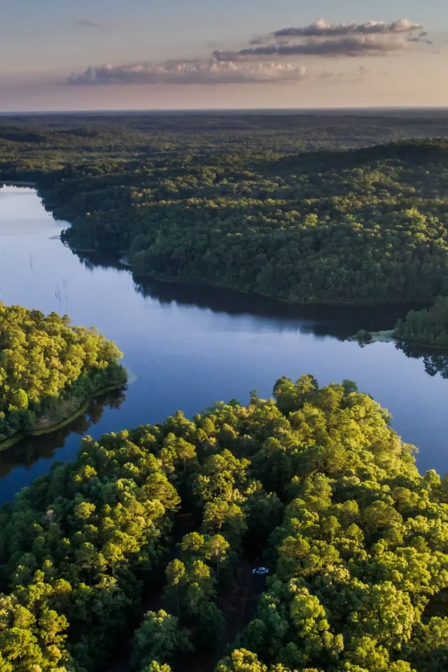
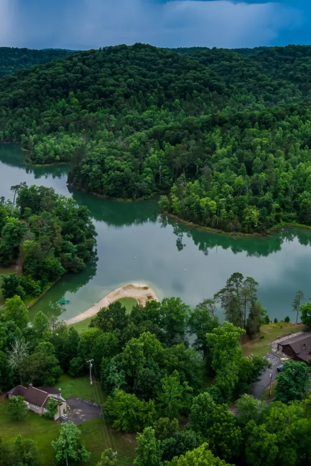
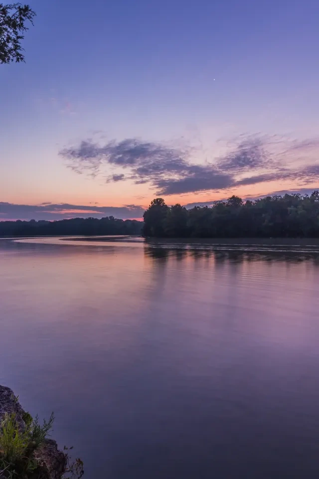
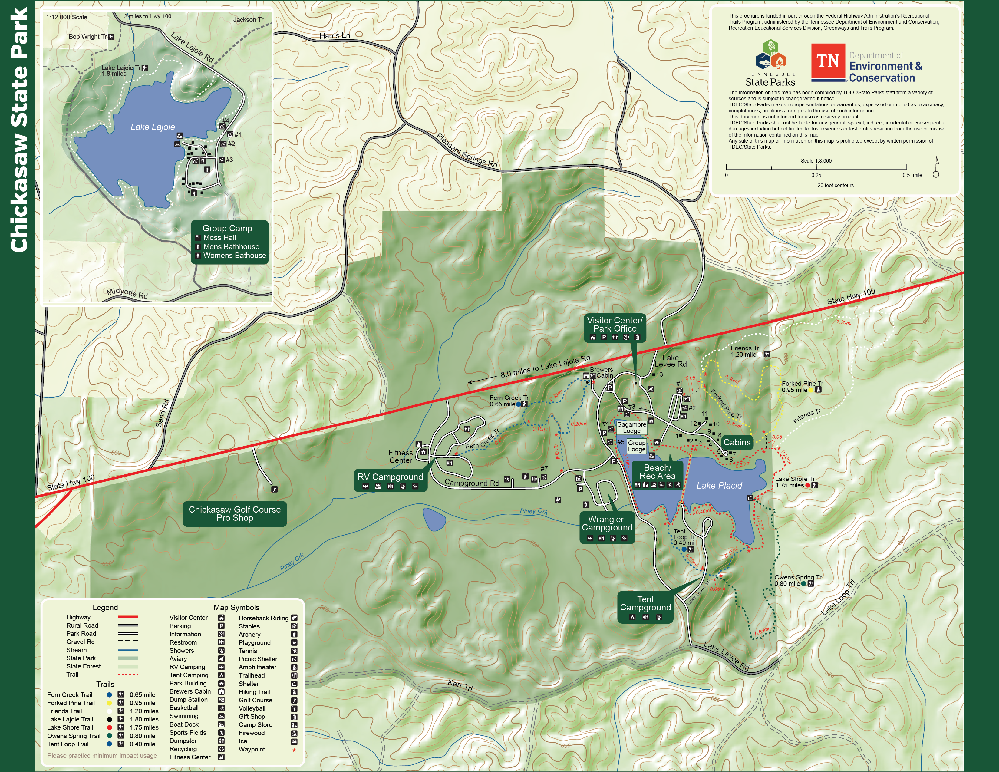
    Chickasaw State Park has a variety of trails that help visitors to view wildlife, the lakes, lowland areas, and upland forests.  

    Trails

    Showing page 1 of 1
    • Fern Creek Trail

      Chickasaw State Park
      Distance
      0.65 mi.
      Difficulty
      Difficult
      Surface
      Natural
      The Fern Creek Trail begins and ends at Brewer Cabin, a one-room log cabin built in the 1870s. This trail passes through both lowland areas as well as upland hardwood forests. Ferns are plentiful all along this route which gives the trail its name. A 0.2-mile spur at the mid-point of the trail connects to the RV campground.
      Availability
      Open Seasonal
      Allowed
      Hiking

      Fern Creek Trail

      Chickasaw State Park
      The Fern Creek Trail begins and ends at Brewer Cabin, a one-room log cabin built in the 1870s. This trail passes through both lowland areas as well as upland hardwood forests. Ferns are plentiful all along this route which gives the trail its name. A 0.2-mile spur at the mid-point of the trail connects to the RV campground.
      Distance
      0.65 mi.
      Difficulty
      Difficult
      Surface
      Natural
      Allowed
      Hiking

      Trail Type
      Information unavailable

      Elevation
      Gain 195.90'
      Loss 135.10'
      Grade
      Typical 7.2%
      Max 31.5%
      Cross Slope
      Typical 3.7%
      Max 22.2%
      Tread Width
      Typical 42"
      Minimum 12"
      Surface Type
      Soil 88.2%; Gravel 9.3%; Wood decking 2.5%
      Obstructions Exist
      Step: 12 in tall; Tree: 24 in of tread remaining; Erosion: 24 in of tread remaining

      Forked Pine Trail

      Chickasaw State Park
      Distance
      0.95 mi.
      Difficulty
      Difficult
      Surface
      Natural
      The Forked Pine Trail begins at the trailhead in the main parking lot. This trail passes through numerous large loblolly pine trees, tulip poplars, and oaks before bringing you back to the main trailhead. There are some hills and elevation change on this trail. This trail connects to both the Friends Trail and Lake Shore Trail along its route.
      Availability
      Open
      Allowed
      Hiking

      Forked Pine Trail

      Chickasaw State Park
      The Forked Pine Trail begins at the trailhead in the main parking lot. This trail passes through numerous large loblolly pine trees, tulip poplars, and oaks before bringing you back to the main trailhead. There are some hills and elevation change on this trail. This trail connects to both the Friends Trail and Lake Shore Trail along its route.
      Distance
      0.95 mi.
      Difficulty
      Difficult
      Surface
      Natural
      Allowed
      Hiking

      Trail Type
      Information unavailable

      Elevation
      Gain 155.90'
      Loss 184.10'
      Grade
      Typical 6.7%
      Max 43.9%
      Cross Slope
      Typical 3.6%
      Max 12.0%
      Tread Width
      Typical 36"
      Minimum 24"
      Surface Type
      Soil 97.5%; Wood decking 2.5%
      Obstructions Exist
      Tree root: 9 in tall; Step: 7 in tall; Drainage dip: 6 in deep

      Friends Trail

      Chickasaw State Park
      Distance
      1.20 mi.
      Difficulty
      Moderate
      Surface
      Natural
      The Friends Trail also begins at the Main Parking Lot Trailhead. This trail was built by the Friends of Chickasaw State Park. This trail begins with several hills and frequent elevation changes through an upland hardwood forest before transitioning to a wetland area. In this area, you will be able to see beaver habitat as well as numerous other aquatic plants and animals. This trail ends on the east side of the Lake Shore Trail.
      Availability
      Open
      Allowed
      Hiking

      Lake Lajoie Paddle Trail

      Chickasaw State Park
      Distance
      Difficulty
      Surface
      Natural
      Availability
      Open
      Allowed
      Hiking

      Lake Lajoie Trail

      Chickasaw State Park
      Distance
      1.80 mi.
      Difficulty
      Easy
      Surface
      Natural
      This trail is available to registered guests of the group camp and follows the shore of Lake Lajoie. The camp and trailhead are on the western edge of Chickasaw State Forest.
      Availability
      Open
      Allowed
      Hiking

      Lake Placid Water Trail

      Chickasaw State Park
      Distance
      Difficulty
      Surface
      Natural
      Availability
      Open
      Allowed
      Hiking

      Lake Shore Trail

      Chickasaw State Park
      Distance
      1.75 mi.
      Difficulty
      Difficult
      Surface
      Mixed
      This is the most popular trail at Chickasaw State Park. This trail follows the entire shoreline of Lake Placid and connects several of our recreation areas including the tent campground, swimming area, and boat dock. This signature feature of this trail is the 640-foot footbridge that crosses the middle of Lake Placid connecting the tent campground with the main recreation area.
      Availability
      Open
      Allowed
      Hiking

      Lake Shore Trail

      Chickasaw State Park
      This is the most popular trail at Chickasaw State Park. This trail follows the entire shoreline of Lake Placid and connects several of our recreation areas including the tent campground, swimming area, and boat dock. This signature feature of this trail is the 640-foot footbridge that crosses the middle of Lake Placid connecting the tent campground with the main recreation area.
      Distance
      1.75 mi.
      Difficulty
      Difficult
      Surface
      Mixed
      Allowed
      Hiking

      Trail Type
      Information unavailable

      Elevation
      Gain 143.90'
      Loss 181.60'
      Grade
      Typical 3.0%
      Max 27.3%
      Cross Slope
      Typical 2.6%
      Max 19.2%
      Tread Width
      Typical 46"
      Minimum 12"
      Surface Type
      Soil 63.5%; Wood decking 19.7%; Asphalt 5.8%; Gravel 5.1%; Concrete 4.6%; Sand 1.1%; Stairs 0.2%
      Obstructions Exist
      Step: 12 in tall; Tree: 24 in of tread remaining; Step: 8 in tall

      Owens Spring Trail

      Chickasaw State Park
      Distance
      0.80 mi.
      Difficulty
      Moderate
      Surface
      Mixed
      Owens Spring Trail begins at the tent campground and travels through both upland areas as well as wetland areas before connecting to the east side of the Lake Shore Trail. The trail passes by several natural springs that feed Lake Placid, as well as crossing the levee of the old fish hatchery that was used in the 1930s to initially stock Lake Placid when the park was originally built.
      Availability
      Open
      Allowed
      Hiking

      Tent Loop Trail

      Chickasaw State Park
      Distance
      0.40 mi.
      Difficulty
      Easy
      Surface
      Paved
      The tent loop connects at two points along the Lake Shore Trail near the tent campground. When combined with the portion of the Lake Shore Trail near the campground this creates an easy 0.8-mile loop that circles the entire tent campground.
      Availability
      Open
      Allowed
      Hiking

    Trail Definitions

    • Cross Slope 

      Describes the degree of incline from one side of the trail path to the other; measured as a percentage. Cross slope aids in water drainage and impacts the overall trail stability.   

    • Grade  

      Describes the rise in elevation over a horizontal distance on the trail; measured as a percentage.  Higher percentages represent a steeper grade indicating a more challenging ascent or descent for hikers.    

    • Standard Ramp Grade

      Serves as a reference guide for the grade of the trail.  Standard Ramp Grade is 8.3% across all trail assessments.  

    • Surface 

      A characteristic of the trail expressed in terms of material type, grading, compaction, and roughness of the path. Possible surface types include soil, gravel, paved, and mulch.   

    • Tread Width    

      Represents the horizontal distance from one edge of the trail path to the other; measurements can vary.  Tread width helps to determine the amount of space a hiker has to pass through. Obstacles on the trail can alter the remaining tread width.   

    • Trail Types: Loop

      Trail returns at or near the point from which you started. 

    • Trail Types: Network 

      Offers multiple route options within one trail, and each route is connected

    • Trail Types: Out and Back

      This type of trail travels out to an endpoint where hikers turn around and travel back to the starting point.   

    • Trail Types: Stacked Loop

      A loop trail contained completely within another trail.   

    Need a Map?

    Explore our collection of printable and digital trail maps, organized by park. Whether you’re hiking, camping, or paddling, you’ll find the resources you need to navigate confidently.


    Visitor Center Gift Shop

    The Visitor Center Gift Shop is the perfect place to pick up a map, learn about the park, or find a souvenir. You'll find an assortment of apparel and keepsakes to remember your trip to the park.

    Address:
    20 Cabin Lane, Henderson TN, 38340 

    Hours:
    8:00 AM - 4:30 PM

    Skip photo gallery
    Media Crowdriff
    Happenings

    No events are scheduled at this time, but there's always more to explore.

    Find More Events