Dunbar Cave Hiking

  • River beside a stone wall and lush green trees under a clear blue sky.
  • Wooded trail with dappled sunlight, surrounded by lush green trees.

    Hiking at Dunbar Cave  

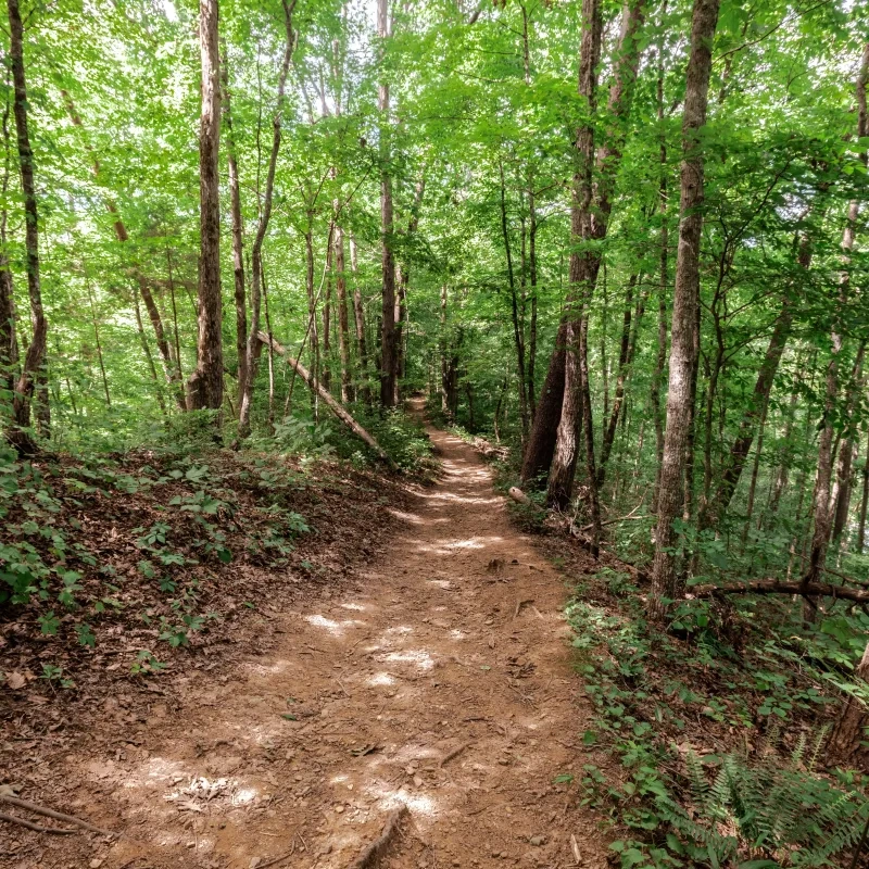
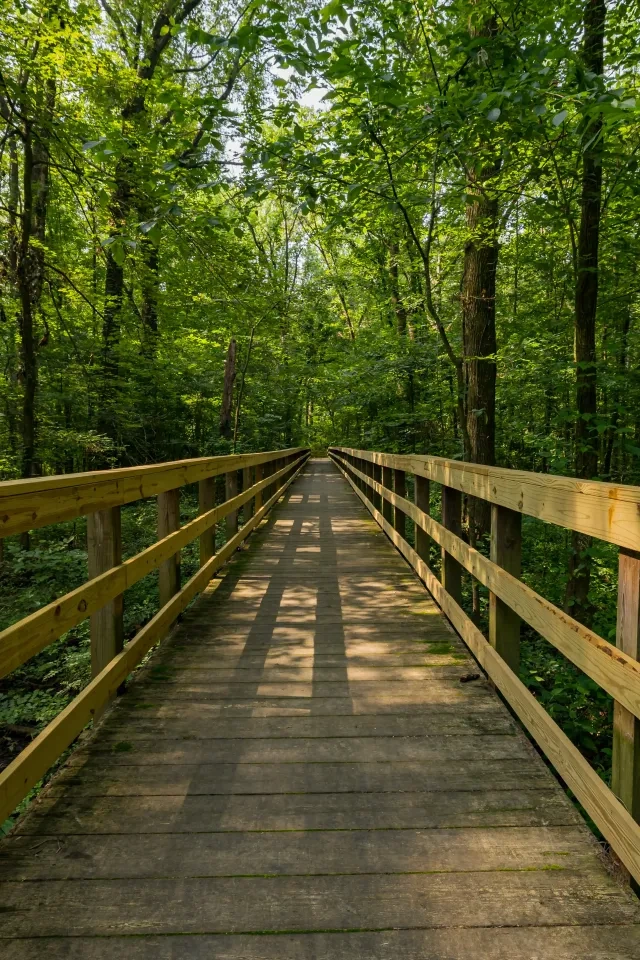
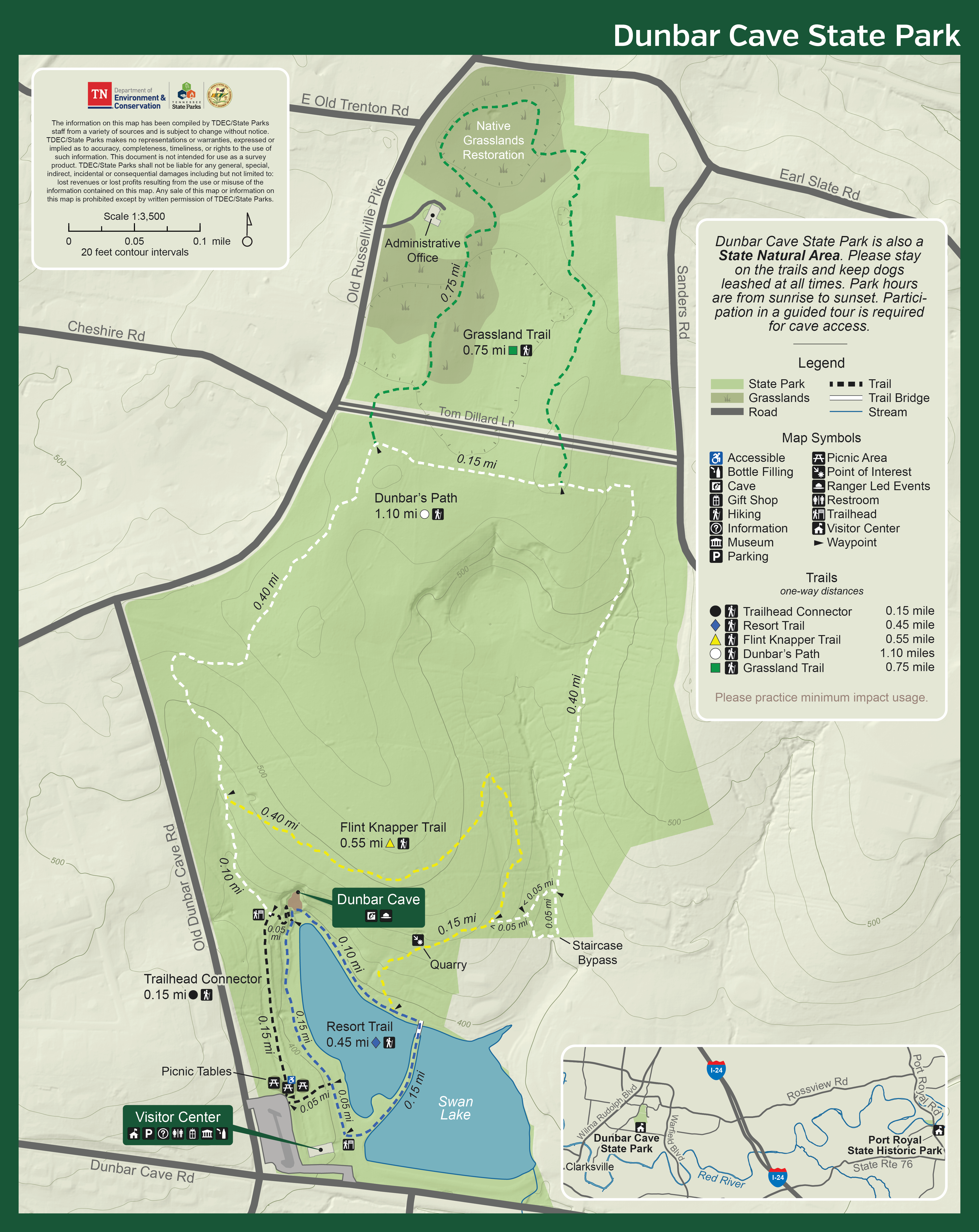
    Over three miles of hiking trails allow visitors to view wildlife and native wildflowers.

    Hiking at Dunbar Cave State Park is a customizable experience given the nature of the trails, and how they connect to each other. Visitors can continue hiking all the way up to the Grassland Trail, where the native grasslands are, or loop back around towards the visitor center.

    View the trail map below.

    Trails

    Showing page 1 of 1
    • Dunbar’s Path

      Dunbar Cave State Park
      Distance
      1.10 mi.
      Difficulty
      Surface
      Mixed
      Availability
      Open
      Allowed
      Hiking

      Flint Knapper Trail

      Dunbar Cave State Park
      Distance
      0.55 mi.
      Difficulty
      Surface
      Natural
      Availability
      Open
      Allowed
      Hiking

      Grassland Trail

      Dunbar Cave State Park
      Distance
      0.75 mi.
      Difficulty
      Surface
      Natural
      Availability
      Open
      Allowed
      Hiking

      Resort Trail

      Dunbar Cave State Park
      Distance
      0.45 mi.
      Difficulty
      Surface
      Paved
      Availability
      Open
      Allowed
      Hiking wheelchair

      Trailhead Connector

      Dunbar Cave State Park
      Distance
      0.15 mi.
      Difficulty
      Surface
      Natural
      Availability
      Open
      Allowed
      Hiking

    Trail Use Rules: Foot traffic only; pets must remain on leash

    Trail Definitions

    • Cross Slope 

      Describes the degree of incline from one side of the trail path to the other; measured as a percentage. Cross slope aids in water drainage and impacts the overall trail stability.   

    • Grade  

      Describes the rise in elevation over a horizontal distance on the trail; measured as a percentage.  Higher percentages represent a steeper grade indicating a more challenging ascent or descent for hikers.    

    • Standard Ramp Grade

      Serves as a reference guide for the grade of the trail.  Standard Ramp Grade is 8.3% across all trail assessments.  

    • Surface 

      A characteristic of the trail expressed in terms of material type, grading, compaction, and roughness of the path. Possible surface types include soil, gravel, paved, and mulch.   

    • Tread Width    

      Represents the horizontal distance from one edge of the trail path to the other; measurements can vary.  Tread width helps to determine the amount of space a hiker has to pass through. Obstacles on the trail can alter the remaining tread width.   

    • Trail Types: Loop

      Trail returns at or near the point from which you started. 

    • Trail Types: Network 

      Offers multiple route options within one trail, and each route is connected

    • Trail Types: Out and Back

      This type of trail travels out to an endpoint where hikers turn around and travel back to the starting point.   

    • Trail Types: Stacked Loop

      A loop trail contained completely within another trail.   

    Need a Map?

    Explore our collection of printable and digital trail maps, organized by park. Whether you’re hiking, camping, or paddling, you’ll find the resources you need to navigate confidently.


    Visitor Center Gift Shop

    The Visitor Center Gift Shop is the perfect place to pick up a map, learn about the park, or find a souvenir. You’ll find an assortment of apparel and keepsakes to remember your trip to the park.

    Address:
    401 Old Dunbar Cave Road, Clarksville TN, 37043
    1-931-648-5526

    Hours
    8:00 AM - 4:30 PM

    Skip photo gallery
    Media Crowdriff
    Happenings

    No events are scheduled at this time, but there's always more to explore.

    Find More Events