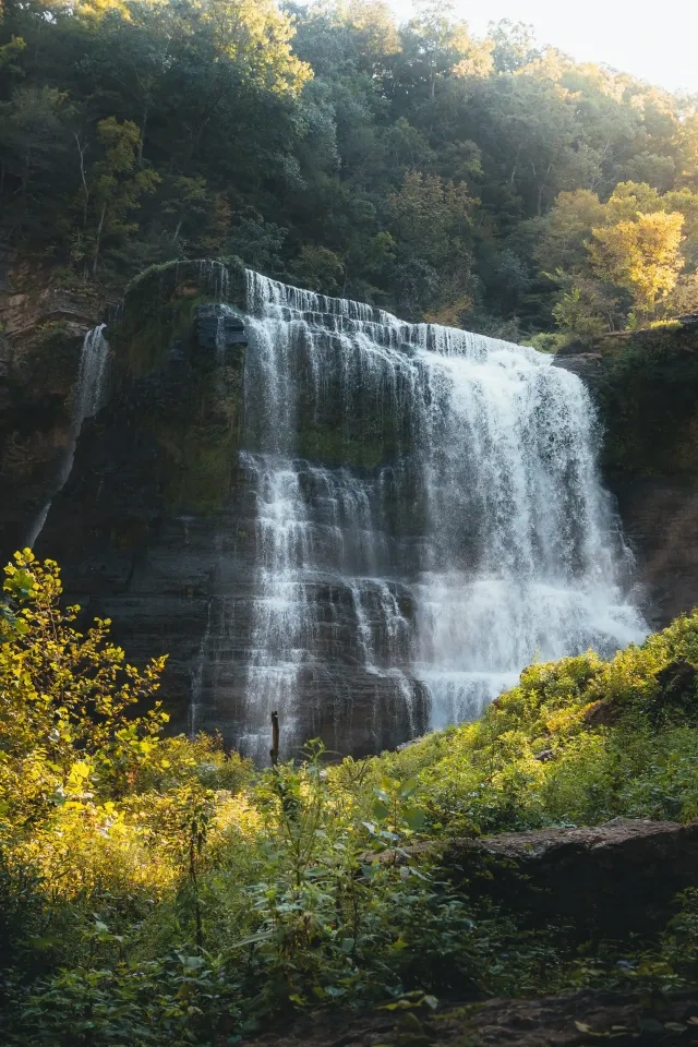
Panther Creek Hiking

Warning Alert
Warning

Temporary Road Closure

Panther Creek State Park

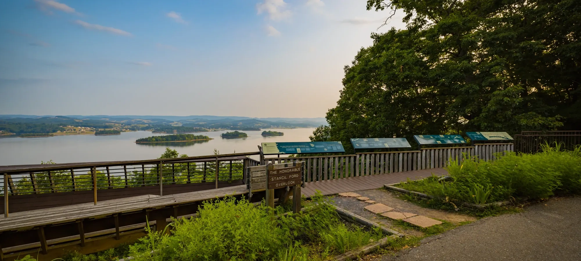
NOTICE: The park road leading to the Smallman Shelter and overlook will be closed to vehicles from March 1, 2026, through May 15, 2026, while extensive renovations to the Lake Observation Platform are performed. The road to and around the first picnic area island will remain open to visitors and vehicular traffic. Foot travel beyond the closed area is permitted but visitors will not be permitted in the immediate area of the construction site.

Notification

Major Improvements at the Park

Panther Creek State Park

A capital improvement project to construct a day-use recreation lodge and new playground will begin at the park on Monday, April 13, 2026. The swimming pool parking lot, playground, playground restrooms, beach volleyball and basketball courts will be closed to the public during construction, which is scheduled to be completed by mid-year 2027.

The tennis courts and disc-golf course will remain open but parking for these amenities will be limited to the lots adjacent to the visitor center and Spoone shelter. This project will significantly enhance the quantity and quality of recreational opportunities provided by the park. We appreciate your patience and understanding as we work to complete this exciting new project for the benefit of our visitors.

Notification

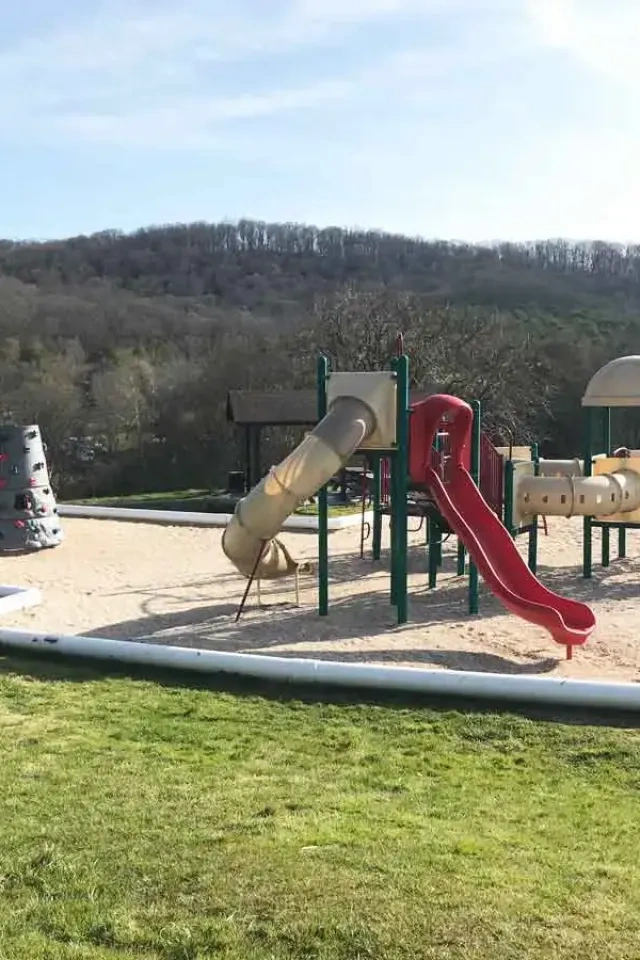
Playground Closed For Renovation

Panther Creek State Park

The park playground will be permanently closed to the public beginning Tuesday, April 7, 2026. The existing playground will be removed, and a new playground will be constructed at the park. The new playground is scheduled to be completed by mid-year 2027 and will be a tremendous improvement over the existing playground.

We appreciate your patience and understanding as we work to improve the park for our visitors. If you have any questions, please contact the park office.

  • Scenic lake view from overlook deck with trees and informational signs.
  • Autumn forest scene with vibrant orange leaves covering trees and path. The leafy ground and warm tones evoke a serene and cozy atmosphere.

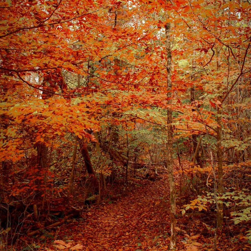
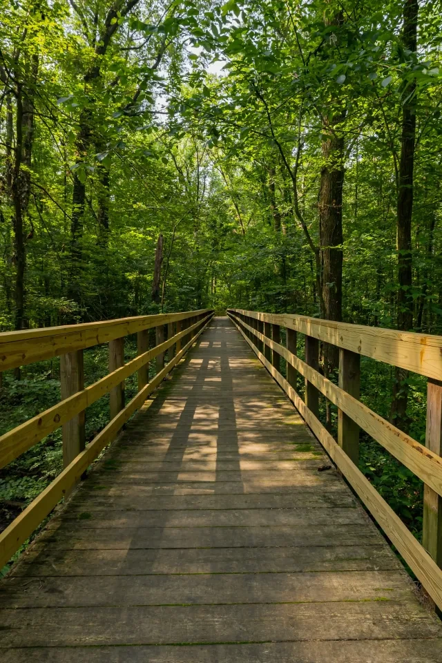
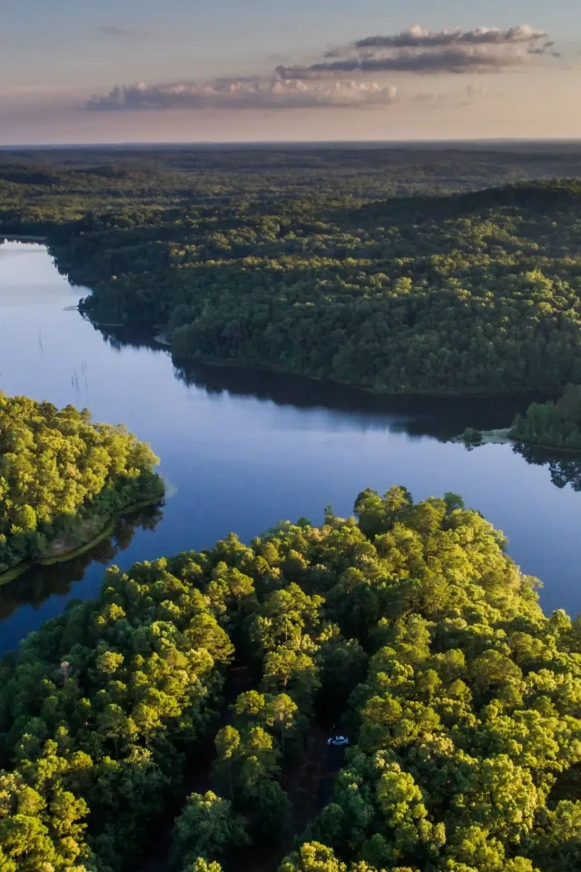
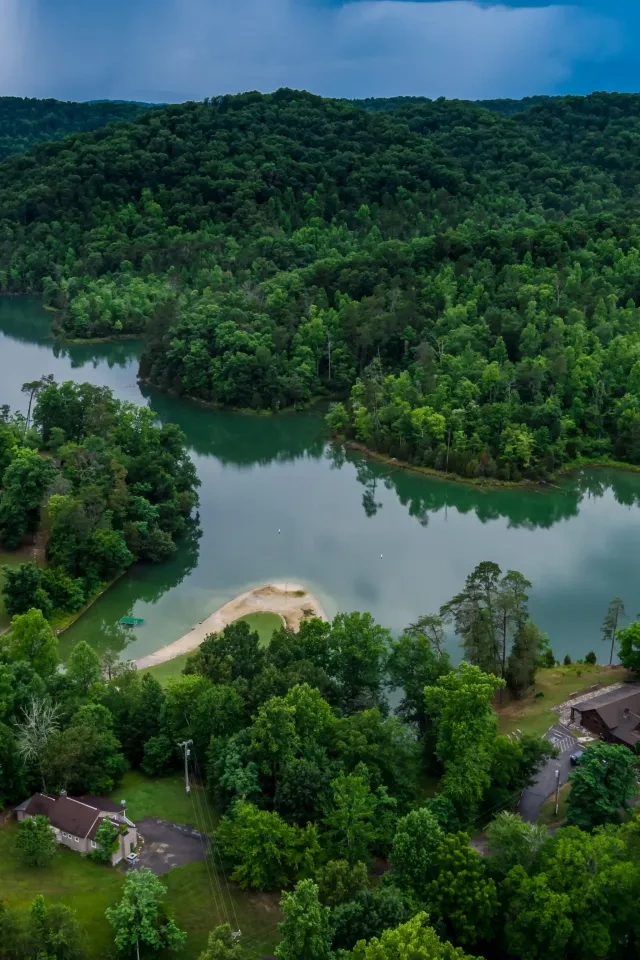
    Hiking at Panther Creek

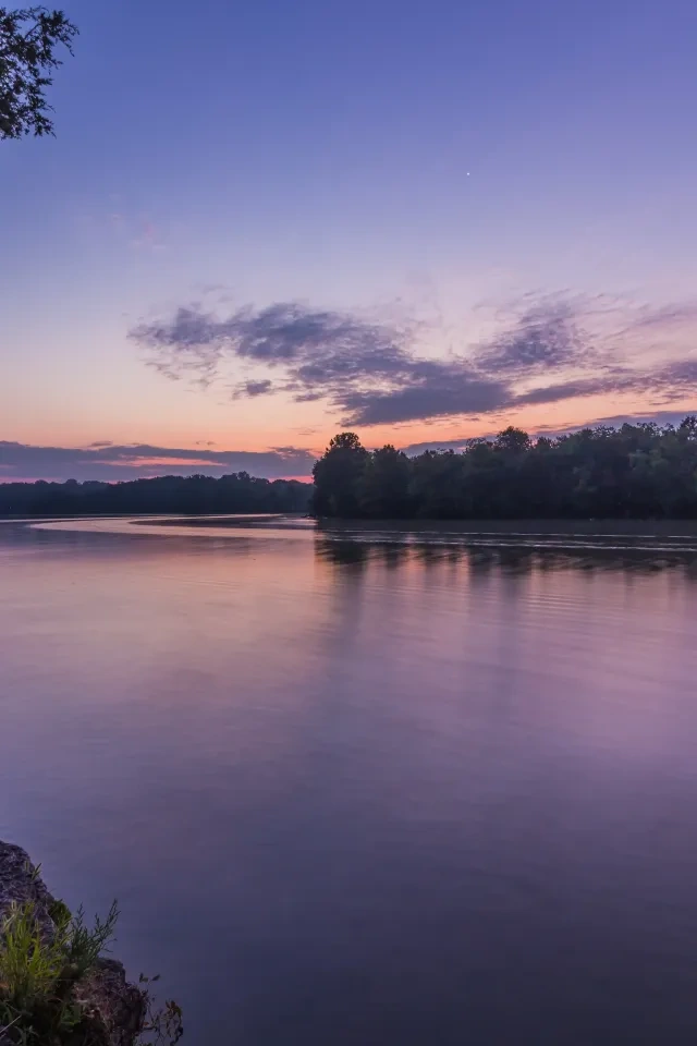
    Panther Creek State Park covers approximately 1,444 acres and is located on the shores of Cherokee Lake. 

    The park boasts approximately 28 miles of world-class trails ranging from easy to difficult. Visitors are encouraged to Leave No Trace when using our trails. Hikers can enjoy a magnificent view of Cherokee Lake and the Cumberland Mountains from the Point Lookout trail, reaching 1,460 feet above sea level. 

    Trails

    Showing page 1 of 3
    • Campground Connector Trail

      Panther Creek State Park
      Distance
      0.20 mi.
      Difficulty
      Surface
      Natural
      Availability
      Open
      Allowed
      Hiking

      Deer Run Trail

      Panther Creek State Park
      Distance
      0.80 mi.
      Difficulty
      Moderate
      Surface
      Natural
      The Deer Run trail passes through cedar glades and pine stands and features a series of curves and short, gentle hills. This trail runs parallel to Cherokee Lake and is named for its similarity to a naturally winding white-tailed deer path. The Deer Run trail is used primarily as a connector trail between Panther Path and the Trout Lily trail.
      Availability
      Open
      Allowed
      Hiking Mountain Biking

      Horse Connector Trail

      Panther Creek State Park
      Distance
      2.60 mi.
      Difficulty
      Moderate
      Surface
      Natural
      The 3.2-mile Maple Arch trail loop is moderately difficult and features sort, steep hills and one very steep ascent.  The trail is named for the unique tendency of red and silver maple trees to form arches as they grow over the trail corridor.  Much of trail follows the shoreline of Cherokee Lake before sharply ascending River Ridge.  The Maple Arch trail is excellent for observing waterfowl and other wildlife and offers many captivating views of Cherokee Lake.
      Availability
      Open Seasonal
      Allowed
      Hiking Horseback Riding

      Hunt Knob Trail

      Panther Creek State Park
      Distance
      3.80 mi.
      Difficulty
      Difficult
      Surface
      Natural
      The 3.8-mile Hunt Knob trail is the longest trail in the park. This scenic trail follows the perimeter of Cherokee Lake 1.75-miles before ascending Hunt Knob ridge. The trail offers variety from easy, strait, gently sloping sections along the lakeshore to strenuous, hilly sections around Hunt Knob. NOTE: The Hunt Knob trail is accessible only from the horse trail parking area along a 1.6-mile connector trail. The total length of the Hunt Knob trail and the connector trail is 5.4-miles.
      Availability
      Open
      Allowed
      Hiking Horseback Riding

      Inner Old Farm Trail

      Panther Creek State Park
      Distance
      1.50 mi.
      Difficulty
      Surface
      Natural
      Availability
      Open
      Allowed
      Hiking Mountain Biking

      Lost Road Trail

      Panther Creek State Park
      Distance
      1.90 mi.
      Difficulty
      Difficult
      Surface
      Natural
      This scenic trail follows portions of the "goat paths" or crude roads traveled by settlers in the early 1900's. The Lost Road trail steeply ascends River Ridge, passing the remaining stone pile foundations and privy depressions of early home sites. This is an excellent trail for observing the park's largest mammal, the white-tailed deer.
      Availability
      Open
      Allowed
      Hiking

      Maple Arch Trail

      Panther Creek State Park
      Distance
      3.20 mi.
      Difficulty
      Moderate
      Surface
      Natural
      The 3.2-mile Maple Arch trail loop is moderately difficult and features short, steep hills and one very steep ascent. This trail is named for the unique tendency of Red and Silver Maple trees to form arches as they grow over the trail corridor. Much of the trail follows the shoreline of Cherokee Lake before sharply ascending River Ridge. The Maple Arch trail is excellent for observing waterfowl and other wildlife and offers many captivating views of Cherokee Lake. NOTE: The Maple Arch trail loop...
      Availability
      Open
      Allowed
      Hiking Horseback Riding

      Norris Blackburn Trail

      Panther Creek State Park
      Distance
      0.45 mi.
      Difficulty
      Moderate
      Surface
      Natural
      The Norris Blackburn trail features a short, moderately steep ascent to the park's wildlife observation deck. This is an excellent location to hear owls in the early evening or observe migratory birds in the fields below. Hikers may also access the Hunt Knob and Old Wagon trails from this trail.
      Availability
      Open
      Allowed
      Hiking

      Old Wagon Trail

      Panther Creek State Park
      Distance
      1.00 mi.
      Difficulty
      Easy
      Surface
      Paved
      The Old Wagon Trail is the most popular trail at the park and is excellent for all ages and abilities. This trail follows the contour of Panther Creek and features a flat, wide gravel surface ideal for mountain bike, hike, or jogging. This is an excellent trail for the wildlife enthusiast, as many different birds and animals are frequently observed along the Old Wagon Trail in the early morning. Old Wagon Trail connects to Piney Cove and Deer Run trails for an extended ride.
      Availability
      Open
      Allowed
      Hiking Mountain Biking
    • Ore Mine Trail

      Panther Creek State Park
      Distance
      1.30 mi.
      Difficulty
      Moderate
      Surface
      Natural
      The Ore Mine trail is a moderately difficult, 1.3-mile trail loop, featuring a series of short, steep hills. This trail is named for manganese mining operations in the area during the early 1800's. Manganese is an important property in the production of steel and has long been related to glass making. The Egyptians and Romans used manganese ore to tint glass purple, pink and black.
      Availability
      Open
      Allowed
      Hiking

      Outer Old Farm Trail

      Panther Creek State Park
      Distance
      1.00 mi.
      Difficulty
      Easy
      Surface
      Natural
      Inner Loop - 1.00mi, Outer Loop - 1.50mi. The Old Farm trails are excellent for wildflower and bird viewing. The inner loop is flat and gently winds through cedar glades and bramble fields laden with blackberries during the summer months. The outer loop traverses open fields, hardwood and pine stands and eventually connects with the Pioneer trail.
      Availability
      Open
      Allowed
      Hiking Mountain Biking

      Panther Path Trail

      Panther Creek State Park
      Distance
      0.90 mi.
      Difficulty
      Difficult
      Surface
      Natural
      Panther Path is an easy 0.9-mile trial loop featuring a series of flat, gently curves and one steep ascent. This trail passes through open fields and shaded stands of hardwood, offering many captivating views of Panther Creek. Panther Path is an excellent trail choice for young bikers and beginning hikers. Panther Path is often combined with the Old Wagon trail to form a 1.9-mile trail loop.
      Availability
      Open
      Allowed
      Hiking Mountain Biking

      Panther Path Trail

      Panther Creek State Park
      Panther Path is an easy 0.9-mile trial loop featuring a series of flat, gently curves and one steep ascent. This trail passes through open fields and shaded stands of hardwood, offering many captivating views of Panther Creek. Panther Path is an excellent trail choice for young bikers and beginning hikers. Panther Path is often combined with the Old Wagon trail to form a 1.9-mile trail loop.
      Distance
      0.90 mi.
      Difficulty
      Difficult
      Surface
      Natural
      Allowed
      Hiking Mountain Biking

      Trail Type
      Information unavailable

      Elevation
      Gain 43.10'
      Loss 182.90'
      Grade
      Typical 4.9%
      Max 20.6%
      Cross Slope
      Typical 2.7%
      Max 15.7%
      Tread Width
      Typical 31"
      Minimum 24"
      Surface Type
      Mowed grass 44.3%; Soil 37.7%; Gravel 10.2%; Crushed stone 7.7%
      Obstructions Exist
      Tree roots: 4 in tall; Rut: 3 in deep; Rut: 2 in deep

      Piney Cove Trail

      Panther Creek State Park
      Distance
      0.60 mi.
      Difficulty
      Moderate
      Surface
      Natural
      The Piney Cove trail passes through stands of Virginia and White Pine and features a series of gentle curves and one short, steep ascent. Generally used as a connector trail between Panther Path and the Old Farm trails, the Piney Cove trail is an excellent choice for the novice mountain biker or hiker.
      Availability
      Open
      Allowed
      Hiking Mountain Biking

      Pioneer Trail

      Panther Creek State Park
      Distance
      2.40 mi.
      Difficulty
      Moderate
      Surface
      Natural
      The Pioneer trail is a moderately difficult 2.4-mile trail loop featuring a series of curves and short, steep hills. This trail winds through stands of Shortleaf Pine and Eastern Red Cedar trees then ascend into a community of mixed hardwood trees. This is an excellent trail for the wildlife enthusiast, as many different birds and animals are frequently observed along the Pioneer Trail.
      Availability
      Open
      Allowed
      Hiking Mountain Biking

      Point Lookout Trail

      Panther Creek State Park
      Distance
      1.90 mi.
      Difficulty
      Moderate
      Surface
      Natural
      The Point Lookout trail is a moderately difficult 1.9-mile trail loop steeply ascending to an elevation 400 feet above Lake Cherokee. Point Lookout is the highest elevation in the park at 1,460 feet above sea level. Along this trail, hikers are rewarded with a breath-taking view overlooking Lake Cherokee. Hikers may access the Lake Trail at the lower end of the Point Lookout Trail.
      Availability
      Open
      Allowed
      Hiking

      Ridge Crest Trail

      Panther Creek State Park
      Distance
      0.70 mi.
      Difficulty
      Difficult
      Surface
      Natural
      The Ridge Crest trail is a very difficult 0.7-mile trail steeply descending along Hunt Knob ridge to the lakeshore below. Hikers may access Hunt Knob trail near the lower end of the Ridge Crest trail or continue on to the shore of Lake Cherokee. The trail ends with a breath-taking view of the lake. Look for communities of Prickly Pear cactus growing in abundance along the Ridge Crest trail.
      Availability
      Open
      Allowed
      Hiking

      Road to Recycling Trail

      Panther Creek State Park
      Distance
      1.20 mi.
      Difficulty
      Difficult
      Surface
      Natural
      This self-guided Road to Recycling trail educates park visitors on the benefits of conserving natural resources. Signs located along the trail were made possible through a partnership between Panther Creek State Park and the Morristown-Hamblen Chapter of Keep America Beautiful. This trail was also awarded the Governor's Greenways and Trails Stewardship Award in 2004.
      Availability
      Open
      Allowed
      Hiking

      Road to Recycling Trail

      Panther Creek State Park
      This self-guided Road to Recycling trail educates park visitors on the benefits of conserving natural resources. Signs located along the trail were made possible through a partnership between Panther Creek State Park and the Morristown-Hamblen Chapter of Keep America Beautiful. This trail was also awarded the Governor's Greenways and Trails Stewardship Award in 2004.
      Distance
      1.20 mi.
      Difficulty
      Difficult
      Surface
      Natural
      Allowed
      Hiking

      Trail Type
      Information unavailable

      Elevation
      Gain 115.00'
      Loss 165.90'
      Grade
      Typical 4.6%
      Max 28.5%
      Cross Slope
      Typical 2.9%
      Max 14.3%
      Tread Width
      Typical 50"
      Minimum 24"
      Surface Type
      Soil 97.5%; Mowed grass 1.7%; Gravel 0.5%; Wood decking 0.3%
      Obstructions Exist
      Tree roots: 7 in tall; Tree root: 6 in tall; Tree root: 5 in tall

      Seven Sinkholes Trail

      Panther Creek State Park
      Distance
      0.60 mi.
      Difficulty
      Easy
      Surface
      Natural
      This trail meanders past seven distinct sink holes before dipping into a lush valley of cedars and pines.  Sinkholes develop when rainfall dissolves the under-layer of porous limestone rock forming cavities. These cavities and depressions within the limestone gradually enlarge creating sinkholes. This easy 0.6-mile trail meanders around seven distinct sinkholes before dipping into a lush valley of cedar and pine.
      Availability
      Open Seasonal
      Allowed
      Hiking
    • Trout Lily Trail

      Panther Creek State Park
      Distance
      2.00 mi.
      Difficulty
      Moderate
      Surface
      Natural
      The Trout Lily trail is a moderately difficult 2-mile trail loop featuring curves, short hills and one very rocky descent. This trail is named after the wildflower found throughout the eastern United States with a leaf pattern similar in appearance to a speckled Brown Trout. Look for the pale yellow blossoms of the Trout Lily from March to May in the moist open woods along the trail. This trail was developed by the Appalachian Mountain Bike Club for experienced bicyclists.
      Availability
      Open
      Allowed
      Hiking Mountain Biking

    Trail Definitions

    • Cross Slope 

      Describes the degree of incline from one side of the trail path to the other; measured as a percentage. Cross slope aids in water drainage and impacts the overall trail stability.   

    • Grade  

      Describes the rise in elevation over a horizontal distance on the trail; measured as a percentage.  Higher percentages represent a steeper grade indicating a more challenging ascent or descent for hikers.    

    • Standard Ramp Grade

      Serves as a reference guide for the grade of the trail.  Standard Ramp Grade is 8.3% across all trail assessments.  

    • Surface 

      A characteristic of the trail expressed in terms of material type, grading, compaction, and roughness of the path. Possible surface types include soil, gravel, paved, and mulch.   

    • Tread Width    

      Represents the horizontal distance from one edge of the trail path to the other; measurements can vary.  Tread width helps to determine the amount of space a hiker has to pass through. Obstacles on the trail can alter the remaining tread width.   

    • Trail Types: Loop

      Trail returns at or near the point from which you started. 

    • Trail Types: Network 

      Offers multiple route options within one trail, and each route is connected

    • Trail Types: Out and Back

      This type of trail travels out to an endpoint where hikers turn around and travel back to the starting point.   

    • Trail Types: Stacked Loop

      A loop trail contained completely within another trail.   

    Need a Map?

    Explore our collection of printable and digital trail maps, organized by park. Whether you’re hiking, camping, or paddling, you’ll find the resources you need to navigate confidently.


    Visitor Center Gift Shop

    The Visitor Center Gift Shop is the perfect place to pick up a map, learn about the park, or find a souvenir. You’ll find an assortment of apparel and keepsakes to remember your trip to the park. 

    Address:
    2010 Panther Creek Road, Morristown TN, 37814
    1-423-587-7046

    Hours
    Monday - Friday 
    8:30 AM - 4:00 PM

    Saturday 
    8:30 AM - 4:00 PM

    Closed Sunday

    Skip photo gallery
    Media Crowdriff
    Happenings

    No events are scheduled at this time, but there's always more to explore.

    Find More Events