Paris Landing Hiking

  • group of people with a ranger going on a trail with a wooden sign that says raptor trail
  • People walking along a lakeside path under a bright sky.

    Hiking at Paris Landing

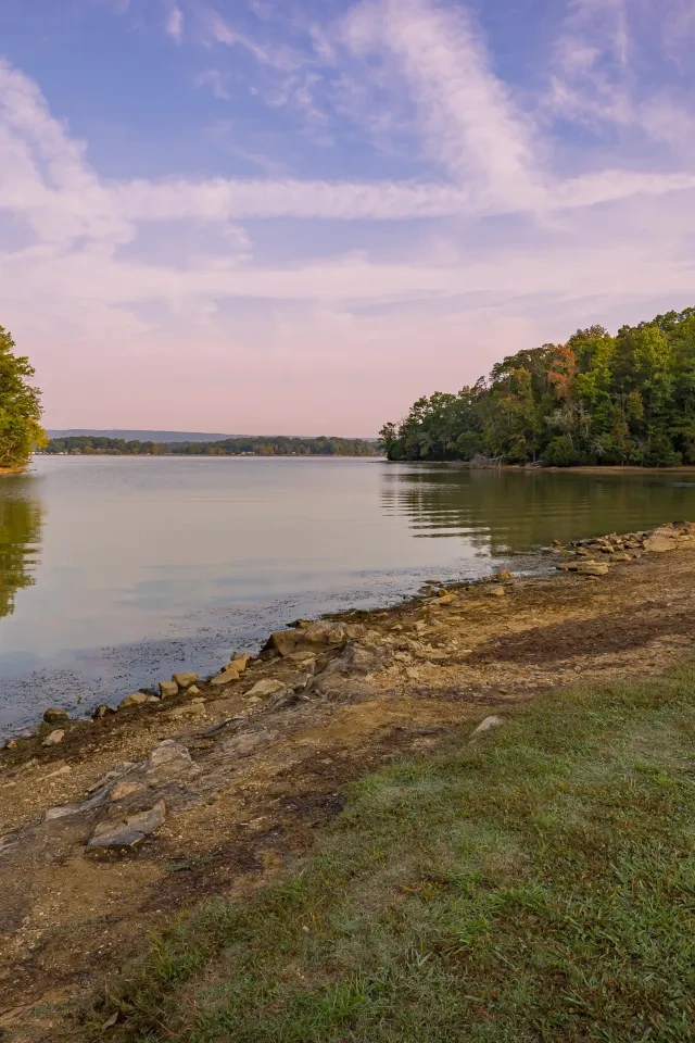
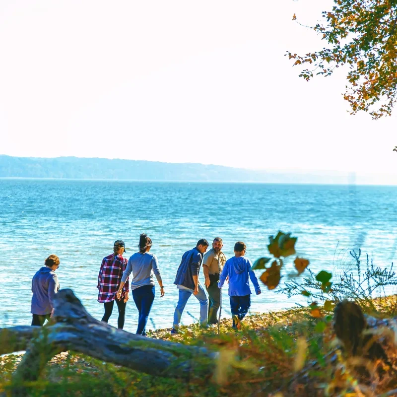
    Take a hike at Paris Landing State Park to view what makes our park unique!

    We have two hiking trails that wander through woods and by lakeshores. 

    A stroll along the Raptor Ridge Trail offers a deeper dive into the park's flora and fauna, including purple coneflower, large oak trees, and other native grasses and wildflowers. Many of Tennessee's beloved animals, such as whitetail deer, raccoons, otters, turkeys, and red and grey foxes, make quiet appearances along the trail. Limestone and sandstone formations can be seen throughout the park and on each trail.  

    Peek into the habitat of many turtles, insects, wildflowers, and grasses via the Wetland Walk. This trail is best for wildflower viewing during the spring and summer months. 

    Trails

    Showing page 1 of 1
    • Camp Hazlewood Trail

      Paris Landing State Park
      Distance
      3.45 mi.
      Difficulty
      Moderate
      Surface
      Natural
      Availability
      Open
      Allowed
      Hiking

      Connector

      Paris Landing State Park
      Distance
      Difficulty
      Surface
      Natural
      Availability
      Open
      Allowed
      Hiking

      Day Use Area to Eagle Creek Water Trail

      Paris Landing State Park
      Distance
      1.70 mi.
      Difficulty
      Surface
      Natural
      Availability
      Open
      Allowed
      Hiking

      Day Use Area to Inn & Cabin Area Water Trail

      Paris Landing State Park
      Distance
      2.10 mi.
      Difficulty
      Surface
      Natural
      Availability
      Open
      Allowed
      Hiking

      Grassland Loop Trail

      Paris Landing State Park
      Distance
      1.60 mi.
      Difficulty
      Surface
      Natural
      Availability
      Open
      Allowed
      Hiking

      Raptor Ridge Trail

      Paris Landing State Park
      Distance
      2.55 mi.
      Difficulty
      Difficult
      Surface
      Natural
      A stroll along the Raptor Ridge Trail offers a deeper dive into the park's flora and fauna, including purple coneflower, large oak trees, and other native grasses and wildflowers. Many of Tennessee's beloved animals, such as whitetail deer, raccoons, otters, turkeys, and red and grey foxes, make quiet appearances along the trail. Limestone and sandstone formations can be seen throughout the park and on each trail.
      Availability
      Open
      Allowed
      Hiking

      Raptor Ridge Trail

      Paris Landing State Park
      A stroll along the Raptor Ridge Trail offers a deeper dive into the park's flora and fauna, including purple coneflower, large oak trees, and other native grasses and wildflowers. Many of Tennessee's beloved animals, such as whitetail deer, raccoons, otters, turkeys, and red and grey foxes, make quiet appearances along the trail. Limestone and sandstone formations can be seen throughout the park and on each trail.
      Distance
      2.55 mi.
      Difficulty
      Difficult
      Surface
      Natural
      Allowed
      Hiking

      Trail Type
      Information unavailable

      Elevation
      Gain 427.10'
      Loss 402.10'
      Grade
      Typical 5.7%
      Max 29.9%
      Cross Slope
      Typical 5.2%
      Max 20.4%
      Tread Width
      Typical 47"
      Minimum 24"
      Surface Type
      Soil 85%; Gravel 13.2%; Asphalt 0.9%; Wood decking 0.8%
      Obstructions Exist
      Tree root: 6 in tall; Erosion: 6 in deep; Tree: 24 in of tread remaining

      Tactile Trail

      Paris Landing State Park
      Distance
      0.10 mi.
      Difficulty
      Easy
      Surface
      Natural
      This trail features a guide rope and wooden white cane-detectable rail along the entire loop, guiding visitors who are blind or low vision through the trees. Experience multiple sensory features through touch, hearing, and smell of the native plant garden, oak and hickory trees lining the trail, and birds chirping. During wetter months, a small creek can be heard. As it flows, it moistens the earth and enhances the natural scent of the rocks and mosses.
      Availability
      Open
      Allowed
      Hiking

      Wetland Walk

      Paris Landing State Park
      Distance
      0.50 mi.
      Difficulty
      Difficult
      Surface
      Natural
      Peek into the habitat of many turtles, insects, wildflowers, and grasses via the Wetland Walk. This trail is best for wildflower viewing during the spring and summer months.
      Availability
      Open
      Allowed
      Hiking

      Wetland Walk

      Paris Landing State Park
      Peek into the habitat of many turtles, insects, wildflowers, and grasses via the Wetland Walk. This trail is best for wildflower viewing during the spring and summer months.
      Distance
      0.50 mi.
      Difficulty
      Difficult
      Surface
      Natural
      Allowed
      Hiking

      Trail Type
      Information unavailable

      Elevation
      Gain 56.10'
      Loss 40.30'
      Grade
      Typical 4.0%
      Max 30.1%
      Cross Slope
      Typical 4.5%
      Max 28.9%
      Tread Width
      Typical 80"
      Minimum 36"
      Surface Type
      Soil 91.7%; Mulch 2.9%; Wood decking 2%; Asphalt 1.8%; Gravel 1.6%
      Obstructions Exist
      Step: 15 in tall; Tree roots: 5 in tall; Hole: 4 in deep

    Trail Definitions

    • Cross Slope 

      Describes the degree of incline from one side of the trail path to the other; measured as a percentage. Cross slope aids in water drainage and impacts the overall trail stability.   

    • Grade  

      Describes the rise in elevation over a horizontal distance on the trail; measured as a percentage.  Higher percentages represent a steeper grade indicating a more challenging ascent or descent for hikers.    

    • Standard Ramp Grade

      Serves as a reference guide for the grade of the trail.  Standard Ramp Grade is 8.3% across all trail assessments.  

    • Surface 

      A characteristic of the trail expressed in terms of material type, grading, compaction, and roughness of the path. Possible surface types include soil, gravel, paved, and mulch.   

    • Tread Width    

      Represents the horizontal distance from one edge of the trail path to the other; measurements can vary.  Tread width helps to determine the amount of space a hiker has to pass through. Obstacles on the trail can alter the remaining tread width.   

    • Trail Types: Loop

      Trail returns at or near the point from which you started. 

    • Trail Types: Network 

      Offers multiple route options within one trail, and each route is connected

    • Trail Types: Out and Back

      This type of trail travels out to an endpoint where hikers turn around and travel back to the starting point.   

    • Trail Types: Stacked Loop

      A loop trail contained completely within another trail.   

    Need a Map?

    Explore our collection of printable and digital trail maps, organized by park. Whether you’re hiking, camping, or paddling, you’ll find the resources you need to navigate confidently.


    Visitor Center Gift Shop

    The Visitor Center Gift Shop is the perfect place to pick up a map, learn about the park, or find a souvenir. You’ll find an assortment of apparel and keepsakes to remember your trip to the park. 

    Address:
    16055 Highway 79 North, Buchanan TN, 38222
    1-731-641-4465

    Skip photo gallery
    Media Crowdriff
    Happenings

    No events are scheduled at this time, but there's always more to explore.

    Find More Events