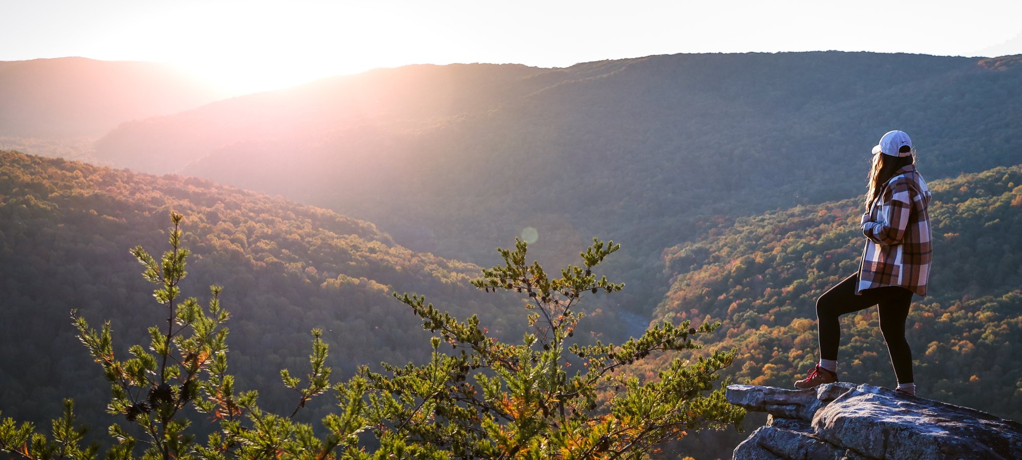
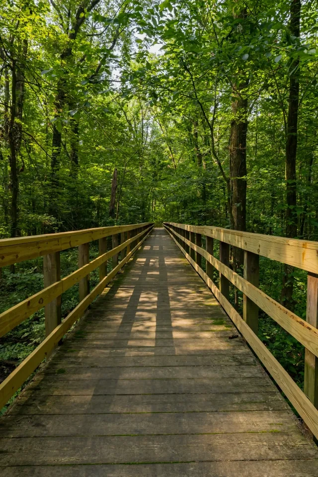
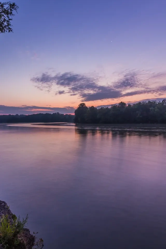
Scott’s Gulf Wilderness State Park has 16 different trails and 39 miles of trails that cover a variety of terrain.
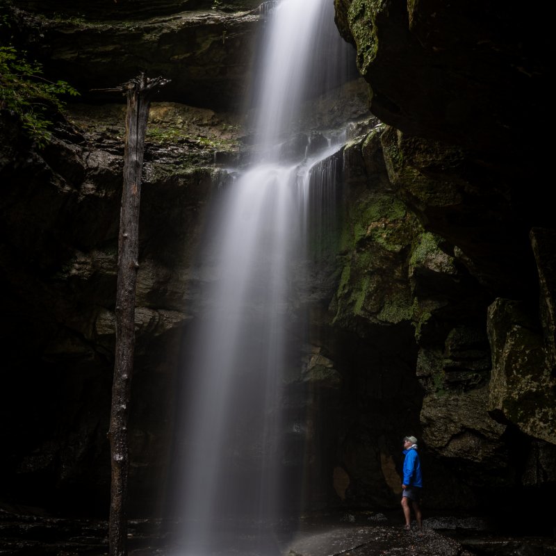
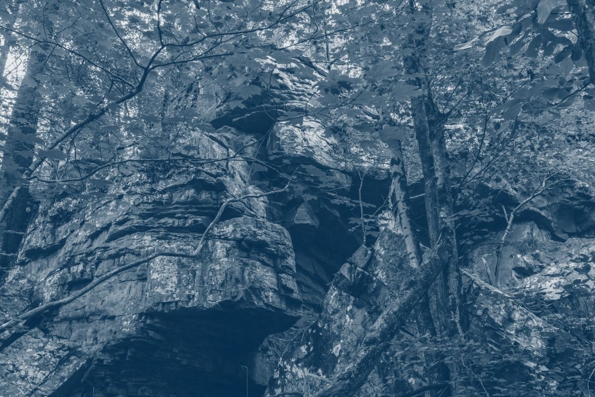
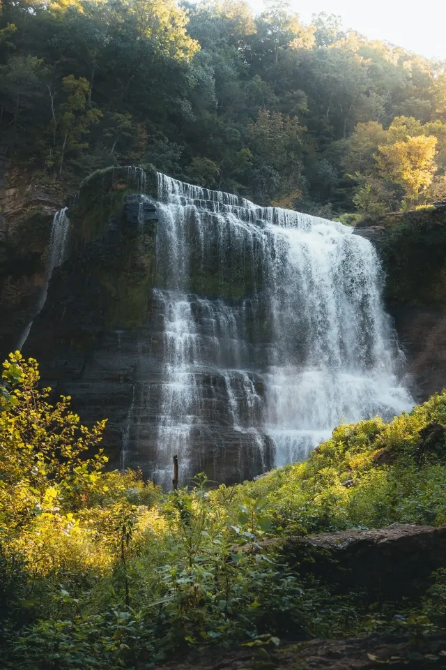
Scott’s Gulf Wilderness is a waterfall hunter’s paradise. Virgin Falls is the iconic, one-of-a-kind waterfall where a creek emerges from a cave, cascades down a 110-foot drop over sculpted rock, and then disappears into another cave. But getting there is not for the faint of heart; it is a 4.3-mile strenuous hike-in, and then a tough hike back out. Easier to see, and yet very beautiful, is the Lost Creek Falls. Other waterfalls include Big Branch Falls, Big Laurel Falls, Sheep Cave Falls, Rylander Cascades, and Dry Creek Falls (actually a double waterfall). There are three unnamed wet-weather waterfalls on the Hardie Loop.
On the left, just before reaching Welch’s Point parking lot, there is a red gate which marks the beginning of the Amber’s Den Trail. The trail quickly descends into the Caney Fork Gulf (or Scott’s Gulf) to the river then following Big Laurel Creek upstream where it connects into the Hemlock Springs Trail near Big Laurel Falls. Amber’s Den Trail also passes by the “Amber’s Den Pool” in the river. On the opposite side of the river pool, you can vaguely see the cave that the hermit, Ambrose Davis lived in for decades.
Availability
Open
Use
Hiking
Caney Fork Trail
Scott's Gulf Wilderness State Park
Distance
6.00 mi.
Difficulty
Difficult
Surface
Natural
This is a wonderful trail featuring a few waterfalls and riverfront views along the way. You can access this trail either from the trailhead down on the Scott’s Gulf Road, near the “Fork Hole”. Or you can park on top at the parking for the Holloway Connector Trail and take the 0.5 mile trail down. Or you can pick it up off of the Polly Branch Trail. But be advised that the beginning portion of the Polly Branch Trail, which is on TWRA, closes during big game hunts. 0.0 miles: The parking lot/trailhead is almost all the way to the “Fork Hole”, on the Scott’s Gulf Road. This is an rough road, so it is advised to do the trail and park instead up on top of the Plateau at the parking for the Holloway Connector Trail. The road is much better up there. 0.2 miles: Holloway Connector Trail comes in on left and Caney Fork Trail on left. Continue straight. 1.1 miles: Gunstock Branch Falls. This area is marked by large boulders and uprooted trees from a dam blow out in 2021 that sent a torrent of water down the canyon there. 3.0 miles: Bee Branch Falls. 3.7 miles: Lower Polly Branch Falls in on your right. Trail continues off to the right. But you may want to turn left to see the upper Jenny Branch Falls, Upper Polly Branch Falls, and head back to the parking lot. 4.3 miles: Copper Cascades. This is a large spring or resurgence that can be difficult to cross during high flow. 5.5 miles: Trail climbs out of the Caney Fork Gulf and ends at one of the burn demonstration areas managed by TWRA.
Availability
Open
Use
Hiking
Dry Creek Falls Trail
Scott's Gulf Wilderness State Park
Distance
3.50 mi.
Difficulty
Difficult
Surface
Natural
This is a wonderful hike through largely through the Bridgestone Nature Reserve, and is noted for large boulders, Dry Creek Falls, overlooks, and shady forested views. It begins and ends on the state park. This trail can be used as a part of a 5 mile through hike from Dog Cove Dry Creek Falls Trailhead to Rylander Cascades Trailhead. This description starts at the parking lot in Dog Cove Historic Area. 0.0 miles: The parking lot is just past the bridge, on the right, when entering Dog Cove Historic Area. 0.3 miles: Dolmen Pass, with nice rock features along the trail. 0.6 miles: Trail continues to ascend toward the top of ridge roughly 200 feet of elevation gain and turns right. There is a private road directly ahead and to the left, but turn right onto trail. 1.25 miles: Arrive at meditation rock. Take a moment to consider what a beautiful area this is! 3.0 miles: Dry Creek Falls. 3.6 miles: End of trail, trail joins the Rylander Cascades Trail. 0.7 miles out to the parking at Rylander Cascades.
Availability
Open
Use
Hiking
Hardie Loop Trail
Scott's Gulf Wilderness State Park
Distance
2.40 mi.
Difficulty
Moderate
Surface
Natural
This spectacular hike is packed with scenery, including three wet-weather waterfalls and a colorful, fern-laden, meandering rock bluff and overhang. The overlook above looks out over Dog Cove Historic Area below. 0.0 miles: Begin the hike at the parking lot and kiosk 0.5 miles: Loop begins, take right trail of loop 1.0 miles: Small waterfall feature crossing Lost Creek headwaters with trail following bottom of 80 feet of bluff line covered in ferns 1.2 miles: Climb up with cable line to overlook point 1.9 miles: End of loop, right takes you to trailhead, left takes back into loop of trail 2.4 miles: End of trail back to parking lot.
Availability
Open
Use
Hiking
Hemlock Springs Trail
Scott's Gulf Wilderness State Park
Distance
1.35 mi.
Difficulty
Moderate
Surface
Natural
Hemlock Springs intersects with the main Virgin Falls Trail at 1.3 miles in, and should be used after heavy rains to avoid the “Cable Crossing” over Big Laurel Creek which may be dangerous to cross. Hemlock Springs Trail is a pleasant hike, with lots of hemlocks, and rock features. Hemlock Springs itself resurges from a bluff below the trail.
Availability
Open
Use
Hiking
Highwater Trail
Scott's Gulf Wilderness State Park
Distance
2.15 mi.
Difficulty
Moderate
Surface
Natural
This trail is an alternative route into Dog Cove Historic Area when heavy rains can flood the valley. This shady trail climbs the hillside of the cove winding through a hardwood dominated forest, such as young Tulip Poplar trees and some large old PawPaw trees with a few springs dotting the trail. In the spring, look for the numerous wildflowers.
Availability
Open
Use
Hiking
Holloway Connector Trail
Scott's Gulf Wilderness State Park
Distance
0.50 mi.
Difficulty
Moderate
Surface
Natural
This is a connector trail tying into the Caney Fork Trail from Scott's Gulf Road. It should be used to access the Caney Fork Trail if your vehicle doesn't have much clearance or isn't 4-wheel drive because Scott's Gulf Road gets much rougher as you travel onto the main Scott's Gulf Trailhead. The trail itself drops steeply into Scott's Gulf and ties into the main Caney Fork Trail.
Availability
Open
Use
Hiking
Homestead Trail
Scott's Gulf Wilderness State Park
Distance
2.25 mi.
Difficulty
Easy
Surface
Natural
The Homestead Trail begins in Dog Cove Historic Area, and crosses through several old fields and follows farm roads used by past generations. Dog Cove was the home for generations of folks, carving a living out of its soils, hunting the hillsides, and fishing the creek. The historic area now provides a glimpse into this past. At 1.2 miles in you will encounter the iconic Davis Homestead. At 2.25 miles in are the chimney remains of the Sapp Homestead. Other old chimney stacks and other remains point to the numerous families that once called this area home. In summer and early falls days, the old fields are abuzz with butterflies and birds. For spring wildflowers, head up to the Highwater Trail. This area is a true “cove”, and the water appears and disappears at intervals. At times, the main drainage of the cove, Lost Creek, can be impassable. Please use the “Highwater Trail” to access the cove during times of high water. 0.0 mile: Begin the hike at the Dog Cove parking lot. Hike back across the bridge, and the trail head is immediately on you right, just past the yellow bollards. .01 miles (500 feet): Highwater Trail on left and Homestead Trail on right, crosses creek bed, walking past big old red barn and the Beecher Wallace Homestead on right 0.3 miles: Creek crossing, usually dry during summer months 0.6 miles: Creek crossing, sandy and muddy 1.2 miles: Jimmy Davis Home on right, trail continues past home to creek crossing 1.21 miles: Creek crossing, mostly dry during summer months 1.7 miles: Limestone Flats, areas of sinking water from creek bed that trail intertwines with Lost Creek 1.9 miles: Highwater Trail on left; Homestead Trail continues on straight ahead 2.25 miles: Billy Sapp Homestead on right. You can continue on up to Little Lost Creek, and cross it to add another 0.25 miles and the end of the trail.
Availability
Open
Use
Hiking
Lost Creek Falls Trail
Scott's Gulf Wilderness State Park
Distance
0.20 mi.
Difficulty
Moderate
Surface
Natural
This trail descends to the base of Lost Creek Falls and marked with cribbed steps. There are other trails that explore the area, some unmarked. From the vantage at the base of the waterfalls, there is another trail that climbs up through a small side drainage, by some nice cascades, and ends at the road. You can follow the road back to the parking lot for a nice loop hike. The trail to the top of the falls, beginning just to the left of the parking lot is worth it, but be aware there are some drop-off so be cautious.
Availability
Open
Use
Hiking
Low Gap Trail
Scott's Gulf Wilderness State Park
Distance
2.00 mi.
Difficulty
Difficult
Surface
Natural
This trail ascends a ridgeline out of Dog Cove Historic Area and traverses a portion of the upland plateau, before descending again down into Dog Cove Historic Area. Be advised that the ascent and descent can be steep, and the trail is uneven in places. The Low Gap Arch is worth the visit, and there are several good overlooks along the trail, especially during the winter months, when the leaves are off the trees. 0.0 miles: Begins off Highwater Trail 0.95 miles: Hunter’s Pass. 1.4 miles: Side trail to Low Gap Arch (1/4 mile over to the Arch itself). Come back to main trail. 2.4 miles: End of trail, right takes you out of Dog Cove Historic Area on Highwater Trail. Continue on straight downhill to the Homestead Trail. Left takes you down Highwater Trail into Homestead Trail towards the Billy Sapp Homestead.
Availability
Open
Use
Hiking
Polly Branch Trail
Scott's Gulf Wilderness State Park
Distance
2.55 mi.
Difficulty
Easy
Surface
Natural
This trail begins at the parking lot on Scott’s Gulf Road 200 yards north of the Virgin Falls parking lot, but on the opposite side of the road from the Virgin Falls Trailhead. Note: the first 1.4 miles of this trail is on TWRA managed land, and it closes during the deer season in the Fall, and in the morning during Spring Turkey season. Once the trail enters the Polly Branch Valley, you are on state park managed property, and it stays open year round.
Availability
Open
Use
Hiking
Rylander Cascades Trail
Scott's Gulf Wilderness State Park
Distance
3.80 mi.
Difficulty
Easy
Surface
Natural
This is a trail that can take you for a quick half mile hike to Rylander Cascades (with lots of spring wildflowers). Or you can continue on for a strenuous hike to Virgin Falls. There are some beautiful stands of mature and diverse forest along much of this trail. At 0.8 miles up the trail, you can divert to the left (northeast) for a hike on over to Dry Creek Falls. With a shuttle, this hike can be tied in with the Virgin Falls Trail for a 8.5 mile through hike. 0.0 miles: Start at the Rylander parking lot, just down the road (south) from the main Lost Creek Falls parking lot. Trail begins across the road. 0.5 miles: Access Rylander Cascades with a short spur trail on the left. 0.8 miles: Intersection of Dry Creek Falls Trail, right continues on Rylander Cascades Trail to Virgin Falls, left starts the Dry Creek Falls Trail. Turn right to go to Virgin Falls. 1.6 miles: Reach the top of Wilson Ridge where there is a kiosk. 2.8 miles: The chimney stack of rocks on the right of the trail are remains of a cabin, thought to be built by a Wilson. Can you imagine raising a family back in this remote area? 3.8 miles: End of trail at Virgin Falls. Enjoy the beauty of one of the most iconic waterfalls in Tennessee!
Availability
Open
Use
Hiking
Sheep Cave Trail
Scott's Gulf Wilderness State Park
Distance
0.85 mi.
Difficulty
Moderate
Surface
Natural
At the 3.6 mile junction, if you bear right this is an alternative route to Virgin Falls to see a spectacular Karst feature called “Sheep’s Cave and Waterfalls”. The falls drops disappears into a large “sink”.
Availability
Open
Use
Hiking
TWRA Fire Learning Trail
Scott's Gulf Wilderness State Park
Distance
1.75 mi.
Difficulty
—
Surface
Natural
Availability
Open
Use
Hiking
Upland Trail
Scott's Gulf Wilderness State Park
Distance
3.00 mi.
Difficulty
Moderate
Surface
Natural
The Upland Trail is noted for its view of hardwood forests, a natural bog, and many varieties of ferns. Much of the trail follows and old road crossing through a pine plantation. This trail’s main feature is called Martha's Pretty Point which provides a dramatic view of Scott's Gulf and the Caney Fork River 900 feet below. This trail can be used as a 5 mile loop by returning on the main Virgin Falls Trail. 0.0 miles: Trail begins from Virgin Falls Trail, about 0.2 miles from Virgin Falls Trailhead (Scott's Gulf Road) atop the plateau. 0.5 Miles: The trail follows an old road through a Loblolly Pine Plantation. 0.9 miles: Big Laurel Creek, at highwater this may be difficult to cross 2.18 miles: Martha’s Pretty Point campsites and overlook. From there you descend down a small ladder next to a small cascading stream for another half mile 2.6 miles: End of trail, right goes to Virgin Falls and left goes to Cable Crossing
Availability
Open
Use
Hiking
Virgin Falls Trail
Scott's Gulf Wilderness State Park
Distance
4.30 mi.
Difficulty
Difficult
Surface
Natural
The Virgin Falls Trail, beginning at the Virgin Falls Parking Lot at 2080 Scott’s Gulf Road presents a tough hike. It is 4.3 mile in on the main trail, and loses over 1000 feet in elevation. And on the return trip, the elevation is regained. This trail requires a certain level of fitness before heading out. The trail leaving the parking area meanders down to the Big Branch of the Big Laurel Creek through an upland oak-hickory/chestnut oak hardwood forest crisscrossing a fern-dominated upland drainage. Upon descending into the gorge, the vegetation changes to hemlock and mixed mesophytic forest, which includes maples, oaks, tulip poplar, hickories, buckeye, basswood, cherry, yellow birch, sycamore, and many more species. Mountain laurel, magnolia and several ericaceous shrubs (such as various wild blueberries) are common along the trail. The trails pass by small rockhouses, boulder fields, sinks, caves, and waterfalls en route to Virgin Falls, where the trail ends. 0.15 miles: Upland Trail to the right, Virgin Falls Trail to the left 1.05 miles: Hemlock Springs Trail to the left, Virgin Falls Trail to the right 1.35 miles: Big Branch Falls 1.6 miles: Cable Crossing over Big Laurel Creek, can be high after heavy rains (Use Hemlock Springs Trail as an alternative). Cable Crossing campsites across Big Laurel Creek 1.8 miles: Upland Trail right, Virgin Falls Trail left. 2.4 miles: Big Laurel Falls, last source of water from trail until Virgin Falls 2.5 miles: Left to Hemlock Springs Trail, right continues on Virgin Falls Trail 3.6 miles: Junction and beginning of the loop: Sheep’s Cave Trail on right, Virgin Falls Trail on left 4.0 miles: Caney Fork campsites on left, Virgin Falls Trail on left 4.3 miles: End of trail at Virgin Falls, left is kiosk to Rylander Cascades Trail, Right uphill is Virgin Falls campsites and Sheep’s Cave Trail
Availability
Open
Use
Hiking
Yellow Bluff Trail
Scott's Gulf Wilderness State Park
Distance
1.00 mi.
Difficulty
Easy
Surface
Natural
This is a short hike to view spectacular overlooks down into the Caney Fork Gorge and Gunstock Branch Falls nearby. 0.0 Miles: Park at the trailhead, which is also the Yellow Bluff Campsite, which is managed by TWRA.
0.3 Miles: Yellow Bluffs. This beautiful overlook peers down into Scott’s Gulf, and across at the junction of Bee Creek. You will also notice across the gulf, an overlook known as “Scott’s Pinnacle”.
0.4 Miles: Crossing Gunstock Branch. You will see the remains, and some remedial work from a dam blowout that occurred there in 2021.
1.0 miles: Trail enters a nice valley. You can appreciate the nice trees and extensive rock features. At this point of writing, the “Boar Hog Gap Overlook” is overgrown and unmarked, and we will get it back open as soon as possible. Trail ends, so back track to your car.
Availability
Open
Use
Hiking
Trail Definitions
Cross Slope
Describes the degree of incline from one side of the trail path to the other; measured as a percentage. Cross slope aids in water drainage and impacts the overall trail stability.
Grade
Describes the rise in elevation over a horizontal distance on the trail; measured as a percentage. Higher percentages represent a steeper grade indicating a more challenging ascent or descent for hikers.
Standard Ramp Grade
Serves as a reference guide for the grade of the trail. Standard Ramp Grade is 8.3% across all trail assessments.
Surface
A characteristic of the trail expressed in terms of material type, grading, compaction, and roughness of the path. Possible surface types include soil, gravel, paved, and mulch.
Tread Width
Represents the horizontal distance from one edge of the trail path to the other; measurements can vary. Tread width helps to determine the amount of space a hiker has to pass through. Obstacles on the trail can alter the remaining tread width.
Trail Types: Loop
Trail returns at or near the point from which you started.
Trail Types: Network
Offers multiple route options within one trail, and each route is connected
Trail Types: Out and Back
This type of trail travels out to an endpoint where hikers turn around and travel back to the starting point.
Trail Types: Stacked Loop
A loop trail contained completely within another trail.
Need a Map?
Explore our collection of printable and digital trail maps, organized by park. Whether you’re hiking, camping, or paddling, you’ll find the resources you need to navigate confidently.
Tennessee State Parks care about your safety when visiting our parks. We encourage you to read more about staying safe at Scott’s Gulf Wilderness State Park during your visit!