Warriors' Path Hiking

  • Trail sign with native plants map in a lush green forest.
  • Forest trail with large trees and exposed roots.

    Hiking at Warriors’ Path

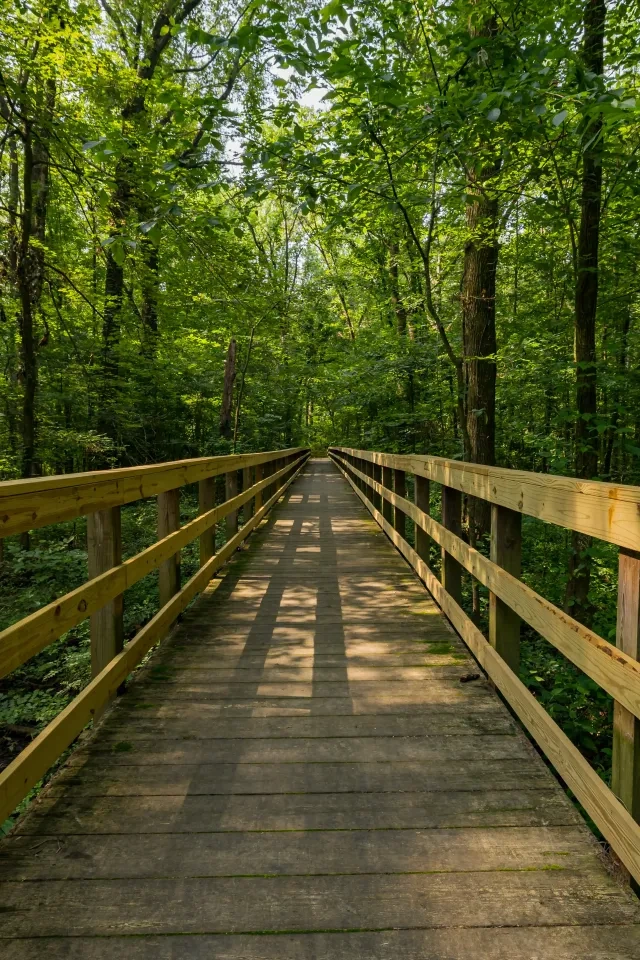
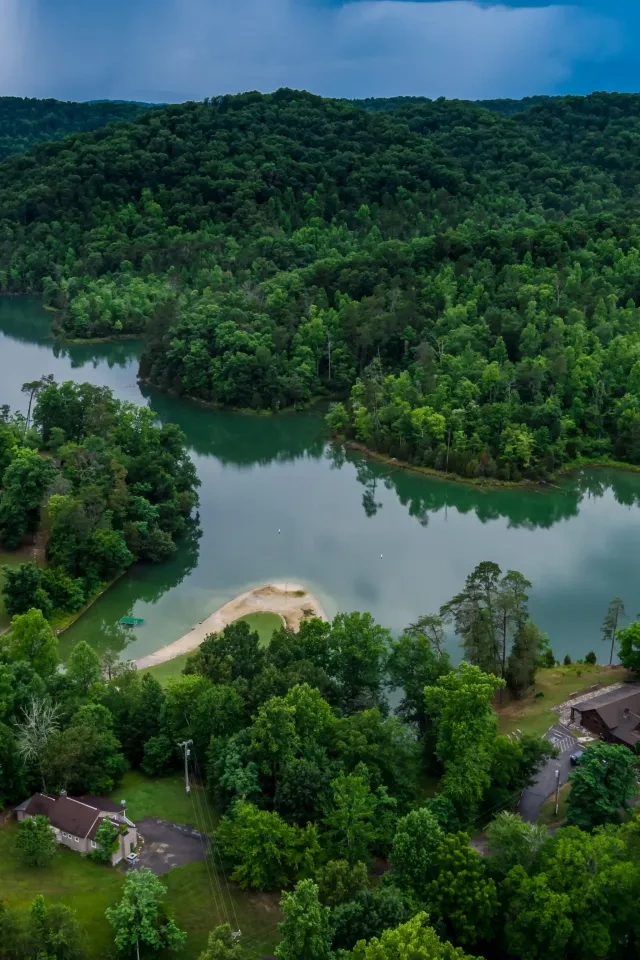
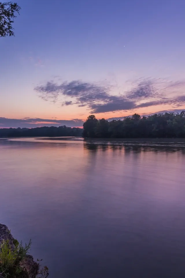
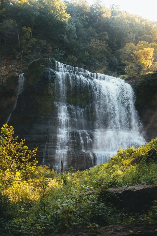
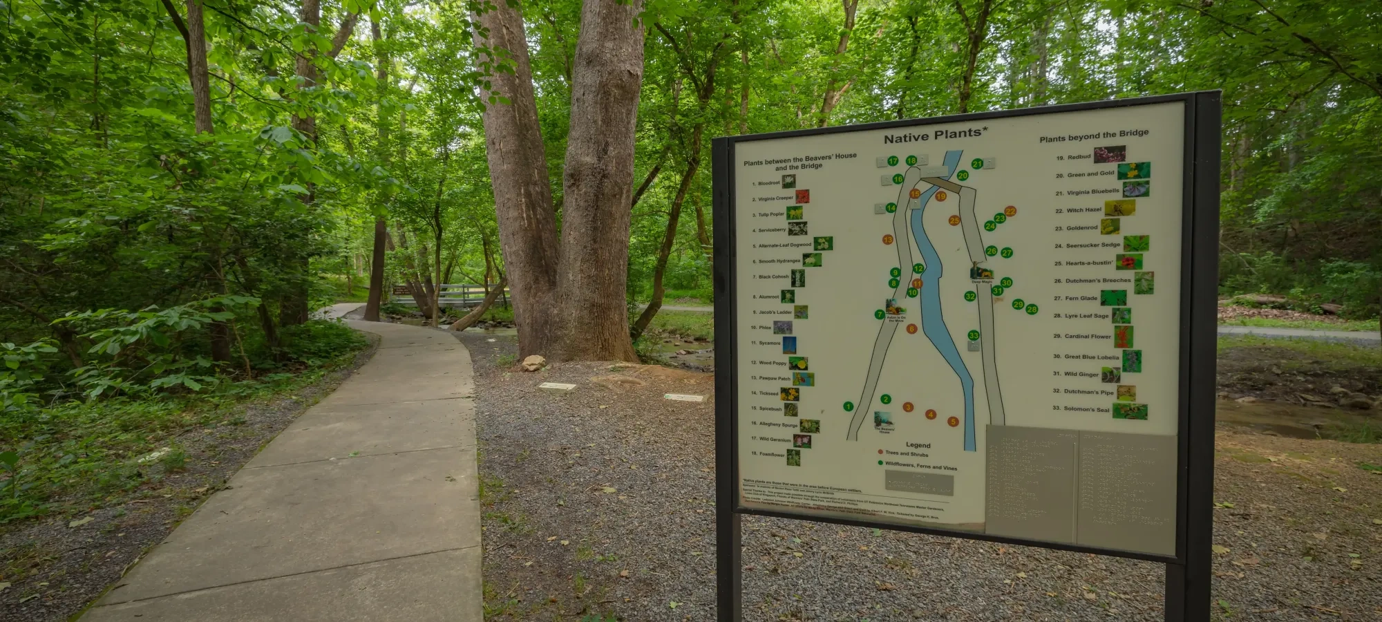
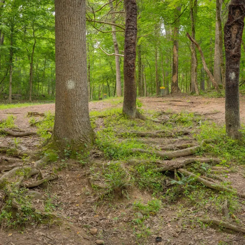
    Twelve miles of hiking trails take you through field and forest, over high bluffs, and along peaceful streams.

    You’re likely to see a variety of native wildlife and wildflowers, and you might even find a creek that disappears!  

    All Warriors' Path State Park hiking trails close at sunset.  

    Camping or overnight parking is prohibited at or on any Warriors' Path hiking trail or trailhead. Camping is only allowed in designated areas inside the park.  

    Trails

    Showing page 1 of 4
    • Boneyard

      Warriors' Path State Park
      Distance
      1.90 mi.
      Difficulty
      Surface
      Natural
      Availability
      Open
      Allowed
      Hiking Mountain Biking

      Boneyard Connector

      Warriors' Path State Park
      Distance
      0.10 mi.
      Difficulty
      Surface
      Natural
      Availability
      Open
      Allowed
      Hiking Mountain Biking

      Connector Trail

      Warriors' Path State Park
      Distance
      0.30 mi.
      Difficulty
      Easy
      Surface
      Natural
      Connects Lakeshore and Lake Hollow trails, so you can walk a complete loop around the campground. Along the way, enjoy views of the high bluffs, varied forest communities, and the remnants of historic Strickler Ferry Road.
      Availability
      Open
      Allowed
      Hiking

      Darwins Connector

      Warriors' Path State Park
      Distance
      0.10 mi.
      Difficulty
      Surface
      Natural
      Availability
      Open
      Allowed
      Hiking Mountain Biking

      Darwins Revenge

      Warriors' Path State Park
      Distance
      1.90 mi.
      Difficulty
      Surface
      Natural
      Availability
      Open
      Allowed
      Hiking Mountain Biking

      Devils Backbone Trail

      Warriors' Path State Park
      Distance
      1.15 mi.
      Difficulty
      Moderate
      Surface
      Natural
      One of the more challenging trails in the park also has some of the richest rewards. Be sure to visit the ridgetop overlooks, then hike on down to see the remnants of early settlement in the valley, and cool your feet in Fall Creek.
      Availability
      Open
      Allowed
      Hiking

      Duck Island Pathways

      Warriors' Path State Park
      Distance
      Difficulty
      Moderate
      Surface
      Paved
      Availability
      Open
      Allowed
      Biking Hiking wheelchair

      Duck Island Pathways

      Warriors' Path State Park
      Distance
      Difficulty
      Moderate
      Surface
      Paved
      Allowed
      Biking Hiking wheelchair

      Trail Type
      Information unavailable

      Elevation
      Gain 42.60'
      Loss 22.50'
      Grade
      Typical 1.8%
      Max 5.6%
      Cross Slope
      Typical 2.5%
      Max 7.4%
      Tread Width
      Typical 117"
      Minimum 96"
      Surface Type
      Asphalt 100%
      Obstructions Exist
      No obstructions present

      Fall Creek Loop Trail

      Warriors' Path State Park
      Distance
      1.00 mi.
      Difficulty
      Moderate
      Surface
      Natural
      Enjoy clear views of the creek valley, hike these hilly, sunny fields, and cool creek bottoms. See reminders of the farm once here, and signs of the woodlands now taking over. Starts at the end of the Devil's Backbone Trail.
      Availability
      Open
      Allowed
      Hiking

      Fawn Loop

      Warriors' Path State Park
      Distance
      0.60 mi.
      Difficulty
      Surface
      Natural
      Availability
      Open
      Allowed
      Hiking Mountain Biking
    • Holston Bluff Trail

      Warriors' Path State Park
      Distance
      0.60 mi.
      Difficulty
      Moderate
      Surface
      Natural
      Here you'll find unique shorelines, with steep, rugged bluffs, rich woodlands, and interesting views of a late 1800s railroad grade.
      Availability
      Open
      Allowed
      Hiking

      Lake Hollow Trail

      Warriors' Path State Park
      Distance
      0.60 mi.
      Difficulty
      Moderate
      Surface
      Natural
      Wander along the water's edge and visit with the forest wildlife and plant life. Try around dawn or dusk for the most wildlife activity.
      Availability
      Open
      Allowed
      Hiking

      Lake Road

      Warriors' Path State Park
      Distance
      0.80 mi.
      Difficulty
      Surface
      Natural
      Availability
      Open
      Allowed
      Hiking Mountain Biking

      Lakeshore Trail

      Warriors' Path State Park
      Distance
      0.35 mi.
      Difficulty
      Easy
      Surface
      Natural
      An easy walk along the lakeshore brings you to fine old forests and good views of the far shore. A self-guiding booklet is available for this trail.
      Availability
      Open
      Allowed
      Hiking

      Lions Braille Trail

      Warriors' Path State Park
      Distance
      0.25 mi.
      Difficulty
      Easy
      Surface
      Natural
      Availability
      Open
      Allowed
      Hiking wheelchair

      Magic Carpet Ride

      Warriors' Path State Park
      Distance
      0.10 mi.
      Difficulty
      Surface
      Natural
      Availability
      Open
      Allowed
      Hiking Mountain Biking

      Overlook Trail

      Warriors' Path State Park
      Distance
      1.10 mi.
      Difficulty
      Difficult
      Surface
      Natural
      Availability
      Open
      Allowed
      Hiking

      Overlook Trail

      Warriors' Path State Park
      Distance
      1.10 mi.
      Difficulty
      Difficult
      Surface
      Natural
      Allowed
      Hiking

      Trail Type
      Information unavailable

      Elevation
      Gain 134.90'
      Loss 76.60'
      Grade
      Typical 8.4%
      Max 39.6%
      Cross Slope
      Typical 4.0%
      Max 21.8%
      Tread Width
      Typical 38"
      Minimum 12"
      Surface Type
      Soil 99%; Rock 1%
      Obstructions Exist
      Rock: 18 in tall; Tree roots: 7 in tall; Rock: 6 in tall

      Paw Paw

      Warriors' Path State Park
      Distance
      0.40 mi.
      Difficulty
      Surface
      Natural
      Availability
      Open
      Allowed
      Hiking Mountain Biking

      Paw Paw Connector

      Warriors' Path State Park
      Distance
      0.10 mi.
      Difficulty
      Surface
      Natural
      Availability
      Open
      Allowed
      Hiking Mountain Biking
    • Ridgetop

      Warriors' Path State Park
      Distance
      0.40 mi.
      Difficulty
      Surface
      Natural
      Availability
      Open
      Allowed
      Hiking Mountain Biking

      Riverbank Trail

      Warriors' Path State Park
      Distance
      0.25 mi.
      Difficulty
      Easy
      Surface
      Natural
      A short invigorating walk along the banks of the river. In the autumn, you'll find views of the ripe hills. In spring and summer, wildflowers abound, and winter brings its own discoveries.
      Availability
      Open
      Allowed
      Hiking

      Rock City

      Warriors' Path State Park
      Distance
      0.50 mi.
      Difficulty
      Surface
      Natural
      Availability
      Open
      Allowed
      Hiking Mountain Biking

      Sinking Waters Forest Loop Trail

      Warriors' Path State Park
      Distance
      0.85 mi.
      Difficulty
      Surface
      Natural
      Availability
      Open
      Allowed
      Hiking

      Sinking Waters Marsh Loops Trail

      Warriors' Path State Park
      Distance
      0.40 mi.
      Difficulty
      Surface
      Natural
      Availability
      Open
      Allowed
      Hiking

      Sinking Waters Meadow Loop Trail

      Warriors' Path State Park
      Distance
      0.80 mi.
      Difficulty
      Surface
      Natural
      Availability
      Open
      Allowed
      Hiking

      Wahoo

      Warriors' Path State Park
      Distance
      2.20 mi.
      Difficulty
      Surface
      Natural
      Availability
      Open
      Allowed
      Hiking Mountain Biking

      Whitetail Alternate

      Warriors' Path State Park
      Distance
      0.20 mi.
      Difficulty
      Surface
      Natural
      Availability
      Open
      Allowed
      Hiking Mountain Biking

      Whitetail Loop

      Warriors' Path State Park
      Distance
      2.20 mi.
      Difficulty
      Surface
      Natural
      Availability
      Open
      Allowed
      Hiking Mountain Biking
    • Woodland Ridge Trail

      Warriors' Path State Park
      Distance
      1.55 mi.
      Difficulty
      Moderate
      Surface
      Natural
      Experience the peace
      Availability
      Open
      Allowed
      Hiking

      Zipline

      Warriors' Path State Park
      Distance
      0.40 mi.
      Difficulty
      Surface
      Natural
      Availability
      Open
      Allowed
      Hiking Mountain Biking

    Trail Definitions

    • Cross Slope 

      Describes the degree of incline from one side of the trail path to the other; measured as a percentage. Cross slope aids in water drainage and impacts the overall trail stability.   

    • Grade  

      Describes the rise in elevation over a horizontal distance on the trail; measured as a percentage.  Higher percentages represent a steeper grade indicating a more challenging ascent or descent for hikers.    

    • Standard Ramp Grade

      Serves as a reference guide for the grade of the trail.  Standard Ramp Grade is 8.3% across all trail assessments.  

    • Surface 

      A characteristic of the trail expressed in terms of material type, grading, compaction, and roughness of the path. Possible surface types include soil, gravel, paved, and mulch.   

    • Tread Width    

      Represents the horizontal distance from one edge of the trail path to the other; measurements can vary.  Tread width helps to determine the amount of space a hiker has to pass through. Obstacles on the trail can alter the remaining tread width.   

    • Trail Types: Loop

      Trail returns at or near the point from which you started. 

    • Trail Types: Network 

      Offers multiple route options within one trail, and each route is connected

    • Trail Types: Out and Back

      This type of trail travels out to an endpoint where hikers turn around and travel back to the starting point.   

    • Trail Types: Stacked Loop

      A loop trail contained completely within another trail.   

    Need a Map?

    Explore our collection of printable and digital trail maps, organized by park. Whether you’re hiking, camping, or paddling, you’ll find the resources you need to navigate confidently.


    Visit Our Camp Store

    The Warriors' Path Camp Store is your best spot for finding gear, snacks, and accessories to make your camping experience exceptional. The Camp Store is your go-to destination for a cold drink, a can of chili, or those matches you forgot to pack.

    Address:
    FGW8+RQ, Colonial Heights, TN 37663

    Hours: 10:00 AM - 6:00 PM

    Skip photo gallery
    Media Crowdriff
    Happenings
    plant coiling into a spiral with a blue highlight