Fiery Gizzard Hiking

  • Forest scene with a small waterfall flowing into a tranquil pool, surrounded by lush green foliage. A staircase descends on the left side, evoking a serene, natural atmosphere.
  • Autumn forest stream with colorful leaves and rocks.

    Hiking at Fiery Gizzard

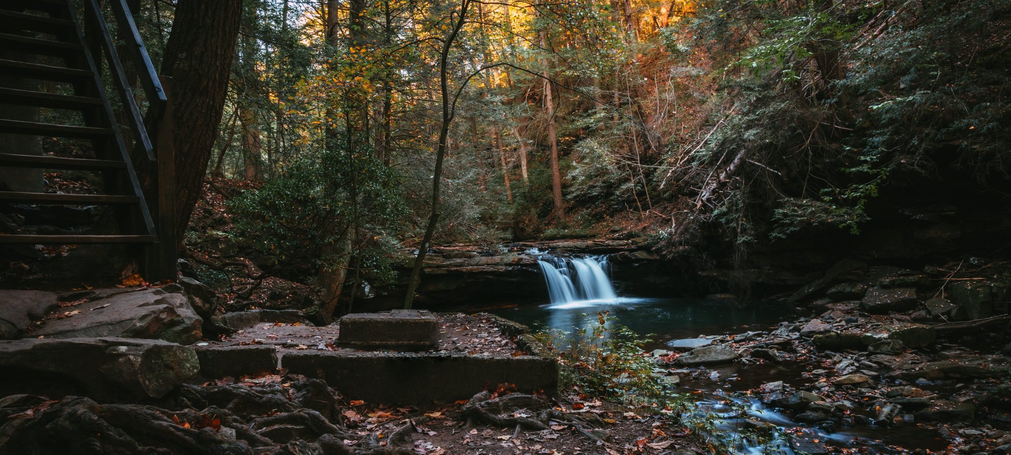
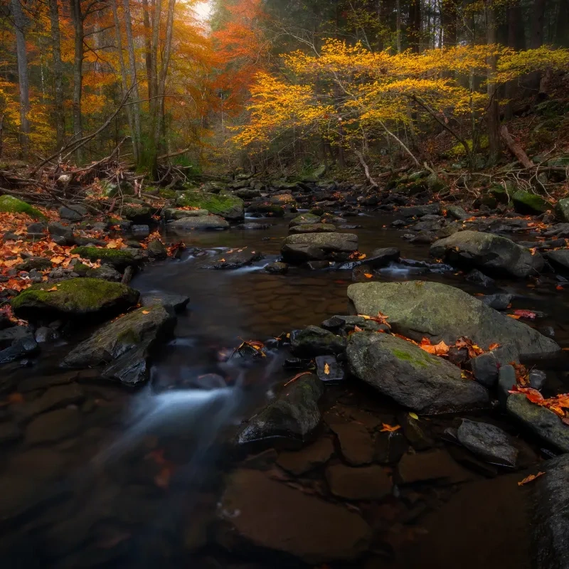
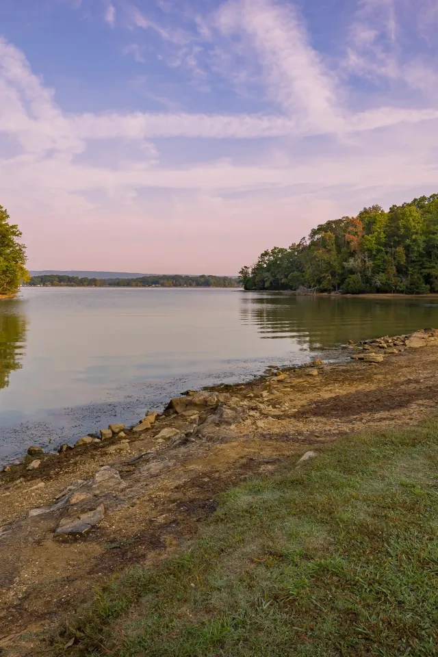
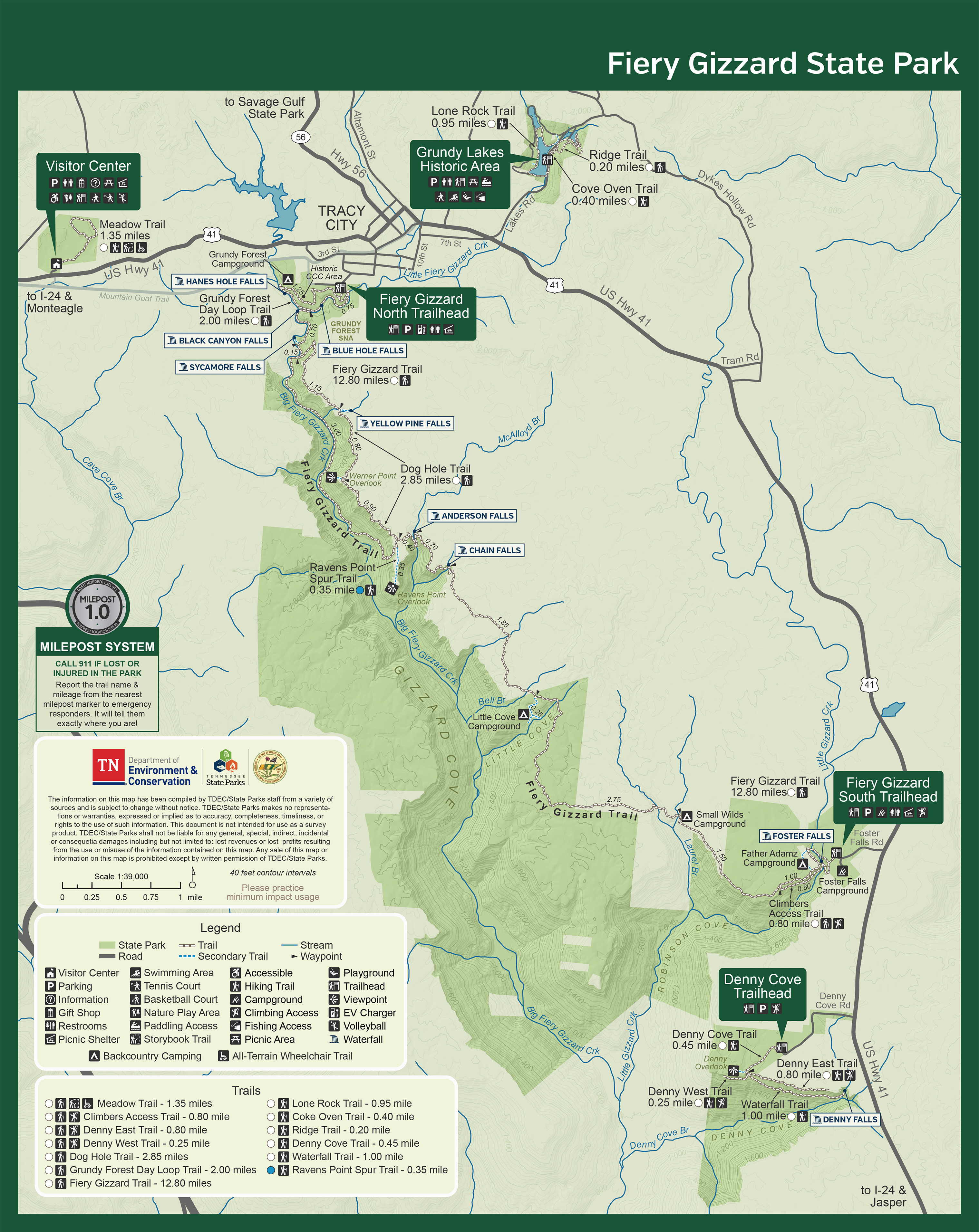
    Fiery Gizzard State Park provides over 20 miles of hiking trails located at twelve different trailheads. Offering peaceful walks through a meadow full of wildflowers, trips back in time to a coal mining area, and breathtaking overlooks of the Cumberland Plateau, Fiery Gizzard is a wondrous hiking destination featuring waterfalls, vistas, historical areas, and some with old-growth trees. 

    The Fiery Gizzard Trails contain 12.80 miles of hiking from the North Trailhead to the South Trailhead, with a few connected trails, leading to several waterfalls and scenic overlooks. Don’t forget your bathing suit to take a dip in the refreshing Sycamore Falls swimming hole! 

    Mountain bikes are not allowed on the trails.

    Trails

    Showing page 1 of 2
    • Climbers Access Trail

      Fiery Gizzard State Park
      Distance
      0.80 mi.
      Difficulty
      Surface
      Natural
      This 0.80-mile hike takes you along a beautiful cliff line and along the base of towering bluff walls, connecting to the Foster Falls and Father Adamz Campgrounds. The picturesque Foster Falls is located on this hike!
      Availability
      Open
      Allowed
      Hiking climb

      Coke Oven Trail

      Fiery Gizzard State Park
      Distance
      0.40 mi.
      Difficulty
      Surface
      Natural
      Lone Rock Trail, Coke Oven Trail, and Ridge Trail combine to create a 2.3-mile round-trip hike circling the Historical Grundy Lakes. Set time aside to explore the coke ovens and to enjoy the views of the lakes in this historical area. Ask a desk attendant for a brochure on the ovens.
      Availability
      Open
      Allowed
      Hiking

      Denny Cove Trail

      Fiery Gizzard State Park
      Distance
      0.45 mi.
      Difficulty
      Surface
      Natural
      Starting at the Betty Dunn Nature Center, this trail features three opportunities to view the Cane Creek Gorge at the different overlooks.
      Availability
      Open
      Allowed
      Hiking

      Denny East Trail

      Fiery Gizzard State Park
      Distance
      0.80 mi.
      Difficulty
      Surface
      Natural
      This 0.80-mile trail features climbing opportunities along the ridges of Denny Cove. 
      Availability
      Open
      Allowed
      Hiking climb

      Denny West Trail

      Fiery Gizzard State Park
      Distance
      0.25 mi.
      Difficulty
      Surface
      Natural
      This 0.25-mile trail leads hikers from just past the Denny Overlook to the Waterfall Trail and features climbing opportunities.
      Availability
      Open
      Allowed
      Hiking climb

      Dog Hole Trail

      Fiery Gizzard State Park
      Distance
      2.85 mi.
      Difficulty
      Moderate
      Surface
      Natural
      A moderate, 2.85-mile hike that features scenic views such as the Werner Point Overlook and a short path to Yellow Pine Falls. Don't forget your bathing suit to take a dip in the refreshing Sycamore Falls swimming hole!
      Availability
      Open
      Allowed
      Hiking

      Fiery Gizzard Trail

      Fiery Gizzard State Park
      Distance
      12.80 mi.
      Difficulty
      Surface
      Natural
      The Fiery Gizzard Trail contains 12.80 miles of hiking from the North Trailhead to the South Trailhead, with a few connected trails, leading to several waterfalls and scenic overlooks. Don’t forget your bathing suit to take a dip in the refreshing Sycamore Falls swimming hole! 
      Availability
      Open
      Allowed
      Hiking

      Grundy Forest Day Loop Trail

      Fiery Gizzard State Park
      Distance
      2.00 mi.
      Difficulty
      Moderate
      Surface
      Natural
      This moderate 2-mile round-trip hike will take you past multiple waterfalls, a historic CCC area, and plenty of enjoyable swimming holes.
      Availability
      Open
      Allowed
      Hiking

      Lone Rock Trail

      Fiery Gizzard State Park
      Distance
      0.95 mi.
      Difficulty
      Easy
      Surface
      Natural
      An easy 2.3-mile round-trip hike circling the Grundy Lakes. Set time aside to explore the coke ovens and enjoy the views of the lakes in this historical area. Ask a desk attendant for a brochure on the ovens.
      Availability
      Open
      Allowed
      Hiking
    • Meadow Trail

      Fiery Gizzard State Park
      Distance
      0.80 mi.
      Difficulty
      Easy
      Surface
      Mulch
      1-mile easy, round-trip hike with views of wildflowers, wildlife, a pond, and berries; can you identify what the trail used to be before it was a park? Ask a Ranger for the answer!
      Availability
      Open
      Allowed
      Hiking all_terrain_wheelchair

      Ridge Trail

      Fiery Gizzard State Park
      Distance
      0.20 mi.
      Difficulty
      Surface
      Natural
      Lone Rock Trail, Coke Oven Tail, and Ridge Trail combine to create a 2.3-mile round-trip hike circling the Historical Grundy Lakes. Set time aside to explore the coke ovens and to enjoy the views of the lakes in this historical area. Ask a desk attendant for a brochure on the ovens.
      Availability
      Open
      Allowed
      Hiking

      Waterfall Trail

      Fiery Gizzard State Park
      Distance
      1.00 mi.
      Difficulty
      Surface
      Natural
      The Waterfall Trail is a 1.00-mile out-and-back runway that leads to Denny Falls, one of the best views in the park.
      Availability
      Open
      Allowed
      Hiking

    Trail Definitions

    • Cross Slope 

      Describes the degree of incline from one side of the trail path to the other; measured as a percentage. Cross slope aids in water drainage and impacts the overall trail stability.   

    • Grade  

      Describes the rise in elevation over a horizontal distance on the trail; measured as a percentage.  Higher percentages represent a steeper grade indicating a more challenging ascent or descent for hikers.    

    • Standard Ramp Grade

      Serves as a reference guide for the grade of the trail.  Standard Ramp Grade is 8.3% across all trail assessments.  

    • Surface 

      A characteristic of the trail expressed in terms of material type, grading, compaction, and roughness of the path. Possible surface types include soil, gravel, paved, and mulch.   

    • Tread Width    

      Represents the horizontal distance from one edge of the trail path to the other; measurements can vary.  Tread width helps to determine the amount of space a hiker has to pass through. Obstacles on the trail can alter the remaining tread width.   

    • Trail Types: Loop

      Trail returns at or near the point from which you started. 

    • Trail Types: Network 

      Offers multiple route options within one trail, and each route is connected

    • Trail Types: Out and Back

      This type of trail travels out to an endpoint where hikers turn around and travel back to the starting point.   

    • Trail Types: Stacked Loop

      A loop trail contained completely within another trail.   

    Need a Map?

    Explore our collection of printable and digital trail maps, organized by park. Whether you’re hiking, camping, or paddling, you’ll find the resources you need to navigate confidently.


    Visitor Center Gift Shop

    The Visitor Center Gift Shop is the perfect place to pick up a map, learn about the park, or find a souvenir. You’ll find an assortment of apparel and keepsakes to remember your trip to the park.

    Address
    11745 US 41, Monteagle TN, 37356
    1-931-924-2980

    Hours:
    Seasonal. Please call for more information.

    Skip photo gallery
    Media Crowdriff
    Happenings

    No events are scheduled at this time, but there's always more to explore.

    Find More Events

    Other Activities at Fiery Gizzard State Park