Frozen Head Hiking

Warning Alert
Warning

Renovations at Frozen Head State Park

Frozen Head State Park

Frozen Head State Park is undergoing several major renovations. As construction progresses, we will keep you updated on which sections have reopened. We thank you for your patience and understanding. If you have any questions about your reservation, please call 1 (888) 867-2757.

Currently Closed:

  • All Big Cove Campsites
  • All Flat Fork Campsites
  • The Visitor Center (but the public restrooms remain open)
  • Shelters B & C
  • The Rocky Fork Area (including the Ross Gap Trailhead and volleyball courts)
  • A number of trails
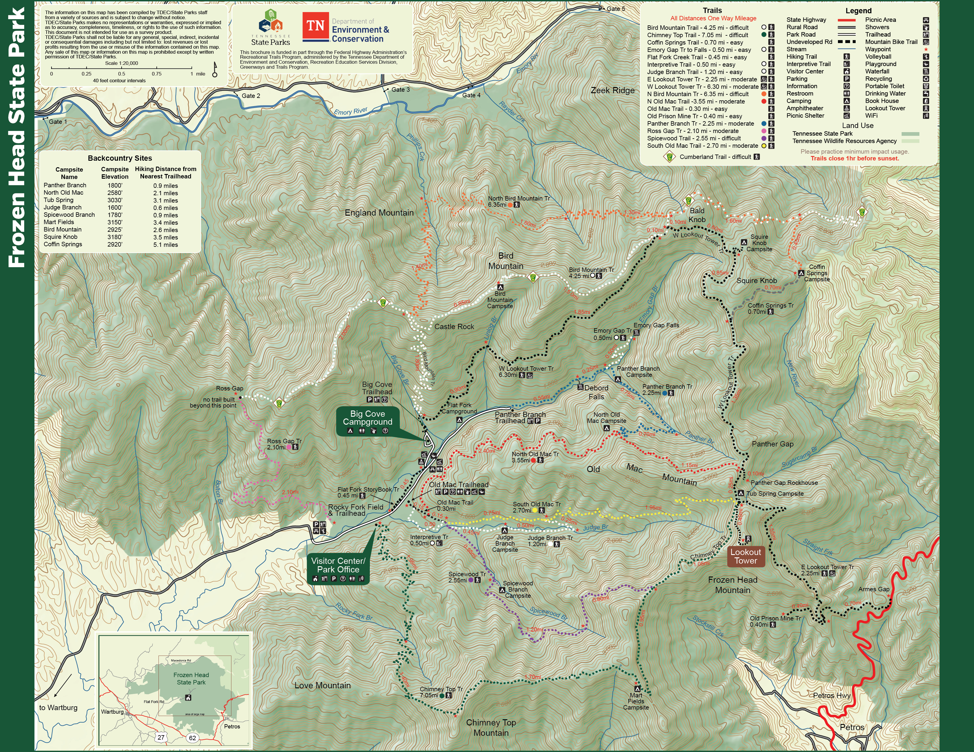
    • The only accessible trail at this time is the Chimney Top Trail behind the Visitor Center. This trail is considered strenuous with significant elevation gain and up to a 14-mile hike.

During this renovation, we encourage campers to check out our nearby parks. Some nearby parks to consider are:

  • Three people hike through a snow-covered forest, wearing winter gear and backpacks. Bare trees and a cloudy sky create a serene, chilly atmosphere.
  • Group walking on a leafy forest path in autumn.

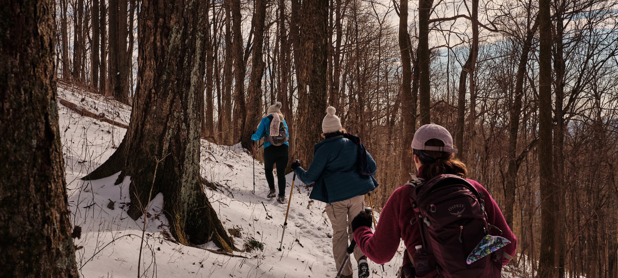
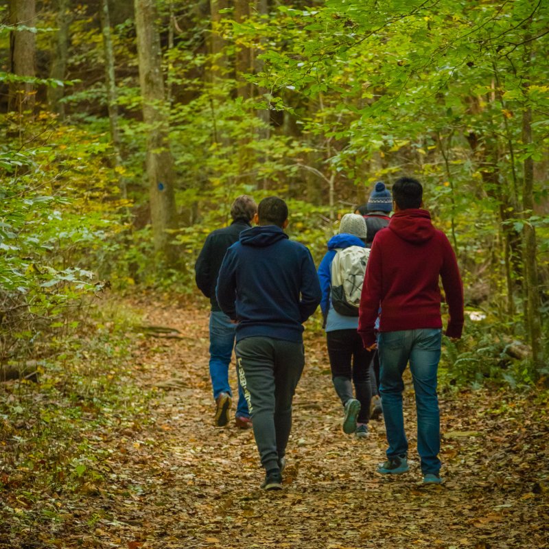
    Hiking at Frozen Head

    The park features over 50 miles of foot trails that meander by waterfalls, rock shelters, and giant mountaintop cap rocks. A portion of the Cumberland Trail passes through the park. 

    Trails

    Showing page 1 of 3
    • Bird Mountain Trail

      Frozen Head State Park
      Distance
      4.25 mi.
      Difficulty
      Difficult
      Surface
      Natural
      Availability
      Open
      Allowed
      Hiking

      Chimney Top Trail

      Frozen Head State Park
      Distance
      7.05 mi.
      Difficulty
      Difficult
      Surface
      Natural
      Availability
      Open
      Allowed
      Hiking

      Coffin Springs Trail

      Frozen Head State Park
      Distance
      0.70 mi.
      Difficulty
      Easy
      Surface
      Natural
      Availability
      Open
      Allowed
      Hiking

      Cumberland Trail

      Frozen Head State Park
      Distance
      9.05 mi.
      Difficulty
      Surface
      Natural
      Availability
      Open
      Allowed
      Hiking

      East Lookout Tower Trail

      Frozen Head State Park
      Distance
      2.25 mi.
      Difficulty
      Moderate
      Surface
      Natural
      Availability
      Open
      Allowed
      Hiking Mountain Biking

      Emory Gap Trail

      Frozen Head State Park
      Distance
      0.50 mi.
      Difficulty
      Easy
      Surface
      Natural
      Availability
      Open
      Allowed
      Hiking

      Interpretive Trail

      Frozen Head State Park
      Distance
      0.50 mi.
      Difficulty
      Easy
      Surface
      Natural
      Availability
      Open
      Allowed
      Hiking

      Judge Branch Trail

      Frozen Head State Park
      Distance
      1.20 mi.
      Difficulty
      Easy
      Surface
      Natural
      Availability
      Open
      Allowed
      Hiking

      Lookout Tower Trail

      Frozen Head State Park
      Distance
      Difficulty
      Surface
      Natural
      Availability
      Open
      Allowed
      Hiking
    • North Bird Mountain Trail

      Frozen Head State Park
      Distance
      6.35 mi.
      Difficulty
      Difficult
      Surface
      Natural
      Availability
      Open
      Allowed
      Hiking

      North Old Mac Trail

      Frozen Head State Park
      Distance
      3.55 mi.
      Difficulty
      Moderate
      Surface
      Natural
      This trail, a spur-tail off of the Old Mac Trail, offers a more gradual ascent to the top of Frozen Head Mountain with excellent views along the way. This trail and many others in the park offer great high-elevation birding opportunities.
      Availability
      Open Seasonal
      Allowed
      Hiking

      Old Mac Trail

      Frozen Head State Park
      Distance
      0.30 mi.
      Difficulty
      Difficult
      Surface
      Natural
      Availability
      Open
      Allowed
      Hiking

      Old Mac Trail

      Frozen Head State Park
      Distance
      0.30 mi.
      Difficulty
      Difficult
      Surface
      Natural
      Allowed
      Hiking

      Trail Type
      Information unavailable

      Elevation
      Gain 33.30'
      Loss 2.50'
      Grade
      Typical 2.3%
      Max 10.8%
      Cross Slope
      Typical 1.9%
      Max 10.0%
      Tread Width
      Typical 68"
      Minimum 48"
      Surface Type
      Gravel 53.9%; Soil 43.6%; Crushed stone 2.5%
      Obstructions Exist
      Tree root: 7 in tall; Tree root: 4 in tall; Tree roots: 4 in tall

      Old Prison Mine Trail

      Frozen Head State Park
      Distance
      0.40 mi.
      Difficulty
      Easy
      Surface
      Natural
      Availability
      Open
      Allowed
      Hiking

      Panther Branch Trail

      Frozen Head State Park
      Distance
      2.25 mi.
      Difficulty
      Moderate
      Surface
      Natural
      Availability
      Open
      Allowed
      Hiking

      Ross Gap Trail

      Frozen Head State Park
      Distance
      2.10 mi.
      Difficulty
      Surface
      Natural
      Availability
      Open
      Allowed
      Hiking

      South Old Mac Trail

      Frozen Head State Park
      Distance
      2.70 mi.
      Difficulty
      Moderate
      Surface
      Natural
      Availability
      Open
      Allowed
      Hiking

      Spicewood Trail

      Frozen Head State Park
      Distance
      2.55 mi.
      Difficulty
      Difficult
      Surface
      Natural
      This trail, a spur-tail off of the Old Mac Trail, skirts along Spicewood Branch Creek before ascending Frozen Head Mountain.
      Availability
      Open Seasonal
      Allowed
      Hiking

      Storybook Trail

      Frozen Head State Park
      Distance
      0.45 mi.
      Difficulty
      Surface
      gravel
      Availability
      Open
      Allowed
      Hiking
    • West Lookout Tower Trail

      Frozen Head State Park
      Distance
      6.30 mi.
      Difficulty
      Moderate
      Surface
      Natural
      Availability
      Open
      Allowed
      Hiking Mountain Biking

    Trail Definitions

    • Cross Slope 

      Describes the degree of incline from one side of the trail path to the other; measured as a percentage. Cross slope aids in water drainage and impacts the overall trail stability.   

    • Grade  

      Describes the rise in elevation over a horizontal distance on the trail; measured as a percentage.  Higher percentages represent a steeper grade indicating a more challenging ascent or descent for hikers.    

    • Standard Ramp Grade

      Serves as a reference guide for the grade of the trail.  Standard Ramp Grade is 8.3% across all trail assessments.  

    • Surface 

      A characteristic of the trail expressed in terms of material type, grading, compaction, and roughness of the path. Possible surface types include soil, gravel, paved, and mulch.   

    • Tread Width    

      Represents the horizontal distance from one edge of the trail path to the other; measurements can vary.  Tread width helps to determine the amount of space a hiker has to pass through. Obstacles on the trail can alter the remaining tread width.   

    • Trail Types: Loop

      Trail returns at or near the point from which you started. 

    • Trail Types: Network 

      Offers multiple route options within one trail, and each route is connected

    • Trail Types: Out and Back

      This type of trail travels out to an endpoint where hikers turn around and travel back to the starting point.   

    • Trail Types: Stacked Loop

      A loop trail contained completely within another trail.   

    Need a Map?

    Explore our collection of printable and digital trail maps, organized by park. Whether you’re hiking, camping, or paddling, you’ll find the resources you need to navigate confidently.


    Visitor Center Gift Shop

    The Visitor Center Gift Shop is the perfect place to pick up a map, learn about the park, or find a souvenir. You’ll find an assortment of apparel and keepsakes to remember your trip to the park.

    Address
    964 Flat Fork Road, Wartburg TN, 37887

    Hours: 
    8:00 AM - 4:00 PM 

    Skip photo gallery
    Media Crowdriff
    Happenings

    No events are scheduled at this time, but there's always more to explore.

    Find More Events

    Other Activities at Frozen Head State Park