Nathan Bedford Forrest Hiking

Warning Alert
Warning

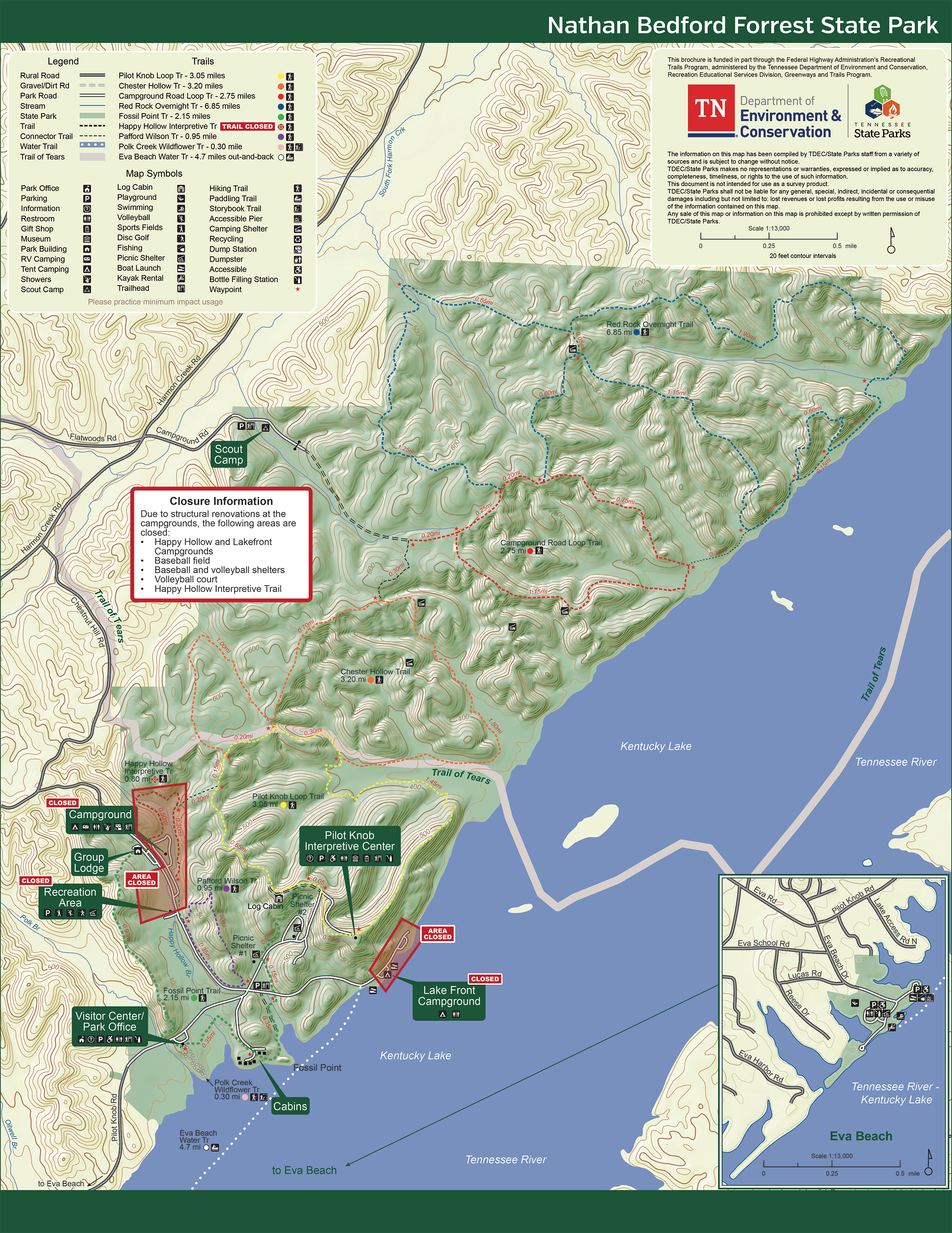
Campgrounds, Baseball Field, and Volleyball Court Closed for Renovations

Nathan Bedford Forrest State Park

Due to structural renovations, the Happy Hollow and Lakefront Campgrounds, the baseball field, and the volleyball court are closed. We anticipate a reopening of all areas in early 2027. Please watch our alerts and our social media accounts for the most updated information.

Thank you for your patience and understanding. If you have any questions, please contact the park office.

Notification

GPS Information

Nathan Bedford Forrest State Park

To get the most direct route to our Park Office when using GPS, please use the park address - 1825 Pilot Knob Road Eva, TN 38333. If you use the park name, it sends you to the back gate which is the long route, depending on your starting point, and there is no cell phone reception. 
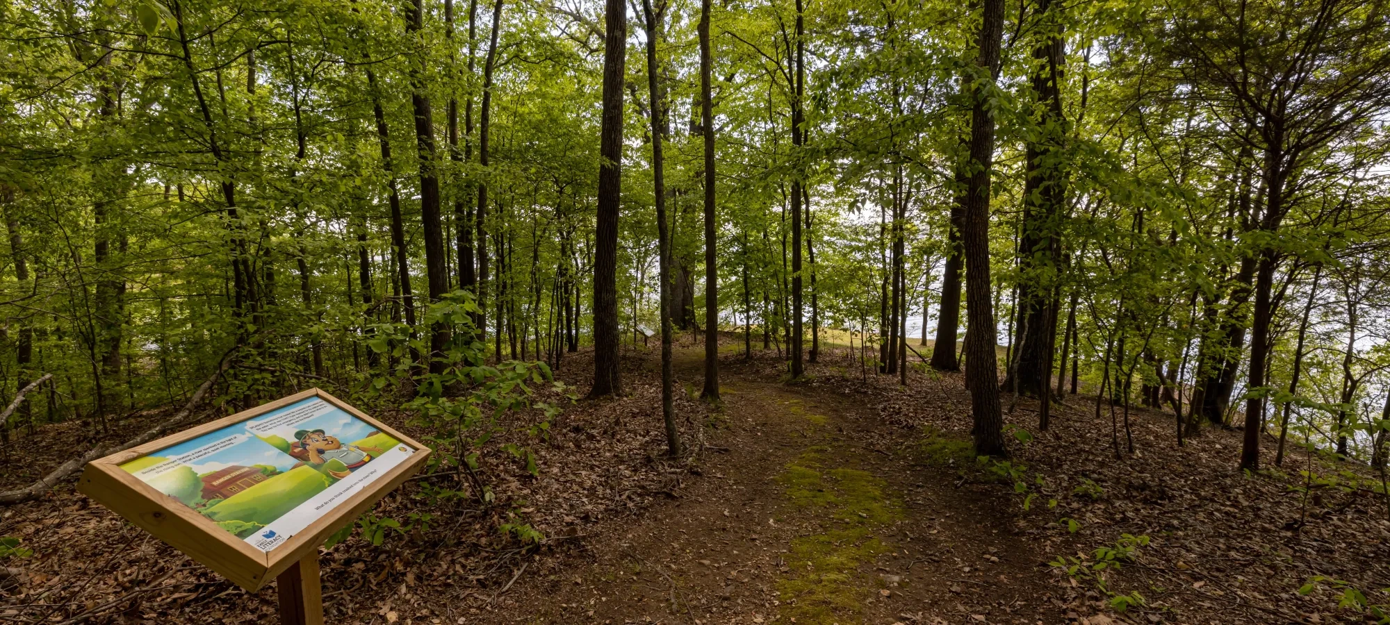
  • HDR shot of a forest pathway lined with tall trees and fallen leaves.
  • Forest trail leading to a cabin with a sign surrounded by green trees.

    Hiking at Nathan Bedford Forrest

    Nathan Bedford Forrest State Park has more than 20 miles of hiking trails offering short jaunts or longer treks.

    Trails

    Showing page 1 of 1
    • Campground Road Loop Trail

      Nathan Bedford Forrest State Park
      Distance
      2.75 mi.
      Difficulty
      Surface
      Natural
      Availability
      Open
      Use
      Hiking

      Chester Hollow Trail

      Nathan Bedford Forrest State Park
      Distance
      3.20 mi.
      Difficulty
      Moderate
      Surface
      Natural
      Availability
      Open
      Use
      Hiking

      Fossil Point Trail

      Nathan Bedford Forrest State Park
      Distance
      2.15 mi.
      Difficulty
      Surface
      Natural
      Availability
      Open
      Use
      Hiking

      Happy Hollow Interpretive Trail

      Nathan Bedford Forrest State Park
      Distance
      0.80 mi.
      Difficulty
      Difficult
      Surface
      Natural
      This trail is a beginner friendly 0.80-mile trail that flows through the trees behind the Happy Hollow Campground. This trail guides you over rustic bridge crossings and small streams and gives the sense of wilderness without being too far from the comforts of hot water. The trail has one trailhead at the entrance to the Happy Hollow Campground next to the linen house and another trailhead at the back of the Happy Hollow Campground across from the Group Lodge.
      Availability
      Closed
      Use
      Hiking

      Happy Hollow Interpretive Trail

      Nathan Bedford Forrest State Park
      This trail is a beginner friendly 0.80-mile trail that flows through the trees behind the Happy Hollow Campground. This trail guides you over rustic bridge crossings and small streams and gives the sense of wilderness without being too far from the comforts of hot water. The trail has one trailhead at the entrance to the Happy Hollow Campground next to the linen house and another trailhead at the back of the Happy Hollow Campground across from the Group Lodge.
      Distance
      0.80 mi.
      Difficulty
      Difficult
      Surface
      Natural
      Use
      Hiking

      Trail Type
      Information unavailable

      Elevation
      Gain 142.30'
      Loss 133.90'
      Grade
      Typical 6.6%
      Max 35.5%
      Cross Slope
      Typical 4.5%
      Max 19.8%
      Tread Width
      Typical 53"
      Minimum 36"
      Surface Type
      Soil 89.3%; Rock 9.1%; Wood decking 1.6%
      Obstructions Exist
      Step: 4 in tall; Tree root: 3 in tall; Tree root: 3 in tall

      Pafford Wilson Trail

      Nathan Bedford Forrest State Park
      Distance
      0.95 mi.
      Difficulty
      Moderate
      Surface
      Natural
      This trail is a 0.95-mile loop with a steep incline and natural surface full of different trees, plants, and colorful mushrooms. This trail is great for those who want a bit of a challenge without the time commitment of a long trail. The entrance begins across the street from the ball field near the Happy Hollow Campground.
      Availability
      Open
      Use
      Hiking

      Pafford Wilson Trail

      Nathan Bedford Forrest State Park
      This trail is a 0.95-mile loop with a steep incline and natural surface full of different trees, plants, and colorful mushrooms. This trail is great for those who want a bit of a challenge without the time commitment of a long trail. The entrance begins across the street from the ball field near the Happy Hollow Campground.
      Distance
      0.95 mi.
      Difficulty
      Moderate
      Surface
      Natural
      Use
      Hiking

      Trail Type
      Information unavailable

      Elevation
      Gain 277.70'
      Loss 287.50'
      Grade
      Typical 11.2%
      Max 39.2%
      Cross Slope
      Typical 8.0%
      Max 36.0%
      Tread Width
      Typical 43"
      Minimum 24"
      Surface Type
      Soil 96.5%; Rock 3.5%
      Obstructions Exist
      Tree root: 4 in tall; Tree root: 4 in tall; Tree root: 4 in tall

      Pilot Knob Loop Trail

      Nathan Bedford Forrest State Park
      Distance
      3.05 mi.
      Difficulty
      Easy
      Surface
      Natural
      Trailhead located at the Pilot Knob Interpretive Center which is one of the highest points in West Tennessee.  
      Availability
      Open
      Use
      Hiking

      Polk Creek Wildflower Trail

      Nathan Bedford Forrest State Park
      Distance
      0.30 mi.
      Difficulty
      Easy
      Surface
      Natural
      Accompanied by an educational series of story boards, this trail is a beginner friendly 0.3-mile hike that takes you through the woods and down to a seating area with a scenic view of Kentucky Lake. This trail is especially great for families with young children. There is a trailhead on either side of the Visitor’s Center.
      Availability
      Open
      Use
      Hiking

      Polk Creek Wildflower Trail

      Nathan Bedford Forrest State Park
      Accompanied by an educational series of story boards, this trail is a beginner friendly 0.3-mile hike that takes you through the woods and down to a seating area with a scenic view of Kentucky Lake. This trail is especially great for families with young children. There is a trailhead on either side of the Visitor’s Center.
      Distance
      0.30 mi.
      Difficulty
      Easy
      Surface
      Natural
      Use
      Hiking

      Trail Type
      Information unavailable

      Elevation
      Gain 53.70'
      Loss 56.40'
      Grade
      Typical 7.3%
      Max 23.4%
      Cross Slope
      Typical 4.3%
      Max 19.7%
      Tread Width
      Typical 64"
      Minimum 36"
      Surface Type
      Soil 100%
      Obstructions Exist
      Tree root: 3 in tall; Dip: 3 in deep; Tree root: 3 in tall

      Red Rock Overnight Trail

      Nathan Bedford Forrest State Park
      Distance
      6.85 mi.
      Difficulty
      Surface
      Natural
      Availability
      Open
      Use
      Hiking

    Trail Definitions

    • Cross Slope 

      Describes the degree of incline from one side of the trail path to the other; measured as a percentage. Cross slope aids in water drainage and impacts the overall trail stability.   

    • Grade  

      Describes the rise in elevation over a horizontal distance on the trail; measured as a percentage.  Higher percentages represent a steeper grade indicating a more challenging ascent or descent for hikers.    

    • Standard Ramp Grade

      Serves as a reference guide for the grade of the trail.  Standard Ramp Grade is 8.3% across all trail assessments.  

    • Surface 

      A characteristic of the trail expressed in terms of material type, grading, compaction, and roughness of the path. Possible surface types include soil, gravel, paved, and mulch.   

    • Tread Width    

      Represents the horizontal distance from one edge of the trail path to the other; measurements can vary.  Tread width helps to determine the amount of space a hiker has to pass through. Obstacles on the trail can alter the remaining tread width.   

    • Trail Types: Loop

      Trail returns at or near the point from which you started. 

    • Trail Types: Network 

      Offers multiple route options within one trail, and each route is connected

    • Trail Types: Out and Back

      This type of trail travels out to an endpoint where hikers turn around and travel back to the starting point.   

    • Trail Types: Stacked Loop

      A loop trail contained completely within another trail.   

    Need a Map?

    Explore our collection of printable and digital trail maps, organized by park. Whether you’re hiking, camping, or paddling, you’ll find the resources you need to navigate confidently.


    Visitor Center Gift Shop 

    The Visitor Center Gift Shop is the perfect place to pick up a map, learn about the park, or find a souvenir. You'll find an assortment of apparel and keepsakes to remember your trip to the park.

    Address:
    1825 Pilot Knob Road, Eva TN, 38333

    Hours: 
    8:00 AM - 4:30 PM

    Image Subject By
    Skip photo gallery
    Media Crowdriff
    Happenings

    No events are scheduled at this time, but there's always more to explore.

    Find More Events

    Other Activities at Nathan Bedford Forrest State Park