Cumberland Trail Hiking

Notification Alert
Notification

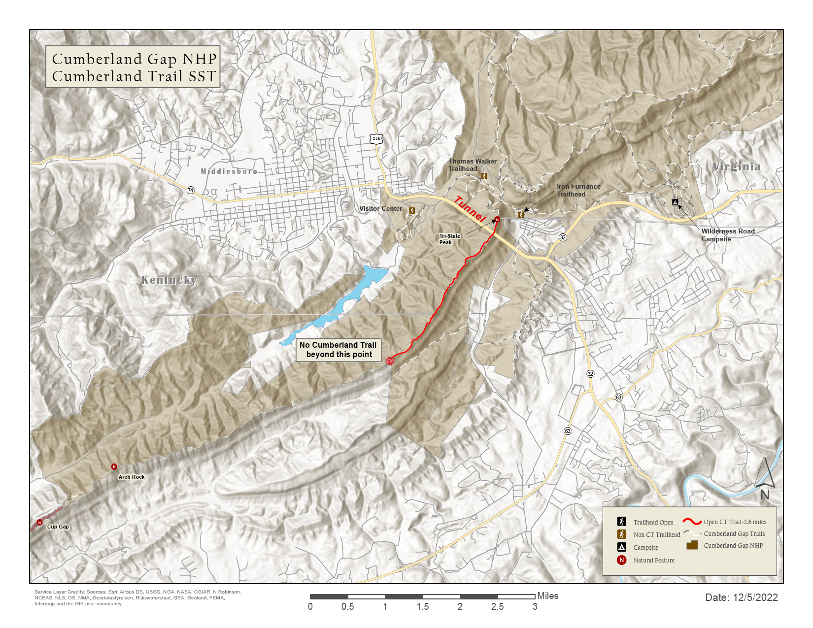
Cumberland Trail Need to Know

Cumberland Trail State Park

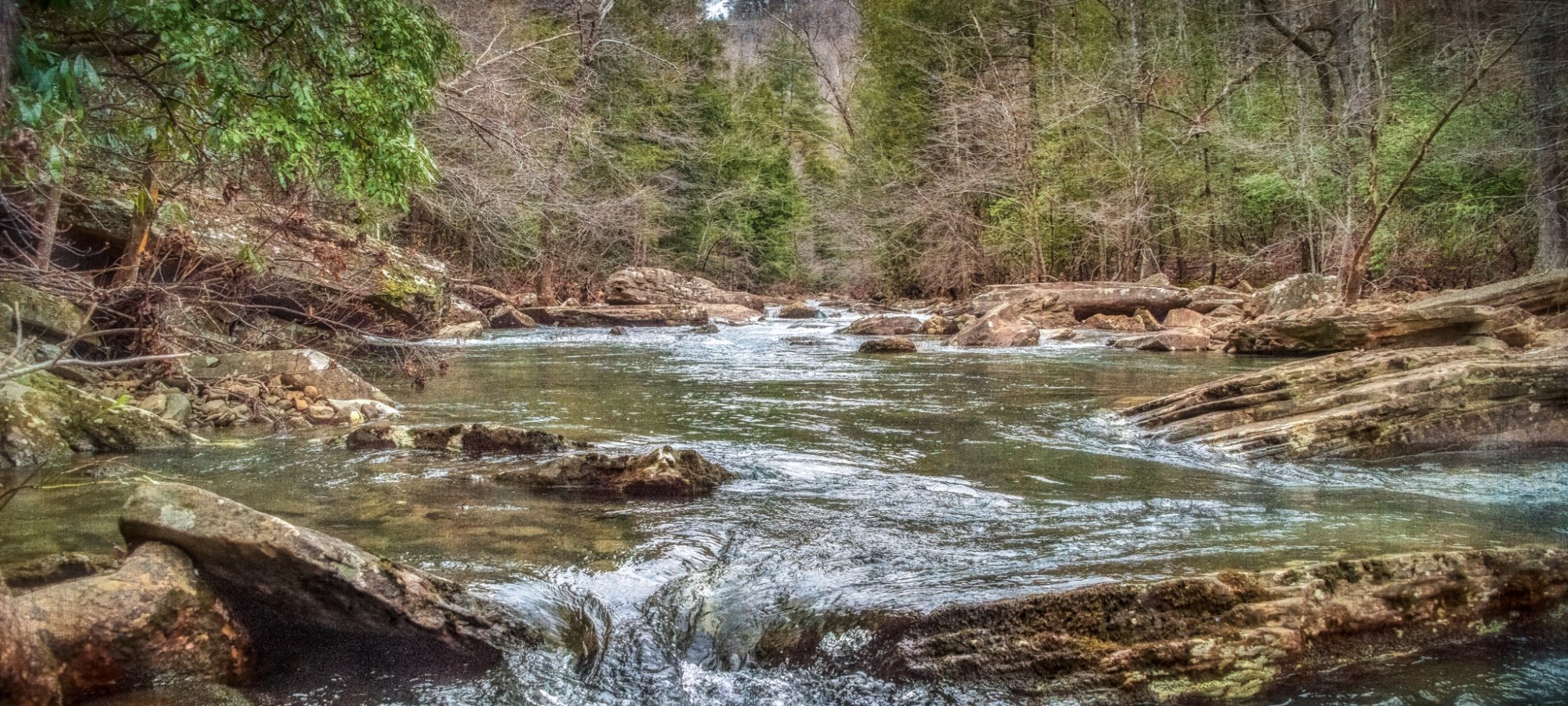
Please exercise extreme caution while enjoying creek areas, including waterfalls. Water levels may change suddenly, running high and moving fast in many areas and posing increased safety risk. Check out our interactive map to plan your trip.

All Counties: All caves on lands managed by the Cumberland Trail State Scenic Trail are closed to the public at this time due to White Nose Syndrome.
  • Cumberland Trail
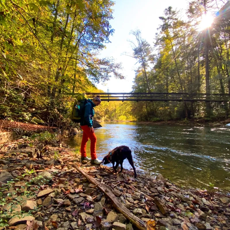
  • Hiker and dog by a river under a sunny sky with trees and a bridge in the background.

    Hiking at Justin P. Wilson Cumberland Trail

    The Cumberland Trail includes a growing 310-mile network of access trails and side trails, connecting hikers with scenic and historic features along the main trail route. Day hiking and overnight camping are most popular at Laurel-Snow State Natural Area, North Chickamauga Creek Gorge State Natural Area, the "Three Gorges" segment, and Black Mountain. 

    Trails

    Showing page 1 of 6
    • (1) Cumberland Trail - Cumberland Gap Section - Cumberland Gap Section

      Cumberland Trail State Park
      Distance
      2.60 mi.
      Difficulty
      Surface
      Natural
      Availability
      Open
      Use
      Hiking

      (10) Cumberland Trail - Brady Mountain Section - Brady Mountain Section

      Cumberland Trail State Park
      Distance
      8.65 mi.
      Difficulty
      Moderate
      Surface
      Natural
      Availability
      Open
      Use
      Hiking

      (11) Cumberland Trail - Hinch Mountain Section - Hinch Mountain Section

      Cumberland Trail State Park
      Distance
      16.40 mi.
      Difficulty
      Difficult
      Surface
      Natural
      Availability
      Open
      Use
      Hiking

      (12) Cumberland Trail - Stinging Fork Section - Stinging Fork Section

      Cumberland Trail State Park
      Distance
      5.90 mi.
      Difficulty
      Moderate
      Surface
      Natural
      Availability
      Open
      Use
      Hiking

      (13) Cumberland Trail - Piney River Section - Piney River Section

      Cumberland Trail State Park
      Distance
      12.05 mi.
      Difficulty
      Moderate
      Surface
      Natural
      Availability
      Open
      Use
      Hiking

      (14) Cumberland Trail - Laurel-Snow Section - Laurel-Snow Section

      Cumberland Trail State Park
      Distance
      5.35 mi.
      Difficulty
      Moderate
      Surface
      Natural
      Availability
      Open
      Use
      Hiking

      (15) Cumberland Trail - Graysville Mountain Section - Graysville Mountain Section

      Cumberland Trail State Park
      Distance
      8.90 mi.
      Difficulty
      Surface
      Natural
      Availability
      Open
      Use
      Hiking

      (16) Cumberland Trail - McGill Creek Section - McGill Creek Section

      Cumberland Trail State Park
      Distance
      2.30 mi.
      Difficulty
      Moderate
      Surface
      Natural
      Availability
      Open
      Use
      Hiking

      (17) Cumberland Trail - Rock Creek Section - Rock Creek Section

      Cumberland Trail State Park
      Distance
      4.80 mi.
      Difficulty
      Moderate
      Surface
      Natural
      Availability
      Open
      Use
      Hiking
    • (18) Cumberland Trail - Possum Creek Section - Possum Creek Section

      Cumberland Trail State Park
      Distance
      8.20 mi.
      Difficulty
      Moderate
      Surface
      Natural
      Availability
      Open
      Use
      Hiking

      (19) Cumberland Trail - Soddy Creek Section - Soddy Creek Section

      Cumberland Trail State Park
      Distance
      15.60 mi.
      Difficulty
      Difficult
      Surface
      Natural
      Availability
      Open
      Use
      Hiking

      (2) Cumberland Trail - Carr Gap Section - Carr Gap Section

      Cumberland Trail State Park
      Distance
      12.90 mi.
      Difficulty
      Surface
      Natural
      Availability
      Open
      Use
      Hiking

      (20) Cumberland Trail - North Chickamauga Section - North Chickamauga Section

      Cumberland Trail State Park
      Distance
      16.35 mi.
      Difficulty
      Moderate
      Surface
      Natural
      North Chickamauga Creek Gorge State Park is home to approximately 16.35 miles of the Cumberland Trail. The main portion of this trail, located in the park, runs from the Montlake Road Trailhead to the Barker Camp Trailhead. There are multiple sandstone bluffs and outstanding views of ridges throughout the park. Visitors can hike next to the bottom of several cliffs along the Cumberland Trail and view the cliffs on the Flipper Bend side of the park.
      Availability
      Partial Closure
      Use
      Hiking

      (21) Cumberland Trail - Prentice Cooper Section - Prentice Cooper Section

      Cumberland Trail State Park
      Distance
      13.70 mi.
      Difficulty
      Moderate
      Surface
      Natural
      Availability
      Open
      Use
      Hiking

      (3) Cumberland Trail - Tank Springs North Section

      Cumberland Trail State Park
      Distance
      3.80 mi.
      Difficulty
      Difficult
      Surface
      Natural
      Availability
      Open
      Use
      Hiking

      (4) Cumberland Trail - North Cumberland WMA Section - Cove Lake Section

      Cumberland Trail State Park
      Distance
      47.30 mi.
      Difficulty
      Difficult
      Surface
      Natural
      Availability
      Open
      Use
      Hiking

      (5) Cumberland Trail - Frozen Head Section - Frozen Head Section

      Cumberland Trail State Park
      Distance
      9.05 mi.
      Difficulty
      Moderate
      Surface
      Natural
      Availability
      Open
      Use
      Hiking

      (6) Cumberland Trail - Morgan County Visitor Center Section - Morgan County Visitor Center Section

      Cumberland Trail State Park
      Distance
      1.60 mi.
      Difficulty
      Moderate
      Surface
      Natural
      Availability
      Open
      Use
      Hiking
    • (7) Cumberland Trail - Obed Wild and Scenic River Section - Obed Wild and Scenic River Section

      Cumberland Trail State Park
      Distance
      13.50 mi.
      Difficulty
      Difficult
      Surface
      Natural
      Availability
      Open
      Use
      Hiking

      (8) Cumberland Trail - Daddy's Creek Section - Daddy's Creek Section

      Cumberland Trail State Park
      Distance
      14.30 mi.
      Difficulty
      Surface
      Natural
      Availability
      Open
      Use
      Hiking

      (9) Cumberland Trail - Black Mountain Section - Black Mountain Section

      Cumberland Trail State Park
      Distance
      10.50 mi.
      Difficulty
      Difficult
      Surface
      Natural
      Availability
      Open
      Use
      Hiking

      Below the Bluff Trail

      Cumberland Trail State Park
      Distance
      0.50 mi.
      Difficulty
      Surface
      Natural
      Availability
      Open
      Use
      Hiking

      Big Soddy Park Access Trail

      Cumberland Trail State Park
      Distance
      0.70 mi.
      Difficulty
      Surface
      Natural
      Availability
      Open
      Use
      Hiking

      Black Mountain North Loop Trail

      Cumberland Trail State Park
      Distance
      0.78 mi.
      Difficulty
      Easy
      Surface
      Natural
      Availability
      Open
      Use
      Hiking

      Black Mountain South Loop Trail

      Cumberland Trail State Park
      Distance
      0.66 mi.
      Difficulty
      Surface
      Natural
      Availability
      Open
      Use
      Hiking

      Buzzard Point Trail

      Cumberland Trail State Park
      Distance
      0.40 mi.
      Difficulty
      Easy
      Surface
      Natural
      Availability
      Open
      Use
      Hiking

      Daddy's Creek Access Trail

      Cumberland Trail State Park
      Distance
      0.15 mi.
      Difficulty
      Surface
      Natural
      Availability
      Open
      Use
      Hiking
    • Duskin Branch Trail

      Cumberland Trail State Park
      Distance
      5.50 mi.
      Difficulty
      Moderate
      Surface
      Natural
      Availability
      Open
      Use
      Hiking

      Falcon Warrior Trail

      Cumberland Trail State Park
      Distance
      0.40 mi.
      Difficulty
      Moderate
      Surface
      Natural
      Availability
      Open
      Use
      Hiking

      Falcon Warrior Trail

      Cumberland Trail State Park
      Distance
      0.40 mi.
      Difficulty
      Moderate
      Surface
      Natural
      Use
      Hiking

      Trail Type
      Information unavailable

      Elevation
      Gain 96.70'
      Loss 43.40'
      Grade
      Typical 6.8%
      Max 30.3%
      Cross Slope
      Typical 4.4%
      Max 18.9%
      Tread Width
      Typical 53"
      Minimum 16"
      Surface Type
      Soil 63.9%; Mowed grass 26.9%; Rock 9.1%
      Obstructions Exist
      Rock steps: 11 in tall; Rock: 10 in tall; Rock: 10 in tall

      Keyes-Harrison Trail

      Cumberland Trail State Park
      Distance
      2.10 mi.
      Difficulty
      Moderate
      Surface
      Natural
      Availability
      Open
      Use
      Hiking

      Laurel Falls Trail

      Cumberland Trail State Park
      Distance
      1.30 mi.
      Difficulty
      Moderate
      Surface
      Natural
      Availability
      Open
      Use
      Hiking

      Leggett Loop Trail

      Cumberland Trail State Park
      Distance
      1.30 mi.
      Difficulty
      Surface
      Natural
      Availability
      Open
      Use
      Hiking

      Leggett Point Trail

      Cumberland Trail State Park
      Distance
      0.25 mi.
      Difficulty
      Easy
      Surface
      Natural
      Availability
      Open
      Use
      Hiking

      Mullen's Cove Loop Trail

      Cumberland Trail State Park
      Distance
      10.20 mi.
      Difficulty
      Moderate
      Surface
      Natural
      Trail is located in Prentice Cooper State Forest and is not maintained by Tennessee State Parks.
      Availability
      Open
      Use
      Hiking

      Piney Falls Trail

      Cumberland Trail State Park
      Distance
      0.60 mi.
      Difficulty
      Moderate
      Surface
      Natural
      Availability
      Open
      Use
      Hiking

      Pot Point Loop Trail

      Cumberland Trail State Park
      Distance
      11.90 mi.
      Difficulty
      Difficult
      Surface
      Natural
      Trail is located in Prentice Cooper State Forest and is not maintained by Tennessee State Parks.
      Availability
      Open
      Use
      Hiking
    • Ritchie Hollow Trail

      Cumberland Trail State Park
      Distance
      2.10 mi.
      Difficulty
      Moderate
      Surface
      Natural
      Trail is located in Prentice Cooper State Forest and is not maintained by Tennessee State Parks.
      Availability
      Open
      Use
      Hiking

      Rock Creek Paved Accessible Trail

      Cumberland Trail State Park
      Distance
      0.25 mi.
      Difficulty
      Easy
      Surface
      Paved
      Availability
      Open
      Use
      Hiking

      Rock Creek Trail

      Cumberland Trail State Park
      Distance
      2.30 mi.
      Difficulty
      Moderate
      Surface
      Natural
      Availability
      Open
      Use
      Hiking

      Sarvis Access Trail

      Cumberland Trail State Park
      Distance
      1.60 mi.
      Difficulty
      Difficult
      Surface
      Natural
      Availability
      Open
      Use
      Hiking

      Selby Loop Trail

      Cumberland Trail State Park
      Distance
      1.00 mi.
      Difficulty
      Moderate
      Surface
      Natural
      Availability
      Open
      Use
      Hiking

      Selby Loop Trail

      Cumberland Trail State Park
      Distance
      1.00 mi.
      Difficulty
      Moderate
      Surface
      Natural
      Use
      Hiking

      Trail Type
      Information unavailable

      Elevation
      Gain 331.00'
      Loss 298.00'
      Grade
      Typical 10.6%
      Max 38.1%
      Cross Slope
      Typical 6.1%
      Max 27.0%
      Tread Width
      Typical 45"
      Minimum 16"
      Surface Type
      Soil 50.2%; Mowed grass 29%; Gravel 16.5%; Rock 4%; Wood decking 0.3%
      Obstructions Exist
      Rock steps: 11 in tall; Rock: 10 in tall; Step: 9 in tall

      Sherrill Cemetery Trail

      Cumberland Trail State Park
      Distance
      0.15 mi.
      Difficulty
      Difficult
      Surface
      Natural
      Availability
      Open
      Use
      Hiking

      Sherrill Cemetery Trail

      Cumberland Trail State Park
      Distance
      0.15 mi.
      Difficulty
      Difficult
      Surface
      Natural
      Use
      Hiking

      Trail Type
      Information unavailable

      Elevation
      Gain 46.30'
      Loss 1.50'
      Grade
      Typical 6.3%
      Max 18.8%
      Cross Slope
      Typical 4.0%
      Max 10.5%
      Tread Width
      Typical 83"
      Minimum 60"
      Surface Type
      Mowed grass 68.2%; Soil 20.4%; Gravel 8.4%; Wood decking 3%
      Obstructions Exist
      Step: 3 in tall; Step: 3 in tall

      Sluder Road Access Trail

      Cumberland Trail State Park
      Distance
      0.40 mi.
      Difficulty
      Moderate
      Surface
      Natural
      Availability
      Open
      Use
      Hiking

      Snow Falls Trail

      Cumberland Trail State Park
      Distance
      2.10 mi.
      Difficulty
      Moderate
      Surface
      Natural
      Availability
      Open
      Use
      Hiking

      Stinging Fork Falls Trail

      Cumberland Trail State Park
      Distance
      0.90 mi.
      Difficulty
      Moderate
      Surface
      Natural
      Availability
      Open
      Use
      Hiking
    • Top of the Falls Trail

      Cumberland Trail State Park
      Distance
      0.15 mi.
      Difficulty
      Moderate
      Surface
      Natural
      Availability
      Open
      Use
      Hiking

      Twin Rocks Trail

      Cumberland Trail State Park
      Distance
      0.80 mi.
      Difficulty
      Moderate
      Surface
      Natural
      Availability
      Open
      Use
      Hiking

    Trail Definitions

    • Cross Slope 

      Describes the degree of incline from one side of the trail path to the other; measured as a percentage. Cross slope aids in water drainage and impacts the overall trail stability.   

    • Grade  

      Describes the rise in elevation over a horizontal distance on the trail; measured as a percentage.  Higher percentages represent a steeper grade indicating a more challenging ascent or descent for hikers.    

    • Standard Ramp Grade

      Serves as a reference guide for the grade of the trail.  Standard Ramp Grade is 8.3% across all trail assessments.  

    • Surface 

      A characteristic of the trail expressed in terms of material type, grading, compaction, and roughness of the path. Possible surface types include soil, gravel, paved, and mulch.   

    • Tread Width    

      Represents the horizontal distance from one edge of the trail path to the other; measurements can vary.  Tread width helps to determine the amount of space a hiker has to pass through. Obstacles on the trail can alter the remaining tread width.   

    • Trail Types: Loop

      Trail returns at or near the point from which you started. 

    • Trail Types: Network 

      Offers multiple route options within one trail, and each route is connected

    • Trail Types: Out and Back

      This type of trail travels out to an endpoint where hikers turn around and travel back to the starting point.   

    • Trail Types: Stacked Loop

      A loop trail contained completely within another trail.   

    Need a Map?

    Explore our collection of printable and digital trail maps, organized by park. Whether you’re hiking, camping, or paddling, you’ll find the resources you need to navigate confidently.


    Visit the Gift Shop

    Cumberland Trail State Park has several gift shops.

      • Gift shop with Cumberland Trail shirts, plush toys, and brochures.

      Cove Creek Visitor Center Gift Shop

      The Cove Creek Visitor Center Gift Shop is the perfect place to pick up a map, learn about the park, or find a souvenir. You’ll find an assortment of apparel and keepsakes to remember your trip to the park.

      Address:
      220 Park Road, Caryville TN, 37714
      1-423-562-1267

      Hours
      Weekdays
      8:00 AM - 4:30 PM EST

      • Old mill by a river with a gentle waterfall, surrounded by hills and grassy banks.

      Head of Sequatchie Visitor Center Gift Shop

      The Head of Sequatchie Visitor Center Gift Shop is the perfect place to pick up a map, learn about the park, or find a souvenir. You’ll find an assortment of apparel and keepsakes to remember your trip to the park.

      Address:
      270 Glyph Parkway, Pikeville TN, 37367
      1-423-533-2928

      Hours
      8:00 AM - 4:00 PM CST

    Skip photo gallery
    Media Crowdriff
    Happenings

    No events are scheduled at this time, but there's always more to explore.
    Find More Events

    Other Activities at Cumberland Trail State Park