Fall Creek Falls Hiking
Notification Alert
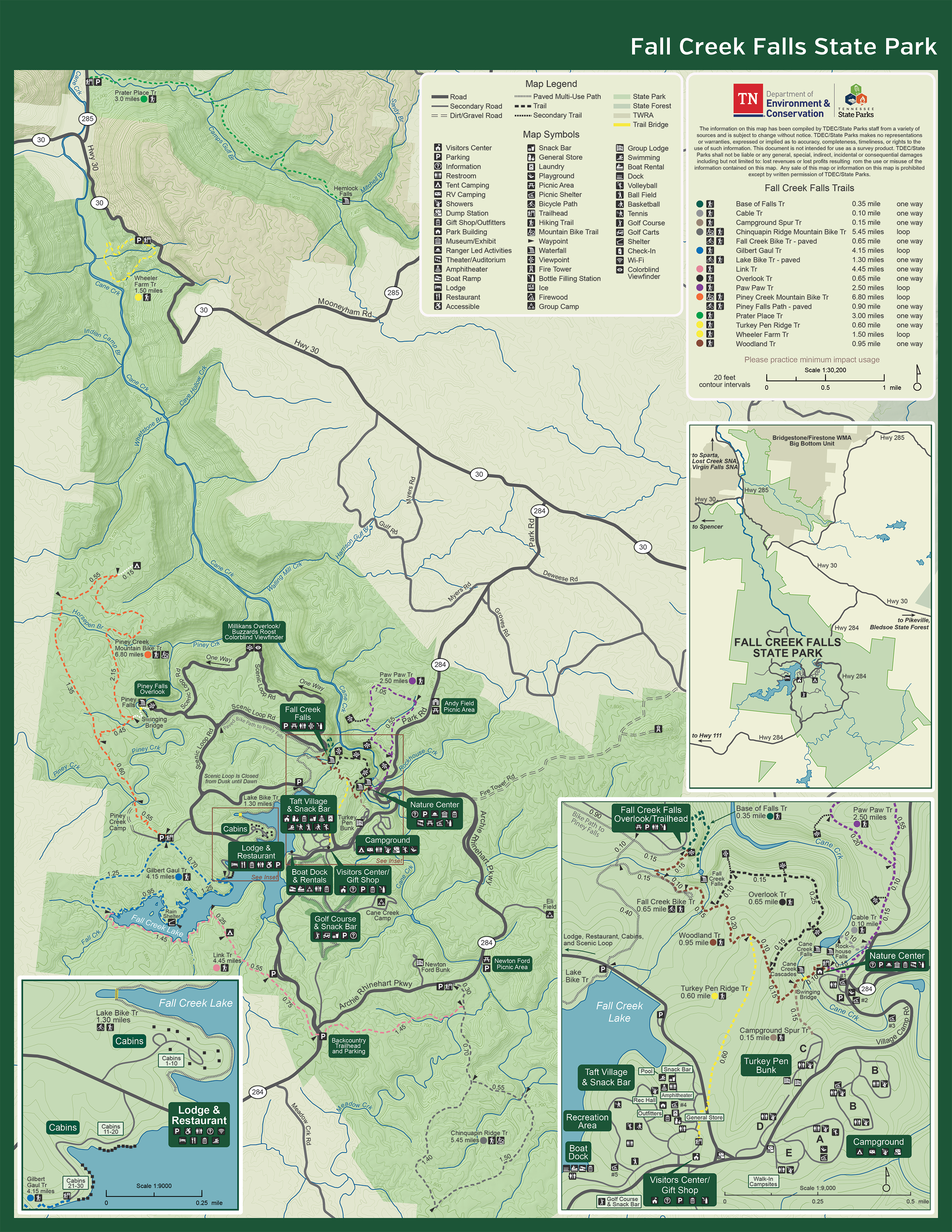
Trail Closures
In August 2023, Fall Creek Falls State Park was impacted by a tornado. Please see the updates below regarding the current status of park availability due to past storm damage.
The following areas remain closed:
- Piney Falls Trail (FCF parking lot to Piney Falls parking lot)
- Millikan's Overlook Trail (overlook is open, trail is closed)

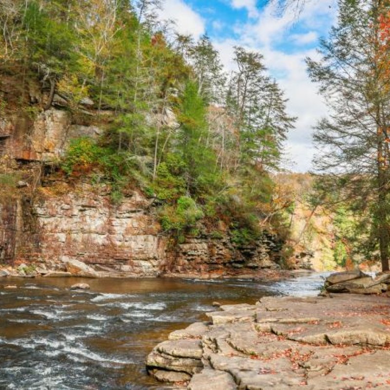
Hiking at Fall Creek Falls
Fall Creek Falls State Park features over 56 miles of hiking trails, allowing for a range of day hikes or overnight adventures. Hikers can opt for short or long walks around the lake and to and from the base of Fall Creek Falls.
The Betty Dunn Nature Center, located near the North entrance of the park, is a popular trailhead. Trail information is available inside the Nature Center.
Trails also originate or can be linked from the Taft Village area, campground, lodge, Piney Creek Group Camp entrance gate, the Fall Creek Falls parking lot, and the Piney Falls parking lot.
Trails
Skip to trail navigationTrail Definitions
Discover More at Fall Creek Falls


Visit Our Gift Shops
Fall Creek Falls State Park has three gift shops throughout the park.
-
Betty Dunn Nature Center Gift Shop
10821 Park Road, Spencer, TN 38585
Open daily from 9:00 AM - 4:30 PM -
Boat Dock Gift Shop
1996 Village Camp Road, Spencer, TN 38585
Open seasonal hours -
Visitor Center Gift Shop
2009 Village Camp Road, Spencer, TN 38585
Open daily from 8:00 AM - 4:30 PM


