Norris Dam Hiking

Notification Alert
Notification

Campgrounds Closed for Renovations

Norris Dam State Park

The East and West Campgrounds are currently closed for renovation with an intended reopening in 2026. 

We apologize for any inconvenience.

Notification

Trailhead Temporarily Closed Due to Construction

Norris Dam State Park

Due to construction associated with the campground renovation on the west side of the park, the trailhead at the Canteen Camp Store is currently inaccessible.

Thank you for your patience and understanding, and please contact the park office if you have any questions.

  • Serene lake view framed by lush green foliage.
  • Two men walking along a forest trail, one holding a walking stick.

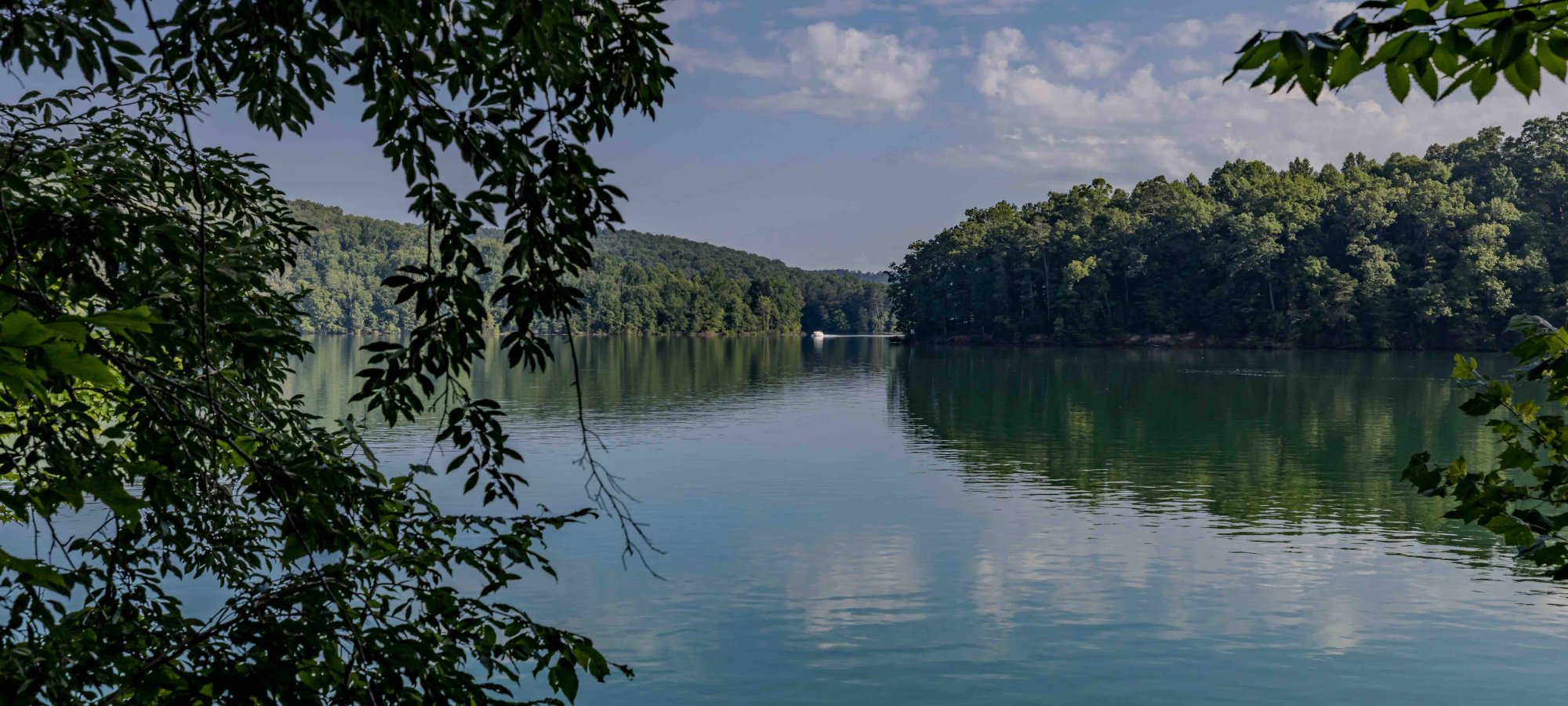
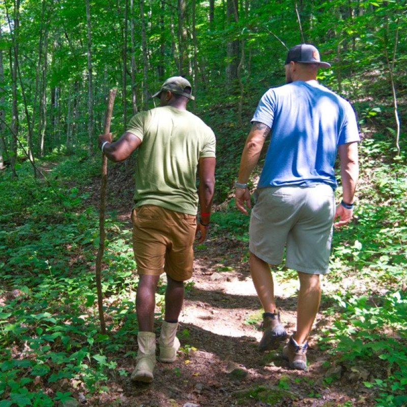
    Hiking at Norris Dam

    The park has 22 trails offering unique scenery, birding, and wildlife viewing opportunities.

    Trails range in length from .5 miles to 6.5 miles and vary in degrees of difficulty, from easy to difficult. These trails traverse ridge tops, valleys, hollows and the lakeshore. Mountain biking and equestrian use is permitted on designated trails. Trail maps are available at the park office.

    West Side

    Trails

    Showing page 1 of 3
    • Andrews Ridge Trail

      Norris Dam State Park
      Distance
      1.95 mi.
      Difficulty
      Difficult
      Surface
      Natural
      West Side: Andrews Ridge Trail System Blazed White. This loop trail offers a wide variety of terrains and can be hiked in either direction. This great hike will lead you right to Norris Lake and even offer views of it as you hike.
      Availability
      Open
      Allowed
      Hiking Mountain Biking

      Andrews Ridge Trail

      Norris Dam State Park
      West Side: Andrews Ridge Trail System Blazed White. This loop trail offers a wide variety of terrains and can be hiked in either direction. This great hike will lead you right to Norris Lake and even offer views of it as you hike.
      Distance
      1.95 mi.
      Difficulty
      Difficult
      Surface
      Natural
      Allowed
      Hiking Mountain Biking

      Trail Type
      Information unavailable

      Elevation
      Gain 287.70'
      Loss 360.80'
      Grade
      Typical 6.3%
      Max 23.8%
      Cross Slope
      Typical 2.6%
      Max 17.9%
      Tread Width
      Typical 49"
      Minimum 12"
      Surface Type
      Soil 56.3%; Crushed stone 23.6%; Gravel 14%; Rock and boulder 6.1%
      Obstructions Exist
      Rocks: 6 in tall; Erosion: 5 in deep; Erosion 7 in deep

      Camp Sam Trail

      Norris Dam State Park
      Distance
      1.50 mi.
      Difficulty
      Difficult
      Surface
      Natural
      East Side: Highway 441 Area Blazed Blue. This trail is easy to enter and explore the CCC Camp. If you wish to complete the trail in its entirety, the backside becomes rather difficult as you steeply traverse up to the first junction and kiosk on High Point Trail at this trail's highest point. 0.4 miles to a CCC Camp that once stood in this hollow from 1933-1942.
      Availability
      Open
      Allowed
      Hiking Horseback Riding Mountain Biking

      CCC Access Trail

      Norris Dam State Park
      Distance
      0.60 mi.
      Difficulty
      Moderate
      Surface
      Natural
      East Side: Historic Cabins Area Blazed Gold. Go back in time while hike this trail and follow the steps once taken by the CCC. This trail leads to the CCC camp once occupied by CCC Camp 494. Take in the history of the foundational structures while reading the interpretive panels within the camp.
      Availability
      Open
      Allowed
      Hiking Mountain Biking

      Christmas Fern Trail

      Norris Dam State Park
      Distance
      0.50 mi.
      Difficulty
      Difficult
      Surface
      Natural
      East Side: Historic Cabins Area Blazed Purple. Along this path down the hill, you can see a huge variety of species in a short distance. Christmas ferns cover the forest floors, and there's a canopy of Umbrella Magnolia. Also, find random patches of delicious raspberries when in season.
      Availability
      Open
      Allowed
      Hiking

      Christmas Fern Trail

      Norris Dam State Park
      East Side: Historic Cabins Area Blazed Purple. Along this path down the hill, you can see a huge variety of species in a short distance. Christmas ferns cover the forest floors, and there's a canopy of Umbrella Magnolia. Also, find random patches of delicious raspberries when in season.
      Distance
      0.50 mi.
      Difficulty
      Difficult
      Surface
      Natural
      Allowed
      Hiking

      Trail Type
      Information unavailable

      Elevation
      Gain 142.00'
      Loss 138.90'
      Grade
      Typical 11.4%
      Max 32.6%
      Cross Slope
      Typical 5.3%
      Max 23.6%
      Tread Width
      Typical 24"
      Minimum 16"
      Surface Type
      Soil 91.4%; Stairs 8.6%
      Obstructions Exist
      Stairs: 10 in tall; Tree root: 5 in tall; Tree stump: 5 in tall

      Chuckmore Trail

      Norris Dam State Park
      Distance
      2.30 mi.
      Difficulty
      Moderate
      Surface
      Natural
      West Side: Andrews Ridge Trail System Blazed Red The trail starts on top of a ridge by connecting it via Elkins trail, and then continues almost all the way down to lake level, then rises back up to one of the highest points in the park before crossing the park entrance and ending at Marine Railway.
      Availability
      Open
      Allowed
      Hiking Mountain Biking

      Elkins Trail

      Norris Dam State Park
      Distance
      2.25 mi.
      Difficulty
      Moderate
      Surface
      Natural
      West Side: Andrews Ridge Trail System This trail starts from Andrews Ridge Road near the West Campground descending 380 feet to the lakeshore and travels through ridgetop oak-hickory forest, open power lines, and lakeshore.
      Availability
      Open
      Allowed
      Hiking Mountain Biking

      Harmon Loop Trail

      Norris Dam State Park
      Distance
      0.95 mi.
      Difficulty
      Moderate
      Surface
      Natural
      This is a quick and quiet stroll to take when time is limited. Look closely, and one can imagine an old homestead along the trail. Views of sink holes. It is a single track designated for foot traffic only. There is also a spur leading from this trail to the Marine Railway Trail.
      Availability
      Open
      Allowed
      Hiking Mountain Biking

      Highpoint Spur Trail

      Norris Dam State Park
      Distance
      0.75 mi.
      Difficulty
      Surface
      Natural
      Availability
      Open
      Allowed
      Hiking Horseback Riding Mountain Biking

      Highpoint Trail

      Norris Dam State Park
      Distance
      2.45 mi.
      Difficulty
      Difficult
      Surface
      Natural
      East Side: Historic Cabins Area Blazed Orange. This trail follows the undefined boundary between the City of Norris Watershed and Norris Dam State Park. It runs parallel to the contour of the lakeshore.
      Availability
      Open
      Allowed
      Hiking Horseback Riding Mountain Biking
    • Holly Grove Trail

      Norris Dam State Park
      Distance
      1.00 mi.
      Difficulty
      Moderate
      Surface
      Natural
      East Side: Shelter 1 Area Blazed Pink. This is one of the park's newest trails and offers a great hike or bike ride to take in views of the Norris Dam. Parking: Please do not park on road shoulders or grassy areas. Parking areas include the Tea Room Parking lot, Horse Trailer Parking lot, Shelters 1 and 2 parking lots, and TVA Visitor Center parking lot.
      Availability
      Open
      Allowed
      Hiking Mountain Biking

      Homestead Trail

      Norris Dam State Park
      Distance
      1.00 mi.
      Difficulty
      Difficult
      Surface
      Natural
      East Side: Historic Cabins Area Blazed Green. See if you can find the areas where you think a homestead would have once resided. This trail offers a great connector between the High Point and Lake View trails and can be utilized with the PawPaw trail to make a loop.
      Availability
      Open
      Allowed
      Hiking Horseback Riding Mountain Biking

      Lake View Trail

      Norris Dam State Park
      Distance
      6.55 mi.
      Difficulty
      Difficult
      Surface
      Natural
      East Side: Historic Cabins Area Blazed Yellow. This trail provides scenic views of the lake, places to rest and eat lunch, and a variety of plants and other historic features. This trail will take you directly to Backcountry Campsites 1 and 2.
      Availability
      Open
      Allowed
      Hiking Horseback Riding Mountain Biking

      Marine Railway Spur

      Norris Dam State Park
      Distance
      0.20 mi.
      Difficulty
      Surface
      Natural
      West Side: Harmon Picnic Area Blazed Black; This trail has some minor elevation changes and is used to connect the Marine Railway and Harmon Loop trail if you want to make your hike a little bit longer. Parking: Please do not park on road shoulders or grassy areas. Parking areas include the canteen, tennis court parking lot, and Marine Railway trailhead off HWY 441.
      Availability
      Open
      Allowed
      Hiking Mountain Biking

      Marine Railway Trail

      Norris Dam State Park
      Distance
      4.00 mi.
      Difficulty
      Moderate
      Surface
      Natural
      West Side: Harmon Picnic Area Blazed Black This trail is accessible from the cabins area on Village Green Road at 1,360 feet elevation and drops down to the lake at 1,040 feet elevation through oak-hickory forest, an open area along a power line and the lakeshore. This trail is the park’s most diverse trail. Parking: Please do not park on road shoulders or grassy areas. Parking areas include the canteen, tennis court parking lot, and Marine Railway trailhead off HWY 441.
      Availability
      Open
      Allowed
      Hiking Mountain Biking

      PawPaw Trail

      Norris Dam State Park
      Distance
      0.70 mi.
      Difficulty
      Difficult
      Surface
      Natural
      East Side: Historic Cabins Area Blazed Green. Take in the scenery of pawpaw trees, along with others, as you hike. This trail offers distant views of the lake when it connects with the Lake View trail. This trail offers a great connector between the High Point and Lake View trails and can be utilized with the Homestead Trail to make a loop.
      Availability
      Open
      Allowed
      Hiking Horseback Riding Mountain Biking

      Scenic Cove Trail

      Norris Dam State Park
      Distance
      0.15 mi.
      Difficulty
      Surface
      Natural
      Availability
      Open
      Allowed
      Hiking Horseback Riding Mountain Biking

      Sequoyah Trail

      Norris Dam State Park
      Distance
      1.35 mi.
      Difficulty
      Surface
      Natural
      Availability
      Open
      Allowed
      Hiking Horseback Riding Mountain Biking

      Sinkhole Trail

      Norris Dam State Park
      Distance
      0.85 mi.
      Difficulty
      Difficult
      Surface
      Natural
      West Side: Andrews Ridge Trail System Blazed Green Varying from wide to single track, this trail winds around sinkholes, the lake, and stream paths. Branches off Andrews Ridge Trail.
      Availability
      Open
      Allowed
      Hiking Mountain Biking

      Sinkhole Trail

      Norris Dam State Park
      West Side: Andrews Ridge Trail System Blazed Green Varying from wide to single track, this trail winds around sinkholes, the lake, and stream paths. Branches off Andrews Ridge Trail.
      Distance
      0.85 mi.
      Difficulty
      Difficult
      Surface
      Natural
      Allowed
      Hiking Mountain Biking

      Trail Type
      Information unavailable

      Elevation
      Gain 131.70'
      Loss 131.90'
      Grade
      Typical 6.0%
      Max 36.1%
      Cross Slope
      Typical 3.9%
      Max 19.8%
      Tread Width
      Typical 39"
      Minimum 16"
      Surface Type
      Soil 48.5%; Crushed stone 39.7%; Rock and boulder 9.1%; Gravel 2.7%
      Obstructions Exist
      Large rocks: 4 in tall; Tree root: 4 in tall; Rock: 4 in tall
    • Storybook Trail

      Norris Dam State Park
      Distance
      0.40 mi.
      Difficulty
      Easy
      Surface
      Natural
      East Side: Historic Cabins Area Blazed White. The trailhead is located right next to the dam itself. The trail splits, forming a loop. Read a rotating story on the panels marked along the trail. The lower section offers a small fishing area.
      Availability
      Open
      Allowed
      Hiking storybook

      Tall Timbers Trail

      Norris Dam State Park
      Distance
      0.40 mi.
      Difficulty
      Easy
      Surface
      Natural
      East Side: Historic Cabins Area Blazed Red. This is part of the CCC trail system and are a series of linear trails that are connected and run between the dam and Historic Cabin #10. Winter months offer views of Norris Lake.
      Availability
      Open
      Allowed
      Hiking

      Tennis Court Trail

      Norris Dam State Park
      Distance
      0.40 mi.
      Difficulty
      Easy
      Surface
      Natural
      West Side: Standard Cabins Area Blazed Orange This trail provides an easy, nature-bound experience for the Standard Cabin guest to access the park's Village Green Complex of activities and information. Designated for foot traffic only.
      Availability
      Open
      Allowed
      Hiking

      TVA River Bluff Trail

      Norris Dam State Park
      Distance
      2.70 mi.
      Difficulty
      Difficult
      Surface
      Natural
      This trail also follows Clinch River and then up the hillside to the ridge top. Approximately 30 different species of wildflowers are found on the lower sections during the season.
      Availability
      Open
      Allowed
      Hiking Mountain Biking

      TVA Songbird Trail

      Norris Dam State Park
      Distance
      2.00 mi.
      Difficulty
      Easy
      Surface
      Natural
      This trail is paved with crushed, packed, limestone gravel making it a great trail and is also a birder's paradise. Over 180 species of birds have been observed throughout the year. Along the trail are various tree orchards and several different species of birds. For walking or running use only.
      Availability
      Open
      Allowed
      Hiking Mountain Biking

    Standard Cabins Area

      Tennis Court Trail

      Norris Dam State Park
      Distance
      0.40 mi.
      Difficulty
      Easy
      Surface
      Natural
      West Side: Standard Cabins Area Blazed Orange This trail provides an easy, nature-bound experience for the Standard Cabin guest to access the park's Village Green Complex of activities and information. Designated for foot traffic only.
      Availability
      Open
      Allowed
      Hiking

    Harmon Picnic Area

      Harmon Loop Trail

      Norris Dam State Park
      Distance
      0.95 mi.
      Difficulty
      Moderate
      Surface
      Natural
      This is a quick and quiet stroll to take when time is limited. Look closely, and one can imagine an old homestead along the trail. Views of sink holes. It is a single track designated for foot traffic only. There is also a spur leading from this trail to the Marine Railway Trail.
      Availability
      Open
      Allowed
      Hiking Mountain Biking

      Marine Railway Spur

      Norris Dam State Park
      Distance
      0.20 mi.
      Difficulty
      Surface
      Natural
      West Side: Harmon Picnic Area Blazed Black; This trail has some minor elevation changes and is used to connect the Marine Railway and Harmon Loop trail if you want to make your hike a little bit longer. Parking: Please do not park on road shoulders or grassy areas. Parking areas include the canteen, tennis court parking lot, and Marine Railway trailhead off HWY 441.
      Availability
      Open
      Allowed
      Hiking Mountain Biking

      Marine Railway Trail

      Norris Dam State Park
      Distance
      4.00 mi.
      Difficulty
      Moderate
      Surface
      Natural
      West Side: Harmon Picnic Area Blazed Black This trail is accessible from the cabins area on Village Green Road at 1,360 feet elevation and drops down to the lake at 1,040 feet elevation through oak-hickory forest, an open area along a power line and the lakeshore. This trail is the park’s most diverse trail. Parking: Please do not park on road shoulders or grassy areas. Parking areas include the canteen, tennis court parking lot, and Marine Railway trailhead off HWY 441.
      Availability
      Open
      Allowed
      Hiking Mountain Biking

    Parking: Please do not park on road shoulders or grassy areas. Parking areas include the canteen, tennis court parking lot, and Marine Railway trailhead off HWY 441.

    East Side Trails

    Historic Cabins Area

      Storybook Trail

      Norris Dam State Park
      Distance
      0.40 mi.
      Difficulty
      Easy
      Surface
      Natural
      East Side: Historic Cabins Area Blazed White. The trailhead is located right next to the dam itself. The trail splits, forming a loop. Read a rotating story on the panels marked along the trail. The lower section offers a small fishing area.
      Availability
      Open
      Allowed
      Hiking storybook

      Christmas Fern Trail

      Norris Dam State Park
      Distance
      0.50 mi.
      Difficulty
      Difficult
      Surface
      Natural
      East Side: Historic Cabins Area Blazed Purple. Along this path down the hill, you can see a huge variety of species in a short distance. Christmas ferns cover the forest floors, and there's a canopy of Umbrella Magnolia. Also, find random patches of delicious raspberries when in season.
      Availability
      Open
      Allowed
      Hiking

      Christmas Fern Trail

      Norris Dam State Park
      East Side: Historic Cabins Area Blazed Purple. Along this path down the hill, you can see a huge variety of species in a short distance. Christmas ferns cover the forest floors, and there's a canopy of Umbrella Magnolia. Also, find random patches of delicious raspberries when in season.
      Distance
      0.50 mi.
      Difficulty
      Difficult
      Surface
      Natural
      Allowed
      Hiking

      Trail Type
      Information unavailable

      Elevation
      Gain 142.00'
      Loss 138.90'
      Grade
      Typical 11.4%
      Max 32.6%
      Cross Slope
      Typical 5.3%
      Max 23.6%
      Tread Width
      Typical 24"
      Minimum 16"
      Surface Type
      Soil 91.4%; Stairs 8.6%
      Obstructions Exist
      Stairs: 10 in tall; Tree root: 5 in tall; Tree stump: 5 in tall

      CCC Access Trail

      Norris Dam State Park
      Distance
      0.60 mi.
      Difficulty
      Moderate
      Surface
      Natural
      East Side: Historic Cabins Area Blazed Gold. Go back in time while hike this trail and follow the steps once taken by the CCC. This trail leads to the CCC camp once occupied by CCC Camp 494. Take in the history of the foundational structures while reading the interpretive panels within the camp.
      Availability
      Open
      Allowed
      Hiking Mountain Biking

      Tall Timbers Trail

      Norris Dam State Park
      Distance
      0.40 mi.
      Difficulty
      Easy
      Surface
      Natural
      East Side: Historic Cabins Area Blazed Red. This is part of the CCC trail system and are a series of linear trails that are connected and run between the dam and Historic Cabin #10. Winter months offer views of Norris Lake.
      Availability
      Open
      Allowed
      Hiking

      Lake View Trail

      Norris Dam State Park
      Distance
      6.55 mi.
      Difficulty
      Difficult
      Surface
      Natural
      East Side: Historic Cabins Area Blazed Yellow. This trail provides scenic views of the lake, places to rest and eat lunch, and a variety of plants and other historic features. This trail will take you directly to Backcountry Campsites 1 and 2.
      Availability
      Open
      Allowed
      Hiking Horseback Riding Mountain Biking

      PawPaw Trail

      Norris Dam State Park
      Distance
      0.70 mi.
      Difficulty
      Difficult
      Surface
      Natural
      East Side: Historic Cabins Area Blazed Green. Take in the scenery of pawpaw trees, along with others, as you hike. This trail offers distant views of the lake when it connects with the Lake View trail. This trail offers a great connector between the High Point and Lake View trails and can be utilized with the Homestead Trail to make a loop.
      Availability
      Open
      Allowed
      Hiking Horseback Riding Mountain Biking

      Homestead Trail

      Norris Dam State Park
      Distance
      1.00 mi.
      Difficulty
      Difficult
      Surface
      Natural
      East Side: Historic Cabins Area Blazed Green. See if you can find the areas where you think a homestead would have once resided. This trail offers a great connector between the High Point and Lake View trails and can be utilized with the PawPaw trail to make a loop.
      Availability
      Open
      Allowed
      Hiking Horseback Riding Mountain Biking

      Highpoint Trail

      Norris Dam State Park
      Distance
      2.45 mi.
      Difficulty
      Difficult
      Surface
      Natural
      East Side: Historic Cabins Area Blazed Orange. This trail follows the undefined boundary between the City of Norris Watershed and Norris Dam State Park. It runs parallel to the contour of the lakeshore.
      Availability
      Open
      Allowed
      Hiking Horseback Riding Mountain Biking

    Highway 441 Area

      Camp Sam Trail

      Norris Dam State Park
      Distance
      1.50 mi.
      Difficulty
      Difficult
      Surface
      Natural
      East Side: Highway 441 Area Blazed Blue. This trail is easy to enter and explore the CCC Camp. If you wish to complete the trail in its entirety, the backside becomes rather difficult as you steeply traverse up to the first junction and kiosk on High Point Trail at this trail's highest point. 0.4 miles to a CCC Camp that once stood in this hollow from 1933-1942.
      Availability
      Open
      Allowed
      Hiking Horseback Riding Mountain Biking

    Shelter 1 Area

      Holly Grove Trail

      Norris Dam State Park
      Distance
      1.00 mi.
      Difficulty
      Moderate
      Surface
      Natural
      East Side: Shelter 1 Area Blazed Pink. This is one of the park's newest trails and offers a great hike or bike ride to take in views of the Norris Dam. Parking: Please do not park on road shoulders or grassy areas. Parking areas include the Tea Room Parking lot, Horse Trailer Parking lot, Shelters 1 and 2 parking lots, and TVA Visitor Center parking lot.
      Availability
      Open
      Allowed
      Hiking Mountain Biking

    Parking: Please do not park on road shoulders or grassy areas. Parking areas include the Tea Room Parking lot, Horse Trailer Parking lot, Shelters 1 and 2 parking lots, and TVA Visitor Center parking lot.

    Neighboring Trails

    Norris Watershed

      Clear Creek Trail

      Norris Dam State Park
      Distance
      1.40 mi.
      Difficulty
      Easy
      Surface

      Neighboring Trails 

      This trail follows Clear Creek from the Rice Grist Mill to the water treatment plant. During Spring, several varieties of wildflowers are found.  

      Availability
      Open
      Allowed
      Hiking

    TVA

      TVA Songbird Trail

      Norris Dam State Park
      Distance
      2.00 mi.
      Difficulty
      Easy
      Surface
      Natural
      This trail is paved with crushed, packed, limestone gravel making it a great trail and is also a birder's paradise. Over 180 species of birds have been observed throughout the year. Along the trail are various tree orchards and several different species of birds. For walking or running use only.
      Availability
      Open
      Allowed
      Hiking Mountain Biking

      TVA River Bluff Trail

      Norris Dam State Park
      Distance
      2.70 mi.
      Difficulty
      Difficult
      Surface
      Natural
      This trail also follows Clinch River and then up the hillside to the ridge top. Approximately 30 different species of wildflowers are found on the lower sections during the season.
      Availability
      Open
      Allowed
      Hiking Mountain Biking

    Trail Definitions

    • Cross Slope 

      Describes the degree of incline from one side of the trail path to the other; measured as a percentage. Cross slope aids in water drainage and impacts the overall trail stability.   

    • Grade  

      Describes the rise in elevation over a horizontal distance on the trail; measured as a percentage.  Higher percentages represent a steeper grade indicating a more challenging ascent or descent for hikers.    

    • Standard Ramp Grade

      Serves as a reference guide for the grade of the trail.  Standard Ramp Grade is 8.3% across all trail assessments.  

    • Surface 

      A characteristic of the trail expressed in terms of material type, grading, compaction, and roughness of the path. Possible surface types include soil, gravel, paved, and mulch.   

    • Tread Width    

      Represents the horizontal distance from one edge of the trail path to the other; measurements can vary.  Tread width helps to determine the amount of space a hiker has to pass through. Obstacles on the trail can alter the remaining tread width.   

    • Trail Types: Loop

      Trail returns at or near the point from which you started. 

    • Trail Types: Network 

      Offers multiple route options within one trail, and each route is connected

    • Trail Types: Out and Back

      This type of trail travels out to an endpoint where hikers turn around and travel back to the starting point.   

    • Trail Types: Stacked Loop

      A loop trail contained completely within another trail.   

    Need a Map?

    Explore our collection of printable and digital trail maps, organized by park. Whether you’re hiking, camping, or paddling, you’ll find the resources you need to navigate confidently.


    Visit the Gift Shops

    Norris Dam State Park has two gift shops.

      • Rustic wooden mill with waterwheel, surrounded by lush trees and stone steps.

      Grist Mill Gift Shop

      The Grist Mill Gift Shop is the perfect place to pick up a map, learn about the park, or find a souvenir. You’ll find an assortment of apparel and keepsakes to remember your trip to the park.

      Address:
      Lower Clear Creek Rd, Norris TN, 37828

      Hours:
      Seasonal

      • Visitor Center with stairs, surrounded by trees and greenery. Overcast sky.

      Park Headquarters Gift Shop

      The Park Headquarters Gift Shop is the perfect place to pick up a map, learn about the park, or find a souvenir. You’ll find an assortment of apparel and keepsakes to remember your trip to the park.

      Address:
      125 Village Green Circle, Rocky Top TN, 37769

      Hours
      8:00 AM - 4:30 PM

    Skip photo gallery
    Media Crowdriff
    Happenings

    No events are scheduled at this time, but there's always more to explore.

    Find More Events