Edgar Evins Hiking

  • Person photographing a serene lake at sunset from a rocky shore, surrounded by autumn trees. Warm glow and peaceful ambiance fill the scene.
  • Man and child walking down a forest trail. The man carries a green backpack. A tree marked with a "Trail" sign is central. Autumn leaves surround them.

    Hiking at Edgar Evins

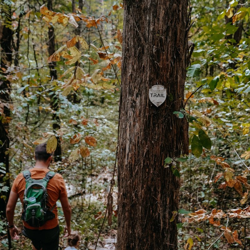
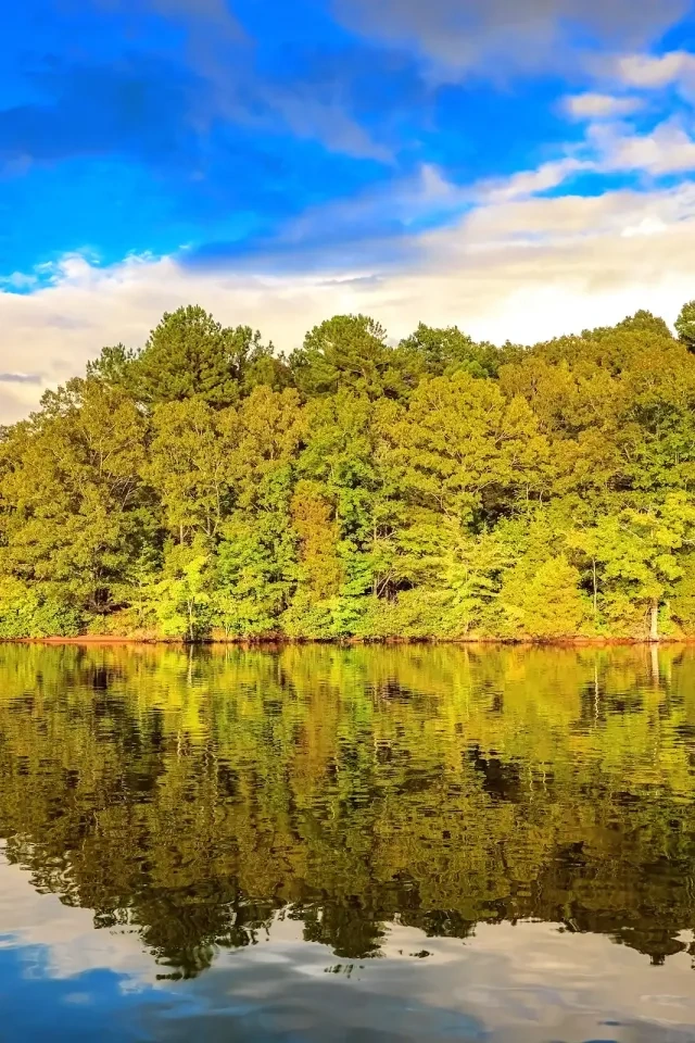
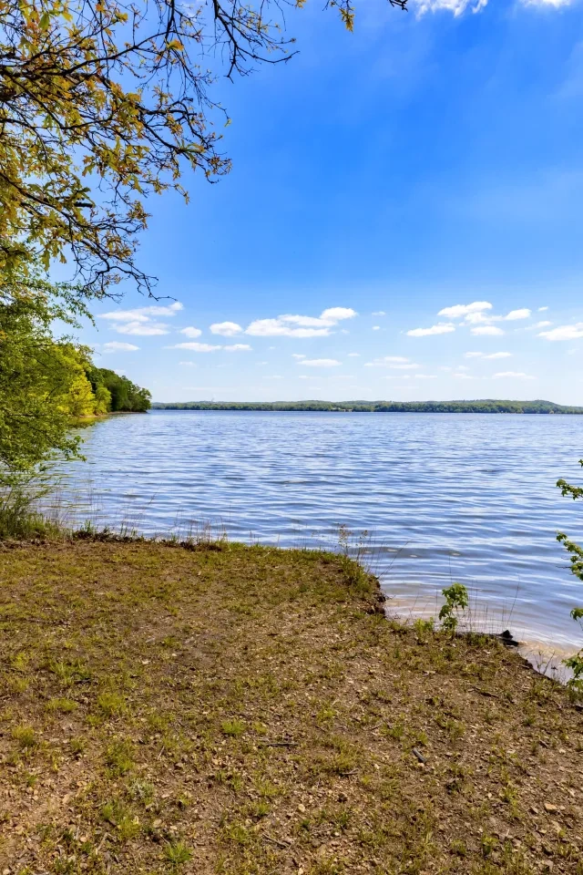
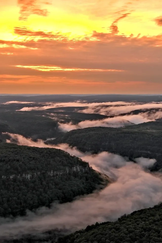
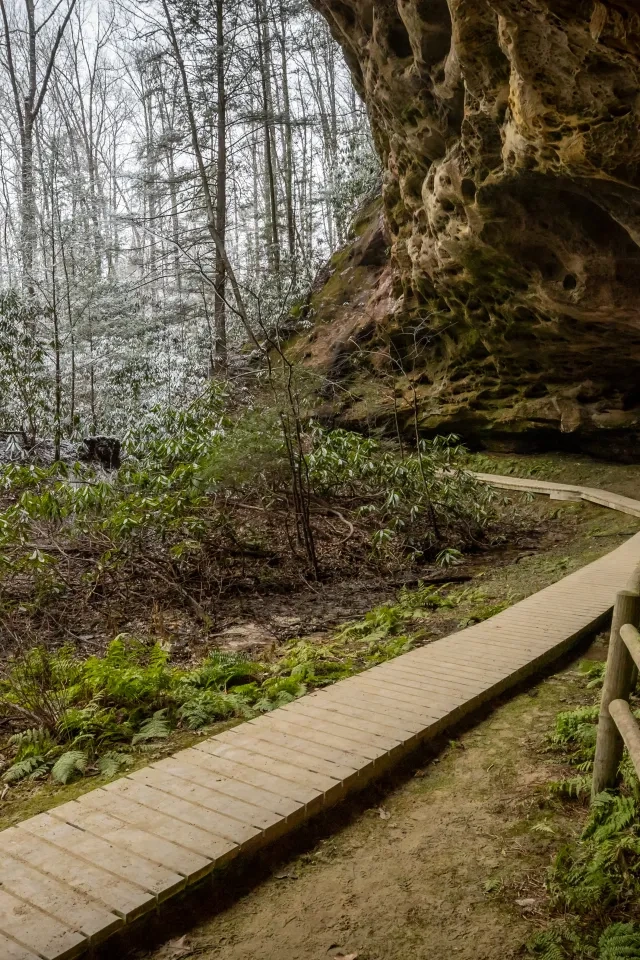
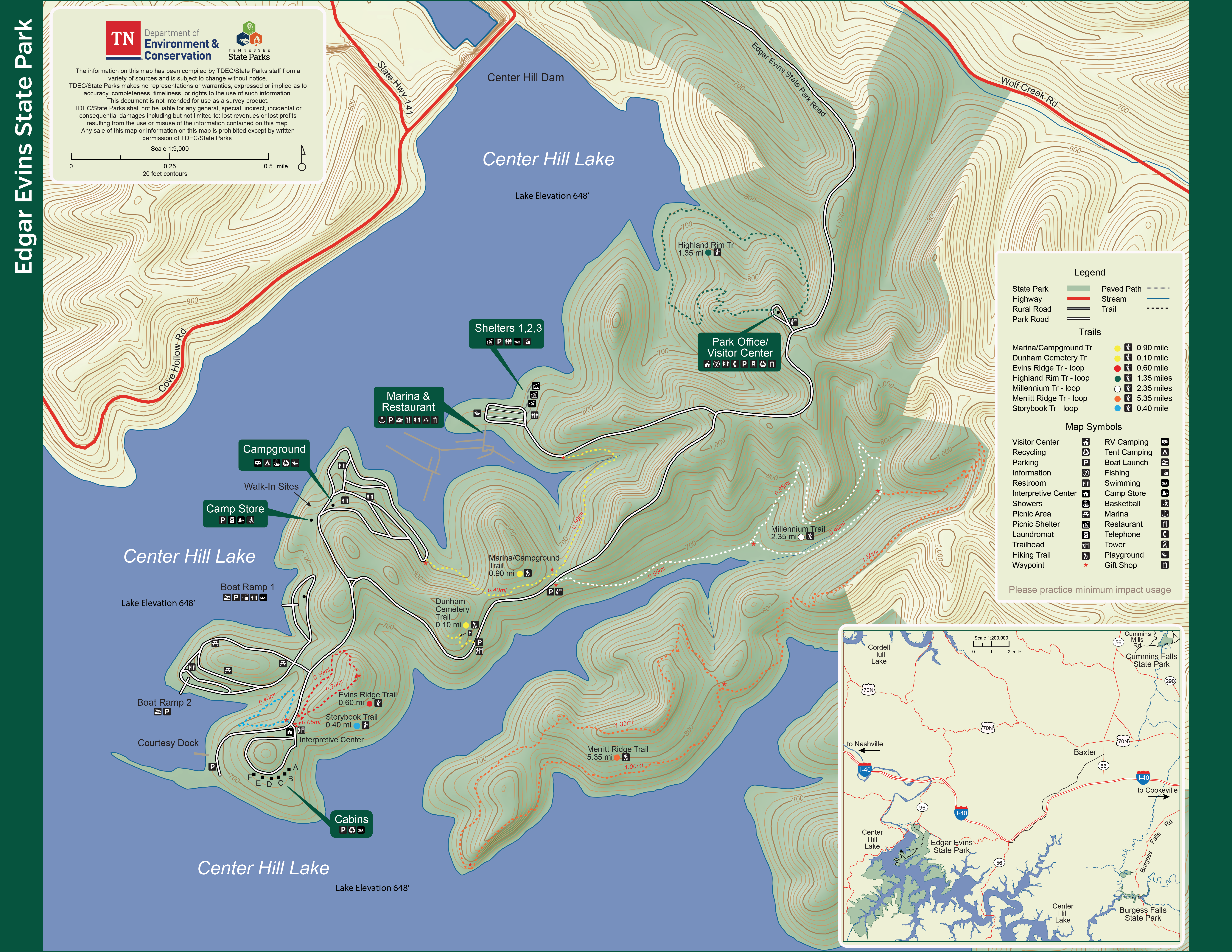
    Edgar Evins State Park is a great place to enjoy the beauty and serenity of the outdoors! We have approximately 12 miles of trails ranging from easy to strenuous that will take you through some of the most beautiful and diverse habitats in our area.  

    Trails

    Showing page 1 of 1
    • Dunham Cemetery Trail

      Edgar Evins State Park
      Distance
      0.10 mi.
      Difficulty
      Easy
      Surface
      Natural
      A very short (one-tenth of a mile) trail that winds up the side of the ridge, taking you to the historical Dunham Cemetery. This peaceful location overlooks the lake and is a beautiful place to linger.
      Availability
      Open
      Allowed
      Hiking

      Evins Ridge Trail

      Edgar Evins State Park
      Distance
      0.60 mi.
      Difficulty
      Difficult
      Surface
      Natural
      Access to this trail is in the cabin area, across from the interpretive center. A small parking lot is available. This rocky trail winds through a drier forested area, as evidenced by the prickly pear that grows here (our native cactus). The trail takes you up and over a ridge that offers lovely views of the lake on either side. Other features of this trail are the abundance of paw paw trees (the food plant of our state butterfly, the zebra swallowtail), and several natural limestone sinks. This half-mile trail is of moderate difficulty.
      Availability
      Open
      Allowed
      Hiking

      Evins Ridge Trail

      Edgar Evins State Park
      Access to this trail is in the cabin area, across from the interpretive center. A small parking lot is available. This rocky trail winds through a drier forested area, as evidenced by the prickly pear that grows here (our native cactus). The trail takes you up and over a ridge that offers lovely views of the lake on either side. Other features of this trail are the abundance of paw paw trees (the food plant of our state butterfly, the zebra swallowtail), and several natural limestone sinks. This half-mile trail is of moderate difficulty.
      Distance
      0.60 mi.
      Difficulty
      Difficult
      Surface
      Natural
      Allowed
      Hiking

      Trail Type
      Information unavailable

      Elevation
      Gain 160.60'
      Loss 195.50'
      Grade
      Typical 12.0%
      Max 47.8%
      Cross Slope
      Typical 6.1%
      Max 20.5%
      Tread Width
      Typical 22"
      Minimum 12"
      Surface Type
      Soil 99.8%; Large rock 0.2%
      Obstructions Exist
      Tree root: 9 in tall; Rock: 7 in tall; Tree: 12 in of tread remaining

      Highland Rim Trail

      Edgar Evins State Park
      Distance
      1.35 mi.
      Difficulty
      Moderate
      Surface
      Natural
      This trail loops behind the visitor’s center and is one of the richest and most diverse trails in the park. It is an excellent wildflower trail in the spring. The trail also happens to be a superb location for bird watching, including a possible glimpse of the cerulean warbler. The trail descends into a forested gully and travels along the lake before ascending back up the ridge behind the visitor center.
      Availability
      Open
      Allowed
      Hiking

      Marina/Campground Trail

      Edgar Evins State Park
      Distance
      0.90 mi.
      Difficulty
      Moderate
      Surface
      Natural
      This one-way trail takes you from the campground to the marina or vice versa. It is a gently sloping hike through a lush lakeside forest and offers excellent opportunities for wildlife viewing, especially birds.
      Availability
      Open
      Allowed
      Hiking

      Merritt Ridge Trail

      Edgar Evins State Park
      Distance
      5.35 mi.
      Difficulty
      Difficult
      Surface
      Natural
      If you are in the mood for a longer and more vigorous hike, this is your trail! The Merritt Ridge Trail branches off the Millennium Trail, approximately one mile in. It climbs steeply on top of Merritt Ridge and offers spectacular views of the lake and surrounding landscape in the early spring and winter months.
      Availability
      Open
      Allowed
      Hiking

      Millennium Trail

      Edgar Evins State Park
      Distance
      2.35 mi.
      Difficulty
      Moderate
      Surface
      Natural
      The beginning of this wooded trail follows an old roadbed that once led to the Wolf Creek community. Remnants of two old homesteads can be found along this trail, as well as several old stone walls. After meandering along the Wolf Creek inlet, the trail follows the creek through a rich, wooded hollow before climbing steeply up a ridge. Once you begin to descend the ridge, shooting star can be seen blooming along the trail in the spring. This trail also happens to be a great place to hear barred owls at dusk. The trail is of moderate difficulty.
      Availability
      Open
      Allowed
      Hiking

      Storybook Trail

      Edgar Evins State Park
      Distance
      0.40 mi.
      Difficulty
      Difficult
      Surface
      Natural
      The trailhead is to the right of the interpretive center. A small parking area is provided. It is a half-mile hike that combines a nature storybook while enjoying the great outdoors. The trail is on a hillside bordering the shores of Center Hill Lake.
      Availability
      Open
      Allowed
      Hiking

      Storybook Trail

      Edgar Evins State Park
      The trailhead is to the right of the interpretive center. A small parking area is provided. It is a half-mile hike that combines a nature storybook while enjoying the great outdoors. The trail is on a hillside bordering the shores of Center Hill Lake.
      Distance
      0.40 mi.
      Difficulty
      Difficult
      Surface
      Natural
      Allowed
      Hiking

      Trail Type
      Information unavailable

      Elevation
      Gain 98.60'
      Loss 118.80'
      Grade
      Typical 10.1%
      Max 35.7%
      Cross Slope
      Typical 11.0%
      Max 32.2%
      Tread Width
      Typical 26"
      Minimum 12"
      Surface Type
      Soil 92.4%; Large rock 5.4%; Gravel 1.2%; Wood decking 1%
      Obstructions Exist
      Tree: 12 in of tread remaining; Tree: 16 in of tread remaining; Tree: 16 in of tread remaining

    Trail Definitions

    • Cross Slope 

      Describes the degree of incline from one side of the trail path to the other; measured as a percentage. Cross slope aids in water drainage and impacts the overall trail stability.   

    • Grade  

      Describes the rise in elevation over a horizontal distance on the trail; measured as a percentage.  Higher percentages represent a steeper grade indicating a more challenging ascent or descent for hikers.    

    • Standard Ramp Grade

      Serves as a reference guide for the grade of the trail.  Standard Ramp Grade is 8.3% across all trail assessments.  

    • Surface 

      A characteristic of the trail expressed in terms of material type, grading, compaction, and roughness of the path. Possible surface types include soil, gravel, paved, and mulch.   

    • Tread Width    

      Represents the horizontal distance from one edge of the trail path to the other; measurements can vary.  Tread width helps to determine the amount of space a hiker has to pass through. Obstacles on the trail can alter the remaining tread width.   

    • Trail Types: Loop

      Trail returns at or near the point from which you started. 

    • Trail Types: Network 

      Offers multiple route options within one trail, and each route is connected

    • Trail Types: Out and Back

      This type of trail travels out to an endpoint where hikers turn around and travel back to the starting point.   

    • Trail Types: Stacked Loop

      A loop trail contained completely within another trail.   

    Caution and Reminders

    First of all, enjoy your visit and stay at Edgar Evins State Park! We hope these gentle reminders enable you to help us keep this park for many generations to come.  

    • Share the Space

      Be aware of the wildlife sharing your space and be respectful of them.  

    • Leave Everything In Place

      Remember, it is against the law to remove anything; plant, animal, or mineral from a state park.  

    • Take Plenty Of Pictures

      Be sure to take nothing but pictures and to leave nothing but footprints, so our park will be here for future generations to enjoy and to cherish.  

    Need a Map?

    Explore our collection of printable and digital trail maps, organized by park. Whether you’re hiking, camping, or paddling, you’ll find the resources you need to navigate confidently.


    Visitor Center Gift Shop

    The Visitor Center Gift Shop is the perfect place to pick up a map, learn about the park, or find a souvenir. You’ll find an assortment of apparel and keepsakes to remember your trip to the park.  

    Address: 
    1630 Edgar Evins Park Road, Silver Point TN, 38582

    Hours: 
    8:00 AM - 4:00 PM

    Skip photo gallery
    Media Crowdriff
    Happenings

    No events are scheduled at this time, but there's always more to explore.

    Find More Events

    Other Activities at Edgar Evins State Park