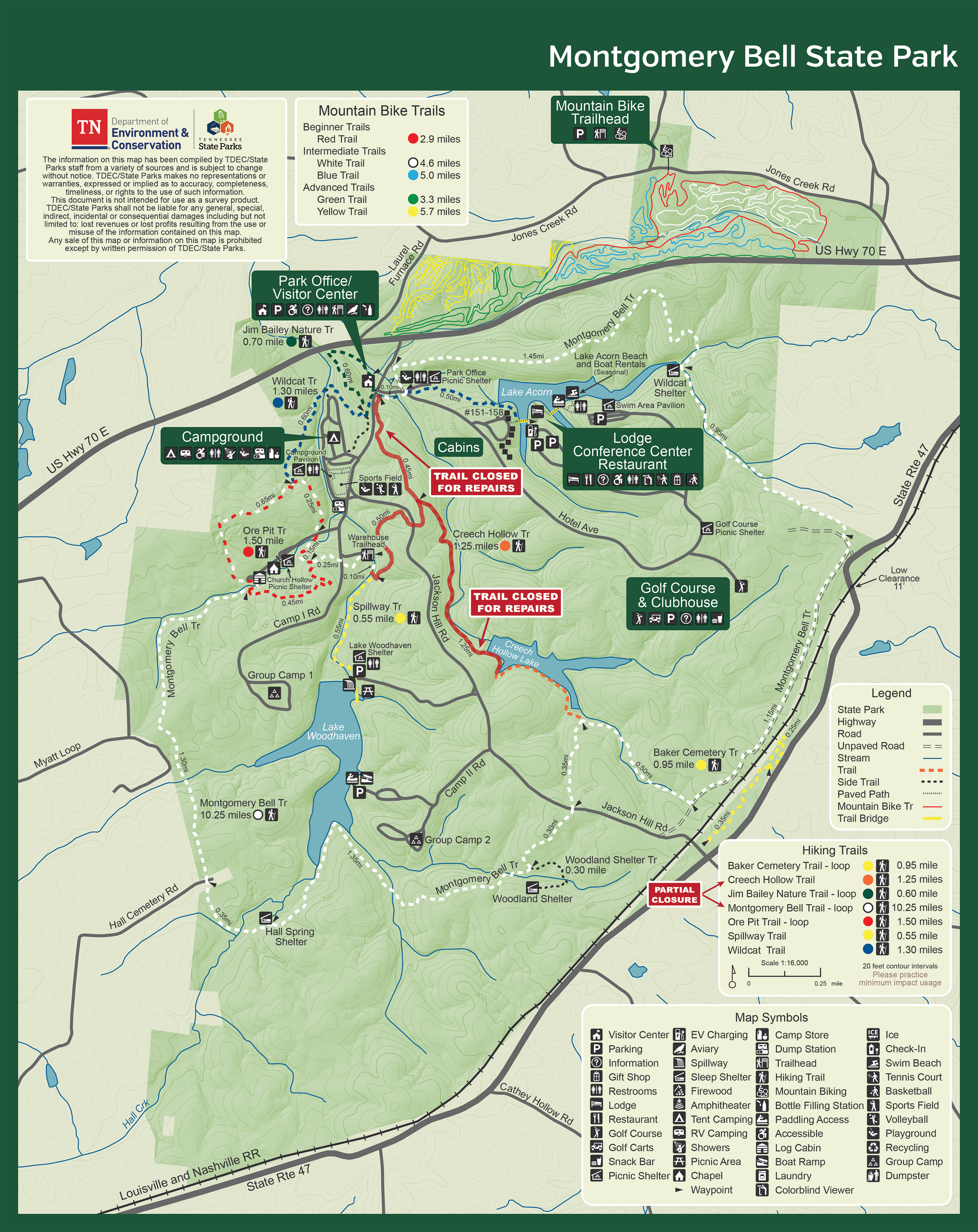
Montgomery Bell Hiking

Notification Alert
Notification

Some Trails Closed

Montgomery Bell State Park

Portions of the Montgomery Bell and Creech Hollow Trails will be closed for visitor safety beginning 3/2/26 due to a timber salvage project as a result of the November storms that brought down thousands of trees. We anticipate reopening the closed portions in May 2026.

We thank you for your continued patience and understanding. If you have any questions, please contact the park office.

  • Aerial view of a riverside building surrounded by lush green forest.
  • Hiker in woods near trail sign, wearing a cap and boots.

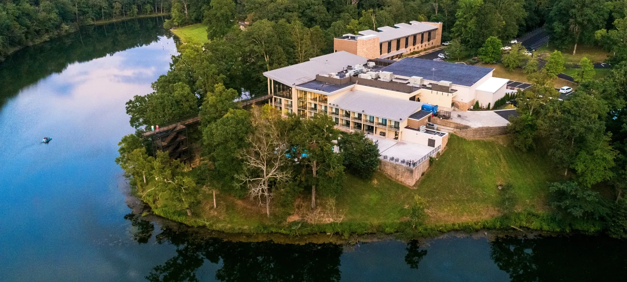
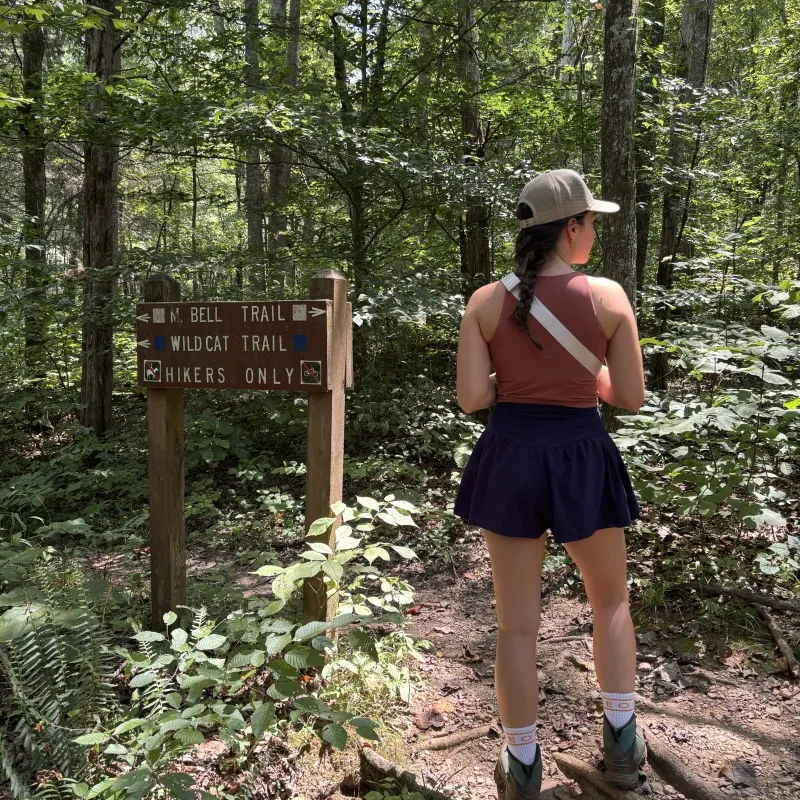
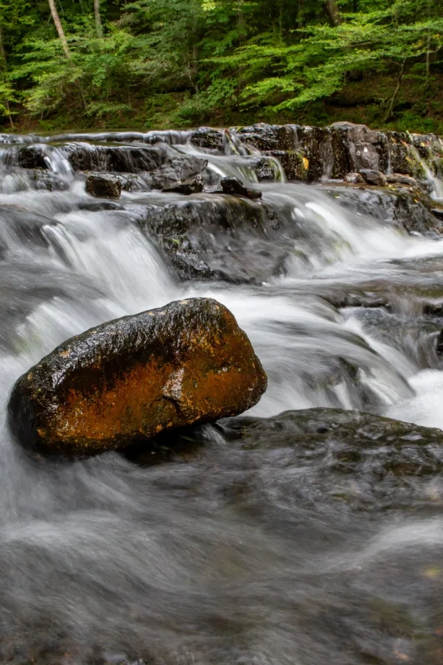
    Hiking at Montgomery Bell

    Montgomery Bell has several hiking trails ranging from easy to moderate, including a 10-mile overnight trail. 

    Trails

    Showing page 1 of 2
    • Baker Cemetery Trail

      Montgomery Bell State Park
      Distance
      0.95 mi.
      Difficulty
      Difficult
      Surface
      Natural
      Availability
      Open
      Allowed
      Hiking

      Baker Cemetery Trail

      Montgomery Bell State Park
      Distance
      0.95 mi.
      Difficulty
      Difficult
      Surface
      Natural
      Allowed
      Hiking

      Trail Type
      Information unavailable

      Elevation
      Gain 106.00'
      Loss 133.80'
      Grade
      Typical 4.4%
      Max 23.9%
      Cross Slope
      Typical 2.7%
      Max 16.5%
      Tread Width
      Typical 37"
      Minimum 16"
      Surface Type
      Soil 100%
      Obstructions Exist
      Tree: 16 in of tread remaining; Tree: 16 in of tread remaining; Tree roots: 6 in tall

      Blue Trail

      Montgomery Bell State Park
      Distance
      5.00 mi.
      Difficulty
      Surface
      Natural
      Availability
      Open
      Allowed
      Mountain Biking

      Cabin to Lodge Connector

      Montgomery Bell State Park
      Distance
      Difficulty
      Surface
      Natural
      Availability
      Open
      Allowed
      Hiking

      Green Trail

      Montgomery Bell State Park
      Distance
      3.30 mi.
      Difficulty
      Surface
      Natural
      Availability
      Open
      Allowed
      Mountain Biking

      Jim Bailey Nature Trail

      Montgomery Bell State Park
      Distance
      0.60 mi.
      Difficulty
      Difficult
      Surface
      Natural
      Availability
      Open
      Allowed
      Hiking

      Jim Bailey Nature Trail

      Montgomery Bell State Park
      Distance
      0.60 mi.
      Difficulty
      Difficult
      Surface
      Natural
      Allowed
      Hiking

      Trail Type
      Information unavailable

      Elevation
      Gain 87.00'
      Loss 109.60'
      Grade
      Typical 5.8%
      Max 41.7%
      Cross Slope
      Typical 3.7%
      Max 19.7%
      Tread Width
      Typical 33"
      Minimum 12"
      Surface Type
      Soil 88.7%; Asphalt 10.2%; Gravel 0.5%; Wood decking 0.5%
      Obstructions Exist
      Tree roots: 9 in tall; Tree: 18 in of tread remaining; Tree roots: 6 in tall

      Lake Woodhaven Water Trail

      Montgomery Bell State Park
      Distance
      Difficulty
      Surface
      Natural
      Availability
      Open
      Allowed
      Hiking

      Lodge to Acorn Beach

      Montgomery Bell State Park
      Distance
      Difficulty
      Surface
      Natural
      Availability
      Open
      Allowed
      Hiking

      Montgomery Bell Trail

      Montgomery Bell State Park
      Distance
      10.25 mi.
      Difficulty
      Surface
      Natural
      Availability
      Open
      Allowed
      Hiking

      Ore Pit Trail

      Montgomery Bell State Park
      Distance
      1.50 mi.
      Difficulty
      Moderate
      Surface
      Natural
      Availability
      Open
      Allowed
      Hiking
    • Paved Trail

      Montgomery Bell State Park
      Distance
      Difficulty
      Surface
      Natural
      Availability
      Open
      Allowed
      Hiking wheelchair

      Pavilion Path

      Montgomery Bell State Park
      Distance
      Difficulty
      Surface
      Natural
      Availability
      Open
      Allowed
      Hiking

      Red Trail

      Montgomery Bell State Park
      Distance
      2.90 mi.
      Difficulty
      Surface
      Natural
      Availability
      Open
      Allowed
      Mountain Biking

      Spillway Trail

      Montgomery Bell State Park
      Distance
      0.55 mi.
      Difficulty
      Difficult
      Surface
      Natural
      Availability
      Open
      Allowed
      Hiking

      Spillway Trail

      Montgomery Bell State Park
      Distance
      0.55 mi.
      Difficulty
      Difficult
      Surface
      Natural
      Allowed
      Hiking

      Trail Type
      Information unavailable

      Elevation
      Gain 38.20'
      Loss 106.20'
      Grade
      Typical 4.3%
      Max 32.0%
      Cross Slope
      Typical 3.2%
      Max 19.5%
      Tread Width
      Typical 42"
      Minimum 12"
      Surface Type
      Soil 65.4%; Concrete 15.1%; Gravel 8.1%; Wood decking 5.7%; Rock 3.6%; Asphalt 2.1%
      Obstructions Exist
      Ditch: 48 in deep; Rock: 24 in of tread remaining; Tree root: 6 in tall

      White Trail

      Montgomery Bell State Park
      Distance
      4.60 mi.
      Difficulty
      Surface
      Natural
      Availability
      Open
      Allowed
      Mountain Biking

      Wildcat Trail

      Montgomery Bell State Park
      Distance
      1.30 mi.
      Difficulty
      Moderate
      Surface
      Natural
      Availability
      Open
      Allowed
      Hiking

      Woodland Shelter Trail

      Montgomery Bell State Park
      Distance
      Difficulty
      Surface
      Natural
      Availability
      Open
      Allowed
      Hiking

      Yellow Trail

      Montgomery Bell State Park
      Distance
      5.70 mi.
      Difficulty
      Surface
      Natural
      Availability
      Open
      Allowed
      Mountain Biking

    Trail Definitions

    • Cross Slope 

      Describes the degree of incline from one side of the trail path to the other; measured as a percentage. Cross slope aids in water drainage and impacts the overall trail stability.   

    • Grade  

      Describes the rise in elevation over a horizontal distance on the trail; measured as a percentage.  Higher percentages represent a steeper grade indicating a more challenging ascent or descent for hikers.    

    • Standard Ramp Grade

      Serves as a reference guide for the grade of the trail.  Standard Ramp Grade is 8.3% across all trail assessments.  

    • Surface 

      A characteristic of the trail expressed in terms of material type, grading, compaction, and roughness of the path. Possible surface types include soil, gravel, paved, and mulch.   

    • Tread Width    

      Represents the horizontal distance from one edge of the trail path to the other; measurements can vary.  Tread width helps to determine the amount of space a hiker has to pass through. Obstacles on the trail can alter the remaining tread width.   

    • Trail Types: Loop

      Trail returns at or near the point from which you started. 

    • Trail Types: Network 

      Offers multiple route options within one trail, and each route is connected

    • Trail Types: Out and Back

      This type of trail travels out to an endpoint where hikers turn around and travel back to the starting point.   

    • Trail Types: Stacked Loop

      A loop trail contained completely within another trail.   

    Need a Map?

    Explore our collection of printable and digital trail maps, organized by park. Whether you’re hiking, camping, or paddling, you’ll find the resources you need to navigate confidently.


    Visit the Gift Shops

      • Small wooden building surrounded by trees, with signs and a vending window.

      The Camp Store 

      The park’s camp store is your best spot for finding gear, snacks, and accessories to make your camping experience exceptional. The camp store is your go-to destination for ice cream, ingredients for S'mores, and of course a lighter! 

      Hours: Open seasonal hours

      • souvenirs placed and lit up on a shelf

      Visitor Center Gift Shop

      The Visitor Center Gift Shop is the perfect place to pick up a map, learn about the park, or find a souvenir. You’ll find an assortment of apparel and keepsakes to remember your trip to the park.   

      Address:
      1020 Jackson Hill Road, Burns TN, 37029
      1-615-797-9052

      Hours
      Monday - Saturday
      8:00 AM to 4:00 PM 
      Closed Sunday

    Happenings
    pile of fern group together with a blue highlight